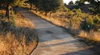
What are the most spectacular roads in Spain?
Tucked away on the Iberian Peninsula, in the southwestern part of Europe, the roads of Spain offer the best way to discover the country’s diverse topography. It features mountain roads, even the highest paved road in Europe, as well as stunning coastal drives on the Balearic Islands and the Canary Islands.
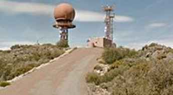
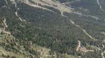
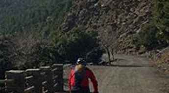
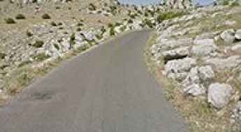
The country is home to Pico del Veleta, the highest paved road in the European continent. Ending at 3,369m (11,053ft) above sea level, it's one of the highest roads in Europe. At an altitude of around 3,000m, road conditions become significantly worse. For those seeking mountain roads, Alto de l’Angliru is the ultimate cycling ascent in Asturias. Climbing up to 1.558m (5,111ft) above sea level, it’s one of the hardest and most epic climbs you can ride on two wheels.
If you’re up for a drive on scenic roads, Mallorca hosts two stunning drives: the sensational road to Formentor Lighthouse and Sa Calobra, the Snake Road. Located on the island of Mallorca, Sa Calobra Road is one of the most scenic drives in the world. Imagine dropping a long piece of wet spaghetti on the floor. The pattern it makes looks something like what the road looks. If you really want a challenge, try tackling it by bike. On the Canary Islands, GC-200 is an exhilarating road with 365 curves and spectacular views. The road has it all, from hairpin bends to sheer cliff-edge drops. It's one of the best roads on the Canary Islands.
So, rev up your engines and let Spain's spectacular routes guide you through a journey of soulful discoveries and unforgettable vistas. You will discover many treasures created by skilled workers employed by construction firms with tradition in Spain.
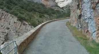
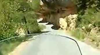
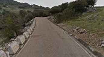
Congost del Pas Nou, a road to die for
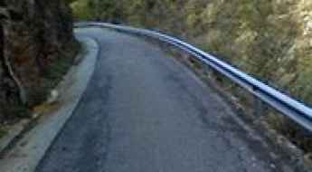
Congost de l'Escala del Pas Nou is the name of a very challenging drive located in the comarca of Noguera, in the province of Lleida, Catalonia, in northern Spain. It’s one of the most scenic canyon roads of Spain.
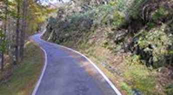
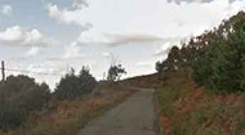
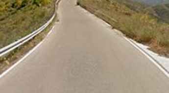
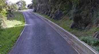
Road NA-4000
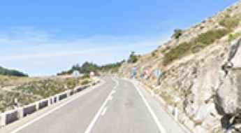
Carretera NA-4000 is a very exciting road in the heart of the province and autonomous community of Navarre, northern Spain.
Travel guide to the top of Tuc de Baciver
Tuc de Baciver is a high mountain peak at an elevation of 2.343m (7,687ft) above the sea level, located in Lleida, Catalonia, in northern Spain. It’s one of the highest roads of the country.
Las Cometas
Las Cometas is a mountain peak at an elevation of 2.291m (7,516ft) above the sea level, located in Aragon in the province of Huesca, in Spain.
The road to Cerrajón de Murtas, a hidden gem
Cerrajón de Murtas is a high mountain peak at an elevation of 1.509m (4,950ft) above the sea level, located in the province of Granada, in the eastern part of the autonomous community of Andalusia, in southern Spain.
Driving to Mirador del Tapadero: 20 hairpins in the heart of Jaén
Located deep within the Sierras de Cazorla, Segura y Las Villas National Park, in the province of Jaén, the ascent to Mirador del Tapadero is a technical challenge that defines the raw nature of high-mountain driving in Andalusia. Reaching an elevation of 1,124m (3,687ft) above sea level, the road—known as the Transversal de las Villas—is a narrow ribbon of asphalt carved into the rock. It is a drive where the mechanical demand of the hairpins meets the psychological pressure of a 200-meter vertical drop just inches from your tires.
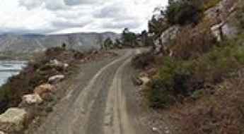
Don’t glance down at your phone on Canelles Reservoir Access Road
Canelles Reservoir Access Road is a scary road located along the border of the province of Huesca, Aragon and the province of Lleida, Catalonia, in northern Spain. The drive will confirm if you are definitely scared of heights.
Collado Zamora
Collado Zamora is a mountain pass at an elevation of 1.446m (4,744ft) above the sea level, located in Jaén, a province of southern Spain, in the eastern part of the autonomous community of Andalusia.
Travel guide to the summit of Pico Colativi
Pico Colativi is a high mountain peak at an elevation of 1.385m (4,543ft) above the sea level, located in Almería province, in the autonomous community of Andalusia, in southern Spain.
Driving the 4x4 track to Pico Labert: 2,316m in the Benasque Valley
Pico Labert is a high mountain peak at an elevation of 2,316m (7,598ft) above sea level, located in the heart of the Pyrenees, in the Ribagorza region of Huesca. Set high in the Benasque Valley, this peak is a rugged balcony over the Aragonese mountains. It is one of the highest roads in Spain.
Tossal dels Altars: Driving the 2,488m peak above the abandoned Llessui resort
Reaching an impressive elevation of 2,488m (8,162ft) above sea level, Tossal dels Altars is a high mountain peak located in the province of Lleida, in the Catalonia region of northern Spain. Situated within the rugged landscape of the Pyrenees, it stands as one of the highest roads in the country, offering a unique glimpse into the remains of an ambitious high-altitude project from the past.
Mirador de los Valles
Mirador de los Valles is a chairlift and a natural lookout at an elevation of 2.208m (7,244ft) above the sea level, located in northeastern Spain in the province of Huesca.
Driving the canyon road to Margalef Dam is not a piece of cake
Located in the Priorat comarca of Tarragona province, in the southern part of the autonomous community of Catalonia, a narrow road leading to Margalef Dam is one of the most scenic canyon roads of Spain.
Pista Hilera de la Cumbre, a track along the Tenerife’s spine
Located on the island of La Palma, in Spain’s Canary Islands, Pista Hilera de la Cumbre is a short mountain road along the islands’s spine.
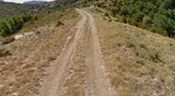
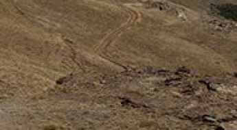
How to drive the unpaved road to Claramunt in Lleida?
Claramunt is a mountain hamlet located in the comarca of the Pallars Jussà, in Spain.
How to drive the wild road to Las Banderillas in Jaen
Las Banderillas is a high mountain peak at an elevation of 1.876m (6,154ft) above sea level, located in the province of Jaén, in Spain.
How to drive the narrow road to Refugi de la Pleta del Prat?
Refugi de la Pleta del Prat is a high-altitude mountain refuge at an elevation of 1,720m (5,643ft) above sea level, located in the Pallars Sobirà comarca of Catalonia. Situated within the Alt Pirineu Natural Park, the refuge serves as the base for the Tavascan ski resort. Logistically, the access involves a sustained climb through a glacial valley, requiring focus on narrow passage management and cooling system efficiency.
The Ultimate Road Trip To Puerto del Pico in Avila
Puerto del Pico is a mountain pass at an elevation of 1.391m (4,563ft) above the sea level, located in the province of Ávila, in the southern part of the autonomous community of Castile and León, in Spain.
Driving the technical track to Valdecebollas: The 2.141m Torreón of Palencia
The unpaved track to Mount Valdecebollas is a high-altitude mountain route located in the Montaña Palentina region, within the province of Palencia, northern Spain. The dirt path climbs the eastern sector of the Cantabrian Mountains, terminating at the concrete tower monument known as El Torreón at 2,141 meters (7,024 ft) above sea level.
Montaña de La Altura has taxed the nerves of more than a few drivers
Montaña de la Altura de Paso Alto is a mountain peak at an elevation of 229m (751ft) above the sea level, located in the island of Tenerife, in Spain’s Canary Islands.
Punta de Estaca de Bares
Framed within an impressive landscape, Punta de Estaca de Bares is the northernmost point of Spain and the entire Iberian Peninsula.
Driving the unpaved Camí de Fontlletera to Coll de Melanell
The Camí de Fontlletera (GIV-5265) is a high mountain track in the Eastern Pyrenees of Girona, Catalonia. Linking Ribes de Freser and Tregurà de Dalt, this 28.9 km route is a serious challenge where the road is carved directly into the mountainside, crossing Coll de Melanell before topping out at over 2,000 meters.
Coll del Torn
Coll del Torn is a high mountain pass at an elevation of 1.865m (6,118ft) above the sea level, located in the autonomous community of Catalonia, northeast Spain.
Campos de Hernán Perea, an adventure track you will never forget
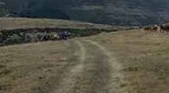
Located in Jaén province, in the eastern part of the autonomous community of Andalusia, southern Spain, Campos de Hernán Perea is said to be the largest high plateau in the country.
Lo Covil
Lo Covil is a high mountain pass at an elevation of 2.402m (7,880ft) above the sea level, located in the comarca of the Pallars Sobirà in Lleida, Catalonia, Spain. It’s one of the highest roads of the country.
Serrat de Capifonts
Serrat de Capifonts is a high mountain peak at an elevation of 2.295m (7,529ft) above the sea level, located in the province of Lleida and autonomous community of Catalonia, Spain.
How to drive the mining road to Colláu del Muru and Altu la Madalena in Asturias?
Colláu del Muru is a high mountain pass at an elevation of 1.638m (5,374ft) above sea level, located on the South of the Principality of Asturias, in Spain.
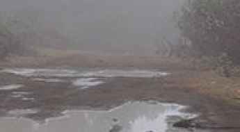
Driving the old and abandoned road to Puerto de Rañadoiro
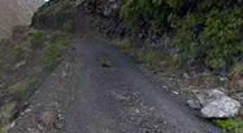
Puerto de la Rañadoiro is a mountain pass at an elevation of 1,178 meters (3,864 ft) above sea level in the Asturias region of northern Spain. Once a vital link in the Sierra de Rañadoiro, this pass—also known as Puerto del Trayecto—has been relegated to a ghost road. Since the opening of a modern tunnel in 2010, the old path has been abandoned, leaving the asphalt to rot under the extreme weather of the Cantabrian Mountains. Driving here now isn't about transit; it’s a journey through a decaying route where the forest is reclaiming the roadbed and the physical hazards of neglect make it a technical challenge for anyone trying to explore what remains of the old Camino Real.
Collado del Puerto
Collado del Puerto is a high mountain peak at an elevation of 2.205m (7,234ft) above the sea level, located in the province of Granada, in the region of Andalucia, southern Spain.
How to get by car to Santuario de Nuestra Señora del Acebo in Asturias
Santuario de Nuestra Señora del Acebo is a high mountain sanctuary at an elevation of 1.172m (3,845ft) above sea level located in the southwest of the Principality of Asturias in Spain.
Cerrillo Redondo
Cerrillo Redondo is a high mountain pass at an elevation of 2.628m (8,622ft) above the sea level, located in the province of Granada, in the region of Andalucia, southern Spain. It’s one of the highest roads of the country.
How to drive the unpaved road to Quiosco la Laguna in Granada?
Quiosco la Laguna is a high mountain refuge at an elevation of 2.610m (8,562ft) above sea level, located in the province of Granada, in Spain. It’s one of the highest roads in the country.
Torcal de Antequera, an awe-inspiring drive in southern Spain
Torcal de Antequera is a nature reserve known for its unusual landforms and karst landscapes, located in the province of Málaga, part of the autonomous community of Andalucía in southern Spain. A road to the visitor’s center tops out at 1.226m (4,022ft) above the sea level.
Valdesqui
Valdesqui is a ski resort at an elevation of 1.877m (6,158ft) above the sea level, located in the Sierra de Guadarrama (mountain range of the Central System), on the edge of the Spanish provinces of Madrid and Segovia, in the central part of the country.
Lago del Valle
Lake Valley is a high mountain lake at an elevation of 1.584m (5,196ft) above the sea level, located in the autonomous community of Asturias, in northern Spain.
Puerto de las Estacas de Trueba
Puerto de las Estacas de Trueba is a mountain pass at an elevation of 1.157m (3,795ft) above the sea level, located on the border of the autonomous communities of Cantabria and Castile and Leon, in northern Spain.
Loma del Caballo
Loma del Caballo is a high mountain pass at an elevation of 2.480m (8,136ft) above the sea level, located in the province of Granada, in the region of Andalucia, southern Spain. It’s one of the highest roads of the country.
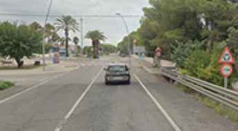
N-340 in Tarragona is the most haunted road in Spain
Located in the province of Tarragona, in the South of Catalonia, Spain, the infamous kilometer 159 of the main N-340 road is said to be the most haunted road in Spain.
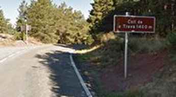
Coll de la Trava
Coll de la Trava is a mountain pass at an elevation of 1.494m (4,901ft) above the sea level, located in the Catalan Pyrenees in Spain.
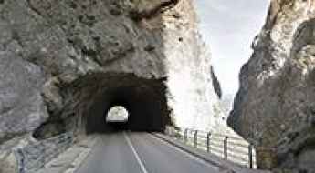
Driving through the narrow tunnels of Desfiladero de La Yecla
Desfiladero de La Yecla is a narrow limestone canyon located in the province of Burgos, Castile and León, Spain. The route through this deep gorge, carved by the Arroyo del Cauce, follows the BU-910 road, a technical and narrow sector characterized by underground transits and high geological instability.
How to drive the curvy Road MA-3111
Carretera MA-3111 is a curvy mountain road located in the province of Málaga, in the autonomous community of Andalusia, in Spain.
Puntal de la Canilla
Puntal de la Canilla is a high mountain peak at an elevation of 2.335m (7,660ft) above the sea level, located in Granada, in the autonomous community of Andalusia, in Southern Spain. It’s one of the highest mountain roads of the country.
Cerro de Los Murciélagos
Cerro de Los Murciélagos is a mountain peak at an elevation of 982m (3,221ft) above the sea level, located in southern Spain, in southwest of the province of Cordoba, in Andalusia.
Pas de Llevata
Pas de Llevata is a high mountain peak at an elevation of 2.445m (8,021ft) above the sea level, located in the province of Lleida, in Catalonia, Spain. It’s one of the highest roads of the country.
Muro de Arraiz
The Muro de Arraiz is a brutal climb located in Bilbao, Basque Country, in northern Spain, with some parts up to 20%.