What are the most spectacular roads in Spain?
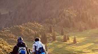
Tucked away on the Iberian Peninsula, in the southwestern part of Europe, the roads of Spain offer the best way to discover the country’s diverse topography. It features mountain roads, even the highest paved road in Europe, as well as stunning coastal drives on the Balearic Islands and the Canary Islands.
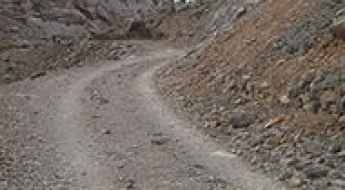
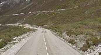
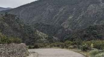
The country is home to Pico del Veleta, the highest paved road in the European continent. Ending at 3,369m (11,053ft) above sea level, it's one of the highest roads in Europe. At an altitude of around 3,000m, road conditions become significantly worse. For those seeking mountain roads, Alto de l’Angliru is the ultimate cycling ascent in Asturias. Climbing up to 1.558m (5,111ft) above sea level, it’s one of the hardest and most epic climbs you can ride on two wheels.
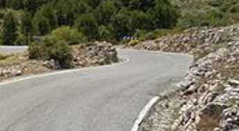
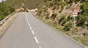
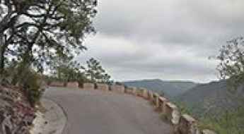
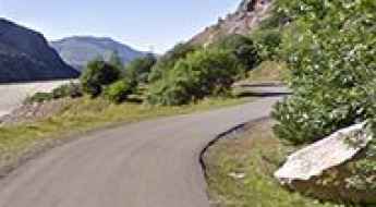
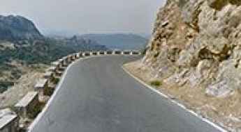
If you’re up for a drive on scenic roads, Mallorca hosts two stunning drives: the sensational road to Formentor Lighthouse and Sa Calobra, the Snake Road. Located on the island of Mallorca, Sa Calobra Road is one of the most scenic drives in the world. Imagine dropping a long piece of wet spaghetti on the floor. The pattern it makes looks something like what the road looks. If you really want a challenge, try tackling it by bike. On the Canary Islands, GC-200 is an exhilarating road with 365 curves and spectacular views. The road has it all, from hairpin bends to sheer cliff-edge drops. It's one of the best roads on the Canary Islands.
So, rev up your engines and let Spain's spectacular routes guide you through a journey of soulful discoveries and unforgettable vistas. You will discover many treasures created by skilled workers employed by construction firms with tradition in Spain.
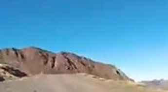
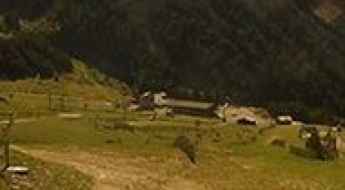
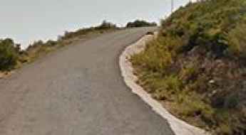
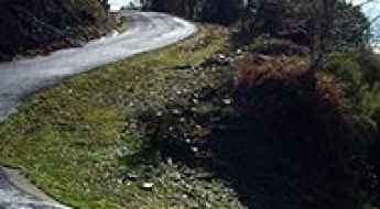
La Raca
La Raca is a high mountain peak at an elevation of 2.271m (7,450ft) above the sea level, located in the heart of the Pyrenees, in northeastern Spain in the province of Huesca.
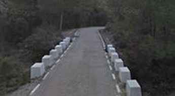
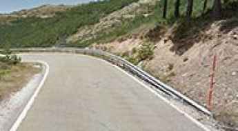
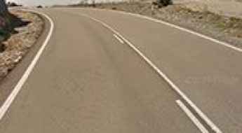
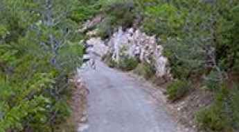
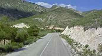
How to drive the paved CV-794 Road to Puerto de Bocairent?
Puerto de Bocairent is a mountain pass at an elevation of 903m (2962ft) above sea level, located in the province of Alicante, in Spain.
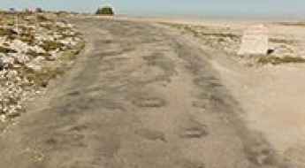
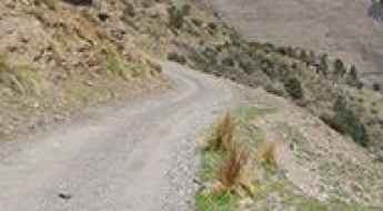
Puerto de Mosqueruela
Puerto de Mosqueruela is a high mountain pass at an elevation of 1.512m (4,960ft) above the sea level, located in the province of Teruel, Aragon, Spain.
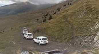
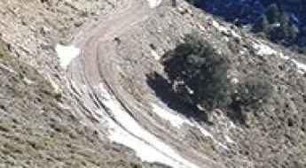
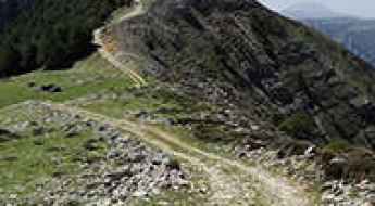
Is the road to Muntanya dels Estanyets in the Pyrenees difficult?
Muntanya dels Estanyets is a high-altitude peak at an elevation of 2,334m (7,657ft) above sea level, located in the Pallars Sobirà region of Catalonia, in Spain. Located on the edge of the Aigüestortes i Estany de Sant Maurici National Park, the track to the summit is one of the highest and steepest drives in the Pyrenees. Originally built as a service road for the Espot Esquí resort chairlifts, it is a brutal unpaved climb that demands total focus and a vehicle prepared for extreme gradients on loose ground.
Les Marmotes: Driving the 25% Gradients of Vallter 2000
Les Marmotes is a high-altitude destination at an elevation of 2,502m (8,208ft) above sea level, located in the heart of the Pyrenees in the province of Girona, Catalonia. Reaching this point, situated within the Camprodon Valley, requires navigating a brutal service road that climbs through the Vallter 2000 ski resort. It's one of the highest roads in the country.
Estany Negre
Estany Negre is a high mountain glacial lake at an elevation of 2.323m (7,621ft) above the sea level, located in the heart of the Pyrenees, in the comarca of the Pallars Sobirà in Catalonia, Spain. It’s one of the highest mountain roads of the country.
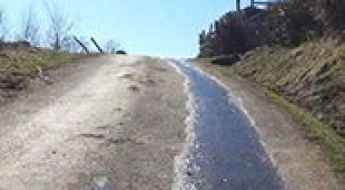
Alto de la Ermita del Alba
Alto de la Ermita del Alba is a mountain pass at an elevation of 1.150m (3,772ft) above the sea level, located in the Autonomous Community of the Principality of Asturias, Spain. The climb is brutal with ramps well into the 20% range and the last 2kms are incredibly steep.
Mas de la Costa
Mas de la Costa is a mountain pass at an elevation of 980m (3,215ft) above the sea level located in the comarca of Alcalatén, province of Castellon, Valencian Community, Spain. It’s said to be one of the Spain's toughest cycling climbs.
Portal de Picos
Portal de Picos is a high mountain peak at an elevation of 1.854m (6,082ft) above the sea level located in Northern Spain, in the autonomous community of Cantabria. At the summit there are several facilities and buildings.
Refugi Cap del Rec
Refugi Cap del Rec is a high mountain shelter at an elevation of 1.986m (6,515ft) above the sea level, located in the province of Girona, Catalonia, northern Spain.
Puerto del Pinar
Puerto del Pinar is a high mountain pass at an elevation of 1.660m (5,446ft) above the sea level, located in the province of Granada, Spain.
El Travieso
El Travieso is a high mountain peak at an elevation of 1.858m (6,095ft) above the sea level, located in the province of Salamanca, Castile and León, Spain.
Ermita de Santa Lucia
Ermita de Santa Lucia is a small church at an elevation of 312m (1,023ft) above the sea level, located in Castelló, a province in the northern part of the Valencian Community, Spain. The climb is simply brutal, with sections up to 20%.
Valdezcaray
Valdezcaray is a ski resort at an elevation of 1.553m (5,095ft) above the sea level, located in the southwest La Rioja, an autonomous region of northern Spain. The maximum slope is 14 %.
Tossal d'Engrilló: The steep 4x4 track through the Parc Natural dels Ports
Tossal d'Engrilló is a mountain peak at an elevation of 1,072 meters (3,517 ft) above sea level, located in the Terra Alta region of Tarragona, Catalonia. The road to the summit, situated within the rugged Parc Natural dels Ports, is a technical unpaved track that scales the limestone massifs of southern Catalonia. The physical reality of driving this route involves managing a raw dirt and gravel surface where the vertical gain of 715 meters over a short distance tests the vehicle's low-end torque and cooling capacity under sustained load.
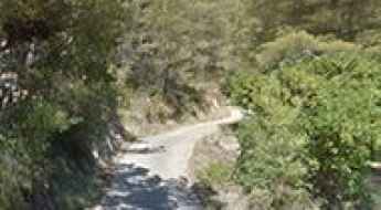
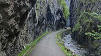
Driving the narrow Hoz del Huécar road (CUV-9144) in Cuenca
The road through the Hoz del Huécar, known as the CUV-9144, is a narrow ribbon of asphalt that snakes along the bottom of a deep limestone gorge. Linking the city of Cuenca with the village of Palomera, this route is carved into the rock, following the path of the Huécar river. It is a technical drive where the vertical walls of the canyon dictate the width of the lane, leaving very little room for error. If you are driving a wide vehicle or a large van, you will need to keep your eyes on the road and your hands firm on the wheel, as the rock faces often overhang the pavement.
Road Logistics: Navigating the Camino de Santiago Route Network
The Camino de Santiago is one of the oldest and most complex road networks in Europe. Originally designed for pilgrims on foot, these routes now cross modern highways, rural tracks, and mountain passes. Managing the logistics of a journey here—whether as a walker or a support vehicle driver—requires a deep understanding of the terrain and the specific safety protocols for shared roads. This guide analyzes the infrastructure and the logistical preparation needed to navigate these iconic Spanish and European routes.
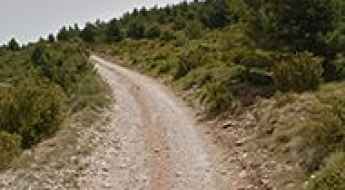
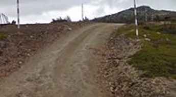
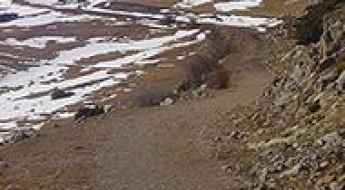
How to drive the unpaved track to Sant Alís in the Serra del Montsec?
Sant Alís is the highest peak in the Serra del Montsec d'Ares, sitting at 1,676m (5,499ft) above sea level. This dirt track in Lleida is the only way to reach the summit, a place where everyone goes to fly. It’s not a long route, but the terrain and the local traffic mean you can’t let your guard down for a second.
Puerto de Fortanete
Puerto de Fortanete is a high mountain pass at an elevation of 1.809m (5,935ft) above the sea level, located in the province of Teruel, Aragon, Spain.
Puntal de la Misa, a wild drive in Spain
Puntal de la Misa is a high mountain peak at an elevation of 1.754m (5,754ft) above the sea level, located in the province of Jaén, in Andalusia, Spain. A 4WD vehicle with high clearance and an experienced driver are required. The road is very steep, with sections up to 20%. It’s one of the wildest drives in the country.
Driving the brutal and steep Puerto de la Bobia in Asturias
Puerto de la Bobia is a high mountain pass reaching 1,103 meters (3,618 ft) above sea level in the Asturias region of northern Spain. Located in the heart of the Sierra de La Bobia, the road to the summit—also known as Alto da Serra da Bovia—is a relentless asphalted track that transitions from narrow forest paths to open mountain ridges. This is not a casual drive; with sustained steepness and sections hitting a 20% gradient, it is one of the most demanding climbs in the Cantabrian Mountains, where the rough surface and the vertical gain will test the cooling system of any vehicle and the endurance of any driver.
Driving the M-130 to Puerto de la Puebla: The wildest pass in Madrid
Located in the northern reaches of the Community of Madrid, the Puerto de la Puebla is a high mountain pass that stands at an elevation of 1,636m (5,367ft) above sea level. Situated within the Sierra del Lobosillo mountain range, this pass is one of the most secluded and authentic driving experiences in Central Spain, far from the crowded routes of the Sierra de Guadarrama.
Ventura Refuge
Refugio Ventura is an abandoned mountain refuge at an elevation of 2.105m (6,906ft) above the sea level, located in Granada province, in the autonomous community of Andalusia, Spain.
How to drive the 4x4 service road to Punta Malacara in Astún?
Punta Malacara is a high mountain peak at an elevation of 2,137m (7,011ft) above sea level, located in the heart of the Pyrenees in the province of Huesca, Spain. Technically, the access route is a specialized service road for the Astún ski resort chairlifts. Navigating this 4.8 km track requires a high-clearance 4x4 vehicle, as the road is engineered for industrial mountain maintenance rather than standard vehicular transit.
Driving the wild road through Pitarque canyon is not a piece of cake
Pitarque canyon road is a very scenic drive running through an incredible landscape located in the province of Teruel, Aragon, in eastern Spain. It’s one of the most scenic canyon roads of Spain.
Road CV-200
Carretera CV-200 is a very challenging road located in eastern Spain, in the province of Castellón, part of the autonomous community of Valencia.
Alto Mirador de Veixia
Alto Mirador de Veixia is a mountain pass at an elevation of 600m (1,968ft) above the sea level located in the province of A Coruña in the autonomous community of Galicia in northwestern Spain.
Desfiladero de la Inclusa: this drive is not for timid drivers
Desfiladero de la Inclusa is a very scenic canyon located in the heart of Huesca, a province in northern Aragon, Spain. It’s one of the most scenic canyon roads of Spain.
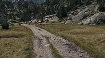
Can I drive the unpaved road to Coll Midós?
Coll Midós is a high mountain pass at an elevation of 2.193m (7,194ft) above sea level, located in Lleida province, in Spain.
Driving the A-226 to Puerto de Cabigordo: History and ice at 1,602m
Located in the heart of the Sierra de Gúdar, in the province of Teruel, Puerto de Cabigordo is a high mountain pass that serves as a vital link between the capital and the high plateaus of Cedrillas. Reaching an elevation of 1,602m (5,255ft) above sea level, the road—officially the A-226—offers a mix of modern high-speed asphalt and a hidden historical track that takes you back decades in time. It is a drive where the cold, dry air of Aragon meets the silent remains of the Spanish Civil War.
How to drive the steep road to Alto El Rey in Guadalajara
Alto El Rey is a high mountain peak at an elevation of 1.858m (6,095ft) above sea level, located in the province of Guadalajara, in Spain.
How to drive the unpaved road to Nuevo Mundo in Almería?
Nuevo Mundo is a high mountain peak at an elevation of 2.115m (6,938ft) above sea level, located in Almería province, in Spain.
Pico de las Tres Güegas
Pico de las Tres Güegas is a high mountain peak at an elevation of 2.240m (7,349ft) above the sea level, located in the province of Huesca, Aragón, in northeast Spain, near the French border.
Cim Fontcalda
Cim Fontcalda is a mountain pass at an elevation of 488m (1,601ft) above the sea level, located in the province of Tarragona, southern Catalonia, in northern Spain.
Puerto de Vegarada-Riopinos
Puerto de Vegarada-Riopinos is a high mountain peak at an elevation of 1.658m (5,439ft) above the sea level, located in the province of León, Castile and León, Spain.
How to drive the unpaved road to Pico Javalambre?
Pico Javalambre is a high mountain pass at an elevation of 2.010m (6,594ft) above sea level, located on the border of Aragon and Valencia, in Spain.
Estany de Sallente
Estany de Sallente is a high mountain reservoir at an elevation of 1.765m (5,790ft) above the sea level, located in La Vall Fosca, in Lleida, Spain.
Roads of Albacete: 8 spectacular drives through the heart of Castilla-La Mancha
Located in the southeast of the Iberian Peninsula, the province of Albacete is a land of dramatic contrasts. While its center is dominated by vast plains, the southern mountains of the Sierra de Alcaraz and Sierra del Segura hide some of the most technical and scenic roads in Spain. This is a territory of deep gorges, river canyons, and limestone cliffs, perfect for those who seek the open road away from the crowds.
Driving the winding Puerto del Boyar in Andalusia
Puerto del Boyar is a mountain pass at an elevation of 1.107m (3,631ft) above the sea level, located in the northeastern part of the province of Cádiz, in the autonomous community of Andalusia, in Spain.
Road trip guide: Conquering Refugi Prat d'Aguiló
Refugi de Prat Aguiló "Cèsar August Torras" is a mountain hut at an elevation of 2.000m (6,561ft) above the sea level, located in the comarca of Cerdanya, Catalonia, in northern Spain near the French border.
The road through Foces del Rio Aller is a rare gem
Foces del Rio Aller is a very scenic canyon located in the autonomous community of Asturias, in Spain. It’s one of the most scenic canyon roads of Spain.
Driving the GU-194 road, the Spanish ‘Great Wall of China’
GU-194 is the name of a stunning road located in the province of Guadalajara, in Castile-La Mancha, an autonomous community of Spain.
Collet de Les Barraques
Collet de Les Barraques is a high mountain pass at an elevation of 1.900m (6,233ft) above the sea level, located in Girona, Catalonia, Spain.
Exploring the Thrilling A-1604: Puerto del Serrablo's Picturesque Road Through the Pyrenees
Carretera A-1604 is a very exciting road in the province of Huesca, Aragon, in Spain. The road is very scenic running along the Guarga River.
Canchal Negro
Canchal Negro is a high mountain peak at an elevation of 2.268m (7,440ft) above the sea level, located in the south of Salamanca province in Castilla y León, Spain.