What are the most spectacular roads in Spain?
Tucked away on the Iberian Peninsula, in the southwestern part of Europe, the roads of Spain offer the best way to discover the country’s diverse topography. It features mountain roads, even the highest paved road in Europe, as well as stunning coastal drives on the Balearic Islands and the Canary Islands.
The country is home to Pico del Veleta, the highest paved road in the European continent. Ending at 3,369m (11,053ft) above sea level, it's one of the highest roads in Europe. At an altitude of around 3,000m, road conditions become significantly worse. For those seeking mountain roads, Alto de l’Angliru is the ultimate cycling ascent in Asturias. Climbing up to 1.558m (5,111ft) above sea level, it’s one of the hardest and most epic climbs you can ride on two wheels.
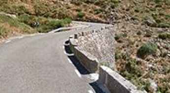
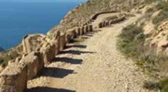
If you’re up for a drive on scenic roads, Mallorca hosts two stunning drives: the sensational road to Formentor Lighthouse and Sa Calobra, the Snake Road. Located on the island of Mallorca, Sa Calobra Road is one of the most scenic drives in the world. Imagine dropping a long piece of wet spaghetti on the floor. The pattern it makes looks something like what the road looks. If you really want a challenge, try tackling it by bike. On the Canary Islands, GC-200 is an exhilarating road with 365 curves and spectacular views. The road has it all, from hairpin bends to sheer cliff-edge drops. It's one of the best roads on the Canary Islands.
So, rev up your engines and let Spain's spectacular routes guide you through a journey of soulful discoveries and unforgettable vistas. You will discover many treasures created by skilled workers employed by construction firms with tradition in Spain.
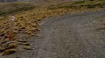
Is the road to Tuc de Salana in the Aran Valley difficult to drive?
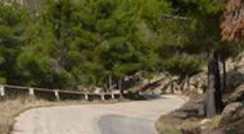
Reaching the Tuc de Salana is a journey to the high-altitude heart of the Pyrenees. At 2,143m (7,030ft) above sea level, this peak dominates the landscape of the Aran Valley in Catalonia. The route, known as the Camin de Pruedo, is a spectacular but demanding mountain loop that connects Salardú and Arties. It’s a road that takes you deep into the Aigüestortes i Estany de Sant Maurici National Park, where the jagged peaks and glacial lakes make you feel very small, very quickly.
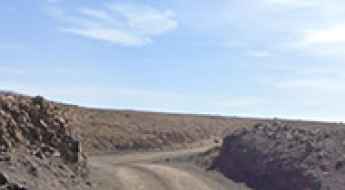
Puerto de Mijares, an absolute must for road lovers
Puerto de Mijares is a high mountain pass at an elevation of 1.575m (5,167ft) above the sea level, located in the south of the province of Ávila, in Castile and León autonomous community, in north-western Spain.
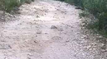
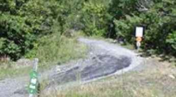
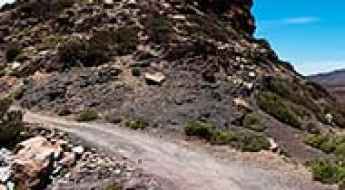
Camino Llano de Tauce: Ultimate 4wd destination
Camino Llano de Tauce is a very scenic high mountain road located on the island of La Palma, in Spain’s Canary Islands.
Morrón del Hornillo
Morrón del Hornillo is a high mountain peak at an elevation of 2.378m (7,801ft) above the sea level, located in the province of Granada, in the region of Andalucia, southern Spain. It’s one of the highest roads of the country.
Puerto Collado
Puerto Collado is a mountain pass at an elevation of 914m (2,998ft) above the sea level, located in the comarca of Axarquía, and province of Málaga, part of the autonomous community of Andalusia in southern Spain.
Driving the steep and narrow road to El Yelmo in Jaén
El Yelmo is one of the most iconic peaks in the Sierra de Segura, standing at 1,785 meters above sea level in the province of Jaén, Andalusia. This is a high-altitude lookout that dominates the Natural Park Sierras de Cazorla, Segura y Las Villas. While the road to the summit is asphalted, do not expect a smooth highway; it is a narrow, twisting ribbon of weathered pavement that climbs aggressively through dense pine forests. It is a technical drive where the wind, the steepness, and the lack of space make it a real challenge for anyone heading toward the communication towers at the top.
Road TV-7411
Carretera TV-7411 is a very scenic road located in the comarca of Ribera d'Ebre in southern Catalonia, near the Aragon region, in northern Spain.
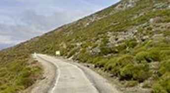
Road CV700
Carretera CV700 is a challenging mountain road located in the Valencian Community, Spain. The road is asphalted. It’s 66.9 km long and links the towns of El Verger (on the AP-7 highway) and Bocairent, on the CV-81 road.
Cap de la Peulla
Cap de la Peulla is a high mountain peak at an elevation of 2.322m (7,618ft) above the sea level, located in the Val d'Aran, a valley in the Pyrenees mountains in the northwestern part of the province of Lleida, in Catalonia, northern Spain. It's one of the highest roads of the country.
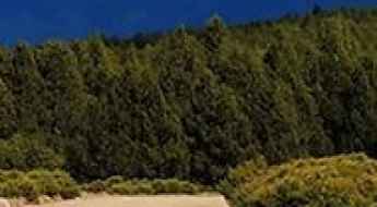
Take An Unforgettable Drive to Mirador del Naranjo de Bulnes
Mirador del Naranjo de Bulnes is a viewpoint at an elevation of 462m (1,515ft) above the sea level, located in the Principality of Asturias, a region of northwest Spain.
Peña Telera
Peña Telera is a high mountain pass at an elevation of 1.791m (5,875ft) above the sea level, located in the province of Huesca, Aragon, in northeastern Spain close to the border with France.
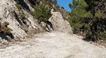
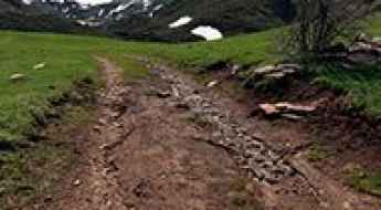
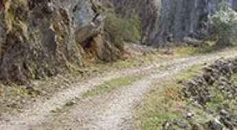
Driving to Coll de Pradell: The 2,135m unpaved pass in Serra d'Ensija
Located in the heart of the Serra d'Ensija, in the Berguedà region of Barcelona, the ascent to Coll de Pradell is a high-altitude journey reaching 2,135m (7,004ft) above sea level. This pass, situated at coordinates 42.19404, 1.64757, should not be confused with the paved pass of the same name located further east. This is a raw, high-mountain environment where the asphalt disappears to give way to a technical track that demands respect from both the driver and the vehicle's mechanics.
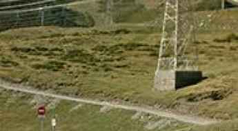
Monte Roldan: a military road to the summit
Monte Roldan is a mountain peak at an elevation of 468m (1,535ft) above the sea level, located in the Murcia region of southeast Spain. The road offers stunning views of the Mediterranean coastline of Murcia.
Montau
Montau is a mountain peak at an elevation of 654m (2,145ft) above the sea level, located in the comarca of Garraf, in the province of Barcelona and autonomous community of Catalonia, Spain. The summit offers stunning views.
Puigsou
Puigsou is a high mountain peak at an elevation of 989m (3,244ft) above the sea level, located in the province of Girona, Catalonia, northern Spain. It has been used by some of the world’s best cyclists as a test climb.
Pico Almadén, a tough and stunning road to the summit
Pico Almadén is a high mountain peak at an elevation of 2.031m (6,663ft) above the sea level, located in the province of Jaen, autonomous community of Andalusia, in southern Spain
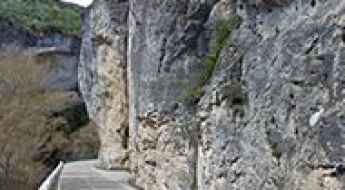
Driving through the infamous Taibilla Canyon
Cañón de Rio Taibilla is a very scenic drive running through an incredible landscape located in Albacete province, in the Spanish autonomous community of Castilla–La Mancha. It’s one of the most scenic canyon roads of Spain.
The Ultimate Guide to Traveling Foces del Rio Somiedo
Foces del Rio Somiedo is the name of a very scenic drive located in the autonomous community of Asturias, in northern Spain. It’s one of the most scenic canyon roads of Spain.
Collada de Montaner: Driving the 9.6% 4x4 border track to Andorra
Reaching an elevation of 2,079m (6,820ft) above sea level, Collada de Montaner is an international high mountain pass situated on the ridgeline of the Pyrenees, marking the border between Spain and Andorra. This high-altitude crossing is a legendary route for off-roaders, linking the Spanish enclave of Os de Civís with the Andorran parish of La Massana.
Alto de Cazorla
Alto de Cazorla is a mountain pass at an elevation of 930m (3,051ft) above the sea level located in the province of Jaén in Spain's autonomous community of Andalusia.
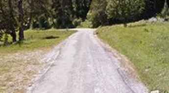
Driving the 4x4 track to Braña de Murias Chongas: 1,650m in Somiedo
The ascent to Braña de Murias Chongas is a high-mountain unpaved track located in the heart of the Somiedo Natural Park, within the Asturias region of northern Spain. Officially designated as part of the PR AS-15.1 route, this mountain path links the village of Valle de Lago with the high summer pastures at an elevation of 1,650 meters (5,413 ft) above sea level.
Cap de la Fesa
Cap de la Fesa is a high mountain peak at an elevation of 2.356m (7,729ft) above the sea level, located in the comarca of Alt Urgell, Lleida, Catalonia, in northern Spain, near the French border. It’s one of the highest roads of the country.
Driving the TV-2443: The WRC legendary stage in Alt Camp
The TV-2443 is a hidden gem in the Alt Camp region of Catalonia, Spain. This 17.4 km paved route connects the town of Vila-rodona with the small village of Aiguaviva (El Montmell). While it may look like a quiet country road, it is a high-speed technical challenge carved through pine forests and almond groves, demanding absolute precision from anyone behind the wheel.
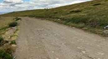
How to drive the unpaved road to Pico del Nevero?
Pico del Nevero is a high mountain pass at an elevation of 2.211m (7,257ft) above sea level, located in Spain.
The cracked LE-CV-192/21 is a mountain road in Castile and Leon
Carretera LE-CV-192/21 is a very scenic high mountain road located in the province of León, in Spain.
Road trip guide: Hoces de Valdeteja
Hoces de Valdeteja is a very scenic drive running through an incredible landscape located north of León province, in Castile and León, Spain. It’s one of the most scenic canyon roads of Spain.
Driving the scenic Estrecho de Priego
Estrecho de Priego is the name of a very scenic canyon located in the heart of Cuenca province in the eastern part of the autonomous community of Castile-La Mancha, in Spain. It’s one of the most scenic canyon roads of Spain.
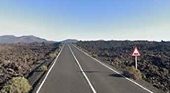
Is the LZ-67 the most photographed road in the Canary Islands?
Located in the Canary Islands, Carretera LZ-67 is an unforgettable drive, offering awe-inspiring views of over 30 volcanic cones.
Driving the 27 hairpins to El Moixer: The 1,441m wall of Roc del Comptador
El Moixer, also known as Roc del Comptador, is a high mountain peak at an elevation of 1,441 meters (4,727 ft) above sea level, located on the international border between Spain (Girona province) and France (Pyrénées-Orientales). Situated as the highest point of the Serra de l'Albera, the summit features telecommunication towers accessible via a steep mountain track climbing the southern slopes.
Laguna de Valdeazores
Laguna de Valdeazores is a high mountain lake at an elevation of 1.289m (4,229ft) above the sea level, located in Jaén, a province of southern Spain, in the eastern part of the autonomous community of Andalusia.
How difficult is the 4x4 road to Cerro del Gargantón in Spain?
Cerro del Gargantón is a high mountain pass reaching an elevation of 1,789m (5,869ft) above sea level, situated on the border between the Community of Madrid and Castile and León in central Spain. Perched in the rugged Sierra de Guadarrama, the road to the summit is a primitive track that serves as a high-altitude balcony over the Lozoya Valley. This is a journey through a world of granite and thin air, where the wide gravel path can be deceptive, hiding technical sections that require a proper 4x4 and a driver who doesn't suffer from vertigo.
Driving the unpaved track to Pico Zapatero in Avila
Pico Zapatero, also known as Cuchillar del Zapatero, is a high mountain peak at an elevation of 1,914 meters (6,279 ft) above sea level, located in the Ávila province of Castile and León, Spain. Situated in the Sierra de la Paramera, the long unpaved track climbs to the telecommunication antennas built at the summit ridge.
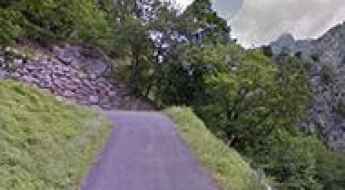
Driving the abandoned curves of Puerto de Contreras: The ghost of the N-III
The Puerto de Contreras, also known as the Cuestas de Contreras, is a ghost of Spanish engineering. Located on the border between the Valencian Community and Castile-La Mancha, this 17-kilometer stretch was once the main artery between Madrid and Valencia. Today, following the opening of the A-3 highway, it has reverted to a narrow, technical, and partially restricted route that remains a brutal test for those looking to understand how traffic used to flow across the Cabriel river gorge.
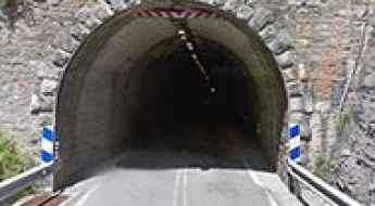
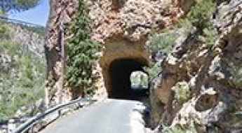
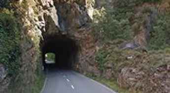
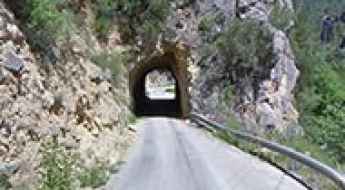
Tunel de Cotefablo
Tunel de Cotefablo is a high mountain tunnel at an elevation of 1.423m (4,668ft) above the sea level, located in the province of Huesca, in northeastern Spain close to the border with France.
Driving the curvy road to Alto de La Nava Grande in the Sierra de Guadarrama
Alto de La Nava Grande is a high mountain peak at an elevation of 1,963m (6,440ft) above sea level, located in the Sierra de Guadarrama, Madrid. Known locally as Alto de La Nava, this summit offers one of the most technical and scenic unpaved climbs in central Spain.
How to drive the paved road to Puerto de San Lorenzo?
Puerto de San Lorenzo is a mountain pass at an elevation of 1.348m (4,422ft) above sea level, located in the province and autonomous community of Asturias, in Spain. Long and steep (with some parts up to 18%) brutal describes the climb but it is worth it as the scenery is spectacular.
Driving the scenic road to Pla de la Feixa
Pla de la Feixa is a high mountain plateau situated at an elevation of 2,212m (7,257ft) above sea level. It is located in the comarca of Cerdanya, in the province of Girona, Catalonia. This plateau sits in the heart of the Pyrenees mountain range, near the French border, between the picturesque towns of Meranges and Guils de Cerdanya.
Estany de Filià
Estany de Filià is a glacial lake located in the province of Lleida and autonomous community of Catalonia, Spain. The road to the lake ends at 2.050m (6,725ft) above the sea level.
How to drive the panoramic road through Zumeta Canyon?
Cañón del Río Zumeta is a very scenic canyon located in Spain. It’s one of the most visited areas on Segura Valley on summers. It’s one of the most scenic canyon roads of Spain.
Can I drive to Pico Papeles in Andalusia?
Pico Papeles is a high mountain pass at an elevation of 2.353m (7,719ft) above sea level, located in the province of Granada, in Spain. It’s one of the highest roads in the country.
El Filo
El Filo is a high mountain pass at an elevation of 2.347m (7,700ft) above the sea level, located in Tenerife in the Canary Islands, Spain. It’s one of the highest roads of Spain.
Pico de Cerler
Pico de Cerler is a high mountain peak at an elevation of 2.322m (7,618ft) above the sea level, located in the Benasque Valley, in the heart of the Pyrenees, in Spain. It's one of the highest mountain roads of Spain.
Tuc de Saumet
Tuc de Saumet is a high mountain peak at an elevation of 2.609m (8,559ft) above the sea level, located in the Val d'Aran, a valley in the Pyrenees mountains in the northwestern part of the province of Lleida, in Catalonia, northern Spain. It's one of the highest roads of the country.
Puerto de Honduras
Puerto de Honduras is a mountain pass at an elevation of 1.433m (4,701ft) above the sea level, located in the north of the province of Cáceres, in Spain.
Here's How To Have The Ultimate Road Trip To Punta de Jandia Lighthouse
Faro de la Punta de Jandía is a lighthouse located in Fuerteventura, on Canary Islands, Spain.