What are the most spectacular roads in Spain?
Tucked away on the Iberian Peninsula, in the southwestern part of Europe, the roads of Spain offer the best way to discover the country’s diverse topography. It features mountain roads, even the highest paved road in Europe, as well as stunning coastal drives on the Balearic Islands and the Canary Islands.
The country is home to Pico del Veleta, the highest paved road in the European continent. Ending at 3,369m (11,053ft) above sea level, it's one of the highest roads in Europe. At an altitude of around 3,000m, road conditions become significantly worse. For those seeking mountain roads, Alto de l’Angliru is the ultimate cycling ascent in Asturias. Climbing up to 1.558m (5,111ft) above sea level, it’s one of the hardest and most epic climbs you can ride on two wheels.
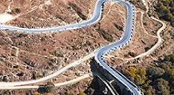
If you’re up for a drive on scenic roads, Mallorca hosts two stunning drives: the sensational road to Formentor Lighthouse and Sa Calobra, the Snake Road. Located on the island of Mallorca, Sa Calobra Road is one of the most scenic drives in the world. Imagine dropping a long piece of wet spaghetti on the floor. The pattern it makes looks something like what the road looks. If you really want a challenge, try tackling it by bike. On the Canary Islands, GC-200 is an exhilarating road with 365 curves and spectacular views. The road has it all, from hairpin bends to sheer cliff-edge drops. It's one of the best roads on the Canary Islands.
So, rev up your engines and let Spain's spectacular routes guide you through a journey of soulful discoveries and unforgettable vistas. You will discover many treasures created by skilled workers employed by construction firms with tradition in Spain.
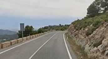
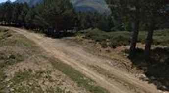
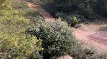
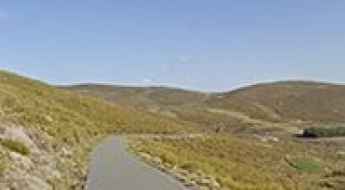
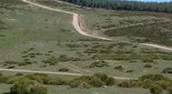
Sant Benet
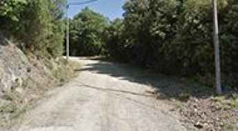
Sant Benet is a high mountain peak at an elevation of 1.150m (3,772ft) above the sea level, located in the comarca of La Selva, in the province of Girona and autonomous community of Catalonia, Spain.
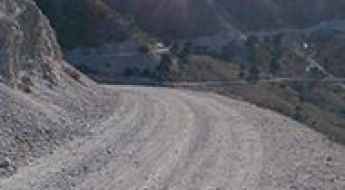
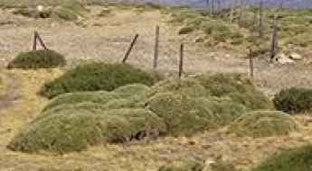
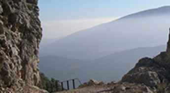
Adventure Along the Wild Road to Mirador de Piedra Lobera
Mirador de Piedra Lobera is a natural viewpoint at an elevation of 1.696m (5,564ft) above the sea level, located in Almería province of the Autonomous Community of Andalusia, Spain.
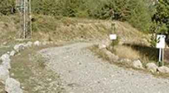
Braña de Vega La Cueva: Driving the 4x4 Track to Lagunas de Canchongo
At an elevation of 1,467m (4,812ft) above sea level, Braña de Vega La Cueva (also known as Braña La Cueva) is a high mountain pass in the southern part of the Principality of Asturias, Spain. Located in the Las Ubiñas-La Mesa Natural Park, this track climbs through the central Cantabrian Mountains toward a small glacial lake called Lagunas de Canchongo.
Surviving the Spanish Death Road: A Comprehensive Guide to Navigating the M618 from Colmenar Viejo to Torrelodones
Located in the northwest of the Autonomous Community of Madrid, Spain, the tiny M618 road is nicknamed the Spanish Death Road. Better avoid it if you’re prone to car sickness.
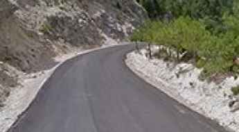
Driving the delightful CV800 Road to Port de la Carrasqueta
CV800 is a very scenic (and delightful) drive located in the southeast of Valencian Community, in Spain.
How to drive the wild unpaved road to Monte Aquiana in Leon?
Monte Aquiana is a high mountain peak at an elevation of 1.819m (5,967ft) above sea level, located in the province of León, in Spain.
If you love to drive, you will love the road to Puerto del Cubillo
Puerto del Cubillo is a high mountain pass at an elevation of 1.617m (5,305ft) above the sea level, located in the province of Cuenca, Castile-La Mancha, Spain.
What Is the Curious Phenomenon Happening on a Road in Malaga That Leaves Experts Astonished?
On a section of the road that connects the town of Ronda with Gaucín, in southern Spain, there is a gravitational anomaly that experts have not been able to explain, continuing to baffle drivers.
Estanho de Vilac
Estanho de Vilac is a high mountain lake with an influence of Atlantic climate at an elevation of 1.642m (5,387ft) above the sea level, located in the Val d'Aran, a valley in the Pyrenees mountains in the northwestern part of the province of Lleida, in Catalonia, northern Spain. The average gradient is 8.85%.
Pico Cascuerres
Pico Cascuerres is a high mountain peak, at an elevation of 1.598m (5,242ft) above the sea level, located in the autonomous community of Cantabria, in northern Spain. The average gradient is 13.93%.
Puig Castellar
Puig Castellar is a mountain pass at an elevation of 943m (3,093ft) above the sea level, located on the border of Alt Penedès and Anoia regions, in the province of Barcelona, Catalonia, Spain. The climb is very steep, with sections up to 12%.
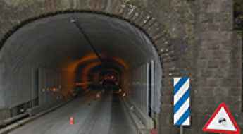
The So-Called 'Tunnel of Time': This is What Happens When Cars Pass Through It
This tunnel is located on the LP-3 road, on the island of La Palma, in Spain’s Canary Islands, and is called the La Cumbre tunnel. Drivers are always surprised by what happens when they exit it.
Puerto de Navaluenga
Puerto de Navaluenga is a high mountain peak at an elevation of 1.804m (5,918ft) above the sea level, located in the province of Ávila, Castile and León, Spain. It’s 12’5% with some sections up to 37%.
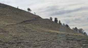
How to drive the 31 hairpin turns to Collado Ordes in Asturias?
Collado Ordes is a high mountain pass at an elevation of 1.147m (3,763ft) above sea level, located in the province and autonomous community of Asturias, in Spain. The average gradient is brutal: 14.64% with 31 hairpin turns.
Puerto de la Mata, an epic road in Andalusia
Puerto de la Mata is a high mountain pass at an elevation of 1.670m (5,479ft) above the sea level, located in Almería province, in the autonomous community of Andalusia, in southern Spain. The road to the summit is steep, hitting an 18%.
Mirador de Sierra Alta
Mirador de Sierra Alta is a natural viewpoint at an elevation of 1.840m (6,036ft) above the sea level, located in the province of Teruel, Aragon, Spain.
Mola del Guerxet
Mola del Guerxet is a high mountain pass at an elevation of 1.109m (3,638ft) above the sea level, located in the comarca of Conca de Barberà, in the province of Tarragona and autonomous community of Catalonia, Spain.
Bellmunt
Bellmunt is a high mountain peak at an elevation of 1.246m (4,088ft) above the sea level, located in the comarca of Osona, in the province of Barcelona and autonomous community of Catalonia, Spain.
El Maigmó: The brutal 16% climb to Alt de les Xemeneies
El Maigmó is a mountain peak at an elevation of 1,192 meters (3,910 ft) above sea level, located in the L'Alcoià region of Alicante, Spain. The road to the summit, often referred to as Alt de les Xemeneies, is a technical and punishing climb that scales the limestone heights of the Costa Blanca interior. The physical reality of this route involves managing a narrow, recently paved ribbon of asphalt that hits extreme gradients, where the lack of space forces drivers to perform high-precision maneuvers on steep ramps when meeting oncoming traffic.
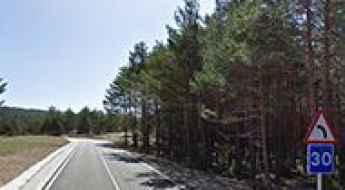
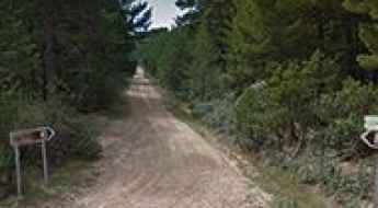
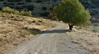
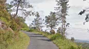
Road Beniarres-Vilallonga
Carretera Beniarres-Vilallonga is a short mountain road located in the Valencian Community of Spain. The road is asphalted. It’s 22.7 km long.
Barratge de Romedo de Baix
Barratge de Romedo de Baix is a high mountain lake at an elevation of 2.018m (6,620ft) above the sea level, located in the province of Lleida, Catalonia, in north-eastern Spain, near the French border.
Cueva del Agua, a road recommended for drivers with strong nerves
Cueva del Agua ('Water Cave’) is a natural cave at an elevation of 1.748m (5,734ft) above the sea level, located in the municipality of Deifontes, in the province of Granada, autonomous community of Andalusia, in southern Spain.
What is the Vía de la Plata? Driving the N-630 and A-66 in Spain
The Vía de la Plata is a historic 700-kilometer transport corridor in western Spain. Following a Roman route that connected the south and north of the Iberian Peninsula, it today functions as a major road link between Seville and Gijón.
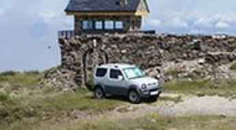
An Explorer's Guide to Mina de Ventana
Mina de Ventana (Window Mine) is an old mine at an elevation of 1.699m (5,574ft) above the sea level, located on the border of Principado de Asturias and Castilla y León, in northern Spain.
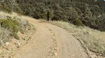
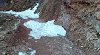
Collado del Álamo: A steep gravel climb in Sierra Nevada
Collado del Álamo is a demanding high-mountain track located in the heart of the Sierra Nevada National Park. Reaching an elevation of 1,729m (5,672ft) above sea level in the province of Granada, this unpaved route serves as a balcony over the highest peaks of the Iberian Peninsula. However, the technical nature of the climb and the extreme gradients make it a road where mechanical reliability and tire traction are far more important than the surrounding scenery.
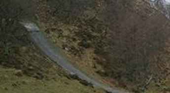
Collado de la Espina is like riding up a wall
Collado de la Espina is a mountain pass at an elevation of 968m (3,175ft) above the sea level, located in the Autonomous Community of Cantabria, in northern Spain. It’s one of the steepest roads that a Spanish bike race has ever tackled where you directly ride against uphill over a huge rock. The climb is brutal: up to 31%.
Monte Faro is an awe-inspiring drive in Galicia
Monte Faro is a high mountain pass at an elevation of 1.181m (3,874ft) above the sea level, located on the boundary of Lugo and Pontevedra provinces, in Galicia, Spain.
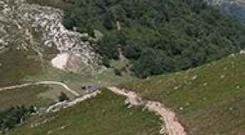
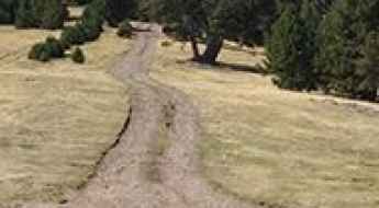
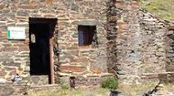
How to drive the unpaved Pista de Boumort in the Pre-Pyrenees?
The Refugi de Boumort is a high mountain hut at an elevation of 1,886m (6,187ft) above sea level, located in the province of Lleida, Catalonia. Situated within the Serra de Boumort National Hunting Reserve, the access is via the Pista de Boumort, a technical unpaved artery that remains the only unrestricted transit for non-authorized vehicles in this high-altitude sector of the Pre-Pyrenees.
Cerro de la Escusa
Cerro de la Escusa is a high mountain peak at an elevation of 1.952m (6,404ft) above the sea level, located in the province of Ávila, Castile and León, Spain.
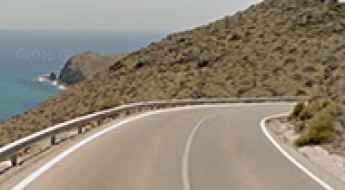
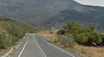
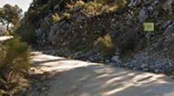
AL-4200 Road: Experience the Coastal Beauty of Almeria
Discover the breathtaking AL-4200, a captivating coastal road nestled in the eastern part of the picturesque province of Almería, within the enchanting autonomous community of Andalusia, Spain.
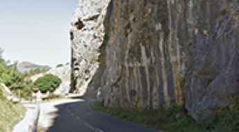
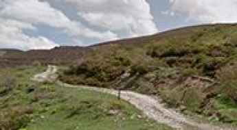
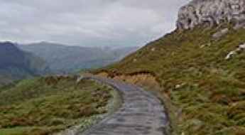
Exploring the majestic road through Desfiladero de la Estrechura in Asturias
Desfiladero de la Estrechura is a very scenic canyon located in the autonomous community of Asturias, in Spain. It’s one of the most scenic canyon roads of Spain.
An unforgettable road to Coll de Caralt in the Pyrenees
Coll de Caralt is a high mountain pass at an elevation of 2100m (6,889ft) above sea level, located in Lleida province, in Spain.
Alto de Gredos
Alto de Gredos is a mountain peak at an elevation of 1.768m (5,800ft) above the sea level, located in the south of the province of Ávila, Castile and León, Spain.
The unpaved road through Garganta del rio Tajo in Guadalajara
Garganta del Rio Tajo is a scenic canyon located in the province of Guadalajara in Castile-La Mancha, Spain. It’s one of the most scenic canyon roads of Spain.
How to get by car to Puerto de Arcones?
Puerto de Arcones is a high mountain pass at an elevation of 1,747m (5,731ft) above sea level, located in Spain.
Road trip guide: Conquering Puerto de Cienfuegos
Puerto de Cienfuegos is a high mountain pass at an elevation of 1.674m (5,492ft) above the sea level, located on the boundary of the province and autonomous community of Asturias and Leon province, in the autonomous community of Castile and León, in northern Spain.
How difficult is the unpaved road to Puerto de la Acebeda in Spain?
Puerto de la Acebeda is a high mountain pass reaching an elevation of 1,690m (5,544ft) above sea level, located on the boundary between the Community of Madrid and the province of Segovia, in Castile and León. Sitting in the central sector of the Sierra de Guadarrama, the pass is crossed by a wide but brutal unpaved track. This is a high-altitude balcony where the road surface is a constant battle between loose granite gravel and deep ruts carved by the harsh Castilian winters, requiring a vehicle with high clearance and a driver who respects the unpredictable nature of the mountains.
A Most Tricky Road to Alto de Calabazosa and Lago de la Cueva Viewpoint
Alto de Calabazosa is a high mountain pass at an elevation of 1.691m (5,547ft) above the sea level, located located on the South of the Principality of Asturias, in northern Spain.
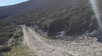
A wild road to El Doctor Refuge, in southern Spain
Refugio-Vivac el Doctor is a high mountain shelter at an elevation of 2.025m (6,643ft) above the sea level, located in the province of Almería, in the region of Andalucia, southern Spain.
The road to Alto de Despiernacaballos is a hidden gem
Alto de Despiernacaballos is a high mountain pass at an elevation of 1.580m (5,183ft) above sea level, located in the province of Jaén, in Spain.
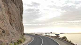
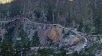
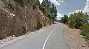
Driving the coastal Carretera del Cañarete is not easy due to the rockslides
Carretera del Cañarete is a very scenic, yet defiant, coastal road located in the southeastern part of Spain. The road is extremely defiant due to the high risk of rockslides.
Camí de la Cabroa in Montsec is a thrilling off road experience
Camí de la Cabroa is the name of a defiant wild cliff road located in the comarca of Noguera, in the province of Lleida, Catalonia, Spain.
How to drive the unpaved road to Collada de les Tores in Lleida?
Collada de les Tores is a high mountain pass at an elevation of 2.000m (6,561ft) above sea level, located in Lleida, Spain.
Punta Alvarosa
Punta Alvarosa is a high mountain pass at an elevation of 2.023m (6,637ft) above the sea level, located in the province of Huesca, Aragon, Spain.
Driving the wild Puerto del Portillo
Puerto del Portillo is a mountain pass at an elevation of 1.250m (4,101ft) above the sea level, located in the province of Salamanca, Castile and León, in Spain.