What are the most spectacular roads in Spain?
Tucked away on the Iberian Peninsula, in the southwestern part of Europe, the roads of Spain offer the best way to discover the country’s diverse topography. It features mountain roads, even the highest paved road in Europe, as well as stunning coastal drives on the Balearic Islands and the Canary Islands.
The country is home to Pico del Veleta, the highest paved road in the European continent. Ending at 3,369m (11,053ft) above sea level, it's one of the highest roads in Europe. At an altitude of around 3,000m, road conditions become significantly worse. For those seeking mountain roads, Alto de l’Angliru is the ultimate cycling ascent in Asturias. Climbing up to 1.558m (5,111ft) above sea level, it’s one of the hardest and most epic climbs you can ride on two wheels.
If you’re up for a drive on scenic roads, Mallorca hosts two stunning drives: the sensational road to Formentor Lighthouse and Sa Calobra, the Snake Road. Located on the island of Mallorca, Sa Calobra Road is one of the most scenic drives in the world. Imagine dropping a long piece of wet spaghetti on the floor. The pattern it makes looks something like what the road looks. If you really want a challenge, try tackling it by bike. On the Canary Islands, GC-200 is an exhilarating road with 365 curves and spectacular views. The road has it all, from hairpin bends to sheer cliff-edge drops. It's one of the best roads on the Canary Islands.
So, rev up your engines and let Spain's spectacular routes guide you through a journey of soulful discoveries and unforgettable vistas. You will discover many treasures created by skilled workers employed by construction firms with tradition in Spain.
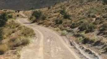
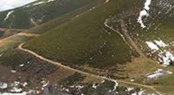
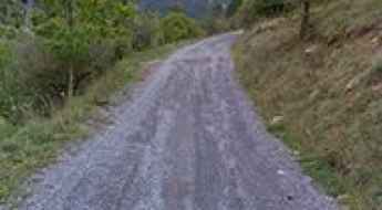
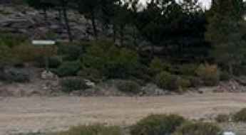
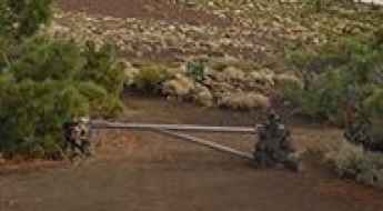
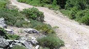
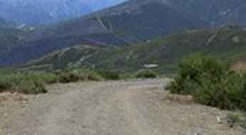
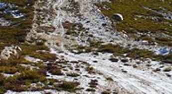
Collado la Gitana, a gravel mountainous track in southern Spain
Collado la Gitana is a high mountain pass at an elevation of 1.714m (5,623ft) above the sea level, located in the province of Granada, in the region of Andalucia, southern Spain.
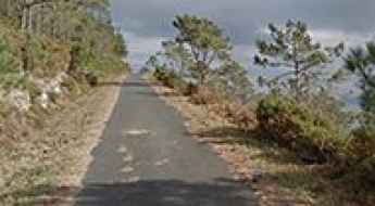
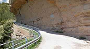
The road to Miradoiro do Limo is littered with outstanding sea-landscapes
Miradoiro do Limo is a spectacular viewpoint located at an elevation of 373m (1,223ft) above sea level in A Coruña, Galicia. Perched on the Serra de l'A Capelada, the road leads to one of the most rugged and vertical coastlines in Spain.
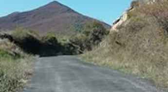
Peñón del Toro
Peñón del Toro is a high mountain pass at an elevation of 1.857m (6,092ft) above the sea level, located in the province of Granada, in Andalusia, Spain.
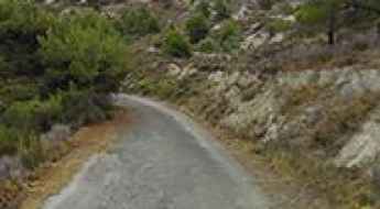
Driving the steep road to Montduver is not a piece of cake
Montduver is a mountain peak at an elevation of 831m (2,726ft) above the sea level, located in the comarca of Safor in the Valencian Community, Spain.
The inhumane climb to Escart with 21% ramps
Escart is a mountain town at an elevation of 1.188m (3,897ft) above sea level, located in the comarca of the Pallars Sobirà, in the province of Lleida and autonomous community of Catalonia, in northern Spain.
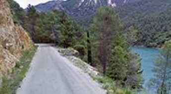
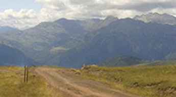
Road trip guide: Conquering Estany de la Gola in the Pyrenees
Estany de la Gola is a glacial lake at an elevation of 1.997m (6,551ft) above the sea level, located in the comarca of the Pallars Sobirà, Province of Lleida, in the western part of the autonomous community of Catalonia, Spain.
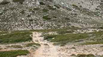
Pico Patana
Pico Patana is a high mountain peak at an elevation of 1.526m (5,006ft) above the sea level, located in the autonomous community of Asturias, in northern Spain.
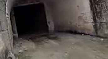
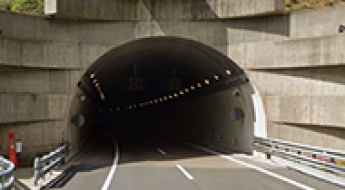
Road trip guide: Conquering the defiant Molinar Tunnel
Túnel del Molinar is the name of a 3km long tunnel located in Albacete, in Castilla–La Mancha autonomous community of Spain.
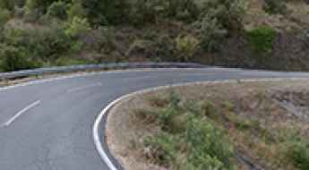
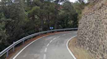
Why Puerto de Monrepos is the Only Road in Spain Where Snow Chains Are Prohibited?
Puerto de Monrepós is a mountain pass at an elevation of 1,282m (4,206ft) above sea level, located in the province of Huesca, in Spain.
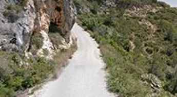
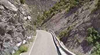
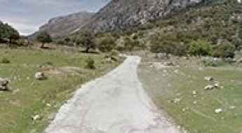
JF-7038: a fabulous road if you are not scared of heights
Located in the province of Jaén, in the eastern part of the autonomous community of Andalusia, in southern Spain, JF-7038 is a very scenic road running through the Segura valley.
Driving the stunning road through Barranco de Guayadeque on the Canary Islands
Barranco de Guayadeque is a stunning ravine with great views located in the eastern part of the island of Gran Canaria, in Spain. The road through the ravine is worth the drive.
How to drive the steep 17% road to Sant Bartomeu de Dorve?
Sant Bartomeu de Dorve is a high-altitude location at an elevation of 1,393m (4,570ft) above sea level, situated in the Pallars Sobirà comarca of Catalonia, Spain. While the site is known for its 16th-century Romanesque architecture, the primary technical interest lies in the high-gradient access road that climbs from the Noguera Pallaresa river valley. Driving this route requires precise throttle control and high-performance braking systems to manage the extreme vertical gain.
Coll de Mola
Coll de Mola is a high mountain pass at an elevation of 1.821m (5,974ft) above the sea level, located in the northwest of the comarca of Berguedà in Catalonia, Spain.
A very bumpy steep road to Alto del Mirlo
Alto del Mirlo is a high mountain peak at an elevation of 1.767m (5,797ft) above the sea level, located in Ávila, in the autonomous community Castile and León, near the border of Madrid, in central Spain.
Discover the Breathtaking AL-5107 Coastal Road and the Scenic Beauty of Almeria
Prepare to be enchanted by the breathtaking beauty of AL-5107, a picturesque coastal road nestled in the eastern part of Almería province, within the enchanting region of Andalusia, Spain.
CV-827: The Ultimate Road Trip Guide
CV-827 is the name of a pleasant ride located in the comarca of Vinalopó Mitjà, in the province of Alicante of the autonomous community of Valencia, Spain.
Driving the steep road to Puerto de Casillas in Ávila
Puerto de Casillas is a mountain pass at an elevation of 1,469m (4,819ft) above sea level, located in the Ávila province of central Spain. Situated within the Iruelas Valley in the Sierra de Gredos, the access road is characterized by a drastic transition in surface integrity and extreme vertical gradients.
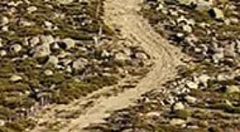
How to drive the unpaved road to Campo de Las Danzas?
Campo de Las Danzas is a mountain pass at an elevation of 1.448m (4,750ft) above sea level, located in the Province of León, in Spain.
Carretera Agost, a winding road only for experienced drivers
Located in the comarca of Vinalopó Mitjà, in the province of Alicante of the autonomous community of Valencia, Spain, Carretera Agost is the name of a defiant road through the mountains with many deep drop offs.
How to drive the 4x4 road to Pedras Blancas in Aragon?
Pedras Blancas is a high mountain peak at an elevation of 2,359m (7,736ft) above sea level, located in the province of Huesca, Aragon, Spain. The unpaved mountain track leading to the summit is famous for being one of the highest drivable routes in the Pyrenees.
How to get to La Negrita in Tenerife?
La Negrita is a high mountain peak at an elevation of 2,223m (7,293ft) above sea level, located on the island of Tenerife, in the Canary Islands of Spain.
GI-400 is a memorable road trip in the Pyrenees
GI-400 is a very scenic mountain road with stunning views located in the province of Girona, in the autonomous community of Catalonia, in Spain.
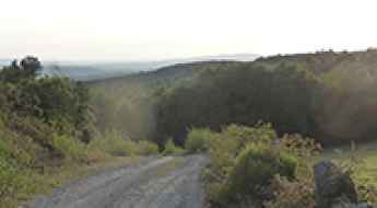
Lagu Terciellu: Driving the brutal 11% Camín de La Poza in Asturias
Located in the southern part of the Principality of Asturias, in northern Spain, Lagu Terciellu is a high mountain lake at an elevation of 1,435m (4,708ft) above sea level. Situated within the Las Ubiñas-La Mesa Natural Park, a UNESCO Biosphere Reserve, the road to the lake is a formidable challenge for off-roaders, known for its sustained verticality and breathtaking Cantabrian scenery.
Venta del Chaleco: Driving the scenic switchbacks of Sierra Contraviesa
Venta del Chaleco is a mountain pass at an elevation of 1,323 meters (4,340 ft) above sea level, located in the eastern part of the Granada province, in southern Spain. Situated within the Sierra Contraviesa range, the pass is linked by the paved GR-6202 road, which connects the Mediterranean coast side with the inner Alpujarra Granadina region.
Collado de los Cadavales
Collado de los Cadavales is a high mountain pass at an elevation of 1.351m (4,432ft) above the sea level, located in the autonomous community of Asturias, in northern Spain.
Paso del Reventón: Driving the 14km Dirt Track in the Sierra de Guadarrama
At an elevation of 2,041m (6,696ft) above sea level, Paso del Reventón is a high mountain pass situated on the boundary between the Segovia province and the Community of Madrid, in central Spain. Located in the Sierra de Guadarrama, this unpaved route is one of the highest crossings in the Sistema Central range.
How to drive the curvy road to Coll d'Alforja in Tarragona?
Coll d'Alforja is a mountain pass at an elevation of 641m (2,103ft) above sea level, located in the province of Tarragona, in Spain.
A pleasant drive to Coll Formic in Montseny
Coll Formic is a mountain pass at an elevation of 1.145m (3756ft) above the sea level located in the province of Barcelona, in the center of the autonomous community of Catalonia, in Spain.
The inhumane climb to Alto La Colladiella, an iconic Spanish Vuelta climb
Alto La Colladiella is a mountain pass at an elevation of 848m (2,782ft) above the sea level, located in the province and autonomous community of Asturias, in Spain.
The wild road to Cueto Mirallo
Cueto Mirallo is a high mountain pass at an elevation of 1.910m (6,266ft) above the sea level, located in the province of León, Castile and León, Spain.
An Unforgettable Drive to Monte Farelo in Galicia
Monte Farelo is a high mountain pass at an elevation of 948m (3,110ft) above the sea level, located on the boundary of Lugo and Pontevedra provinces, in Galicia, Spain.
Puerto de las Coberteras, a challenging yet scenic road to the summit
Puerto de las Coberteras is a mountain pass at an elevation of 1.254m (4,114ft) above the sea level, located in the Province of Jaen in the autonomous community of Andalusia, in southern Spain.
Things to Know Before Driving to Refugio de Las Hoyas in Almeria
Refugio de Las Hoyas is a high mountain hut at an elevation of 1,981m (6,499ft) above sea level, located in the Almería province of Andalusia, Spain. It sits in the heart of the Sierra de Los Filabres, a mountain range known for its rugged and arid landscapes. This area is famous for its clear skies, which is why the Calar Alto Observatory is located nearby.
Conquering the Challenging Road to Alt de Capolat, one of Catalonia's Hardest Climbs
Alt de Capolat is a mountain pass at an elevation of 1,307m (4,288ft) above sea level, located in Spain. Expect a concrete section on the steepest ramps, loose gravel, and slow speeds because it is a narrow, steep, and curvy road.
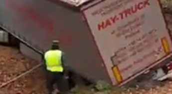
The Triangulo de la Pantaloneta in Spain terrifies Russian and Ukrainian truck drivers
Triangulo de la Pantaloneta is an area, located in the La Rioja region of Spain, that has gained notoriety as authorities frequently need to intervene to rescue trucks stuck amid steep roads, trees, and thick vegetation.
The Road To Muela de San Juan Has it All
Muela de San Juan is a high mountain pass at an elevation of 1.830m (6,003ft) above the sea level, located in the province of Teruel, Aragon, northern Spain.
Collado Chaquetas, a chillout road in high mountains
Collado Chaquetas is a high mountain pass at an elevation of 1.801m (5,908ft) above the sea level, located in the province of Granada, in the region of Andalucia, southern Spain.
Conquering Coll de Peguera: Catalonia's Challenging Mountain Road Adventure
Coll de Peguera is a mountain pass at an elevation of 1,721m (5,646ft) above sea level, located in the province of Barcelona, in Spain.
Driving the Panoramic L-501 in Lleida: The Road That Has It All
Located in the Pre-Pyrenees of Lleida, the L-501 road—known locally as La Pista (The Track)—is a uniquely challenging and rewarding route for motorcyclists and driving enthusiasts. Stretching 41 km, its appeal lies in the isolation, the countless primitive stone tunnels carved into the rock, and its significant history.
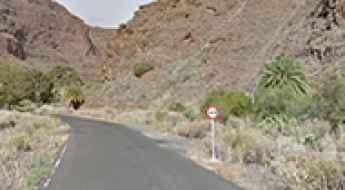
A gravel road to the virgin Verodal beach in Canary Islands
Located on the northwestern coast of El Hierro, the smallest and farthest south and west of the Canary Islands, Spain, in the Atlantic Ocean off the coast of Africa, Playa del Verodal is a red volcanic sand beach.
Driving to Mina de Riosol: A technical 14% climb in León
Located in the heart of the Cordillera Cantábrica, in the province of León, the ascent to the abandoned Mina de Riosol is a short but brutal mechanical grind. Reaching an elevation of 1,680m (5,511ft) above sea level in the Cabañas Valley, this unpaved track leads to the ruins of a mercury mine, also known as Mina Carmina, which operated during the 1960s. It is a journey through a rugged, industrial-scarred landscape where the steepness of the terrain and the decaying state of the road surface demand a vehicle with serious off-road credentials.
The road to Pico Faeda is a must
Pico Faeda is a high mountain peak at an elevation of 2.008m (6,587ft) above the sea level, located on the boundary of León and Zamora provinces in the autonomous community of Castilla y León, in northern Spain.
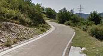
How to drive the steep road to the summit of Montagut?
El Montagut is a mountain peak at an elevation of 948m (3,110ft) above sea level, located in Tarragona, Spain. The ascent is a mix of degraded asphalt and a final gravel spur.
Conquering the Curvy Wonders: Driving Adventures in Catalonia's Priorat Region
Nestled in Catalonia's picturesque Priorat region, you'll find an absolute haven for driving enthusiasts, with winding roads that carve through the rugged terrain and provide an exhilarating driving experience.
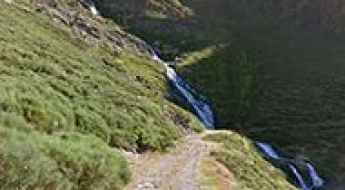
How to get to Soria Waterfall in the Canary Islands by car?
Cascada de Soria is a wonderful waterfall located on the island of Gran Canaria, in the Canary Islands of Spain. Be warned, the mountain road to the waterfall isn’t for the faint-hearted.