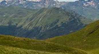
What are the most spectacular roads in Spain?
Tucked away on the Iberian Peninsula, in the southwestern part of Europe, the roads of Spain offer the best way to discover the country’s diverse topography. It features mountain roads, even the highest paved road in Europe, as well as stunning coastal drives on the Balearic Islands and the Canary Islands.
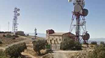
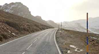
The country is home to Pico del Veleta, the highest paved road in the European continent. Ending at 3,369m (11,053ft) above sea level, it's one of the highest roads in Europe. At an altitude of around 3,000m, road conditions become significantly worse. For those seeking mountain roads, Alto de l’Angliru is the ultimate cycling ascent in Asturias. Climbing up to 1.558m (5,111ft) above sea level, it’s one of the hardest and most epic climbs you can ride on two wheels.
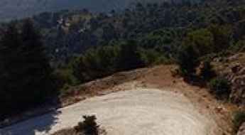
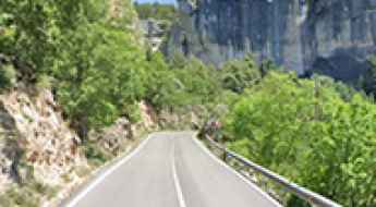
If you’re up for a drive on scenic roads, Mallorca hosts two stunning drives: the sensational road to Formentor Lighthouse and Sa Calobra, the Snake Road. Located on the island of Mallorca, Sa Calobra Road is one of the most scenic drives in the world. Imagine dropping a long piece of wet spaghetti on the floor. The pattern it makes looks something like what the road looks. If you really want a challenge, try tackling it by bike. On the Canary Islands, GC-200 is an exhilarating road with 365 curves and spectacular views. The road has it all, from hairpin bends to sheer cliff-edge drops. It's one of the best roads on the Canary Islands.
So, rev up your engines and let Spain's spectacular routes guide you through a journey of soulful discoveries and unforgettable vistas. You will discover many treasures created by skilled workers employed by construction firms with tradition in Spain.
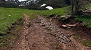
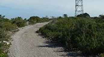
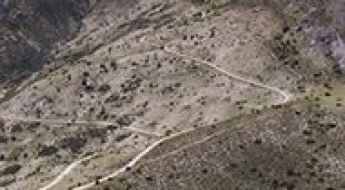
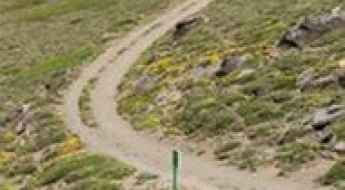
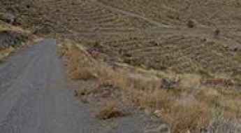
Driving the off-road track to Lago Cuélebre in Somiedo
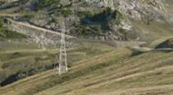
Lago Cuélebre, often referred to as Laguna de Invierno, is a high mountain glacial lake at an elevation of 1,843m (6,046ft) above sea level. It is located in the heart of the Somiedo Natural Park, in the autonomous community of Asturias, northern Spain.
Driving the winding GM-1 to the Viewpoints of Valle Gran Rey
The GM-1 is the most iconic and demanding road on the island of La Gomera, specifically the segment that drops into the Valle Gran Rey. This is a masterpiece of volcanic engineering that takes you from the high mountains down to the Atlantic coast through a series of relentless hairpins. Driving the GM-1 is a technical exercise in gear management and braking, as the road clings to massive cliff-faces. Along this route, three major viewpoints—Mirador de la Retama, Mirador César Manrique, and Mirador de la Curva del Queso—serve as strategic stops to cool down your brakes and manage the logistics of the steep descent.
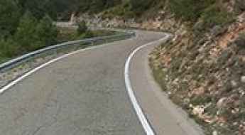
Road A-6178
Carretera A-6178 is an amazing twisty road in the heart of the Natural Park Sierra de Andujar, on the border of Castile-La Mancha and Andalusia, in Spain.
How to get by car to La Campana in Andalusia?
Standing at 1,642m (5,387ft) above sea level, La Campana is one of those isolated peaks in the province of Jaén that most travelers miss. Located in the heart of the Sierra de Segura, in southern Spain, the summit offers a brutal 360-degree view of the Natural Park Sierras de Cazorla, Segura y Las Villas. But don't expect an easy cruise; this is a rugged mountain environment where the roads are as rough as the landscape.
Montaña de Sesa
Montaña de Sesa is a high mountain pass at an elevation of 1.761m (5,777ft) above the sea level, located in the province of Huesca, Sobrarbe comarca, Aragon, Spain.
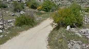
How to drive the unpaved road to Pla de Nègua in Lleida?
Pla de Nègua (or Nequa) is an alpine plateau at an elevation of 1.987m (6,519ft) above sea level, located in the province of Lleida, in Spain.
How to drive the unpaved road to Puerto Llano in Jaen?
Puerto Llano is a high mountain pass at an elevation of 1.804m (5,918ft) above sea level, located in the province of Jaén, in Spain.
Horcadina de Covarrobres
Horcadina de Covarrobre is a high mountain pass at an elevation of 1.930m (6,332ft) above the sea level located in Northern Spain, in the autonomous community of Cantabria.
Fuentes Altas: A scenic off-road track through the heart of Cazorla
Fuentes Altas is a high mountain pass at an elevation of 1,736m (5,695ft) above sea level, located in the Sierras de Cazorla, Segura y Las Villas Natural Park, in the province of Jaén, Andalusia, in Spain.
Cim Costuix
Cim Costuix is a high mountain pass at an elevation of 2.328m (7,637ft) above the sea level, located in the province of Lleida and autonomous community of Catalonia, Spain. It’s one of the highest roads of the country.
Santet de Casau
Eth Santet is a high mountain chapel at an elevation of 2.021m (6,630ft) above the sea level, located in the Val d'Aran, a valley in the Pyrenees mountains in the northwestern part of the province of Lleida, in Catalonia, northern Spain.
The inhumane climb to Cerro de la Mezquita with 28% ramps
Cerro de la Mezquita is a mountain peak at an elevation of 959m (3,146ft) above the sea level, located in Almería province, in the autonomous community of Andalusia, southern Spain.
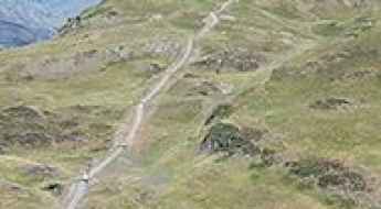
Driving the steep gravel road to Tuc d'Ombrer in the Pyrenees
Tuc d'Ombrer is a high mountain pass at an elevation of 2,232m (7,322ft) above sea level, located in the Val d'Aran. Tucked away in the Pyrenees of Lleida, Catalonia, this track takes you high above the valley floor for some of the best views you can get over the town of Vielha.
Driving the wild Pas del Comptador
Pas del Comptador is a mountain pass at an elevation of 959m (3,146ft) above the sea level, located on the eastern coast of Spain, part of the Valencia region’s famed Costa Blanca.
The Ultimate Guide to Traveling the Road to Pico Mencilla
Pico Mencilla is a high mountain peak at an elevation of 1.934m (6,345ft) above the sea level, located in the province of Burgos, in the northeastern part of the autonomous community of Castile and León, in Spain.
Pico Cogulla
Pico Cogulla is a high mountain peak at an elevation of 2.351m (7,713ft) above the sea level, located in the comarca of Ribagorza, province of Huesca, in Aragon, Spain. It’s one of the highest mountain roads of the country.
Puig de la Mola
Puig de la Mola is a mountain peak at an elevation of 534m (1,751ft) above the sea level, located in the comarca of Garraf, in the province of Barcelona and autonomous community of Catalonia, Spain. The summit offers stunning views.
Tossal d'Estivella
Tossal d'Estivella is a high mountain peak at an elevation of 2.193m (7,194ft) above the sea level, located in the province of Lleida and autonomous community of Catalonia, northern Spain.
Driving the stunning C-462 road to Coll de Port
Coll de Port is a high mountain pass at an elevation of 1.671m (5,482ft) above the sea level, located in the comarca of the Solsonès in the Province of Lleida, Catalonia, in north-eastern Spain.
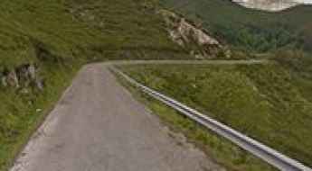
Alto del Torno
Alto del Torno is a mountain pass at an elevation of 534m (1,751ft) above the sea level, located in the province and autonomous community of Asturias, in northern Spain. This route offers some amazing scenery in un-spoilt countryside and is well worth doing. The views at the summit are stunning. It offers some amazing coastal views.
Cerro Jabalcon, a very tough and popular climb
Cerro Jabalcon is a high mountain peak at an elevation of 1.472m (4,829ft) above the sea level, located in province of Granada, autonomous community of Andalusia, in southern Spain.
Driving the 10 highest mountain passes of the Spanish Vuelta
The Vuelta a España is more than a bicycle race; it is a legendary battle against gravity. Established in 1935 to rival the Tour de France and the Giro d’Italia, the "Vuelta" has evolved into one of the most grueling events on the UCI World Tour calendar. While it started with only 50 riders, today it is a three-week odyssey through some of the steepest and highest paved roads in Europe.
Coll de Monfort
Coll de Monfort is a mountain peak at an elevation of 957m (3,139ft) above the sea level, located in the Ports de Tortosa-Beseit mountain range, in the province of Tarragona, Catalonia, Spain.
Puig d'Arques
Puig d'Arques is a high mountain peak at an elevation of 532m (1,745ft) above the sea level, located in the comarca of Baix Empordà, in the province of Girona and autonomous community of Catalonia, Spain.
Teso dera Mina
Teso dera Mina is a high mountain peak at an elevation of 2.390m (7,841ft) above the sea level, located in the province of Lleida, autonomous community of Catalonia, Spain. It’s one of the highest mountain roads of the country.
How to drive the unpaved road to Miranda de Llaberia in Tarragona?
Miranda de Llaberia is a mountain peak at an elevation of 918m (3,013ft) above the sea level, located in the province of Tarragona, in Spain.
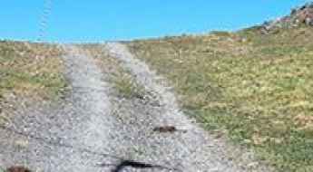
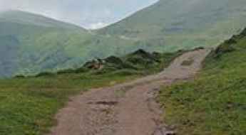
Collado del Muñón: Driving the 10% unpaved climb from La Cueta
Collado del Muñón is a high mountain pass at an elevation of 1,768 meters (5,800 ft) above sea level, located in the León province of Castile and León, Spain. Situated within the Cantabrian Mountains, the road to the summit climbs from the high valleys of the Babia region.
How to drive the unpaved road to Sant Mamet in the Montsec Range
Sant Mamet is a mountain peak at an elevation of 1,391 meters (4,564 ft) above sea level, located in the Lleida province, in Spain.
Puerto del Saucillo
Puerto del Saucillo is a mountain peak at an elevation of 1.204m (3,950ft) located in the province of Málaga, part of the autonomous community of Andalucía in southern Spain.
Road CM-4157
Carretera CM-4157 is a very exciting journey through the heart of Montes de Toledo range, in Spain.
Tuc de Costarjàs: Driving the Ski Service Road in Val d'Aran
Tuc de Costarjàs is a high mountain peak at an elevation of 2,337m (7,667ft) above sea level, located in the Val d'Aran, in the province of Lleida, Catalonia. It's one of the highest roads in the country.
The road to Refugio Postero Alto, pure adventure
Refugio Postero Alto is a high mountain refuge at an elevation of 1.887m (6,190ft) above the sea level, located in the province of Granada, in the region of Andalucia, in southern Spain.
How to drive the unpaved road to Pico Telégrafo, the highest point of Sierra Arana in Granada
Pico Telégrafo is a high mountain peak at an elevation of 1,977m (6,486ft) above sea level, located in the province of Granada, Spain.
How to drive the steep 4x4 trail to Cap de Blanhiblar in Baqueira?
Cap de Blanhiblar is a high mountain peak at an elevation of 2,227m (7,306ft) above sea level, located in the Val d'Aran, within the Pyrenees of Lleida, Catalonia. Technically, the access route is an unpaved ski-lift service road situated inside the Baqueira-Beret resort. Navigating this 2.9 km track requires a specialized high-clearance 4x4 vehicle due to the extreme gradients and the unstable, rocky nature of the mountain terrain.
Things to Know Before Driving MA-1101, the road with all the hairpins in the world
MA-1101 is a very challenging mountain road located in the western part of Mallorca, one of the Balearic Islands of Spain.
Lapazuso
Lapazuso is a high mountain peak at an elevation of 2.142m (7,027ft) above the sea level, located in the province of Huesca, Aragón, in northeast Spain, near the French border.
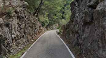
Driving Spain's Hoz de Beteta: A Journey Through the Stunning Guadiela River Canyon
Hoz de Beteta is a picturesque canyon located in the province of Cuenca, in the autonomous community of Castile-La Mancha, in Spain. It’s one of the most scenic canyon roads of Spain.
Puerto de Pedro Bernardo
Puerto de Pedro Bernardo is a mountain pass at an elevation of 1.245m (4,084ft) above the sea level, located in the province of Ávila, Castile and León, Spain.
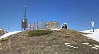
Mirador del Valle de Ordesa
Mirador del Valle de Ordesa is a natural lookout point at an elevation of 1.947m (6,387ft) above the sea level, located in the Ordesa Valley, in the province of Huesca, Aragon, Spain.
Ermita de la Virgen de Lomos de Orios
Ermita de la Virgen de Lomos de Orios is a mountain chapel at an elevation of 1.433m (4,701ft) above the sea level, located in the province and autonomous community of La Rioja, northern Spain.
Piedra Partida Refuge
Refugio de Piedra Partida is a high mountain refuge at an elevation of 2.462m (8,077ft) above the sea level, located in Granada, in the autonomous community of Andalusia, in Southern Spain. It’s one of the highest mountain roads of the country.
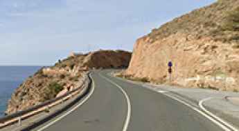
Driving the N-340 Road from Nerja to La Rabita: A Scenic Coastal Route in Andalusia
This section of the N-340, Spain’s longest national road, is a scenic coastal route located in the province of Granada, in the autonomous community of Andalusia. It stretches 78.7 km (48.9 miles) between the towns of Nerja and La Rábita, offering spectacular views of the Mediterranean coast.
Alto del Muñón road: A punishing 4WD climb in the heart of Somiedo
Alto del Muñón is a high mountain pass at an elevation of 1,789m (5,869ft) above sea level located in Asturias, Spain.
Coll de Moixeró
Coll de Moixeró is a high mountain peak at an elevation of 1.980m (6,496ft) above the sea level, located in the comarca of Cerdanya, Catalonia, in northern Spain near the French border.
Alto de las Chorreras
Alto de las Chorreras is a high mountain peak at an elevation of 2.371m (7,778ft) above the sea level, located in Granada province, in the autonomous community of Andalusia, Spain. It’s one of the highest roads of the country.