What are the most spectacular roads in Spain?
Tucked away on the Iberian Peninsula, in the southwestern part of Europe, the roads of Spain offer the best way to discover the country’s diverse topography. It features mountain roads, even the highest paved road in Europe, as well as stunning coastal drives on the Balearic Islands and the Canary Islands.
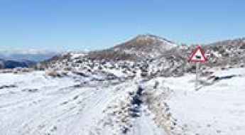
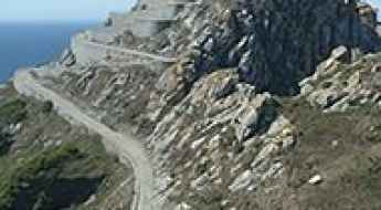
The country is home to Pico del Veleta, the highest paved road in the European continent. Ending at 3,369m (11,053ft) above sea level, it's one of the highest roads in Europe. At an altitude of around 3,000m, road conditions become significantly worse. For those seeking mountain roads, Alto de l’Angliru is the ultimate cycling ascent in Asturias. Climbing up to 1.558m (5,111ft) above sea level, it’s one of the hardest and most epic climbs you can ride on two wheels.
If you’re up for a drive on scenic roads, Mallorca hosts two stunning drives: the sensational road to Formentor Lighthouse and Sa Calobra, the Snake Road. Located on the island of Mallorca, Sa Calobra Road is one of the most scenic drives in the world. Imagine dropping a long piece of wet spaghetti on the floor. The pattern it makes looks something like what the road looks. If you really want a challenge, try tackling it by bike. On the Canary Islands, GC-200 is an exhilarating road with 365 curves and spectacular views. The road has it all, from hairpin bends to sheer cliff-edge drops. It's one of the best roads on the Canary Islands.
So, rev up your engines and let Spain's spectacular routes guide you through a journey of soulful discoveries and unforgettable vistas. You will discover many treasures created by skilled workers employed by construction firms with tradition in Spain.
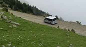
Ardibide: Driving the brutal 30% concrete climb in Navarre
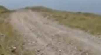
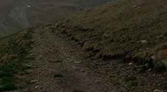
Ardibide is a high mountain peak at an elevation of 1,457m (4,780ft) above sea level, located in the autonomous community of Navarre, northern Spain. The ascent to the summit is characterized by a brutal incline that ranks among the steepest paved tracks in the Pyrenees, providing access to critical telecommunications infrastructure.
Road Chera-Sot de Chera
Carretera Chera-Sot de Chera (CV-395) is a mountainous road located in the comarca of Requena-Utiel in the Valencian Community, Spain.
Coll de Josa
Coll de Josa is high mountain pass at an elevation of 1.633m (5,357ft) above the sea level, located in the northwest of the comarca of Berguedà in Catalonia, Spain.
Driving to Puerto de Valdelinares: The Highest Town in Spain
Puerto de Valdelinares is a high mountain pass at an elevation of 1,837m (6,026ft) above sea level, located in the province of Teruel, in Spain.
Cap de Baqueira
Cap de Baqueira is a high mountain peak at an elevation of 2.467m (8,093ft) above the sea level, located in the Val d'Aran, a valley in the Pyrenees mountains in the northwestern part of the province of Lleida, in Catalonia, northern Spain. It's one of the highest roads of the country.
Alto de Capileira
Alto de Capileira is a mountain pass at an elevation of 1.436m (4,711ft) above the sea level, located in the southern side of the Sierra Nevada mountain range known as the Alpujarras, in the province of Granada, in Spain.
Pas de la Mainera
Pas de la Mainera is a high mountain pass at an elevation of 2.134m (7,001ft) above the sea level, located in Catalonia, in northern Spain.
Cabeza de Manzaneda
Cabeza de Manzaneda is a high mountain peak at an elevation of 1.751m (5,744ft) above the sea level, located in eastern province of Ourense in the Galicia region of north-west Spain.
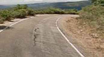
The real road to Coll de Rates is not for timid drivers
Coll de Rates is a mountain peak at an elevation of 928m (3,044ft) above the sea level, located in the comarca of Marina Alta, a region in the province of Alicante, in the Valencian Community of Spain.
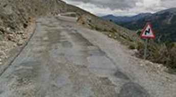
How to drive the 4x4 road to Coll de Laquell in the Pyrenees?
Coll de Laquell is an international high mountain pass at an elevation of 2,162m (7,093ft) above sea level, located in the province of Lleida, Catalonia. Situated in northern Spain, very close to the border with Andorra, this pass is a hidden gem for off-roaders in the Pyrenees.
Ibon de Asnos
Ibon de Asnos is a high mountain lake at an elevation of 2.135m (7,004ft) above the sea level, located in the heart of the Pyrenees, in northeastern Spain in the province of Huesca.
Road AS-260
Located in the Principality of Asturias, an autonomous community in north-west Spain, the AS-260 road is said to be one of the most beautiful drives in the country. Through the drive is a viewpoint called the Mirador del Fito, which offers an incredible view of the ocean, valleys and the Picos de Europa in the distance.
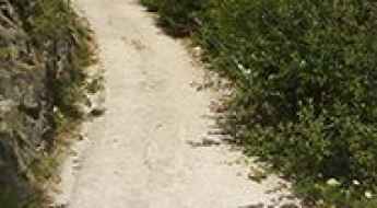
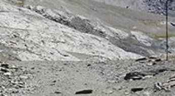
How to drive the unpaved road to Collado de la Cruz de Guardia in Huesca
Collado de la Cruz de Guardia is a high mountain pass at an elevation of 2.202m (7,224ft) above sea level, located in the province of Huesca, in Spain.
How to drive the unpaved road to Hoyo Cerrado in the Sierra de Guadarrama
Hoyo Cerrado is a high mountain pass at an elevation of 2,144m (7,034ft) above sea level, located in the heart of Spain.
Chanajiga
Chanajiga is a high mountain pass at an elevation of 1.186m (3,891ft) above the sea level, located on the northern part of the island of Tenerife, which forms part of the Canary Islands, Spain. The climb is simply terrible with sections up to 30%.
Vilafranca detour road is a famous widow maker
Variant de Vilafranca is a short stretch of the N-340 highway, located near Vilafranca del Penedès, the capital of the comarca of the Alt Penedès in Catalonia, Spain. The road is a famous widow maker: 45 people were killed in road accidents between 2000 and 2015.
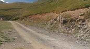
Driving the gravel road to Port de Fontalba in the Pyrenees
Port de Fontalba is a high mountain pass at an elevation of 2,071 meters (6,794 ft) above sea level, located in the Ripollès region of Catalonia, Spain. Situated in the eastern Pyrenees at the foot of Puigmal, the route leading to the summit is the Carretera de Fontalba. It is a long, unpaved single-lane mountain track packed with loose stone switchbacks, open dirt ramps, and severe vertical exposure with zero side protections.
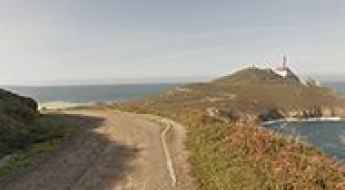
A scenic road to Faro de Cabo Vilán lighthouse
Cabo Vilán lighthouse is located on the west coast of Galicia, in the Costa da Morte of northwestern Spain. The wind is intense.
How to drive the unpaved road to Coll de la Creu d'Eixol in Lleida
Coll de la Creu d'Eixol is a high mountain pass at an elevation of 2.233m (7,326ft) above sea level located in the province of Lleida, in Spain.
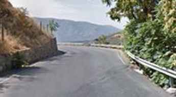
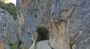
Hoz del Júcar: The narrow B-5 cliff road in Albacete
Hoz del Júcar is a high-risk canyon road carved into the limestone cliffs of the Albacete province in Castile–La Mancha, Spain. The road, officially designated as the B-5, follows the deep gorge created by the Júcar river. The physical reality of this route involves managing a narrow asphalt ribbon that clings to the karst walls, where the vertical exposure is total and the space for maneuvering is virtually non-existent in the tighter sectors of the canyon.
Collado del Alguacil
Collado del Alguacil is a high mountain pass at an elevation of 1.896m (6,220ft) above the sea level, in the Sierra Nevada mountain range, located in the Spanish Autonomous Region of Andalusia. The climb is simply terrible, going up to 20% gradients.
The Ultimate Guide to Traveling to Portarró d'Espot
Portarró d'Espot is a high mountain pass at an elevation of 2.430m (7,972ft) above the sea level, located in the province of Lleida, in the autonomous community of Catalonia, northern Spain. It’s one of the highest roads of the country.
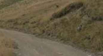
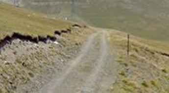
Road to Pico de Turbón: Driving the 12.90% Track in Ribagorza
Located in the Ribagorza county, within the province of Huesca, Pico de Turbón is a mountain peak at an elevation of 2,052m (6,732ft) above sea level. Situated in the Aragonese Pre-Pyrenees, the road is an unpaved mountain track that provides access to the Refugio del Turbón and the upper limestone massifs of the range.
Puerto de Villarroya
Puerto de Villarroya is a high mountain pass at an elevation of 1.700m (5,577ft) above the sea level, located in the Maestrazgo comarca, province of Teruel, Aragon, Spain.
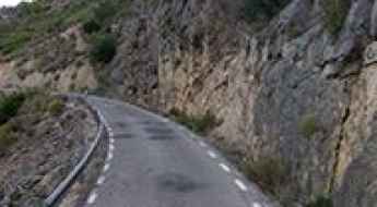
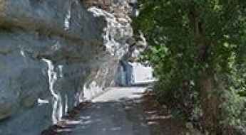
Driving the narrow Tartalés Canyon Road in Burgos
Tartalés Canyon Road is a brutal stretch of asphalt that clings to the limestone walls of the Garganta de Tartalés in Burgos. This is not a road for casual drivers; it is a narrow path where the rock face overhangs the track and the drops into the creek below are vertical and unguarded. The route connects Hoz de Valdivielso with the small village of Tartalés de los Montes, and it feels more like a mountain trail than a public road. If you suffer from vertigo or your vehicle is wider than a standard 4x4, you should think twice before heading up here.
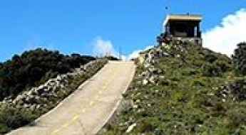
Road to Puig Neulós: Driving the 1,251m Border Peak in the Albera Range
Puig Neulós is a mountain peak at an elevation of 1,251 meters (4,104 ft) above sea level, located on the international border between France (Pyrénées-Orientales) and Spain (Girona). Situated as the highest point of the Albera Range, the summit features high-power telecommunication antennas accessible via a narrow paved road climbing the northern slope.
Is the road to Casetón de Ándara Refuge in Picos de Europa difficult?
Reaching the Refugio Casetón de Ándara is a journey into the heart of the Macizo Oriental of Picos de Europa. At 1,720m (5,643ft) above sea level, this high-altitude shelter in Cantabria sits at the end of a raw, unforgiving track. It’s not just a mountain road; it’s a relic of the old mining industry that once dominated these peaks. Today, it serves as a brutal test for 4x4 vehicles and drivers who aren't afraid of sharp stones and vertical drops.
A beautiful road through Congosto de Olvena
Congosto de Olvena is the name of a very scenic drive running through an incredible landscape located in Huesca province, in the autonomous community of Aragon, Spain. It’s one of the most scenic canyon roads of Spain.
Puig de Fontlletera
Puig de Fontlletera is a high mountain peak at an elevation of 2.401m (7,877ft) above the sea level, located in Girona, Catalonia, in northern Spain. It’s one of the highest roads of the country.
Los Portillinos is a classic road trip in Castile and Leon
Los Portillinos is a high mountain pass at an elevation of 1.957m (6,420ft) above sea level, located in the province of León, in Spain.
How To Drive The Defiant Pista de la Estiva in Bielsa
Pista de la Estiva is the name of a stunning drive through the mountains, in Aragon, an autonomous community of Spain. It’s a great drive with exceptional views.
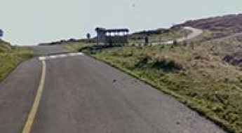
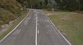
Driving the road to Alto del Naranco: The 634m balcony over Oviedo
Alto del Naranco is a mountain pass at an elevation of 634 meters (2,080 ft) above sea level, located just north of Oviedo, in the Asturias region of northern Spain. Traversed by the fully paved AS-232 road, the route scales the southern slope of the mountain massif to reach the summit monument area.
Driving the ZA-103 Road to Laguna de los Peces in Sanabria
Located in the northeastern corner of the province of Zamora, in northern Spain, Laguna de los Peces (Lake of Fishes) is a stunning glacier lake sitting at an elevation of 1,725m (5,659ft) above sea level. This high-altitude destination in the Montes de León mountain range is a terminal point for drivers seeking some of the most dramatic landscapes within the Sanabria Lake Natural Park.
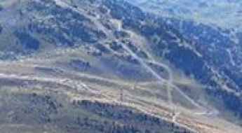
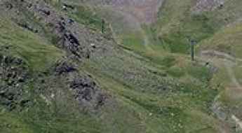
Driving the service road to Collado de las Yeguas: 2,859m in Sierra Nevada
Collado de las Yeguas is a high mountain pass at an elevation of 2,859 meters (9,379 ft) above sea level, located in the Granada province of Andalusia, Spain. Set high in the upper reaches of the Sierra Nevada range, the unpaved route is a service road for the ski resort machinery and chairlift maintenance. It is of the highest mountain roads in Spain.
Driving the A-4301 to Alto de la Sagra: A bumpy climb in Granada
Located in the northern tip of the province of Granada, the ascent to Alto de la Sagra (popularly known as Puerto de la Losa) is a journey through one of the most rugged and isolated landscapes in Andalusia. Reaching an elevation of 1,764m (5,787ft) above sea level, the road—designated as the A-4301—is a technical nightmare for vehicles with poor suspension. It is a route where the limestone mass of La Sagra dominates a horizon of broken asphalt and high-altitude silence.
Tuca Blanca
Tuca Blanca is a high mountain peak at an elevation of 2.236m (7,335ft) above the sea level, located in the heart of the Pyrenees, in northeastern Spain in the province of Huesca.
Coll de la Portella
Coll de la Portella is a high mountain pass at an elevation of 2.269m (7,444ft) above the sea level, located in Catalonia, in northern Spain.
Faro do Monte Faro
Monte Faro lighthouse is located on the Cíes Islands, an archipelago off the coast of Pontevedra in Galicia (Spain). The track is for 4x4 vehicles only. Closed to private vehicles. The road to the summit includes 10 steep hairpin turns.
Alto del Golobar: enjoy a road among the clouds
Alto del Golobar is a high mountain peak at an elevation of 1.778m (5,833ft) above the sea level, located in the province of Palencia, autonomous community of Castile and León, Spain.
Port de Filià
Port de Filià is a high mountain peak at an elevation of 2.404m (7,887ft) above the sea level, located in the province of Lleida, in Catalonia, Spain. It’s one of the highest roads of the country.
Take the Scenic Route and Discover Alto de la Tornería
Alto de la Tornería is a mountain pass at an elevation of 469m (1,538ft) above the sea level, located in the province and autonomous community of Asturias, in northern Spain. With very dangerous curves, this route offers some amazing scenery in un-spoilt countryside and is well worth doing.
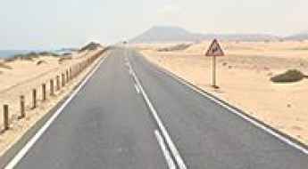
How To Travel The Dunas de Corralejo Road
Located on the northeast coast of Fuerteventura, one of the Canary Islands of Spain, FV-1A is the name of a stunning road through Dunas de Corralejo, a massive expanse of golden sand dunes near sprawling beaches.
How to drive the unpaved road to Pleta de Comabella?
Pleta de Comabella is a remote mountain sheep pen and stone shelter built in 1967, at an elevation of 2.148m (7,047ft) above sea level, located in the comarca of Berguedà, in Spain.
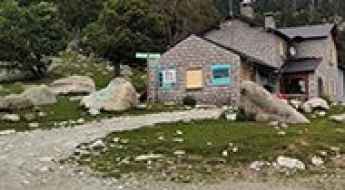
Refugi Malniu
Refugi Malniu is a high mountain hut at an elevation of 2.131m (6,991ft) above the sea level, located in the Catalan comarca of Cerdanya, in the province of Girona, Catalonia, northern Spain.
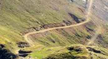
Pla de Beret
Pla de Beret is a high mountain plateau at an elevation of 1.881m (3,027ft) above the sea level, located In Val d’Aran Valley, Catalonia, in northern Spain. The view on the mountains is unique.