What are the most spectacular roads in Spain?
Tucked away on the Iberian Peninsula, in the southwestern part of Europe, the roads of Spain offer the best way to discover the country’s diverse topography. It features mountain roads, even the highest paved road in Europe, as well as stunning coastal drives on the Balearic Islands and the Canary Islands.
The country is home to Pico del Veleta, the highest paved road in the European continent. Ending at 3,369m (11,053ft) above sea level, it's one of the highest roads in Europe. At an altitude of around 3,000m, road conditions become significantly worse. For those seeking mountain roads, Alto de l’Angliru is the ultimate cycling ascent in Asturias. Climbing up to 1.558m (5,111ft) above sea level, it’s one of the hardest and most epic climbs you can ride on two wheels.
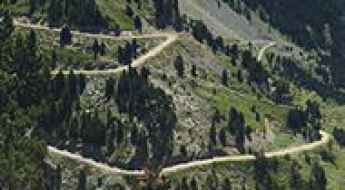
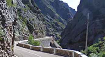
If you’re up for a drive on scenic roads, Mallorca hosts two stunning drives: the sensational road to Formentor Lighthouse and Sa Calobra, the Snake Road. Located on the island of Mallorca, Sa Calobra Road is one of the most scenic drives in the world. Imagine dropping a long piece of wet spaghetti on the floor. The pattern it makes looks something like what the road looks. If you really want a challenge, try tackling it by bike. On the Canary Islands, GC-200 is an exhilarating road with 365 curves and spectacular views. The road has it all, from hairpin bends to sheer cliff-edge drops. It's one of the best roads on the Canary Islands.
So, rev up your engines and let Spain's spectacular routes guide you through a journey of soulful discoveries and unforgettable vistas. You will discover many treasures created by skilled workers employed by construction firms with tradition in Spain.
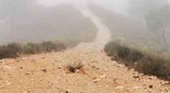
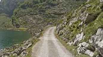
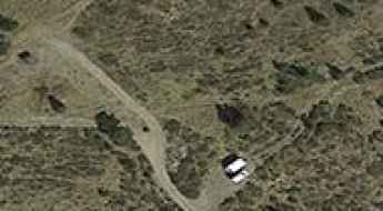
Pico Musales
Pico Musales is a high mountain peak at an elevation of 2.035m (6,676ft) above the sea level, located in the province of Huesca, Aragon, Spain.
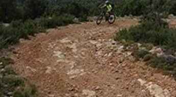
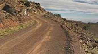
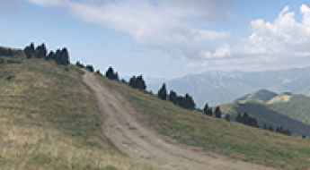
Driving the steep Road to Pico el Puntal
Pico el Puntal is a prominent mountain peak reaching an elevation of 1,286m (4,219ft) above sea level, located in the Almería province of Andalusia, southern Spain. The summit is situated within the Sierra Alhamilla Natural Park, bordering the Tabernas Desert, which is known as the driest and warmest region in the country.
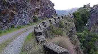
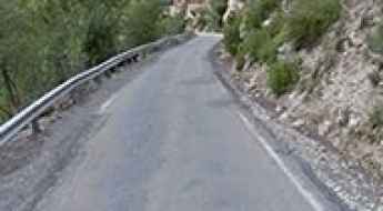
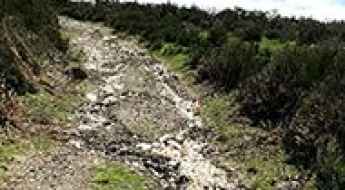
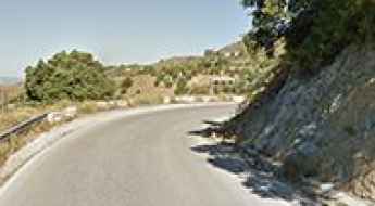
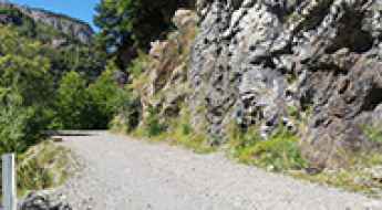
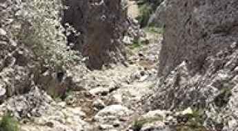
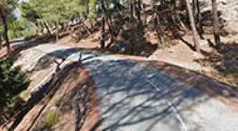
Driving the narrow A-2218 road through Congosto de Baldellou
Congosto de Baldellou is a technical and high-exposure canyon passage located in the Huesca province of Aragon, Spain. Traversed by the A-2218 road, this route through the Litera comarca follows the deep gorges carved by the Pedriza River, including the sectors known as Congosto de Camporrélls and Congosto del Regué. While the surface is paved, the physical reality of the drive is defined by extreme narrowness, unlined rock tunnels, and a landscape where the mountain walls sit inches away from the vehicle's mirrors, making it one of the most demanding canyon roads in Spain.
Puntal de la Buitrera
Puntal de la Buitrera is a high mountain peak at an elevation of 1.664m (5,459ft) above the sea level, located in the province of Jaén, in Andalusia, Spain.
The Wild Road to Pico del Relojero in Murcia
Pico del Relojero is a mountain peak at an elevation of 600m (1,968ft) above the sea level, located in the Region of Murcia, an autonomous community of Spain. The climb is brutal, with sections up to 15%.
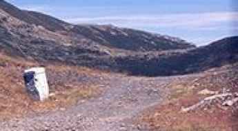
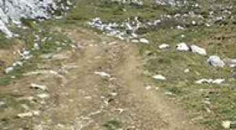
How to drive the old mining road to Collado de la Mina in Sierra de Baza?
Collado de la Mina is a high mountain pass at an elevation of 2,024 meters (6,640 ft) above sea level, located in the Granada province of Andalusia, southern Spain. Situated within the Sierra de Baza Natural Park, the route follows an old unpaved industrial road originally built to access the historical mining sites of the area.
How to drive the 4x4 road to El Coscollet in Lleida?
El Coscollet is a high mountain peak at an elevation of 1.609m (5,278ft) above sea level, located in the comarca of Alt Urgell, in Spain.
A journey on the legendary Pista del Marroquí
Pista del Marroquí is the name of an abandoned cliff road located in the province of Ourense, in Spain.
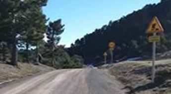
Road TE-V-2001
Carretera TE-V-2001 is a very exciting mountain road located at the southern end of Aragon, bordering the Valencian Community, in Spain.
What You Need to Know about Driving the Road to Puig de Sant Salvador
Puig de Sant Salvador is a mountain peak at an elevation of 468m (1,535ft) above the sea level, located on the island of Mallorca, part of the Spanish autonomous community of the Balearic Islands.
The brutally steep road to Sant Jaume de Montagut church
Esglesia de Sant Jaume de Montagut is a mountain church at an elevation of 862m (2,828ft) above the sea level, located in Tarragona province, in northeastern Spain’s Catalonia region. It’s one of the most demanding roads of Spain due its narrowness and steepness.
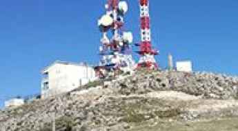
A touristic road to Bandama Caldera, a dormant volcano in the Canary Islands
Pico Bandama is a volcanic cinder cone adjacent to Bandama Caldera, at an elevation of 566 meters (1856 feet) above sea level, located in the Canary Islands, Spain.
La Merica: Driving the exposed cliffside track above Valle Gran Rey
La Merica is a natural viewpoint situated at an elevation of 817m (2,680ft) above sea level located on the western coast of La Gomera, in the Canary Islands, Spain. Perched high above the Valle Gran Rey, the track offers one of the most dramatic coastal driving experiences in the archipelago.
Llano de los Infantes
Llano de los Infantes is a high mountain plateau topping out at an elevation of 2.315m (7,595ft) above the sea level, located in Tenerife in the Canary Islands, Spain. It’s one of the highest roads of Spain.
Puig Drau
Puig Drau is a high mountain peak at an elevation of 1.345m (4,413ft) above the sea level, located in the comarca of Osona, in the province of Barcelona and autonomous community of Catalonia, Spain.
Travel guide to the top of Cap del Verd
Cap del Verd is a high mountain peak at an elevation of 2.285m (7,496ft) above the sea level, located in the northwest of the comarca of Berguedà in Catalonia, northern Spain.
Mirador del Rey
Mirador del Rey (King´s viewpoint) is a natural viewpoint at an elevation of 1.081m (3,546ft) above the sea level, located in the Picos de Europa mountain range, in region of Asturias, northern Spain.
Road trip guide: Conquering Pico El Morrón
Pico El Morrón is a high mountain peak at an elevation of 1.593m (5,226ft) above the sea level, located in the westernmost area of the province of Granada, in the autonomous community of Andalusia, in southern Spain.
How to drive the scenic road to Collada Fonda in Girona?
Collada Fonda is a high mountain pass at an elevation of 1.911m (6,269ft) above sea level, located in Girona, in Spain.
The road to Alt del Miserat: not recommended to newbies
Alt del Miserat is a mountain peak at an elevation of 754m (2,473ft) above the sea level, located in the province of Alicante, in the Valencian Community of Spain.
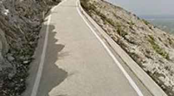
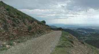
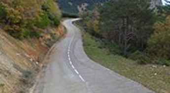
Road MA-126
Located in the province of Málaga in the autonomous community of Andalusia in southern Spain, MA-126 road is a very scenic drive.
Peña Caballera
Peña Caballera is a high mountain pass at an elevation of 2.187m (7,175ft) above the sea level, located in the province of Granada, in the region of Andalucia, southern Spain.
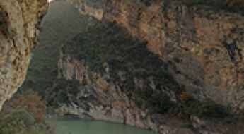
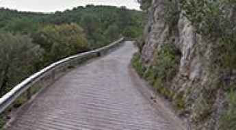
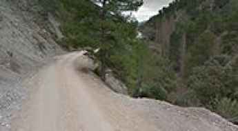
Conquering the Dangerous Congost de Mont-rebei: A Vertigo-Filled Adventure
Congost de Mont-rebei is one of Spain's most stunning natural wonders, located on the border between the provinces of Lleida in Catalonia and Huesca in Aragón. With its towering cliffs, vertigo-inducing walkways, and jaw-dropping views, it offers an adrenaline-pumping adventure for those seeking both beauty and challenge.
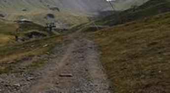
Is the road to Cap de Vaques in the Pyrenees difficult to drive?
Reaching Cap de Vaques is a short but brutal climb into the high peaks of the Alta Ribagorça. At 2,312m (7,585ft) above sea level, this summit sits at the top of the Boí Taüll ski resort in the Catalan Pyrenees. This isn't a mountain pass for tourists; it’s a rugged, unpaved service track that tests your traction and your nerves. If you're looking for a smooth drive, stay in the parking lot—once you leave the asphalt at the resort base, the mountain takes over. It's one of the highest roads in the country.
Hoz de Llanaves is a canyon road adventure in Castile and Leon
Nestled in the heart of León province lies the Hoz de Llánaves, a picturesque canyon situated in the northwestern region of the autonomous community of Castile and León, Spain. It’s one of the most scenic canyon roads of Spain and promises drivers an unforgettable experience.
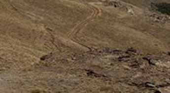
Driving to Sierra de la Guillimona: A high mountain track in Granada
Sierra de la Guillimona is a high mountain peak reaching an elevation of 1,876m (6,154ft) above sea level, located in the province of Granada, Andalusia, Spain. Situated near the border with Albacete, this climb takes you through a rugged and isolated landscape in the northern part of the province.
Can I drive the unpaved road to Victòria Mine in Val d'Aran?
Mina Victòria is an abandoned zinc mine located in the Val d'Aran valley, in the northwestern part of the province of Lleida, in Spain.
Piedra Negra Refuge, a Most Tricky Scenic Drive
Refugio Vivac Piedra Negra is a high mountain shelter at an elevation of 2.059m (6,755ft) above the sea level, located in the province of Almería, in the region of Andalucia, southern Spain.
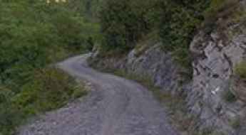
Driving the Challenging Bujaruelo Valley Road: A Scenic Adventure in the Pyrenees
Bujaruelo Valley Road is a very challenging drive, with concrete and gravel sections located in the northeastern part of Spain. It’s one of the best canyon roads in Spain.
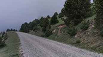
Ruta de los Tres Valles is a Spanish road with 1313 curves
Running through the natural beauty of La Rioja, a Spanish autonomous community, Ruta de los Tres Valles (Route of the Three Valleys) is the name of one of the most intense yet scenic drives in the country.
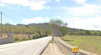
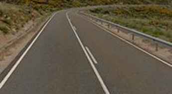
What Is the Longest Straight Road in Spain and Where Does It Start?
Located in the autonomous community of Castile-La Mancha, the N-301 Road is home to the longest straight stretch of road in Spain.
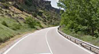
Road CV705
The CV-705 is a paved mountain road with a length of 19.7 kilometers (12.2 miles) located in the eastern part of Spain. The route crosses the provincial boundary between Valencia and Alicante, cutting through the mountain ridge that separates the Vall d'Albaida and El Comtat basins.
Estrecho del Infierno
Estrecho del Infierno is a narrow stretch of trail through some interesting rock formations located in the province of Cuenca, Castile-La Mancha, in Spain.
Puerto de Navalmoral, an iconic Vuelta a España climb
Puerto de Navalmoral is a high mountain pass at an elevation of 1.517m (4,977ft) above the sea level, located in the central part of the province of Ávila, in Castile and León autonomous community, in north-western Spain.
Driving the steep mountain road to Jabalcuz in Jaén
Jabalcuz is a mountain peak at an elevation of 1,610 meters (5,282 ft) above sea level, located in the Province of Jaén, within the Andalusia region of southern Spain. Tucked inside the Montes de Jaén and the Sub-Baetic system, the single-lane route leading to the top transitions from broken asphalt into rough concrete ramps and loose gravel tracks with severe slopes and no side protections.
Driving the wild road to Puerto de Piedrafita
Puerto de Piedrafita is a high mountain pass at an elevation of 1,687m (5,534ft) above sea level, located on the border between the province of León (Castile and León) and Asturias in northwest Spain. This pass is nestled in the heart of the Cordillera Cantábrica mountain range, serving as a historic link for travelers crossing between the southern and northern slopes of the mountains.
Estany Closell
Estany Closell is a high mountain lake at an elevation of 2.086m (6,843ft) above the sea level, located in the province of Lleida, Catalonia, in north-eastern Spain, near the French border. The average gradient is 7.16%.
The road to Sobrón Alto is not for the sissies
Sobrón Alto is a small village located in Álava province, in the Basque Country, in northern Spain.
Driving the forest track to Adou del Bastareny in the Pyrenees
Adou del Bastareny is the powerful natural spring where the Bastareny River is born, located at an elevation of 1,013m (3,323ft) above sea level. Situated in the heart of the Berguedà region in Catalonia, this spot is a hidden gem within the Cadí-Moixeró Natural Park, known for its limestone cliffs and lush waterfalls.
Journeying through Spain's Echoing Canyon: Hoz de Valeria Road Adventure
Hoz de Valeria is the name of a very scenic canyon located in the heart of Cuenca province in the eastern part of the autonomous community of Castile-La Mancha, in Spain. It’s one of the most scenic canyon roads of Spain.
M541, a narrow mountain road in Madrid
M541 is a very narrow mountain road located in the southwesternmost end of the Community of Madrid in Spain. The drive is pretty challenging and a paradise for bikers.
Laguna de Sobia
Laguna de Sobia (Sobia's Lake) is a high mountain lake at an elevation of 1.363m (4,471ft) above the sea level, located on the South of the Principality of Asturias, in northern Spain. The climb is brutal: 21.13% of average gradient.
How dangerous is the narrow road to Cerrada de la Magdalena in Spain?
Cerrada de la Magdalena is a high mountain track at an elevation of 1,225 meters (4,019 ft) above sea level, located on the boundary between the provinces of Granada and Jaén in Andalusia, in southern Spain. The unpaved route runs through the Sierra de Castril Natural Park, tracing a narrow shelf cut into the limestone mountainside.
Road to Alberg de Montfalcó: Driving the gateway to Congost de Mont-rebei
Situated in the rugged Montsec mountain range, within the Ribagorza region of Huesca (Aragon), Alberg de Montfalcó is a mountain refuge at an elevation of 785m (2,575ft) above sea level. This destination has become famous as the starting point for the spectacular stairs of Montfalcó and the nearby Congost de Mont-rebei, but reaching it requires driving a road that is as scenic as it is challenging.
Driving the wild Pista la Caña to the top of Punta Estaton in the Pyrenees
Punta Estatón is a high mountain peak at an elevation of 2,108m (6,916ft) above sea level, located in the Huesca province of Aragón, in Spain.