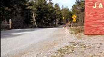
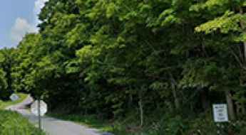
What are the most spectacular roads in the USA?
Located in North America, the USA is a true paradise for drivers, as it hosts more than 2,000 roads listed as the most spectacular in the world.
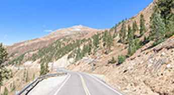
Featuring mountains, deserts, coasts, and snow, in the USA you’ll get your dream road. And you’ll never want to wake up. For instance, at the top of your list, you need to drive the Million Dollar Highway, the most beautiful road in America, and probably in the world. Built in the late 1880s, you'll be on the "outside" for a while with a hell of a view to your right (let the passenger enjoy the view; you'll want to watch the road). Another paved option must be the Iron Mountain Road, featuring 17 miles, 314 curves, 14 switchbacks, 3 pigtails, and 3 tunnels in the Black Hills of South Dakota. No list would be complete without the winding Tail of the Dragon: 318 curves in 11 miles. Spanning Tennessee and North Carolina, it is one of the most scenic drives in the USA. You also can’t skip driving Mount Evans Scenic Byway, the highest paved road in North America, climbing up to 4,310m (14,130ft) in Colorado. It is said to be the highest paved road in North America.
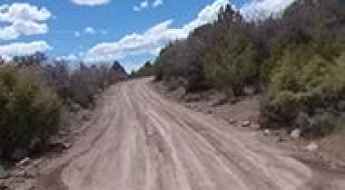
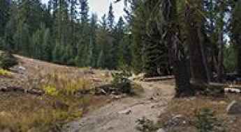
For those who prefer unpaved experiences, the country hosts some of the most defiant yet scenic roads in the world. You can’t miss Black Bear Pass, a high mountain adventure in the Colorado Rockies. Climbing up to 3,915m (12,844ft) above sea level, it's one of the highest roads in Colorado. You can also discover the beauty of Engineer Pass, a mountain pass at an elevation of 3,901m (12,800ft) above sea level in Colorado. It’s mostly a first-gear ride because the road is rough and rocky. The legendary Shafer Trail Road in Utah's Canyonlands National Park is an iconic drive located on the east-central edge of Utah. At times, the road is so narrow that only one car can pass. And Lippincott Mine Road in California is for experienced 4WD drivers using high-clearance vehicles only. You'll need a good map, as the routes are not marked and there are no signs. It’s one of the challenging backcountry roads in Death Valley National Park.
James Ridge
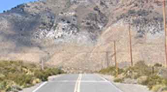
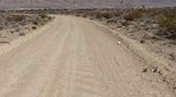
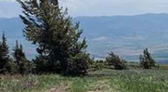
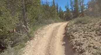
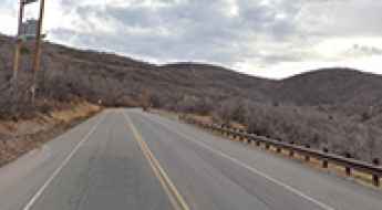
James Ridge is a high mountain pass at an elevation of 2.625m (8,612ft) above the sea level, located in Otero County, New Mexico, in USA.
Road trip guide: Conquering Morrell Mountain in Montana
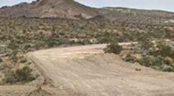
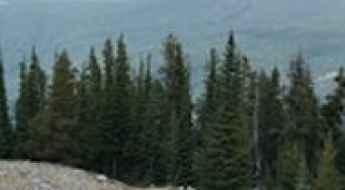
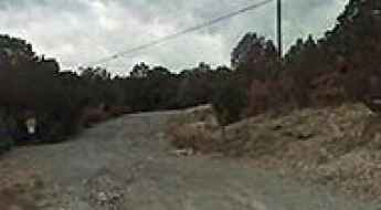
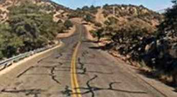
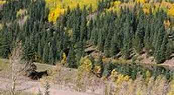
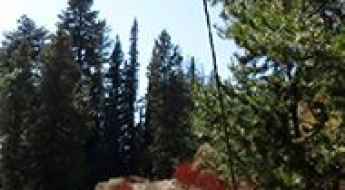
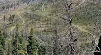
Morrell Mountain is a high mountain peak at an elevation of 2.369m (7,772ft) above sea level, located in Powell County, in the U.S. state of Montana.
Slide Peak
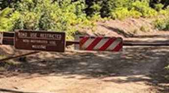
Slide Peak is a high mountain peak at an elevation of 2.390m (7,841ft) above the sea level, located in San Bernardino County, Southern California, United States.
Cerro Rubio
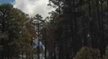
Cerro Rubio is a high mountain peak at an elevation of 3.002m (9,849ft) above the sea level, located in Los Alamos County, in north central New Mexico, USA.
Is the road to Lundy Lake paved all the way?
Lundy Lake is a high-mountain lake at an elevation of 2,379m (7,805ft) above sea level, located in Mono County, in the US state of California.
Harvey Mountain
Harvey Mountain is a high mountain peak at an elevation of 2.238m (7,342ft) above the sea level, located in Plumas County, California, in USA.
How to drive the unpaved road to the lookout at Garnet Mountain in Montana
Garnet Mountain is a high mountain peak at an elevation of 2.516m (8,254ft) above sea level, located in Gallatin County, in the U.S. state of Montana.
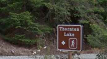
What You Need to Know about Driving the Thornton Lake Road in WA
Thornton Lake Road is a very scenic yet demanding drive located in Whatcom County is a county located in the U.S. state of Washington.
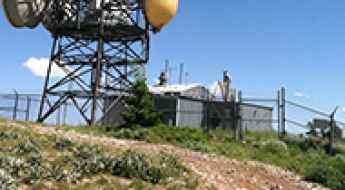
Repeater Road
Repeater Road is a very exciting journey in Lincoln County, in the U.S. state of Nevada, climbing up to 1.886m (6,187ft) above the sea level. The road ends at an abandoned RF radio site.
A gravel road to the top of Waterman Hills
Waterman Hills is a mountain peak at an elevation of 1.025m (3,362ft) above the sea level, located in San Bernardino County, in the southern portion of the U.S. state of California.
How to Get to Burley Mountain in Washington by Car?
Burley Mountain is a high mountain peak at an elevation of 1,624m (5,328ft) above sea level, located in Lewis County, in the U.S. state of Washington.
Take the Scenic CA-299 Road and Discover Cedar Pass in California
Cedar Pass is a high mountain pass at an elevation of 1,926 m (6,318 ft) above sea level, located in Modoc County, in the U.S. state of California.
A defiant road to Baldy Mountain in Idaho
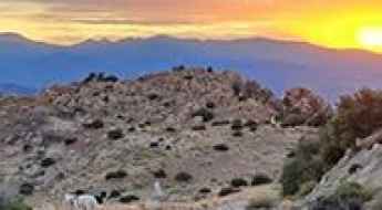
Baldy Mountain is a high mountain peak at an elevation of 2.536m (8,320ft) above sea level, located in Bannock County, in the southeastern part of the U.S. state of Idaho.
Usery Pass in Arizona is an absolute must for road lovers
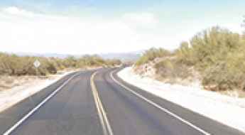
Usery Pass is a mountain pass at an elevation of 647m (2,122ft) above sea level, located in Maricopa County, in the U.S. state of Arizona.
Snow Mountain in Grant County: Driving the NF-215 to the Lookout
Reaching an elevation of 2,184m (7,165ft) above sea level, Snow Mountain in Grant County is a high mountain summit in the central part of Oregon. Located north of Riley, the peak sits on the boundary of the Ochoco and Malheur National Forests, serving as a critical point for fire surveillance in the region.
An epic enthralling road to Webb Mountain in MT
Webb Mountain is a high mountain peak at an elevation of 1.826m (5,990ft) above the sea level, located in Lincoln County, in the U.S. state of Montana.
Forest OHV Trail 33089: Driving the narrow red tracks of Garfield County
Forest OHV Trail 33089 is a technical high-mountain track located in Garfield County, within the west-central region of Utah. Reaching an elevation of 2,445m (8,021ft) above sea level, this trail is a raw example of the rugged backcountry driving found in the Dixie National Forest. It is not a standard forest road but a dedicated Off-Highway Vehicle (OHV) route where the narrowness of the track and the volatile nature of the red Utah soil demand a high-clearance 4x4 and advanced technical skills.
A dusty rocky road to Cedro Peak
Cedro Peak is a high mountain peak at an elevation of 2.371m (7,778ft) above the sea level, located in Bernalillo County, in the U.S. state of New Mexico.
Road trip guide: Conquering Up Up Lookout in MT
Up Up Lookout is a 40-foot wooden tower at an elevation of 1.804m (5,918ft) above the sea level, located in Mineral County, in the U.S. state of Montana.
Ultimate 4wd destination: Negrito Mountain
Negrito Mountain is a high mountain peak at an elevation of 2.620m (8,595ft) above the sea level, located in Catron County, in the U.S. state of New Mexico.
How to drive the unpaved Forest Road 177 in Utah?
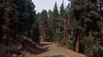
Forest Road 177 is a high mountain road located in Cache County, in the US state of Utah.

Urban Driving: Top Metropolitan Hubs for Road Travel in the USA
For any motorist entering the United States, navigating the country’s primary metropolitan hubs is a necessary challenge. From the high-density grid of New York City to the sprawling desert arteries of Las Vegas, each region presents unique driving conditions. Mastering these urban roads requires a professional approach to traffic telemetry, complex interchanges, and local regulations that govern some of the busiest transit zones in North America.
How to drive the unpaved Lost Creek Canyon Road in Utah?
Located in Sevier County, in the US state of Utah, Forest Road 053—often referred to as Lost Creek Canyon Road—is a high mountain track within the Fishlake National Forest.

Urban Navigation: A 24-Hour Logistics Guide to San Francisco’s Iconic Roads
San Francisco presents one of the most complex urban driving environments in the United States, defined by extreme vertical gradients, historic infrastructure, and high-density bridge corridors. Successfully navigating the city in a limited timeframe requires a professional approach to route timing and vehicle management. From the structural masterclass of the Golden Gate Bridge to the restricted access zones of the waterfront, driving these roads demands precision and a deep understanding of the city’s unique topographical challenges.
Driving the dusty Antelope Creek Road in Arizona
Antelope Creek Road is a winding desert road located in Yavapai County, in the US state of Arizona.
An old mine road to South Peak in Colorado
South Peak is a high mountain peak located in Lake County, in the U.S. state of Colorado. An old mining road, to the south of the summit, climbs up to 3,824m (12,545ft) above sea level. It's one of the highest roads in Colorado.

Driving Hawaii: Volcanic passes, flash floods, and coastal ledges
Driving in Hawaii is often misunderstood as a simple tropical tour, but the reality for any serious driver is a high-stakes environment of extreme altitude, 15% gradients, and coastal tracks that crumble into the Pacific. In March 2026, severe Kona Low storms have left many of these routes in a critical state, with landslides and flash floods making respect for the terrain a matter of survival.
Driving Emigration Canyon Road to Little Mountain Summit in Salt Lake City
Little Mountain Summit is a high mountain pass at an elevation of 1,905m (6,250ft) above sea level, located in Salt Lake County, in the U.S. state of Utah.
The road to the summit of Mount Fowlkes
Mount Fowlkes is a high mountain peak at an elevation of 2.030m (6,660ft) above the sea level, located in Jeff Davis County, Texas, in the United States. It's one of the highest roads in Texas.
Forest Road 310
Forest Road 310 is a challenging mountain road located in Routt County, in the U.S. state of Colorado. It runs entirely over 3.100m above the sea level.

6 Safe Driving Tips for Winter in the US
Winter driving across the United States has become increasingly unpredictable, with extreme weather patterns affecting regions from the Sierra Nevada to the southern plains. Operating a vehicle in sub-zero conditions requires a fundamental shift in driving mechanics and logistical preparation. Whether managing high-altitude mountain passes or ice-covered interstates, a professional approach to traction control and visibility is the only way to mitigate the inherent risks of winter road networks.

I Was Injured In a Different State – What Do I Do?
Securing legal and medical assistance after an accident becomes significantly more complex when the incident occurs outside your home state. Personal injury laws, insurance mandates, and driving regulations vary across state lines, creating a jurisdictional challenge for the affected motorist. Understanding the immediate logistics of evidence collection and local compliance is essential to protecting your operational rights and ensuring fair compensation after a crash on unfamiliar roads.
Fox Mountain
Fox Mountain is a high mountain peak at an elevation of 3.407m (11,177ft) above the sea level, located in Mineral County, in the U.S. state of Colorado.
Gravity Hill: The optical illusion road in New Paris, Pennsylvania
Gravity Hill, located in the rural backroads of Bedford County, Pennsylvania, is a psychological challenge for any driver. Situated just south of New Paris, this section of Bethel Hollow Road (SR 4016) is famous for a gravity anomaly that makes vehicles appear to roll uphill against all logic. While it is a well-known optical illusion, the real experience at the wheel is a complete distortion of the horizon that forces the brain to misinterpret the actual slope of the asphalt.
How to drive the Top of the Rockies National Scenic Byway
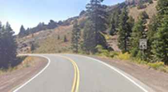
The Top of the Rockies National Scenic Byway is a designated National Scenic Byway and Colorado Scenic and Historic Byway located in the Rocky Mountains of Colorado. It spans approximately 115 miles (185 kilometers) through Lake, Eagle, Pitkin, and Summit Counties.
Driving the rugged forest road to Indian Ridge Lookout
Indian Ridge is a high-altitude summit standing at 1,647 meters above sea level in Lane County, Oregon. Tucked deep within the Willamette National Forest, the final push to the top is a raw forest track that leads to a historic 1958 fire lookout tower. This isn't a scenic drive for city cars; it’s a journey through the Cascade Range where the road surface is a mix of jagged rock and shifting gravel. While it’s technically navigable, the reality is a bumpy, high-vibration climb that will test your vehicle's underbody and your patience as you crawl toward one of the best vantage points for fire surveillance in the region.
Road trip guide: Conquering Castle Pass in CA
Castle Pass is a high mountain pass at an elevation of 2.420m (7,939ft) above the sea level, located in Nevada County, in the U.S. state of California.
A memorable road trip to Bear Lake in Huerfano County
Bear Lake is an alpine lake at an elevation of 3.202m (10,505ft) above the sea level, located in Huerfano County, in the U.S. state of Colorado.
The breathtaking road to Castle Dome in Pima County
Castle Dome is a high mountain peak at an elevation of 1.873m (6,145ft) above the sea level, located in Pima County, in the south central region of the U.S. state of Arizona.
Adventure along Little Annie Road
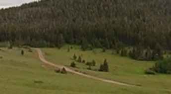
Little Annie Road is a very scenic drive in the heart of Pitkin County, in the U.S. state of Colorado.
How to Drive the Historic Priest Pass in Montana
Priest Pass is a high mountain pass at an elevation of 1,832 m (6,010 ft) above sea level, located on the boundary between Powell and Lewis and Clark counties in the US state of Montana.
The road to Ben Harrison Peak in OR isn’t an easy one
Ben Harrison Peak is a high mountain peak at an elevation of 2.348m (7,703ft) above the sea level, located in Grant County, in the U.S. state of Oregon.
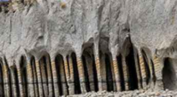
How to drive the off-road trail to Crowley Lake Columns in California?
The Crowley Lake Columns are a series of volcanic stone pillars located on the eastern shore of Crowley Lake in California’s Eastern Sierra. Accessing the columns requires driving through a network of desert tracks east of U.S. Highway 395 that turn into a technical 4x4 challenge near the water.
How to drive the unpaved road to Round Hill in Colorado?
Round Hill is a high mountain peak at an elevation of 3.424m (11,233ft) above sea level, located in Park County, in the US state of Colorado.
The unpaved road with breathtaking views to Sherman Peak in California
Sherman Peak is a high mountain peak at an elevation of 3.022m (9,914ft) above sea level, located in Tulare County, in the U.S. state of California. It's one of the highest roads in California.
Dog Mountain: Driving the NF-406 road to the 6,929ft lookout in Oregon
Rising to an elevation of 2,112m (6,929ft) above sea level, Dog Mountain is a prominent peak located in Lake County, Oregon. Situated within the vast Fremont-Winema National Forest, the summit is home to an active fire lookout tower, offering expansive views over the rugged, high-desert landscape of Southern Oregon, just a few miles from the California border.
Ultimate 4wd destination in Arizona: Spruce Mountain
Spruce Mountain is a high mountain peak at an elevation of 2,337m (7,667ft) above sea level, located in Yavapai County, Arizona. Situated within the Prescott National Forest, the drive to the summit is famous for providing some of the most outstanding panoramic views in the Sierra Prieta range, making the climb a favorite for desert travelers seeking high-country vistas.
How to drive the unpaved road to Nolina Peak in California?
Nolina Peak is a mountain peak at an elevation of 1.496m (4,908ft) above sea level, located in San Bernardino County, in the U.S. state of California.