What are the most spectacular roads in the USA?
Located in North America, the USA is a true paradise for drivers, as it hosts more than 2,000 roads listed as the most spectacular in the world.
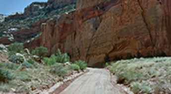
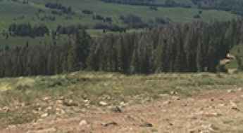
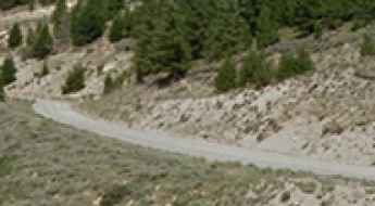
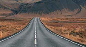
Featuring mountains, deserts, coasts, and snow, in the USA you’ll get your dream road. And you’ll never want to wake up. For instance, at the top of your list, you need to drive the Million Dollar Highway, the most beautiful road in America, and probably in the world. Built in the late 1880s, you'll be on the "outside" for a while with a hell of a view to your right (let the passenger enjoy the view; you'll want to watch the road). Another paved option must be the Iron Mountain Road, featuring 17 miles, 314 curves, 14 switchbacks, 3 pigtails, and 3 tunnels in the Black Hills of South Dakota. No list would be complete without the winding Tail of the Dragon: 318 curves in 11 miles. Spanning Tennessee and North Carolina, it is one of the most scenic drives in the USA. You also can’t skip driving Mount Evans Scenic Byway, the highest paved road in North America, climbing up to 4,310m (14,130ft) in Colorado. It is said to be the highest paved road in North America.
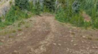
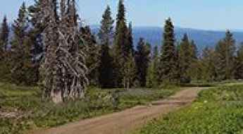
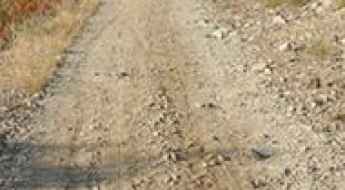
For those who prefer unpaved experiences, the country hosts some of the most defiant yet scenic roads in the world. You can’t miss Black Bear Pass, a high mountain adventure in the Colorado Rockies. Climbing up to 3,915m (12,844ft) above sea level, it's one of the highest roads in Colorado. You can also discover the beauty of Engineer Pass, a mountain pass at an elevation of 3,901m (12,800ft) above sea level in Colorado. It’s mostly a first-gear ride because the road is rough and rocky. The legendary Shafer Trail Road in Utah's Canyonlands National Park is an iconic drive located on the east-central edge of Utah. At times, the road is so narrow that only one car can pass. And Lippincott Mine Road in California is for experienced 4WD drivers using high-clearance vehicles only. You'll need a good map, as the routes are not marked and there are no signs. It’s one of the challenging backcountry roads in Death Valley National Park.

Tips for a Quality Stay in Pigeon Forge
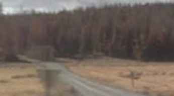
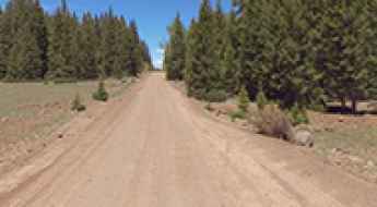
Pigeon Forge, situated at the base of the Great Smoky Mountains, serves as the primary logistical hub for exploring the high-exposure road networks of eastern Tennessee. Success in this region depends on strategic planning—from selecting a base of operations with heavy vehicle access to timing your transit through high-saturation corridors. A disciplined approach to your itinerary ensures that you can maximize your time **driving the Smokies** while maintaining the necessary recovery standards for long-distance travel.
Tip Top
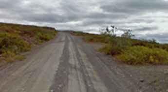
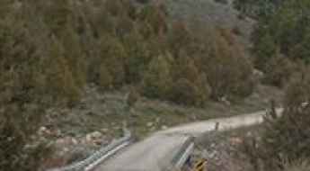
Tip Top is a high mountain pass at an elevation of 3.006m (9,862ft) above the sea level, located in Piute County, in south-central Utah, United States.
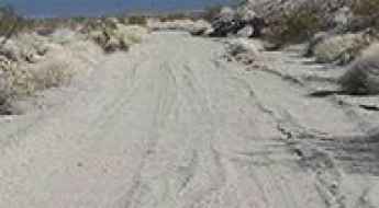
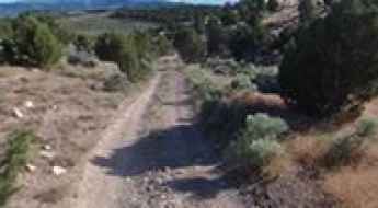
Tamarisk Road is a drive worth taking on the shore of Lake Mohave
Tamarisk Road is a scenic sandy road located in Clark County, in the U.S. state of Nevada, on the shore of Lake Mohave. It’s a stock friendly track but you’ll want four wheel drive and tires that have some gripping power in the sand.
Fields Peak
Fields Peak is a high mountain peak at an elevation of 2.246m (7,368ft) above the sea level, located in Grant County, Oregon, in USA. The average gradient is brutal: 15.92%.
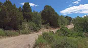
Is it possible to drive the unpaved Navy Road in Santa Cruz Island?
Navy Road is a rugged mountain track located on Santa Cruz Island, the largest of the Channel Islands in the US state of California.
Is the road to the Bald Butte fire lookout in Oregon difficult?
Bald Butte is a high mountain peak at an elevation of 2,299m (7,542ft) above sea level, located in Lake County, Oregon. Tucked away in the south-central part of the state, it offers a perfect blend of volcanic landscapes, sage basins, and total solitude.
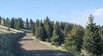
Forest Road 227: Driving the 3,000m Plateau in Duchesne County
Reaching an elevation of 3,165m (10,383ft) above sea level, Forest Road 227 is a high-altitude mountain track in Duchesne County, Utah. Located within the Ashley National Forest, the road is notable for running its entire length at elevations exceeding 3,000 meters, making it one of the highest sustained forest routes in the region.
Tombstone Pass is an absolute must for road lovers in Oregon
Tombstone Pass is a mountain pass at an elevation of 1,294m (4,245ft) above sea level, located in Linn County, in the US state of Oregon.
Tower Mountain
Tower Mountain is a high mountain peak at an elevation of 2.088m (6,850ft) above the sea level, located in Umatilla County, in northeastern Oregon, USA.
Forest Road 196
Forest Road 196 is a high mountain road located in Duchesne County, Utah, United States. It runs entirely over 3.000m above the sea level.
Quartz Mountain: The steep unpaved road to the Selkirk lookout
Quartz Mountain is a high-altitude peak at an elevation of 1,580 meters (5,183 ft) above sea level, located in Spokane County, Washington. Situated within Mount Spokane State Park, near the Idaho border, the summit serves as a critical logistical point for fire monitoring, hosting an active lookout tower built to survey the Spokane Valley and the Selkirk Mountains. The road to the top is a raw, unpaved track that presents a technical challenge due to its steep gradients and loose surface, although accessibility is strictly regulated by park authorities.
How to drive the unpaved road to Osborne Peak in New Mexico
Osborne Peak is a high mountain peak at an elevation of 2.762m (9,061ft) above sea level, located in Rio Arriba County, in the US state of New Mexico.
Forest Road 1877, an epic enthralling drive
Forest Road 1877 is a high mountain road located in Taos County, in the U.S. state of New Mexico. It’s one of the highest mountain roads of New Mexico.
Take the Scenic Route and Discover Maclaren Summit in AK
MacLaren Summit is a high mountain pass at an elevation of 1.250m (4,101ft) above the sea level, in the US state of Alaska. It’s one of the highest roads in Alaska.
Driving a Wild 4x4 Road to Mount Taylor in New Mexico
Mount Taylor is a dormant volcano at an elevation of 3,441m (11,289ft) above sea level, located in Cibola County, in the U.S. state of New Mexico. It’s one of the highest roads in New Mexico.
New York Mountain: Driving the rough FR-418 to the Polar Star Mine
Located in the heart of the White River National Forest, in Eagle County, Colorado, New York Mountain is a high-altitude peak in the Northern Sawatch Range. North of the summit, a rugged trail climbs to a staggering 3,427m (11,243ft) above sea level, following the path of the pioneers who once extracted riches from the high-altitude mines of this region.
An awe-inspiring road to Little Guard Peak in ID
Little Guard Peak is a high mountain peak at an elevation of 1.837m (6,026ft) above the sea level, located in Shoshone County, in the U.S. state of Idaho.
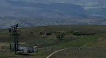
The road to KHIW-FM Essex is not for the faint of heart
KHIW-FM Essex is a radio station at an elevation of 1.097m (3,599ft) above the sea level, located in San Bernardino County, in the southern portion of the U.S. state of California.
How to get to Limantour Beach in California by car?
Limantour Beach is a sandy beach located between Drakes Bay and the Limantour Estero estuary, in Marin County, in the US state of California.

Driving Hylan Boulevard, the most dangerous road in Staten Island
Located in the borough of Staten Island, in the New York City, Hylan Boulevard is said to be the most dangerous road in Staten Island.
A memorable road trip to Currant Summit in Nevada
Currant Summit is a high mountain pass at an elevation of 2.135m (7,004ft) above sea level, located in Nye County, in the U.S. state of Nevada.
Travel guide to the top of Gem Peak in MT
Gem Peak is a high mountain peak at an elevation of 1.857m (6,092ft) above the sea level, located in Sanders County, in the U.S. state of Montana.
The Ultimate Road Trip To Aquarius Plateau in UT
Aquarius Plateau is a high mountain plateau at an elevation of 3.016m (9,895ft) above the sea level, located within Garfield and Wayne counties in the US state of Utah.
Driving the eroded 4x4 road to Monument Peak in Sevier County
Monument Peak is a high-altitude summit reaching 3,185 meters above sea level on the eastern edge of the Sevier Plateau in Central Utah. Located in Sevier County (38.59052, -111.96089), this peak is often confused with other mountains of the same name, but its access via the Koosharem Ranger Station Road sets it apart as a true 4x4 challenge. The road is a raw, unpaved track that climbs through the rugged wilderness of the Fishlake National Forest, where the thin air and the poor state of the trail demand a vehicle with high clearance and a driver who doesn't mind a bumpy, uncomfortable ride.
Travel guide to the top of Griffith Mountain in Colorado
Griffith Mountain is a high mountain peak at an elevation of 3.522m (11,555ft) above sea level, located in Clear Creek County, in the US state of Colorado.
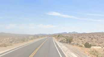
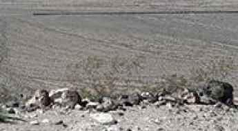
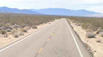
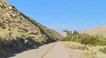
Driving the Scenic California State Route 127 in Death Valley
California State Route 127 is a breathtaking drive with stunning desert views, straddling Inyo and San Bernardino counties.
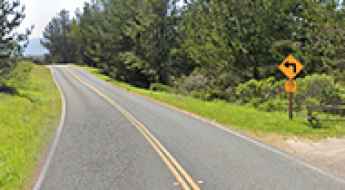
Driving the picturesque Kelso-Cima Road in the heart of Mojave Desert
Kelso-Cima Road is a very scenic paved road, running through the heart of the Mojave Desert of San Bernardino County, in the U.S. state of California. As you travel this road, remember to exercise caution and watch out for wildlife, particularly the desert tortoise.
Forest Road 220
Forest Road 220 is a high mountain road located in Blaine County, Idaho, in USA, running entirely over 2.300 meters above the sea level.
The journey is the destination along the Energy Loop in UT
The Energy Loop: Huntington-Eccles Scenic Byway is a very scenic drive in the central part of Utah, in the USA.
Brown Mountain: a steep unpaved road to the top
Brown Mountain is a high mountain peak at an elevation of 2.133m (6,998ft) above the sea level, located in Jeff Davis County, in the U.S. state of Texas. It's one of the highest roads in Texas.
Driving the Scenic Capitol Gorge Road in Capitol Reef National Park
Capitol Gorge Road is a very scenic, unpaved drive located in Wayne County, in the U.S. state of Utah. It’s fairly well-maintained, though still somewhat rough.
Clear Creek Trail: Driving the steep 8% 4x4 climb in the Anaconda Range
Tucked away at the foot of the Anaconda Range in southwestern Montana, Clear Creek Trail is a high mountain road that demands respect from any off-road driver. Reaching a peak elevation of 2,602m (8,536ft) above sea level, this route in Deer Lodge County is a relentless climb through some of the most rugged terrain in the state.
Francie's Cabin
Francie's Cabin is a high mountain refuge at an elevation of 3.471m (11,387ft), located in Summit County, in central Colorado, United States.
Road trip guide: Conquering McFadden Peak
McFadden Peak is a high mountain peak at an elevation of 2.177m (7,142ft) above the sea level, located in Gila County, in the central part of the U.S. state of Arizona.
Black Mountain
Black Mountain is a high mountain peak at an elevation of 2.005m (6,578ft) above the sea level, located in north-central Sevier County, Utah, United States.
Road trip guide: Conquering Salina Creek Road in Utah
Set high in Sevier County, in the US state of Utah, Salina Creek Road is a scenic mountain drive, winding through Manti-La Sal National Forest.
KWLI-FM Eagle
KWLI-FM Eagle is a radio broadcaster at an elevation of 3.198m (10,492ft) above the sea level, located in Eagle County, Colorado, United States.
Fishlake Scenic Byway: Driving the U-25 to the heights of Southern Utah
The Fishlake Scenic Byway, officially known as Utah State Route 25 (U-25), is a high-altitude paved road that cuts through the heart of the Fishlake National Forest. Reaching an elevation of 2,763m (9,064ft), it connects the high desert plains with one of the most significant alpine environments in southern Utah, serving as the main access to the massive Fish Lake basin.
All About the Road to Blue Slide in Washington
Blue Slide is a high mountain peak at an elevation of 2,072m (6,797ft) above sea level, located in Yakima County, in the U.S. state of Washington. It’s one of the highest roads in Washington.
Road trip guide: Conquering Moffit Pass in UT
Moffit Pass is a high mountain pass at an elevation of 3.144m (10,314ft) above the sea level, located in Summit County, in the U.S. state of Utah.
Spring Operations: 8 Strategic Activities in Pigeon Forge and the Smokies
Spring in Pigeon Forge represents a critical seasonal transition for motorists and outdoor enthusiasts. As the gateway to the Great Smoky Mountains, this Tennessee hub offers access to high-exposure road networks that demand precise driving discipline. From navigating the vertical gradients of the national park to managing the high-density traffic of major automotive events, spring provides a unique window to experience the technical beauty of the Appalachian landscape.
Driving the Steep Pine Creek Road in Inyo County
Pine Creek Road is a challenging drive with steep sections and narrow parts, located in Inyo County, in the US state of California.
All About the Road to Grand Junction FAA Radar Site in CO
Located in Garfield County, in the U.S. state of Colorado, Grand Junction FAA Radar Site sits at an elevation of 2.747m (9,012ft) above the sea level.
A memorable road trip to Indian Rock
Indian Rock is a high mountain peak at an elevation of 2.195m (7,201ft) above the sea level, located in Grant County, in the U.S. state of Oregon.
California’s Most Dangerous Highways : The Killer Roads in the Golden State
From perilous mountain passes to high-clearance interstate highways with deadly reputations, California's highway routes are beautiful and hazardous. Here is a map of the most dangerous pieces of highway where hands are steady and eyes are peeled.
An epic enthralling road to Bolan Peak in OR
Bolan Peak is a high mountain peak at an elevation of 1.902m (6,240ft) above the sea level, located in Josephine County, in the U.S. state of Oregon.

6 Tips to Create the Perfect Travel Itinerary for Your Vacation
Planning a trip to a high-density destination like Myrtle Beach requires more than a list of attractions; it demands a technical audit of transit times, reservation windows, and operational flow. An efficient itinerary is a logistical tool that balances high-energy activities with necessary downtime, ensuring that you maximize your time on the roads and at your destination. From coordinating specialized entertainment to managing culinary logistics and contingency plans, every element must be engineered to avoid bottlenecks and operational friction. This guide analyzes six professional strategies to build a seamless and productive travel itinerary.
Temple Peak
Temple Peak is a high mountain peak at an elevation of 2.746m (9,009ft) above the sea level, located in Cache County, on the northern edge of Utah, United States.