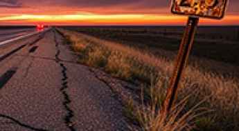
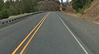
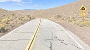
What are the most spectacular roads in the USA?
Located in North America, the USA is a true paradise for drivers, as it hosts more than 2,000 roads listed as the most spectacular in the world.
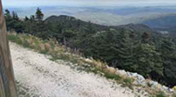
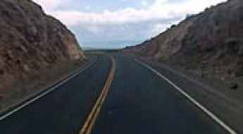
Featuring mountains, deserts, coasts, and snow, in the USA you’ll get your dream road. And you’ll never want to wake up. For instance, at the top of your list, you need to drive the Million Dollar Highway, the most beautiful road in America, and probably in the world. Built in the late 1880s, you'll be on the "outside" for a while with a hell of a view to your right (let the passenger enjoy the view; you'll want to watch the road). Another paved option must be the Iron Mountain Road, featuring 17 miles, 314 curves, 14 switchbacks, 3 pigtails, and 3 tunnels in the Black Hills of South Dakota. No list would be complete without the winding Tail of the Dragon: 318 curves in 11 miles. Spanning Tennessee and North Carolina, it is one of the most scenic drives in the USA. You also can’t skip driving Mount Evans Scenic Byway, the highest paved road in North America, climbing up to 4,310m (14,130ft) in Colorado. It is said to be the highest paved road in North America.
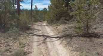
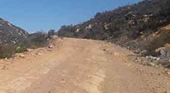
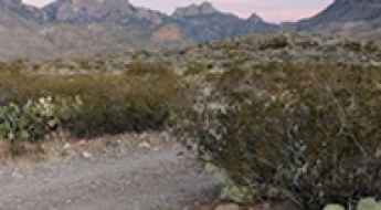
For those who prefer unpaved experiences, the country hosts some of the most defiant yet scenic roads in the world. You can’t miss Black Bear Pass, a high mountain adventure in the Colorado Rockies. Climbing up to 3,915m (12,844ft) above sea level, it's one of the highest roads in Colorado. You can also discover the beauty of Engineer Pass, a mountain pass at an elevation of 3,901m (12,800ft) above sea level in Colorado. It’s mostly a first-gear ride because the road is rough and rocky. The legendary Shafer Trail Road in Utah's Canyonlands National Park is an iconic drive located on the east-central edge of Utah. At times, the road is so narrow that only one car can pass. And Lippincott Mine Road in California is for experienced 4WD drivers using high-clearance vehicles only. You'll need a good map, as the routes are not marked and there are no signs. It’s one of the challenging backcountry roads in Death Valley National Park.
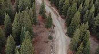
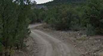
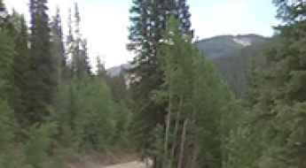
How to get to Crystal Lake in Colorado by car?
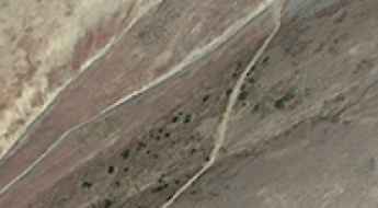
Crystal Lake is a high mountain lake at an elevation of 3.570m (11,712ft) above sea level, located in Summit County, in central Colorado, United States.

How to Take Care of Your Vehicle So that It Operates at Peak Efficiency
Maintaining a vehicle at peak operational efficiency is a fundamental requirement for long-distance driving on high-exposure road networks. Beyond simple ownership care, professional maintenance ensures that every mechanical system can withstand the thermal and structural stresses of diverse terrains. Implementing a rigorous inspection and service schedule is the only way to extend the vehicle's service life and prevent catastrophic mechanical failure during critical transits.
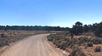
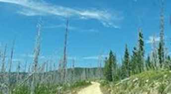
Cedar Mountain Road: Driving the high-desert plateau in Utah
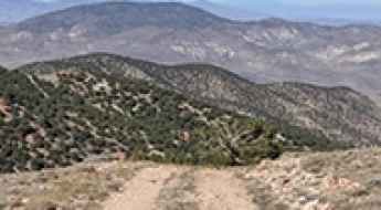
Cedar Mountain is a high-altitude desert plateau reaching an elevation of 2,339m (7,673ft) above sea level in Emery County, Utah. Located in the central-eastern part of the state, the summit is accessed via the Cedar Mountain Road, a sustained unpaved transit that crosses the Cedar Mountain Recreation Area. This is a journey defined by its vast scale and the technical demand of maintaining a steady pace over 21 miles of gravel and silt, where the exposure to the elements and the isolation of the San Rafael Swell region dictate the driving rules.
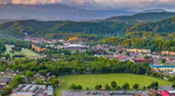
Driving the Great Smoky Mountains: Road Guide to Pigeon Forge and Beyond
Pigeon Forge, Tennessee, serves as a primary gateway to the Great Smoky Mountains National Park. Navigating this region requires understanding high-altitude weather patterns, steep mountain gradients, and the logistical challenges of one of the most visited national parks in the USA.
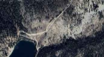
Driving the wild 4x4 road to Iron Lake in Lemhi County
Iron Lake is a beautiful remote lake located in Lemhi County, in the U.S. state of Idaho. It's one of the highest roads in Idaho.
How To Have The Ultimate Road Trip To Methodist Mountain in Colorado
Methodist Mountain is a high mountain peak at an elevation of 3.569m (11,709ft) above sea level, located in the U.S. state of Colorado.
The road to Columbia Ridge is not for the faint of heart
Columbia Ridge is a high mountain peak at an elevation of 2.398m (7,867ft) above the sea level, located in Idaho County, in the U.S. state of Idaho.
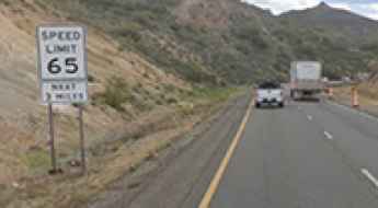
Road Safety Alert: Two Arizona Highways Flagged as Among the Nation's 'Most Dangerous'
Recent data from Teletrac Navman identifies two major Arizona highways as some of the most hazardous road networks in the United States. Interstate 17, connecting Phoenix and Flagstaff, and Interstate 19, running from Nogales to Tucson, have recorded significant fatality rates per mile. For motorists driving these roads, the combination of rapid population growth, mountainous terrain, and high-velocity traffic patterns requires a professional approach to risk management and situational awareness.
12 things to know about driving the Fern Lake Road in Rocky Mountain NP
Fern Lake Road is a very scenic drive located in Larimer County, in the US state of Colorado.
A memorable road trip to Pilot Peak in California
Pilot Peak is a high mountain peak at an elevation of 1.833m (6,013ft) above the sea level, located on the boundary between Mariposa and Tuolumne counties in the U.S. state of California.
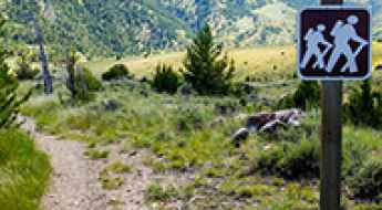
Going Hiking in the Smoky Mountains? Here Are Some Things to Remember
The Great Smoky Mountains offer an extensive network of high-exposure trails that require rigorous physical and logistical preparation. Navigating these lush forests and rugged vertical gradients demands more than basic fitness; it requires a disciplined approach to gear selection, route intelligence, and wildlife management. For those accessing the backcountry via the region's complex road systems, maintaining a high standard of situational awareness is essential to ensure a safe and successful expedition.
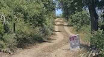
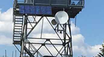
Benchmark Lookout: Driving Road 26 in the San Juan National Forest
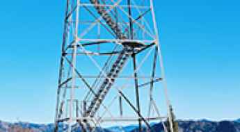
Benchmark Lookout is a high-altitude fire observation station located at 2,828m (9,278ft) above sea level in Dolores County, Colorado. Situated within the San Juan National Forest, it is one of only six active lookouts remaining in the state, serving as a critical point for forest fire detection.
Driving the road to Eddy Gulch Lookout atop Klamath Peak in CA
Klamath Peak is a high mountain peak at an elevation of 1.987m (6,519ft) above the sea level, located in Siskiyou County in the U.S. state of California.
How to drive the unpaved Forest Road 98 to Blue Bird Mesa?
Blue Bird Mesa is a high-altitude mountain pass at an elevation of 2,824m (9,265ft) above sea level, located in Sandoval County, New Mexico. Situated in the north-central part of the state within the Jemez Mountains, the transit via Forest Road 98 is a technical unpaved corridor requiring specific vehicle capabilities for high-altitude desert and forest terrain.
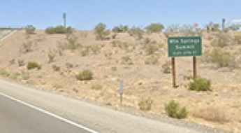
Driving the Paved I-40 to Mountain Springs Summit in California
Mountain Springs Summit is a mountain pass at an elevation of 844m (2,770ft) above sea level, located in San Bernardino County, in the U.S. state of California.
How to Get by Car to Otay Mountain in California?
Otay Mountain is a mountain an elevation of 1,087m (3,566ft) above sea level located in southeastern San Diego County, in the US state of California.
How to drive the rugged NF-395 to Surveyors Ridge in Idaho?
Surveyors Ridge is a high mountain peak at an elevation of 1,886m (6,187ft) above sea level, located in Shoshone County, within the Idaho Panhandle National Forests, USA. Technically, the access route is the St. Joe National Forest Road 395 (NF-395), a rugged single-lane track that requires high-clearance vehicles and precise logistical planning due to its extreme isolation and technical terrain constraints.
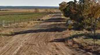
The 10 Deadliest Roads in Texas: Traffic Risks and Data
Texas consistently records some of the highest traffic fatality numbers in the country. Certain roads stand out as especially hazardous due to high speeds, heavy truck traffic, and complex designs. With more than 554,000 crashes reported in Texas in 2024, the scale of the problem is clear. Drivers should be aware of these high-risk areas to maintain safety while driving across the state.

Kentucky Car Accident: How to File a Personal Injury Case
According to the latest statistics released by the Kentucky State Police, more than 131,000 traffic accidents occurred in the state in a single year and 1 in 150 residents were injured due to a collision.
Forest Road 697
Forest Road 697 (Casto Canyon Trail) is a very scenic high mountain road located in Garfield County, in Utah, in the westcentral region of the United States of America.
A memorable road trip to Joseph Peak in Utah
Joseph Peak is a high mountain peak at an elevation of 2.836m (9,304ft) above sea level, located in Sevier County, in the US state of Utah.

5 Things to Consider Before Signing Up to Become a Ride Share Driver in the USA
Initiating a career in the ride-share industry requires more than basic driving skills; it demands a professional approach to vehicle logistics and risk management. Operating as a transport provider on American road networks involves sustained periods of high-intensity urban driving, which places extreme stress on both the driver and the vehicle's mechanical systems. Before entering the ride-share sector, a thorough audit of your equipment, driving record, and operational strategy is mandatory to ensure a sustainable and safe service.
The breathtaking road to Bald Mountain in Blaine County
Bald Mountain is a high mountain peak at an elevation of 2.790m (9,153ft) above the sea level, located in Blaine County, in the US state of Idaho.
Road trip guide: Conquering the Forest Road 820
Forest Road 820 is a high mountain road located in San Juan County, in the U.S. state of Colorado.
What are the highest roads of Vermont?
Vermont, often called The Green Mountain State, is situated in the New England region of the northeastern United States. Its name comes from the French words mont and vert, translating to "green mountain." Vermont shares borders with Canada to the north, New Hampshire to the east, Massachusetts to the south, and New York to the west, and it remains one of the more sparsely populated states.
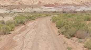
Drive the Wild Horse Road Near Hanksville and Feel Like You’re on the Moon
Straddling Wayne and Emery counties, Wild Horse Canyon Road is a scenic dirt road that runs through the San Rafael Swell in the US state of Utah.

Tactical Gear: Essential Equipment for High-Exposure Road Missions
Operating on remote road networks requires more than a reliable vehicle; it demands a professional kit of tactical gear. Whether you are navigating mountain passes or stuck on an isolated route due to mechanical failure, having the right tools is a matter of safety and self-reliance. For any driver, preparation means carrying equipment that supports both the vehicle’s maintenance and the operator’s survival in unpredictable environments. This guide breaks down the essential hardware for serious driving operations.
Driving the paved road to Battle Mountain in Oregon
Battle Mountain is a mountain pass at an elevation of 1,306 meters (4,284 feet) above sea level, located in Umatilla County, in the U.S. state of Oregon.
How to Get by Car to Tecate Peak in California?
Tecate Peak is a mountain with an elevation of 1,185m (3,887ft) above sea level, located in southeastern San Diego County, in the US state of California.
The Loneliest Highway to Hickison Summit in NV
Hickison Summit is a high mountain pass at an elevation of 2.007m (6,584ft) above the sea level, located in Lander County, in the U.S. state of Nevada.
Driving to Mount Disappointment: A Road through California's Missile Legacy
Mount Disappointment is a high mountain peak at an elevation of 1,797m (5,895ft) above sea level, located in Los Angeles County, in the US state of California.
An Epic Road to Cebolla Pass in New Mexico
Cebolla Pass is a high mountain pass at an elevation of 2,338m (7,670ft) above sea level, located on the boundary between Mora and San Miguel counties, in the US state of New Mexico.

How to drive the complex road and transit logistics of Chicago?
Chicago, the primary logistical hub of the American Midwest, presents a unique urban navigation challenge due to its multi-layered infrastructure. The city’s core is defined by a three-level street system and a high-density "L" (elevated train) network that dictates traffic flow. Navigating the city effectively requires an understanding of the vertical logistics of the Loop and the high-speed transit protocols of Lake Shore Drive (US-41), where weather-induced friction changes from Lake Michigan are a constant technical factor.
Travel Guide to Enterprise Mine in Pitkin County
Enterprise Mine is an abandoned silver mine at an elevation of 3,811m (12,503ft) above sea level, located in Pitkin County, in the U.S. state of Colorado. It’s one of the highest roads in Colorado.
Pat Knoll: Driving Forest Road 90 in the Apache-Sitgreaves National Forest
At an elevation of 2,859m (9,379ft) above sea level, Pat Knoll is a high mountain peak in Apache County, Arizona. Located within the Apache-Sitgreaves National Forest in the northeastern part of the state, it stands as one of the highest roads in Arizona.
Driving the challenging Sleeping Deer Road in Idaho
Sleeping Deer Road is a very challenging 4x4 road located in the center of the U.S. state of Idaho. It’s one of the highest roads in Idaho.
The breathtaking road to Sugarloaf Peak in NV
Sugarloaf Peak is a high mountain peak at an elevation of 2.767m (9,078ft) above the sea level, located on the boundary of Esmeralda and Mineral counties, in the U.S. state of Nevada.
Road trip guide: Conquering Blue Ridge in Siskiyou County
Blue Ridge is a high mountain peak at an elevation of 1.814m (5,951ft) above the sea level, located in Siskiyou County in the U.S. state of California.
Driving the Rugged Juniper Canyon Road in Big Bend
Juniper Canyon Road is a scenic drive located in Brewster County, Texas, offering stunning views of the Chisos Mountains. The road is very rocky and rough, typically requiring a 4WD vehicle.
The wild 4x4 road to Hager Mountain in Oregon
Hager Mountain is a volcanic peak at an elevation of 2,191m (7,188ft) above sea level, located in Lake County, in the U.S. state of Oregon. The area is known for its scenic vistas and wild places.
Ranchos Peak: Driving the rough logging roads of Taos
Ranchos Peak is a high-altitude mountain summit located in Taos County, in the US state of New Mexico. Located within the Carson National Forest, the track leading to the peak is a raw, unpaved logging road that climbs the Sangre de Cristo Mountains, forcing vehicles to cross 8.7 kilometers of deep mud ruts, sharp rocks, and unstable high-desert soil.
Driving the U.S. Highway 395 to Long Creek Mountain Summit in Oregon
Long Creek Mountain Summit is a high mountain pass reaching an elevation of 1,551m (5,088ft) above sea level, located in Grant County, Oregon. Positioned within the Blue Mountain Range, the pass is a critical logistical point on the U.S. Highway 395, a route subject to significant elevation shifts and high-desert weather patterns.
Driving the steep 4x4 road to Swanholm Peak in Idaho
Swanholm Peak is a high mountain peak at an elevation of 2.662m (8,733ft) above sea level, located in Elmore County, in the U.S. state of Idaho. The road to the summit, on a very steep grade, is not for the faint of heart.
A Wild 4x4 Road to Marble Mountain in Colorado
Marble Mountain is a high mountain pass at an elevation of 3,699 m (12,135 ft) above sea level, located in Rio Grande County, in the U.S. state of Colorado. It’s one of the highest roads in Colorado.
From Expedition Routes to Asphalt: Lewis and Clark's Mountain Pass Discoveries
The Lewis and Clark Expedition played a crucial role in the exploration of the American West. This text examines the expedition's context, its key figures, and its lasting impact on the development of overland travel routes, specifically in relation to several mountain passes that are utilized by modern roads.
Gilbert Pass: Driving the narrow single-lane section of CA-168
Reaching an elevation of 1,948 meters (6,391 feet) above sea level, Gilbert Pass is a high mountain pass located in Inyo County, California. Situated within the Inyo National Forest, the road over the pass is one of the most unusual state highways in the U.S., famous for its extreme narrowness and sections where the asphalt disappears into a single lane shared by both directions.
How to drive the treacherous 4x4 road to Blacktail Mountain in Montana?
Blacktail Mountain is a high mountain peak at an elevation of 2,785m (9,137ft) above sea level, located in Beaverhead County, in the southwestern part of Montana. Situated south of the town of Dillon, it offers a true wilderness driving experience in one of the most isolated sections of the state.
Driving the Scenic Pine Canyon Road in Big Bend NP
Pine Canyon Road is a very scenic drive located in Brewster County, in the U.S. state of Texas, offering stunning views of the Chisos Mountains. A high-clearance vehicle is recommended, as some parts of the road can be rough.