What are the most spectacular roads in the USA?
Located in North America, the USA is a true paradise for drivers, as it hosts more than 2,000 roads listed as the most spectacular in the world.
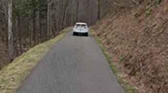
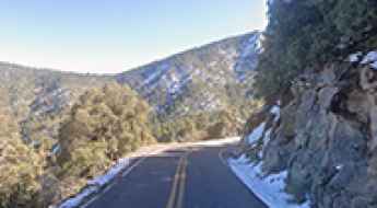
Featuring mountains, deserts, coasts, and snow, in the USA you’ll get your dream road. And you’ll never want to wake up. For instance, at the top of your list, you need to drive the Million Dollar Highway, the most beautiful road in America, and probably in the world. Built in the late 1880s, you'll be on the "outside" for a while with a hell of a view to your right (let the passenger enjoy the view; you'll want to watch the road). Another paved option must be the Iron Mountain Road, featuring 17 miles, 314 curves, 14 switchbacks, 3 pigtails, and 3 tunnels in the Black Hills of South Dakota. No list would be complete without the winding Tail of the Dragon: 318 curves in 11 miles. Spanning Tennessee and North Carolina, it is one of the most scenic drives in the USA. You also can’t skip driving Mount Evans Scenic Byway, the highest paved road in North America, climbing up to 4,310m (14,130ft) in Colorado. It is said to be the highest paved road in North America.
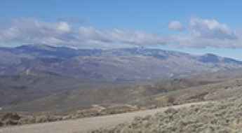
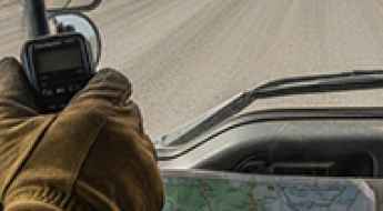
For those who prefer unpaved experiences, the country hosts some of the most defiant yet scenic roads in the world. You can’t miss Black Bear Pass, a high mountain adventure in the Colorado Rockies. Climbing up to 3,915m (12,844ft) above sea level, it's one of the highest roads in Colorado. You can also discover the beauty of Engineer Pass, a mountain pass at an elevation of 3,901m (12,800ft) above sea level in Colorado. It’s mostly a first-gear ride because the road is rough and rocky. The legendary Shafer Trail Road in Utah's Canyonlands National Park is an iconic drive located on the east-central edge of Utah. At times, the road is so narrow that only one car can pass. And Lippincott Mine Road in California is for experienced 4WD drivers using high-clearance vehicles only. You'll need a good map, as the routes are not marked and there are no signs. It’s one of the challenging backcountry roads in Death Valley National Park.
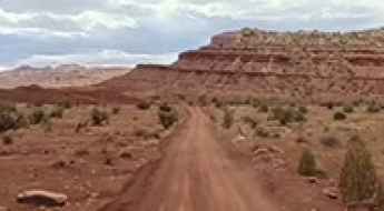
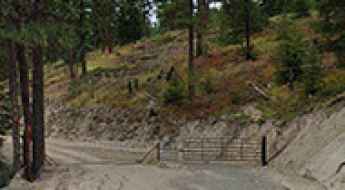
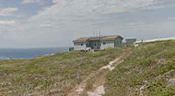
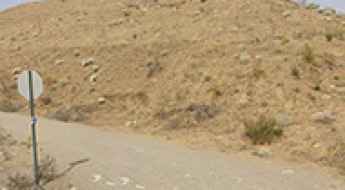
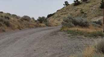
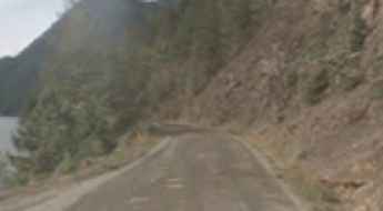
Is the road to Lucky Strike Mine in Utah’s San Rafael Swell dangerous?
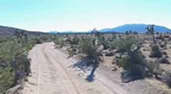
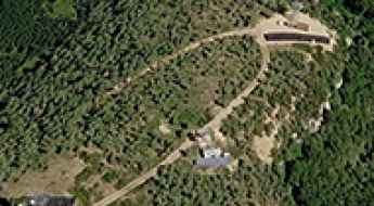
Lucky Strike Mine is a forgotten uranium and vanadium ghost town tucked away at 1,771m (5,810ft) above sea level in Emery County, Utah. Located in the heart of the San Rafael Swell, specifically within the rugged Reds Canyon area, this site is a relic of the 1950s uranium boom. Driving to the mine is more than a scenic trip; it is an entry into a remote, unmonitored desert environment where the road surface, the lack of communication, and the lingering radiation from the old shafts create a high-stakes adventure for any off-road driver.
How to get by car to North Walton Peak in Colorado?
North Walton Peak is a high mountain peak at an elevation of 3,090 m (10,137 ft) above sea level, located in Routt County, in the U.S. state of Colorado.
The Wild Unpaved 4x4 Road to Bald Knoll in Sevier County
Bald Knoll is a high mountain pass at an elevation of 2,881m (9,452ft) above sea level, located in Sevier County, in the U.S. state of Utah.
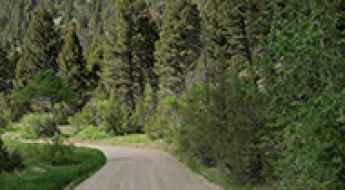
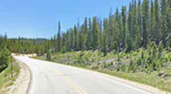
Peak to Peak Highway: Driving Colorado’s Oldest and Most Scenic Byway
Established in 1918, the Peak to Peak Highway is Colorado's oldest scenic byway. Spanning 55 miles (89 km) through the heart of the Front Range, this route offers matchless views of the Continental Divide. It is an essential mountain corridor that connects Rocky Mountain National Park with historic gold-mining districts, blending alpine nature with the rugged ghost towns of the Old West.
How to Get by Car to the Lookout at the Summit of Buck Mountain in Washington?
Buck Mountain is a high mountain peak at an elevation of 1,868m (6,128ft) above sea level, located in Okanogan County, in the U.S. state of Washington.
How difficult is the unpaved road to Jack Mountain in Montana?
Jack Mountain is a high mountain summit reaching an elevation of 2,667m (8,750ft) above sea level in Jefferson County, Montana. Tucked away south of Helena, the state capital, the peak sits within the massive Beaverhead-Deerlodge National Forest. The road to the top is a primitive and abandoned fire lookout track that has not seen regular maintenance for years, turning a 21-kilometer climb into a brutal test of suspension and tire grip in the heart of the Montana wilderness.
How to drive the 4x4 road to Daniel’s Pass in Utah?
Daniel’s Pass is a high mountain pass at an elevation of 3,129 m (10,265 ft) above sea level, located in Sevier County, in the U.S. state of Utah. Logistically, the pass is situated in the high-altitude plateau region of the Fishlake National Forest, a terrain characterized by volcanic soil and rapid weather shifts that can significantly alter road surface conditions within hours.
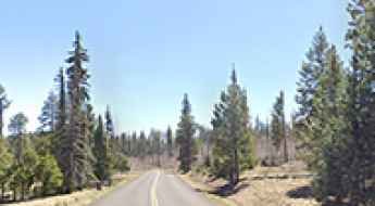
How to drive the Three Forks Road of Arizona?
Three Forks Road is a stunning drive with awesome views of streams, forest, and meadows, located in Apache County, in the U.S. state of Arizona. It’s one of the highest roads in Arizona.
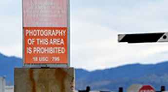
San Miguel Island: Military service tracks and UXO hazards
San Miguel Island, the westernmost of the Channel Islands in California, features a unique network of unpaved service tracks within a high-risk environment. Established during the U.S. Navy's tenure (1930s–1970s) when the island served as a bombing and gunnery range, these tracks were built for military logistics. Today, the island remains a high-security zone managed by the National Park Service, where the presence of Unexploded Ordnance (UXO) makes driving and even walking a strictly regulated activity.
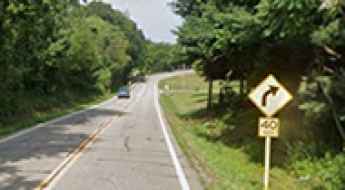
Is Ohio State Route 170 the Best Technical Drive in the Rust Belt?
Ohio State Route 170 (SR 170) is a north-south highway that offers a surprising technical escape through the rolling terrain of eastern Ohio. Specifically, the segment from Calcutta to Poland is a favorite for those seeking a rhythmic driving experience. Unlike the flat, grid-like roads common in the Midwest, this route follows the natural contours of the Little Beaver Creek valley, providing a series of sweepers and elevation changes that demand constant throttle adjustment. It is one of the most scenic drives in the USA.
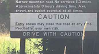
Magruder Road Corridor: The Ultimate Test of Remote Off-Road Navigation
The Magruder Road Corridor, officially Forest Service Road 468, stretching between Elk City, Idaho, and Darby, Montana, is one of the most remote and primitive tracks in the lower 48 states. Carving a thin line between two massive wilderness areas—the Selway-Bitterroot and the Frank Church-River of No Return—this 101-mile (162 km) forest road offers no services, no cell signal, and no room for mechanical error. It is a high-altitude transit through the heart of the Bitterroot Mountains, where the environment remains as rugged and unforgiving as it was a century ago.
TV Hill: Driving to the 10,291ft summit in Nevada's Wassuk Range
Reaching a staggering elevation of 3,137m (10,291ft) above sea level, TV Hill is a high mountain peak located in Mineral County, within the rugged wilderness of Nevada. As one of the highest roads in Nevada, this summit offers an extreme off-road experience for those looking to reach the heights of the Great Basin Desert.
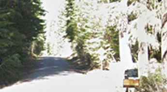
Driving the Cherokee Orchard Road in Tennessee
Cherokee Orchard Road serves as the vital logistical link between the urban grid of Gatlinburg and the high-density forest of the Great Smoky Mountains National Park. More than just an access route, this road is a steep mountain ascent that prepares the motorist for the technical demands of the Roaring Fork Motor Nature Trail. Driving this road requires managing a high volume of pedestrian traffic, narrow lane widths, and a continuous vertical incline that tests vehicle cooling systems from the moment you leave the city limits.
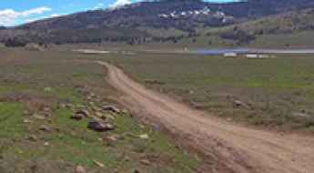
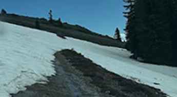
Driving an easy dirt road to Muddy Pass in Eagle County
Muddy Pass might sound intimidating, but in good weather, it’s one of the more relaxed dirt routes in Eagle County. At 2,632m (8,635ft) above sea level, this pass north of Wolcott offers a classic Colorado backcountry experience without the rock-crawling drama of the higher peaks. However, don't let the "easy" label fool you; as soon as the clouds open up, this road earns its name very quickly.
CB Radio: The Lifeline of the Dalton Highway
On Alaska’s remote Dalton Highway, standard safety tools like cell phones are useless. With hundreds of miles of zero signal and extreme arctic conditions, survival depends on a technology that predates the internet: the CB (Citizens Band) radio. For truck drivers and expeditionary travelers alike, the "CB" is more than a communication tool—it is a critical safety system used to navigate blind corners, heavy dust clouds, and life-threatening mechanical failures.
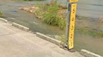
Is the Slab Road crossing in Kingsland dangerous to drive?
The Slab is a legendary low-water crossing located in Llano County, in the U.S. state of Texas. Situated just outside of Kingsland, this section of Ranch Road 3404 is a popular summer destination that can turn deadly in a matter of minutes due to extreme flash flooding.
How to Get by Car to the Lookout at the Summit of Whitmore Mountain in Washington?
Whitmore Mountain is a mountain peak at an elevation of 1,201m (3,940ft) above sea level, located in Okanogan County, in the U.S. state of Washington.
How to drive the unpaved road to Pennellen Pass in Utah?
Pennellen Pass is a high mountain pass at an elevation of 2,411m (7,910ft) above sea level, located in eastern Garfield County, in the US state of Utah.
How to drive the unpaved road to Stanton Pass in Utah?
Stanton Pass is a high mountain pass at an elevation of 2,253m (7,391ft) above sea level, located in eastern Garfield County, in the US state of Utah.
How to drive the unpaved NF-2150 road to Aldrich Mountain in Oregon?
Aldrich Mountain is a high-altitude peak reaching 2,127m (6,978ft) above sea level, located in Grant County, Oregon. Tucked away in the Malheur National Forest, the summit is home to an active fire lookout. Accessing the top requires driving the Forest Service Road 2150 (NF-2150), a remote and unpaved track that demands mechanical self-sufficiency and caution due to its isolation in the central Oregon wilderness.
How to drive the unpaved road to Desert Queen Mine in California?
Desert Queen Mine is an abandoned gold mine located in Riverside County, in the US state of California. You can still see some of the equipment on site, but all the mine entrances and stuff like that is fenced off.
Can I drive to the perimeter of Area 51 in Nevada?
Area 51 is a highly classified United States Air Force facility located within the Nevada Test and Training Range in Lincoln County, Nevada. While the base itself is strictly off-limits to the public, you can legally drive to the perimeter gates through remote desert tracks.
How to drive the paved CO-125 road to Willow Creek Pass in Colorado?
Willow Creek Pass is a high mountain pass at an elevation of 2951m (9683ft) above sea level, located of the Continental Divide in the US state of Colorado.
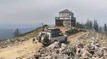
Dutchman Peak: Driving to the historic 1927 lookout in Oregon
At an elevation of 2,243m (7,358ft) above sea level, Dutchman Peak is a high mountain summit in the Siskiyou Mountains of Southern Oregon. Located within the Rogue River-Siskiyou National Forest near the California border, the peak is home to one of the oldest fire lookouts still in service in the United States.
How to drive high-mountain AZ-366 Road in Arizona?
Arizona State Route 366 (AZ-366) is a high-mountain winding road, with sharp curves and no guardrails, located in Graham County, in the U.S. state of Arizona. It tops out at 2,936m (9,632ft) above sea level near Mount Graham.
The Ultimate Guide to Driving State Route 14 in Washington (2026)
Wind slams against the basalt cliffs of the Columbia River Gorge with zero warning. Unwary motorists drift across the double-yellow line of State Route 14. And you? You're steering through shadows cast by 4,000-foot volcanic canyon walls, fighting unpredictable gusts that batter your vehicle's side profile.
How difficult is the 4x4 road to Tetilla Peak and Costilla Peak?
Tetilla Peak (3,283m / 10,771ft) and Costilla Peak are two high mountain summits located in Colfax County, New Mexico. Situated in the Sangre de Cristo Mountains near the Colorado border, the primitive road connecting these peaks is one of the highest roads of New Mexico.
How to drive the mine road to Gibbs Peak in Colorado?
Gibbs Peak is a high mountain peak located on the boundary between La Plata and Montezuma counties in southwestern Colorado. While the summit sits higher, a minor gravel road situated on its eastern side tops out at an elevation of 3,507m (11,505ft) above sea level. This rugged mine road within the San Juan National Forest is a demanding 4x4 transit that requires precise vehicle placement and high-altitude experience.
How steep is the 4x4 road to Uncompahgre Butte?
Uncompahgre Butte is a high mountain peak at an elevation of 2,955m (9,694ft) above sea level, located in Mesa County, in the US state of Colorado. The summit is reached via a short but brutal 1.6 km spur that branches off the Divide Road on the Uncompahgre Plateau.
Driving history: The abandoned 7:30 Mine Road in Colorado
The 7:30 Mine Trail is an abandoned mining road in the historic town of Silver Plume, in the US state of Colorado. Built in 1872 as a toll road, it climbed the steep slopes of Republican Mountain to reach the silver mines.
How to drive the 31 hairpins of the abandoned road to Diorite Peak?
Diorite Peak is a high mountain peak located on the boundary of La Plata and Montezuma counties in southwestern Colorado. While the summit sits higher, a gravel road situated south of the peak tops out at an elevation of 3,583m (11,755ft) above sea level. This route, an abandoned wagon road within the San Juan National Forest, is one of the most technical and eroded tracks in the region.
Scenic but Demanding: Roads That Test Driver Focus and Precision
A mountain highway carves through a granite canyon, every curve revealing another postcard view. The problem is that each of those curves also demands total concentration, split-second steering corrections, and zero room for error.
How to drive the steep Spirit Mountain Road to Cedar Mountain in Cody?
Cedar Mountain is a high mountain peak at an elevation of 2,405m (7,890ft) above sea level, located in Park County, in the US state of Wyoming.
Can I drive to the lookout at the summit of Hershberger Mountain in Oregon?
Hershberger Mountain is a high mountain peak at an elevation of 1,853m (6,079ft) above sea level, located in Douglas County, in the U.S. state of Oregon.
How to drive the unpaved road to Cougar Peak in Oregon?
Cougar Peak is a high mountain peak at an elevation of 2,415m (7,923ft) above sea level, located in Lake County, in the US state of Oregon.
How to drive the unpaved road to High Mountain in Utah?
High Mountain is a high mountain peak at an elevation of 3,030m (9,940ft) above sea level, located in Iron County, in the US state of Utah.
How high is the unpaved road to Van Diest Peak in New Mexico?
Van Diest Peak is a high mountain summit in the Sangre de Cristo Mountains of New Mexico. While the peak reaches 3,731m, the unpaved track stops at an elevation of 3,396m (11,141ft) above sea level in Taos County. This high-altitude spur is one of the highest roads of New Mexico, though it remains behind private gates.
How to drive the Forest Road 91B to Burned Mountain in New Mexico?
Burned Mountain is a high pass at an elevation of 3,048m (10,000ft) above sea level located in Rio Arriba County, in the US state of New Mexico. It is the highest roads of New Mexico.
How to drive the unpaved road to Thunder Mountain in California?
Thunder Mountain is a high mountain peak at an elevation of 2,613m (8,572ft) above sea level, located in San Bernardino County, in the US state of California. The road to the summit is a service road for the ski lifts.
Driving the steep Forest Road 4717 to South Mountain in Utah
South Mountain is a high mountain peak at an elevation of 3,258m (10,688ft) above sea level, located in San Juan County, in the US state of Utah. It is one of the highest roads in Utah.
How to drive the unpaved road to Indian Creek Point in Idaho?
Indian Creek Point is a high mountain peak at an elevation of 2,608m (8,556ft) above sea level located in Valley County, in the U.S. state of Idaho.
How to drive the 4x4 road to Duck Creek Point in Idaho?
Duck Creek Point is a mountain peak at an elevation of 2,515m (8,251ft) above sea level located in Lemhi County, in the US state of Idaho.
How to drive the unpaved road to Treasure Hill in Nevada?
Treasure Hill is a high mountain peak at an elevation of 2,805m (9,202ft) above sea level located in White Pine County, in the US state of Nevada.
How to drive the unpaved road to Buena Vista Peak in Colorado?
Buena Vista Peak is a high mountain peak at an elevation of 2,614m (8,575ft) above sea level located in Moffat County, in the US state Colorado.
How to drive the Staircase Road in Washington?
Staircase Road, or Forest Service Road 24 (NF-24), is the only access to the southeastern corner of Olympic National Park in Washington.
How to drive the unpaved road to the lookout at Stonewall Mountain in Montana
Stonewall Mountain is a mountain peak at an elevation of 2.525m (8,284ft) above sea level, located in Lewis and Clark County, in the U.S. state of Montana.
How to drive to Mount Union in Arizona?
Mount Union is a high mountain peak at an elevation of 2,431m (7,975ft) above sea level, located in Yavapai County, in the US state of Arizona.
Driving the Forest Service Road 310 to Blue Nose
Blue Nose is a high mountain peak at an elevation of 2,641m (8,664ft) above sea level located on the border between Montana and Idaho.