What are the most spectacular roads in the USA?
Located in North America, the USA is a true paradise for drivers, as it hosts more than 2,000 roads listed as the most spectacular in the world.
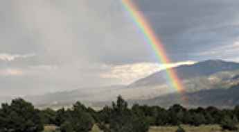
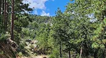
Featuring mountains, deserts, coasts, and snow, in the USA you’ll get your dream road. And you’ll never want to wake up. For instance, at the top of your list, you need to drive the Million Dollar Highway, the most beautiful road in America, and probably in the world. Built in the late 1880s, you'll be on the "outside" for a while with a hell of a view to your right (let the passenger enjoy the view; you'll want to watch the road). Another paved option must be the Iron Mountain Road, featuring 17 miles, 314 curves, 14 switchbacks, 3 pigtails, and 3 tunnels in the Black Hills of South Dakota. No list would be complete without the winding Tail of the Dragon: 318 curves in 11 miles. Spanning Tennessee and North Carolina, it is one of the most scenic drives in the USA. You also can’t skip driving Mount Evans Scenic Byway, the highest paved road in North America, climbing up to 4,310m (14,130ft) in Colorado. It is said to be the highest paved road in North America.
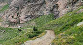
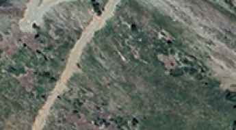
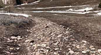
For those who prefer unpaved experiences, the country hosts some of the most defiant yet scenic roads in the world. You can’t miss Black Bear Pass, a high mountain adventure in the Colorado Rockies. Climbing up to 3,915m (12,844ft) above sea level, it's one of the highest roads in Colorado. You can also discover the beauty of Engineer Pass, a mountain pass at an elevation of 3,901m (12,800ft) above sea level in Colorado. It’s mostly a first-gear ride because the road is rough and rocky. The legendary Shafer Trail Road in Utah's Canyonlands National Park is an iconic drive located on the east-central edge of Utah. At times, the road is so narrow that only one car can pass. And Lippincott Mine Road in California is for experienced 4WD drivers using high-clearance vehicles only. You'll need a good map, as the routes are not marked and there are no signs. It’s one of the challenging backcountry roads in Death Valley National Park.
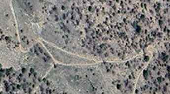
Driving the Rugged Forest Road 254 to Mount Shavano in Colorado
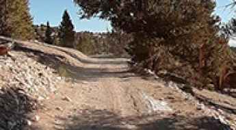
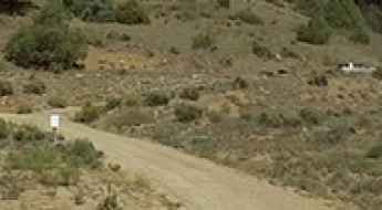
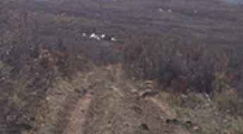
Mount Shavano is a prominent high mountain peak in the Sawatch Range of central Colorado. While the summit reaches a towering 4,338m (14,235ft), an old mining track known as Forest Road 254 (Blank’s Cabin Road) climbs the southeastern slopes up to an elevation of 3,217m (10,554ft) above sea level. This road is the primary access for those seeking the famous "Angel of Shavano."
Everything You Need to Know About the Wild Road to Palo Encebado Peak in New Mexico
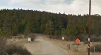
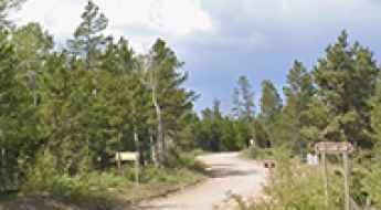
Palo Encebado Peak is a high mountain peak at an elevation of 3,069m (10,068ft) above sea level, located in Taos County, in the U.S. state of New Mexico. It’s one of the highest roads in New Mexico.
Planning a Successful Road Trip to Pigeon Forge
Organizing a large group or family trip to Pigeon Forge requires careful management of transport and logistics. When driving with a large number of people, the complexity of the journey increases—from finding suitable parking to timing your arrival at the Great Smoky Mountains. A professional approach to planning ensures that your group stays coordinated and that every road transit is executed safely and efficiently.
Driving the Scenic Paved Road to Oldman Pass in Washington
Oldman Pass is a mountain pass with an elevation of 934m (3,064ft) above sea level, located in Skamania County, in the U.S. state of Washington.
How to Get to Patriarch Grove by Car in California?
Located at an elevation of 3,455 meters (11,335 feet), in the US state of California, Patriarch Grove is part of the Ancient Bristlecone Pine Forest and is notable for the Patriarch Tree, the largest bristlecone pine in the world. It's one of the highest roads in California.
How to get to Slide Lake in Colorado by car
Slide Lake is a high mountain lake at an elevation of 3,575m (11,729 ft) above sea level, located in Lake County, in the US state of Colorado.
Why the Volcanic Legacy Scenic Byway Might Be America’s Best Hidden Drive
The Volcanic Legacy Scenic Byway is a designated All-American Road in the U.S. states of California and Oregon. Spanning approximately 500 miles (800 km), it follows the Cascade Range and passes numerous volcanic sites, including Crater Lake National Park, Mount Shasta, and Lassen Volcanic National Park. The route is recognized for its geological significance and connects a range of natural and cultural landmarks.
How to get by car to Yellow Mountain in California?
Yellow Mountain is a high mountain peak at an elevation of 2.465m (8,087ft) above sea level, located in Modoc County, in the U.S. state of California.
Driving the unpaved road to Brooks Mountain in Jeff Davis County
Brooks Mountain is a high mountain pass at an elevation of 2.185m (7,168ft) above sea level, located in Jeff Davis County, in the U.S. state of Texas. It's one of the highest roads in Texas.
How to get by car to Smith Creek Lakes in Utah?
Smith Creek Lakes are three small glacial cirque lakes at an elevation of 2,722m (8,930ft) above sea level, located in Morgan County, in the U.S. state of Utah.
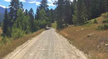
Driving the scenic Main Boulder Road in south Montana
Main Boulder Road is a very scenic drive located in the U.S. state of Montana. The route closely follows the Boulder River and provides access to countless campgrounds.
Driving the challenging Forest Road 597 to Sawmill Pass in New Mexico
Sawmill Pass is a high mountain pass at an elevation of 3,153m (10,344ft) above sea level, located in Taos County, in the U.S. state of New Mexico. It’s one of the highest roads in New Mexico.
Driving the Wild 4x4 Road to Thurston Peak in Utah
Thurston Peak is a high mountain located in the U.S. state of Utah. A minor gravel road, north of the peak, climbs up to 2,990m (9,809ft) above sea level.
6 Reasons to Choose a Cabin for Your Smoky Mountains Trip
When planning a trip to the Smoky Mountains, choosing the right base is a tactical decision. Sevierville is a key hub for accessing some of the most famous roads in Tennessee. While hotels are an option, renting a cabin offers specific advantages for drivers and groups who need more space, secure parking, and direct access to mountain routes. For a successful driving expedition, a cabin provides the infrastructure needed to manage your vehicle and your schedule with total autonomy.
An Unforgettable Drive to Rhyolite Mountain in Teller County
Rhyolite Mountain is a high mountain peak at an elevation of 3,230 m (10,597 ft) above sea level, located in Teller County, in the U.S. state of Colorado.
How long is the road to Mount Tom in Jefferson County?
Mount Tom is a high mountain peak at an elevation of 2,889m (9,478ft) above sea level, located in Jefferson County, in the US state of Colorado. The summit is reached via a 5 km (3.1 miles) unpaved track that starts off Drew Hill Road, west of Golden.
What You Need to Know About the Wild Road to Casita de Piedra Peak in New Mexico
Casita de Piedra Peak is a high mountain peak at an elevation of 3,061m (10,042ft) above sea level, located in Taos County, in the U.S. state of New Mexico. It’s one of the highest roads in New Mexico.
Driving the 4x4 road to Bonito Mountain in Colorado
Bonito Mountain is a high mountain peak at an elevation of 3,673 m (12,050 ft) above sea level, located in Rio Grande County, in the U.S. state of Colorado. It stands as one of the highest roads in Colorado, offering a true high-alpine driving experience.
Driving the unpaved road to Black Mountain in Jeff Davis County
Black Mountain is a high mountain pass at an elevation of 2.008m (6,587ft) above sea level, located in central Jeff Davis County, in the U.S. state of Texas. It's one of the highest roads in Texas.
Centralia Mountain: Driving the 9% Service Track in Jefferson County
At an elevation of 2,876m (9,435ft) above sea level, Centralia Mountain is a high summit in Jefferson County, Colorado. Located west of Denver within the Front Range, the peak is home to various communication towers, making the road to the top a vital but restricted service corridor.
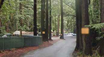
Is the asphalted Mystery Spot Road really a gravity hill?
Mystery Spot Road is a specialized access route at an elevation of 110m (360ft) above sea level, located in the Santa Cruz Mountains of California. Situated within a dense redwood forest, the road is internationally recognized as a gravity hill, where specific topographical tilts create a documented optical distortion of the horizon line.
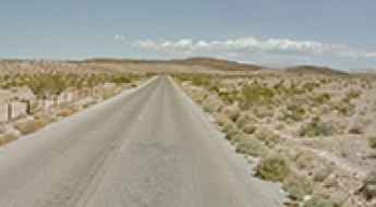
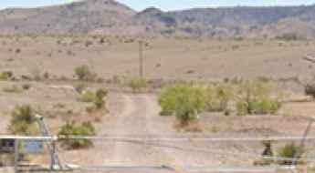
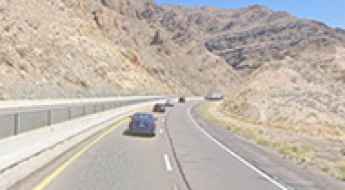
The Ultimate Trip on Government Wash Road to Lake Mead
Government Wash Road is a scenic sandy drive leading to Lake Mead, a large reservoir on the Colorado River, located in Clark County, in the US state of Nevada.
How to Get to Kerr Lake by Car in Southern Colorado?
Kerr Lake is a high mountain lake at an elevation of 3,482m (11,423 ft) above sea level, located in Conejos County in the U.S. state of Colorado.
Driving the Wild Road to Cerro Pelon in the Manzano Mountains
Cerro Pelon is a high mountain peak at an elevation of 3,058m (10,032 ft) above sea level, located in Cibola County, in the U.S. state of New Mexico. It’s one of the highest roads in New Mexico.
What You Need to Know About Driving Forest Road 4725 in San Juan County
Forest Road 4725 is a high mountain unpaved road located in San Juan County, in the US state of Utah.
How to Get by Car to Coffeepot Crater in Oregon?
Coffeepot Crater is a large, remarkably well-preserved breached cinder cone located in Malheur County, in the southeastern corner of Oregon. It is the centerpiece of the Jordan Craters Volcanic Field, a 27-square-mile landscape of twisted basalt and jagged lava flows that looks more like the lunar surface than the Pacific Northwest.
A wild unpaved road to Table Rock Lookout in Oregon
Table Rock is a summit at an elevation of 2,375m (7,791ft) above sea level, located in Baker County, in the U.S. state of Oregon.
Driving the Wild 4x4 Road to Lily Lake near Leadville
Lily Lake is a high mountain lake at an elevation of 3,233m (10,606ft) above sea level, located in Lake County, in the US state of Colorado.
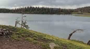
How to drive to Blue Lake in south Montana?
Blue Lake is a high mountain lake at an elevation of 2,901m (9,517ft) above sea level, located in Sweet Grass County, in the U.S. state of Montana.
How to Get to Horsethief Lookout Tower by Car in Arizona
Located in Yavapai County, in the U.S. state of Arizona, Horsethief Lookout Tower sits at an elevation of 2,045m (6,709ft) above sea level.
Driving the mining road to Silver Lake near Silverton
Silver Lake is a high mountain lake located in San Juan County, in the US state of Colorado. A gravel road, to the north of the lake, ends at 3,403 m (11,164 ft) above sea level.
Driving the high mountain MT-569 Road in Anaconda
MT-569 is a high mountain road located in Deer Lodge County, in the U.S. state of Montana.
Lockes Gap: Driving the high unpaved road in the Davis Mountains of Texas
Lockes Gap is a high-altitude mountain pass located in Jeff Davis County, Texas. Cut into the volcanic rock of the rugged Davis Mountains in West Texas, this dirt track sits at an elevation of 2,035 meters (6,676 ft) above sea level. It's one of the highest roads in Texas.
A Wild Mining Road to MacKay Peak in Idaho
MacKay Peak is a high mountain peak located in Custer County, in the U.S. state of Idaho. A mining road that leads high up its slopes, south of the peak, tops out at 2,913m (9,557ft) above sea level. It’s one of the highest roads in Idaho.
Exploring Lakeview Drive in North Carolina: The Mysterious Road to Nowhere
Lakeview Drive, commonly known as the Road to Nowhere, is a unique and scenic drive located near Bryson City, in the US state of North Carolina. Nestled in the Great Smoky Mountains National Park, it’s both a historical landmark and a popular destination for tourists, hikers, cyclists, and even paranormal enthusiasts.
How to get by car to the summit of Hamaker Mountain in Oregon
Hamaker Mountain is a high mountain peak at an elevation of 2,012m (6,601ft) above sea level, located in Klamath County, in the U.S. state of Oregon.
How to get to the top of Chase Mountain in Oregon
Chase Mountain is a high mountain peak at an elevation of 1,936m (6,351ft) above sea level, located in Klamath County, in the U.S. state of Oregon.
Virgin River Gorge: The Most Expensive and Dangerous Stretch of Interstate 15
The Virgin River Gorge, located in the northwestern corner of Arizona, is one of the most geographically stunning and engineered-intense sections of the entire Interstate Highway System. Carved through sheer limestone cliffs, this 29-mile stretch of I-15 serves as a vital artery between Las Vegas and Salt Lake City. However, its breathtaking beauty hides a treacherous environment where narrow lanes, extreme weather, and complex bridge structures create a high-stakes driving experience.
How to get by car to Whitetail Mountain in Texas?
Whitetail Mountain is a high mountain pass at an elevation of 2.216m (7,270ft) above sea level, located in central Jeff Davis County, in the U.S. state of Texas. It's one of the highest roads in Texas.
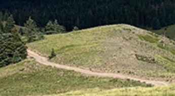
McMillan Peak: Driving the Steep 4x4 Road in the San Juan Mountains
Located in San Juan County, Colorado, McMillan Peak is a high mountain summit reaching an elevation of 3,587m (11,768ft) above sea level. Situated in the heart of the San Juan Mountains, the peak is known for its steep access road and the prominent telecommunications antenna located near the summit.
Sheep Ridge: Driving the rugged Forest Service Road in Colorado’s Pike National Forest
Sheep Ridge is a mountain peak situated in Park County, Colorado, reaching an elevation of 3,418m (11,213ft) above sea level. For off-road enthusiasts, the real draw is the rugged forest service road that climbs the southern ridge, offering a short but technical high-altitude driving experience in the heart of the Pike National Forest.
Driving the breathtaking 4x4 road to Lo 7 Hill in Colorado is not easy
Lo 7 Hill is a high mountain peak at an elevation of 2,603 m (8,540 ft) above sea level, located in Rio Blanco County, in the U.S. state of Colorado.
Driving the scenic MT-278 Road through the mountains of Montana
Montana State Highway 278 (MT-278) is a very scenic road, running through the mountains of Beaverhead County, in the U.S. state of Montana.
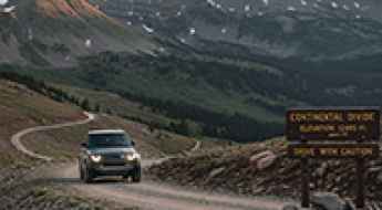
Safety Guide: Driving the Highest Passes in the US
America’s loftiest roads are gorgeous and unforgiving. Grades run long, shoulders stay narrow, and the air gets thin enough to bother engines and people. If you’re aiming for Colorado fourteeners or western summit byways, a little planning turns a white-knuckle climb into a day you’ll actually enjoy.
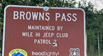
A Memorable Road Trip to Browns Pass in Park County
Browns Pass is a high mountain pass at an elevation of 3,475m (11,400ft) above sea level, located in Park County, in the U.S. state of Colorado.
How long is the unpaved road to Leidy Peak in Utah?
Leidy Peak is a mountain peak at an elevation of 3,361 meters above sea level, located in Uintah County, Utah. The track to the top is one of the highest roads in Utah, crossing the Uintah Range through a landscape of loose rocks and thick forest.
How to get by car to Walton Peak in Colorado?
Walton Peak is a high mountain peak at an elevation of 3,224 m (10,577 ft) above sea level, located in Routt County, in the U.S. state of Colorado.
How steep is the 4x4 road to Mount Leecher in Washington?
Mount Leecher is a mountain peak at an elevation of 1,531m (5,022ft) above sea level, located in Okanogan County, in the US state of Washington. The road to the top is a 7.9 km (4.9 miles) unpaved spur branching off the NF-4150 road in the North Cascades.