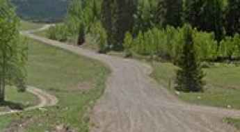
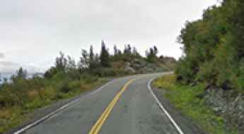
What are the most spectacular roads in the USA?
Located in North America, the USA is a true paradise for drivers, as it hosts more than 2,000 roads listed as the most spectacular in the world.
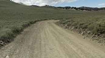
Featuring mountains, deserts, coasts, and snow, in the USA you’ll get your dream road. And you’ll never want to wake up. For instance, at the top of your list, you need to drive the Million Dollar Highway, the most beautiful road in America, and probably in the world. Built in the late 1880s, you'll be on the "outside" for a while with a hell of a view to your right (let the passenger enjoy the view; you'll want to watch the road). Another paved option must be the Iron Mountain Road, featuring 17 miles, 314 curves, 14 switchbacks, 3 pigtails, and 3 tunnels in the Black Hills of South Dakota. No list would be complete without the winding Tail of the Dragon: 318 curves in 11 miles. Spanning Tennessee and North Carolina, it is one of the most scenic drives in the USA. You also can’t skip driving Mount Evans Scenic Byway, the highest paved road in North America, climbing up to 4,310m (14,130ft) in Colorado. It is said to be the highest paved road in North America.
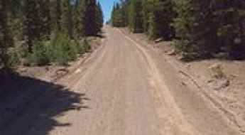
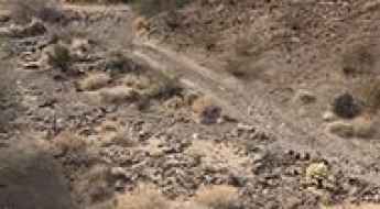
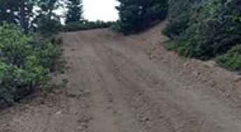
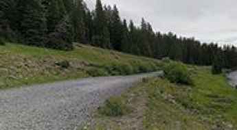
For those who prefer unpaved experiences, the country hosts some of the most defiant yet scenic roads in the world. You can’t miss Black Bear Pass, a high mountain adventure in the Colorado Rockies. Climbing up to 3,915m (12,844ft) above sea level, it's one of the highest roads in Colorado. You can also discover the beauty of Engineer Pass, a mountain pass at an elevation of 3,901m (12,800ft) above sea level in Colorado. It’s mostly a first-gear ride because the road is rough and rocky. The legendary Shafer Trail Road in Utah's Canyonlands National Park is an iconic drive located on the east-central edge of Utah. At times, the road is so narrow that only one car can pass. And Lippincott Mine Road in California is for experienced 4WD drivers using high-clearance vehicles only. You'll need a good map, as the routes are not marked and there are no signs. It’s one of the challenging backcountry roads in Death Valley National Park.
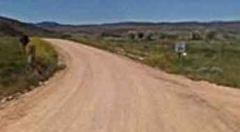
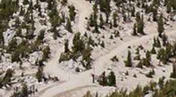
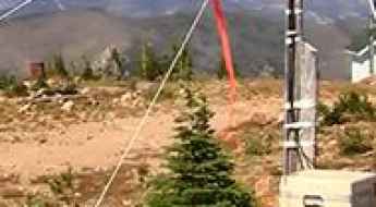
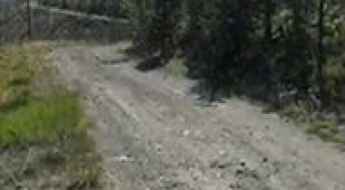
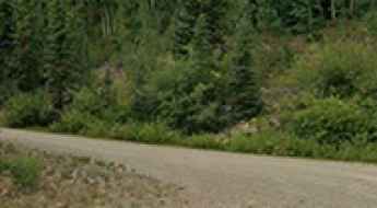
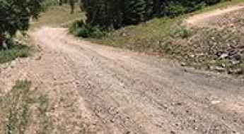
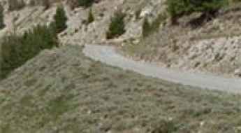
The scenic and remote 4x4 road to Jaybird Peak in Wyoming
Jaybird Peak is a high mountain pass reaching an elevation of 2,357m (7,732ft) above sea level, located in Albany County, in the southeastern part of Wyoming, USA. Situated within the Laramie Mountains, this rugged drive offers a true taste of the Wyoming backcountry through the Medicine Bow National Forest.
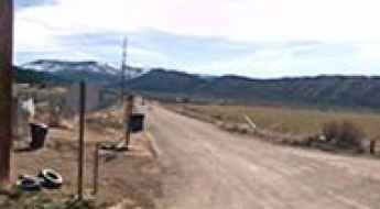
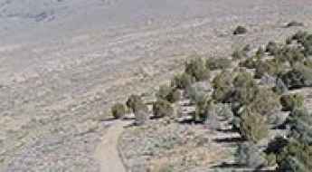
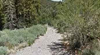
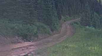
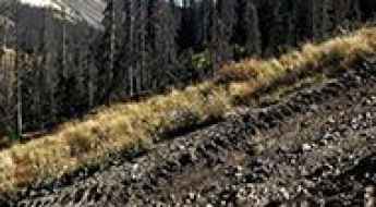
How to drive the unpaved road to Burnt Ridge in Utah?
Burnt Ridge is a high mountain ridge at an elevation of 3073m (10085ft) above sea level, located in Duchesne County, in the U.S. state of Utah.
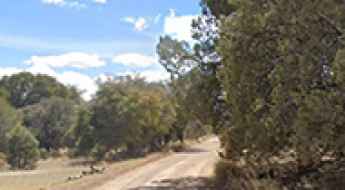
Parrott Peak
Parrott Peak is a high mountain peak at an elevation of 3.352m (10,997ft) above the sea level, located in La Plata County, in the U.S. state of Colorado.
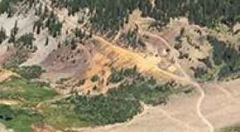
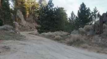
Driving the unpaved mining road to Mount Owen in Colorado
Mount Owen is a high mountain peak at an elevation of 3,542m (11,620ft) above sea level, located in Gunnison County, in the US state of Colorado.
East Peak: Driving the 20% ski service ramps in the Sierra Nevada
East Peak is a high-altitude mountain peak situated at an elevation of 2,893m (9,491ft) above sea level in El Dorado County, California. Located in the heart of the Sierra Nevada mountains, the road to the summit is a rugged service track used primarily for chairlift maintenance. This is one of the highest roads in California, representing a brutal mechanical challenge where the combination of loose stones and extreme verticality requires a high-clearance 4x4 and advanced off-road driving skills.
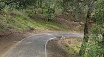
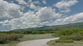
Searching for Murrieta’s treasure on Morgan Territory Road
Morgan Territory Road is a very scenic yet curvy drive located in Contra Costa County, in the US state of California. It’s said to be haunted.
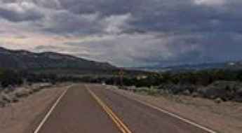
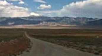
The Loneliest Highway to Robinson Summit in NV
Robinson Summit is a high mountain pass at an elevation of 2.317m (7,601ft) above the sea level, located in White Pine County, along the central eastern boundary of the U.S. state of Nevada.
Mount Siegel: Driving the technical Pine Nut Mountains track
Mount Siegel is a prominent high-altitude peak reaching 2,833m (9,294ft) above sea level in Douglas County, Nevada. Situated within the rugged Pine Nut Mountains, the road to the summit is a demanding backcountry track that tests the technical limits of any vehicle. This is not a standard mountain drive; it is a raw, unpaved transit where the combination of steep gradients, loose volcanic rock, and extreme isolation requires a high-clearance 4x4 and advanced off-road driving skills.
Forest Road 137
Forest Road 137 is a winding mountain road located in Beaver County, in west central Utah, United States, running entirely over 2.200m above the sea level.
Lewis Peak
Lewis Peak is a high mountain peak at an elevation of 2.837m (9,307ft) above the sea level, located on the border of Morgan and Summit counties, in northern Utah, United States.
Take the Scenic Route and Discover Naylor Lake in CO
Naylor Lake is a high mountain lake at an elevation of 3.476m (11,404ft) above the sea level, located in southwestern Clear Creek County, in the U.S. state of Colorado.

Technical Driving Guide: Navigating Georgia’s High-Risk Mountain Passages
Georgia’s topography offers a complex transition from coastal marshlands to the rugged metamorphic rock formations of the Blue Ridge Mountains. For expedition drivers, the northern quadrant of the "Peach State" presents significant technical challenges, including rapid elevation gains, unstable forest service roads (FSR), and extreme humidity affecting brake cooling and engine performance. This guide deconstructs the state's most demanding routes from an engineering and safety perspective.
Bonanza King
Bonanza King is a high mountain peak at an elevation of 2.120m (6,955ft) above the sea level, located in Trinity County, northern California, in USA.
How to drive the unpaved mountain road to Meadow Creek in Idaho
Meadow Creek is a high mountain peak at an elevation of 2.699m (8,854ft) above sea level, located in Valley County, in the U.S. state of Idaho.
Telephone Canyon Road
Telephone Canyon Road is a short mountain road located in Clark County, in the U.S. state of Nevada.
A drive to Canelo Pass in Arizona is an otherworldly experience
Canelo Pass is a high mountain pass at an elevation of 1.667m (5,469ft) above sea level, located in Santa Cruz County, in the US state of Arizona.
How to drive the unpaved road to the lookout at Breckenridge Mountain in California?
Breckenridge Mountain is a high mountain peak at an elevation of 2.291m (7,516ft) above sea level, located in Kern County, in the US state of California. It hosts the southernmost lookout on the Sequoia National Forest
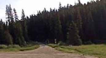
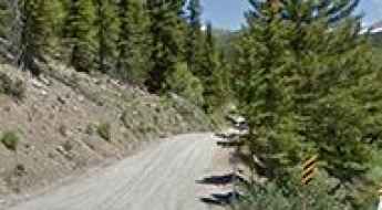
Gird Point: Driving the 23 hairpins of the Sapphire Mountains in Montana
Located in the heart of Ravalli County, Montana, Gird Point is a high mountain summit reaching an elevation of 2,295m (7,529ft) above sea level. Perched within the Bitterroot National Forest, the drive to the top is a rewarding but demanding backcountry expedition, offering one of the most comprehensive views of the Montana wilderness.
How to drive the unpaved road to Sand Point in Montana?
Sand Point is a high mountain pass at an elevation of 2.506m (8,221ft) above sea level located in Judith Basin County, in the US state of Montana.
Exploring the Backroads: Why the USA is the Ultimate Training Ground for Adventure Drivers
Traveling the vast road network of the United States is more than a vacation; it’s a foundational experience for any aspiring adventure driver. From the desert tracks of the Southwest to the coastal shelves of the Pacific, the USA offers a diverse range of terrains that test your vehicle, your navigation skills, and your adaptability. For students and young travelers, hitting the road is the best way to gain high-mileage experience before tackling the world’s most dangerous international routes.
The road to Etna Summit in CA has it all
Etna Summit is a high mountain pass at an elevation of 1.827m (5,994ft) above the sea level, located in Siskiyou County, in the northernmost part of the U.S. state of California.
Green Mountain
Green Mountain is a high mountain peak at an elevation of 2.204m (7,230ft) above the sea level, located in Idaho County, Idaho, in USA.
Forest Road 140 is a drive worth taking in UT
Forest Road 140 is a scenic drive through the high mountains of Garfield County, in south central Utah, United States. It’s one of the highest roads of Utah.
A lonely and remote road to Augustine Pass
Augustine Pass is a mountain pass at an elevation of 733m (2,404ft) above the sea level, located in Riverside County, in the southern portion of the U.S. state of California.
Is the road to Iron Mountain in California difficult to drive?
Climbing to the summit of Iron Mountain is a journey into the rugged, sun-baked heart of the Inyo Mountains. At 2,892m (9,488ft) above sea level, this peak offers one of the highest roads in California. It’s not a route for casual SUVs; it’s a punishing jeep trail that demands high clearance, low-range gears, and a driver who knows how to handle a vehicle when the ground starts sliding away toward the abyss.
How to drive the unpaved road to Groundhog Mountain in Colorado?
Groundhog Mountain is a high mountain pass at an elevation of 3.379m (11,085ft) above sea level, located in Dolores County, in the US state of Colorado.
O'Neal Peak
O'Neal Peak is a high mountain peak at an elevation of 2.930m (9,612ft) above the sea level, located in White Pine County, in northeastern Nevada in the western United States. It’s one of the highest roads of Nevada.
Gold Mountain
Gold Mountain is a high mountain peak at an elevation of 3.259m (10,692ft) above the sea level, located in Piute County, in south-central Utah, United States. It’s one of the highest roads of Utah.
The curvy road to Triunfo Pass in California
Triunfo Pass is a mountain pass at an elevation of 642m (2,106ft) above sea level, located in southeastern Ventura County, in Southern California, in the United States.
Elk Camp Summit
Elk Camp Summit is a high mountain peak at an elevation of 3.459m (11,348ft) above the sea level, located in Pitkin County, Colorado, United States.
Forest Road 564
Forest Road 564 is a very scenic high mountain road located in the San Juan Mountains, in Montezuma County, the southwesternmost county in the U.S. state of Colorado.

Motorcycle road safety guide in the USA
If the late summer sunshine is calling your name, you aren’t alone! Many are taking advantage of the remaining warm weather to hit the road, but unfortunately summer is also the time when collisions are more common, especially those involving two-wheel vehicles.

Charleston Events: Navigating the Hub During Major Festivals
Charleston, South Carolina, is a city where historic architecture meets high-density event logistics. Known for its narrow, cobblestone streets and coastal geography, the city faces significant traffic challenges during its major annual festivals. For those driving into the Lowcountry, understanding the congestion patterns and the structural limits of the local road network is essential to avoid gridlock during these massive public gatherings.

5 Things You Need to Know While Buying Tyres in the USA
Tyres are the only point of contact between your vehicle and the road. On the diverse and often extreme terrains of the USA—from the sun-baked asphalt of Arizona to the icy passes of the Rockies—selecting the correct rubber is a critical safety decision. Understanding tread dynamics and carcass construction is essential before visiting a service center to ensure your vehicle is equipped for the challenges ahead.
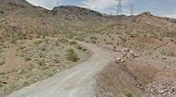
A narrow shelf road to Gold Strike Pass in NV
Gold Strike Pass is a mountain pass at an elevation of 734m (2,408ft) above the sea level, located in Clark County, in the U.S. state of Nevada.
How to drive the rough road to Big Creek Baldy Mountain in Montana?
Big Creek Baldy is a high mountain peak at an elevation of 1,764m (5,787ft) above sea level, located in Lincoln County, Montana. Tucked deep within the Kootenai National Forest, the road to the summit is a relentless forest track that serves one of the most isolated fire lookouts in the state. Driving to this peak isn't a casual trip; it’s a 4x4 challenge through the Purcell Range where the air starts to thin and the track becomes a mix of loose dirt and jagged Montana rock. It is a route for those who don't mind the sound of gravel hitting the chassis and the constant work of managing the steering on a steep, unmaintained incline.
Pike Ridge
Pike Ridge is a high mountain pass at an elevation of 2.723m (8,933ft) above the sea level, located in Garfield County, in the U.S. state of Colorado.
Driving the defiant USFS 503 Road
USFS 503 is the name of a defiant short mountain road located in Mineral County, in the U.S. state of Colorado. It’s one of the highest roads of Colorado.
The road to Bent Peak in CO is not for the faint of heart
Bent Peak is a high mountain peak located in Hinsdale County, in the U.S. state of Colorado. A minor gravel road south of the peak climbs up to 3.953m (12,969ft) above the sea level. It’s one of the highest roads of Colorado.
How to drive the 15 hairpins of Oreana Peak Road in Nevada?
Oreana Peak is a high mountain peak at an elevation of 2,833m (9,294ft) above sea level, located in Douglas County, Nevada. Situated in the Pine Nut Mountains, near the California border, the access to the summit via a technical unpaved track is a demanding high-altitude drive requiring specialized 4x4 equipment and mechanical self-sufficiency.
The Ultimate Road Trip on the Edgerton Highway in AK
Edgerton Highway is a very scenic paved road located in Alaska’s Big Delta near Chitina in the Copper River Valley, in the USA.
How to drive the 8 hairpins of Columbus Basin Road in Colorado?
Lewis Mountain is a high mountain peak located in La Plata County, Colorado. While the summit sits higher, a technical gravel road situated north of the peak climbs to an elevation of 3,573m (11,722ft) above sea level. This route, known as Columbus Basin Road, is a demanding high-altitude track within the San Juan National Forest that requires specialized 4x4 equipment.
Driving Texas: Why Farm-to-Market Roads are Deadlier than Interstates
Texas has the second-largest population in the United States, but the real danger isn't found in the congested cities. While Interstates handle the most volume, Texas’s vast network of Farm-to-Market (FM) and state highways recorded the highest rates of fatal crashes. Understanding the unique infrastructure of the Lone Star State is key to surviving its rural corridors.
A wild road to Pilot Peak in Plumas County (CA)
Pilot Peak is a high mountain peak at an elevation of 2.273m (7,457ft) above the sea level, located in Plumas County, in the US state of California.
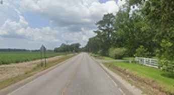
Driving the Bayou Teche Scenic Byway in Louisiana
The Bayou Teche Scenic Byway takes you through some of the most attractive landscapes and scenery of Louisiana.
Robbs Peak
Robbs Peak is a high mountain peak at an elevation of 2.039m (6,689ft) above the sea level, located in El Dorado County, California, in USA.
Lakeshore Drive
Forest Road 121 (Lakeshore Drive) is a very scenic journey in the heart of Mesa County, Colorado, United States.
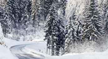
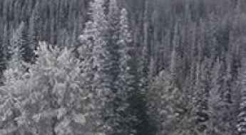
Self-Salting Asphalt: The Future of Winter Road Safety
Winter driving is often a battle against invisible hazards like black ice and sudden slush accumulation. Traditionally, keeping roads open during a freeze requires a massive fleet of salt trucks and constant monitoring. However, a new shift in civil engineering is emerging: self-salting roads. By embedding de-icing agents directly into the road surface, researchers are looking for a way to make the asphalt itself react to the cold, potentially eliminating the "skating rink" effect that leads to thousands of winter accidents every year.