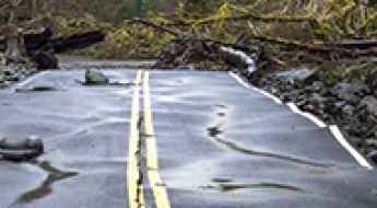
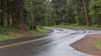
What are the most spectacular roads in the USA?
Located in North America, the USA is a true paradise for drivers, as it hosts more than 2,000 roads listed as the most spectacular in the world.
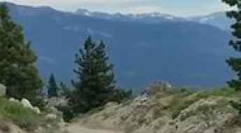
Featuring mountains, deserts, coasts, and snow, in the USA you’ll get your dream road. And you’ll never want to wake up. For instance, at the top of your list, you need to drive the Million Dollar Highway, the most beautiful road in America, and probably in the world. Built in the late 1880s, you'll be on the "outside" for a while with a hell of a view to your right (let the passenger enjoy the view; you'll want to watch the road). Another paved option must be the Iron Mountain Road, featuring 17 miles, 314 curves, 14 switchbacks, 3 pigtails, and 3 tunnels in the Black Hills of South Dakota. No list would be complete without the winding Tail of the Dragon: 318 curves in 11 miles. Spanning Tennessee and North Carolina, it is one of the most scenic drives in the USA. You also can’t skip driving Mount Evans Scenic Byway, the highest paved road in North America, climbing up to 4,310m (14,130ft) in Colorado. It is said to be the highest paved road in North America.
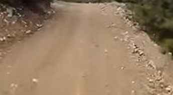
For those who prefer unpaved experiences, the country hosts some of the most defiant yet scenic roads in the world. You can’t miss Black Bear Pass, a high mountain adventure in the Colorado Rockies. Climbing up to 3,915m (12,844ft) above sea level, it's one of the highest roads in Colorado. You can also discover the beauty of Engineer Pass, a mountain pass at an elevation of 3,901m (12,800ft) above sea level in Colorado. It’s mostly a first-gear ride because the road is rough and rocky. The legendary Shafer Trail Road in Utah's Canyonlands National Park is an iconic drive located on the east-central edge of Utah. At times, the road is so narrow that only one car can pass. And Lippincott Mine Road in California is for experienced 4WD drivers using high-clearance vehicles only. You'll need a good map, as the routes are not marked and there are no signs. It’s one of the challenging backcountry roads in Death Valley National Park.
Haystack Mountain
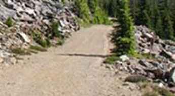
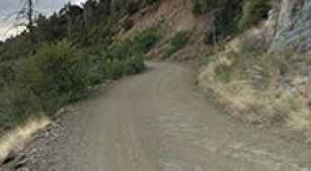
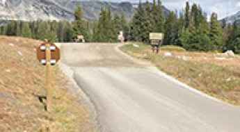
Haystack Mountain is a high mountain peak at an elevation of 2.613m (8,572ft) above the sea level located in the Salmon River Mountains, in Idaho, USA.
Uncle Bud's Hut
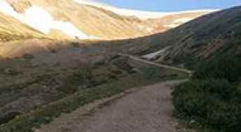
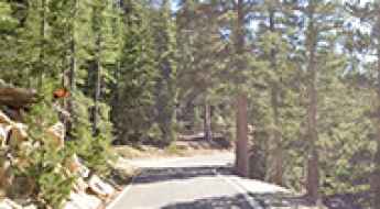
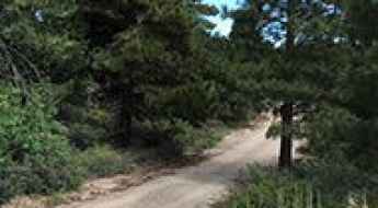
Uncle Bud's Hut is a high mountain refuge at an elevation of 3.474m (11,397ft), located in Lake County, central Colorado, United States.

10 Weird Motorcycle Laws In The US That You Didn't Know About
Motorcycle legislation in the United States is designed to standardize safety across diverse jurisdictions. However, embedded within state vehicle codes are obscure regulations that range from the archaic to the highly specific. While many of these statutes are rarely enforced in a modern context, they offer a technical look at how authorities have attempted to regulate noise, visibility, and livestock interactions on the American road network over the last century.

Driving the steep and rocky roads to Mineral Hill in Idaho
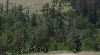
Mineral Hill is a high mountain peak at an elevation of 2,590m (8,497ft) above sea level, located in Idaho County, within the north-central region of the U.S. state of Idaho. As the third highest summit in the Gospel Hump Wilderness, it offers a window into the state's rugged mining past and some of the most technical off-road driving in the area.
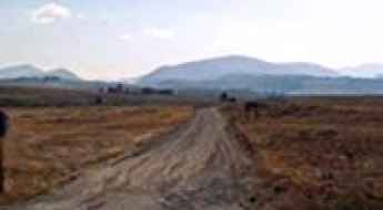
Road trip guide: Conquering Stemple Pass in MT
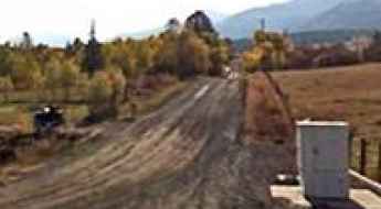
Stemple Pass is a high mountain pass at an elevation of 1.945m (6,381ft) above the sea level, located in Lewis and Clark County, in the U.S. state of Montana.
Muddy Mountain
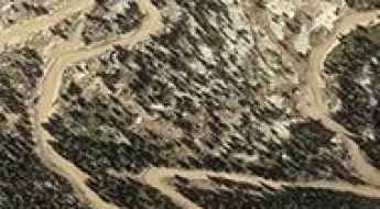
Muddy Mountain is a high mountain pass at an elevation of 2.884m (9,461ft) above the sea level located in Albany County, in Wyoming, USA.
Stein Mountain
Stein Mountain is a high mountain peak at an elevation of 2.608m (8,555ft) above the sea level, located in Lemhi County, in the U.S. state of Idaho.

Car Modifications That Make Driving More Dangerous in the USA
Vehicle modification in the United States is often driven by aesthetic preference rather than engineering necessity. However, altering a vehicle’s factory specifications—specifically its suspension geometry, window transparency, and wheel diameter—can severely compromise its performance on technical roads. When navigating high-consequence environments, the margin for error is thin; a modification that prioritizes "status" over "dynamics" can transform a manageable transit into a catastrophic mechanical failure.
Hilman Lake
Hilman Lake is a high mountain lake at an elevation of 3.353m (11,000ft) above the sea level, located in Conejos County, in the U.S. state of Colorado.
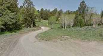
How to drive the unpaved road to Olson Mountain in Montana
Olson Mountain is a high mountain peak at an elevation of 2.578m (8,458ft) above sea level, located in Deer Lodge County, in the U.S. state of Montana.
June Lake Loop
June Lake Loop (California State Route 158) is a very scenic drive in Mono County, in the east central portion of the U.S. state of California passing four alpine lakes, towering mountains and incredible alpine scenery.
The 8 Most Challenging Roads of Olympic National Park
Located on Washington's Olympic Peninsula in the Pacific Northwest, Olympic National Park is a maritime-alpine wilderness that presents significant challenges for even experienced drivers. Tucked into the northwestern corner of Washington State, the park—often described as "three parks in one"—encompasses glacier-capped peaks, temperate rainforests, and a rugged Pacific coastline across 922,650 acres. While U.S. Highway 101 circumnavigates the peninsula, the interior routes are characterized by extreme narrowness, blind curves, and surfaces vulnerable to severe Pacific storms.
Gold Mountain
Gold Mountain is a high mountain peak at an elevation of 2.487m (8,159ft) above the sea level, located in San Bernardino County, in Southern California, United States. The average gradient is 12.37%.
The unpaved road to Palomar Mountain High Point Lookout
Palomar Mountain is a high mountain peak at an elevation of 1.874m (6,148ft) above the sea level, located in northern San Diego County, California, United States.

Why Millennials are Navigating Roads Differently
The traditional "rite of passage" of obtaining a driver’s license is undergoing a fundamental shift in the United States. For previous generations, operating a vehicle was synonymous with independence; however, for Millennials, the decision to engage with the road is increasingly viewed through the lens of risk assessment and logistical cost. Beyond the financial barriers, a heightened awareness of road fatalities and the inherent dangers of high-exposure corridors has led many to reconsider the necessity of personal vehicle operation.
Pajarito Mountain
Pajarito Mountain is a high mountain peak at an elevation of 3.158m (10,360ft) above the sea level, located in Los Alamos County, in north central New Mexico, USA. It’s one of the highest mountain roads of New Mexico.
Wickiup Pass
Wickiup Pass is a high mountain pass at an elevation of 2.821m (9,255ft) above the sea level, located in Garfield County, in the U.S. state of Utah.
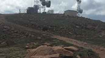
How to drive the unpaved road to the lookout at Mount Tom in California
Mount Tom is a fire observation point at an elevation of 2,751m (9,026ft) above sea level, located in Fresno County, in the US state of California.
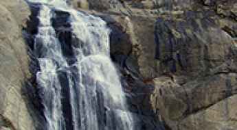
Taking the scenic route and driving to Stevenson's Creek Falls in California
Stevenson's Creek Falls, nestled in Fresno County, in the US state of California, stands as one of the state's grandest waterfalls with an impressive drop of approximately 1,280 feet.
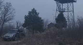
Driving to Sun Notch: The highest viewpoint over the Phantom Ship
Sun Notch is a high mountain pass at an elevation of 2,176m (7,139ft) above sea level, located on the southern rim of the Crater Lake caldera in Oregon. It is one of the highest points accessible by vehicle on the East Rim Drive, providing a breathtaking perspective over the deepest lake in the United States.
How to get by car to the lookout at Jureano Mountain in Idaho?
Jureano Mountain is a high mountain peak at an elevation of 2.546m (8,353 ft) above sea level located in Lemhi County, in the US state of Idaho.
Ford Ridge
Ford Ridge is a high mountain peak at an elevation of 2.858m (9,376ft) above the sea level, located in Carbon County, in the U.S. state of Utah.
How to drive the paved road to Quartz Mountain Pass in Oregon?
Quartz Mountain Pass is a high mountain pass at an elevation of 1.679m (5,508ft) above sea level, located in Lake County, in the U.S. state of Oregon.
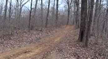
Mill Creek Trail
Located in southern Madison County, Arkansas, in United States, Mill Creek Trail is a challenging trail, leading the rider through remote forest areas of the Ozark National Forest.
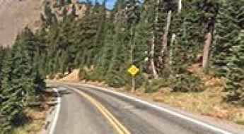
Things to Know Before Driving the Sol Duc Road in WA
Sol Duc Road is a very scenic drive with stunning views located in Clallam County, in the U.S. state of Washington, leading to Sol Duc Falls.
Jackson Peak
Jackson Peak is a high mountain pass at an elevation of 2.477m (8,126ft) above the sea level, located on the northern fringes of the vast Boise Mountain Range, in the western United States, in Boise County, Idaho.
Mount Pluto
Mount Pluto is an extinct volcano at an elevation of 2.626m (8,615ft) above the sea level, located in Placer County, in the U.S. state of California.
Silver Peak
Silver Peak is a high mountain peak at an elevation of 3.311m (10,862ft) above the sea level, located in Inyo County, California, United States. It’s one of the highest roads of California.
Road trip guide: Conquering Peerless Mountain in CO
Peerless Mountain is a high mountain peak at an elevation of 4.022m (13,195ft) above the sea level, located on the boundary between Park and Lake counties in the U.S. state of Colorado. It’s one of the highest roads of Colorado.
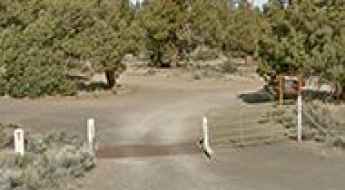
How to drive the unpaved road to Cline Butte in Oregon
Cline Butte is a mountain peak at an elevation of 1.250m (4,101ft) above sea level, located in Deschutes County, in the US state of Oregon.

Mine Camp Peak
Mine Camp Peak is a high mountain peak at an elevation of 3.115m (10.222ft) above the sea level, located in Millard County, in the U.S. state of Utah.
Forest Road 053
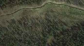
Forest Road 053 is a high mountain road located in Custer County in the center of the U.S. state of Idaho. It’s one of the highest mountain roads of Idaho.
A narrow curvy road to Betty Jumbo Mine
Betty Jumbo Mine is an abandoned tungsten mine at an elevation of 2.219m (7,280ft) above the sea level, located in Inyo County, in the US state of California.
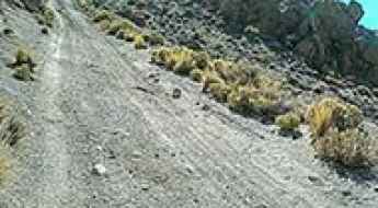
How to drive the 4x4 road to Bald Mountain in Wyoming?
Bald Mountain is a high-altitude peak at an elevation of 3,246m (10,649ft) above sea level, located in Park County, Wyoming. Technically, the road to the summit is a relic of the region’s industrial past, starting from the historic Kirwin ghost town. This route is classified as one of the highest mountain roads in Wyoming and requires a specific technical approach due to its unmaintained mining-track geometry.
How to drive the unpaved road to Indian Head in Utah?
Indian Head is a high mountain peak at an elevation of 3.039m (9,970ft) above the sea level, located in Utah County, in the U.S. state of Utah.
How to drive the 4x4 road to Almagre Mountain South in Colorado?
Almagre Mountain South is a high-altitude peak at an elevation of 3,771m (12,372ft) above sea level, located in Teller County, Colorado. Logistically, the summit is reached via the Forest Service Road 379, also known as Mt. Baldy. Technically, this is one of the highest vehicular routes in the state, requiring a high-clearance 4x4 vehicle to navigate a surface that remains largely unmaintained and exposed to severe alpine erosion.
Saddle Mountain
Saddle Mountain is a high mountain peak at an elevation of 2.538m (8,326ft) above the sea level, located in Catron County, New Mexico, United States.
How to drive the 14 hairpins of Eddy Peak Road in Montana?
Eddy Peak is a high mountain peak at an elevation of 2,093m (6,866ft) above sea level, located in Sanders County, Montana. Situated in the northern part of the Lolo National Forest, the drive to the summit via Eddy Peak Road is a demanding high-altitude transit that requires specialized 4x4 equipment and technical driving skills.
Driving the idyllic Ebbetts Pass National Scenic Byway across California's Sierra Nevada
Ebbetts Pass National Scenic Byway is the name of an idyllic drive in the heart of the Sierra Nevada, in the US state of California.
Murray Saddle
Murray Saddle is a high mountain pass at an elevation of 2.150m (7,054ft) above the sea level, located in Wallowa County, Oregon, United States.
Road trip guide: Conquering the Boehmer Reservoir
Boehmer Reservoir is a high mountain reservoir at an elevation of 3.610m (11,843ft) above the sea level, located in El Paso County, in the U.S. state of Colorado.

Off-Road Protection in the USA: Tonneau Covers, Skid Plates, and Lift Kits
Off-road transit in the United States requires specific vehicle reinforcements to manage mechanical stress and terrain impact. Standard truck configurations often lack the necessary shielding for high-clearance trails, making aftermarket protection mandatory for vehicle recovery and long-haul durability.
Barfoot Peak
Barfoot Peak is a high mountain peak at an elevation of 2.509m (8,231ft) above the sea level, located in Cochise County, in the southeastern part of the U.S. state of Arizona.
Signal Peak
Signal Peak is a high mountain peak at an elevation of 2.380m (7,808ft) above the sea level, located in Gila County, Arizona, United States.
How to drive the unpaved road to Cougar Ridge in Nevada
Cougar Ridge is a high mountain ridge at an elevation of 2.792m (9,160ft) above sea level, located in Clark County, in the U.S. state of Nevada.
Rose Peak
Rose Peak is a high mountain peak at an elevation of 2.653m (8,705ft) above the sea level, located in Greenlee County, in the southeastern part of the U.S. state of Arizona.
How to get by car to Libby Lake in Wyoming?
Lewis Lake is a high mountain, crystal-clear snow-melt lake at an elevation of 3.289m (10,790ft) above sea level, located in Albany County, in the US state of Wyoming. It's one of the highest roads in Wyoming.
Pigeon Spring Road
Pigeon Spring Road is a pretty steep gravel road located in Gila County, in the central part of the U.S. state of Arizona.