What are the most spectacular roads in the USA?
Located in North America, the USA is a true paradise for drivers, as it hosts more than 2,000 roads listed as the most spectacular in the world.
Featuring mountains, deserts, coasts, and snow, in the USA you’ll get your dream road. And you’ll never want to wake up. For instance, at the top of your list, you need to drive the Million Dollar Highway, the most beautiful road in America, and probably in the world. Built in the late 1880s, you'll be on the "outside" for a while with a hell of a view to your right (let the passenger enjoy the view; you'll want to watch the road). Another paved option must be the Iron Mountain Road, featuring 17 miles, 314 curves, 14 switchbacks, 3 pigtails, and 3 tunnels in the Black Hills of South Dakota. No list would be complete without the winding Tail of the Dragon: 318 curves in 11 miles. Spanning Tennessee and North Carolina, it is one of the most scenic drives in the USA. You also can’t skip driving Mount Evans Scenic Byway, the highest paved road in North America, climbing up to 4,310m (14,130ft) in Colorado. It is said to be the highest paved road in North America.
For those who prefer unpaved experiences, the country hosts some of the most defiant yet scenic roads in the world. You can’t miss Black Bear Pass, a high mountain adventure in the Colorado Rockies. Climbing up to 3,915m (12,844ft) above sea level, it's one of the highest roads in Colorado. You can also discover the beauty of Engineer Pass, a mountain pass at an elevation of 3,901m (12,800ft) above sea level in Colorado. It’s mostly a first-gear ride because the road is rough and rocky. The legendary Shafer Trail Road in Utah's Canyonlands National Park is an iconic drive located on the east-central edge of Utah. At times, the road is so narrow that only one car can pass. And Lippincott Mine Road in California is for experienced 4WD drivers using high-clearance vehicles only. You'll need a good map, as the routes are not marked and there are no signs. It’s one of the challenging backcountry roads in Death Valley National Park.
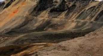
John Kerr Peak
John Kerr Peak is a high mountain peak at an elevation of 2.705m (8,874 ft) above the sea level, located in Catron County, in the U.S. state of New Mexico.
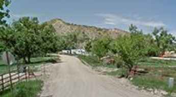
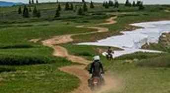
An Unforgettable Drive to Snowstorm Peak in CO
Snowstorm Peak is a high mountain peak at an elevation of 3.669m (12,037ft) above the sea level, located in La Plata County, in the U.S. state of Colorado. 4WD with good clearance is required.
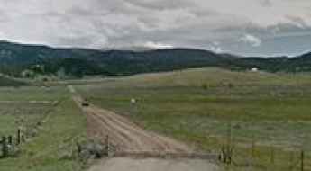
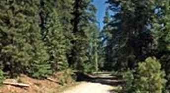
Tamarack Ridge
Tamarack Ridge is a high mountain pass at an elevation of 2.312m (7,585ft) above the sea level, located in Fresno County, California, in USA.
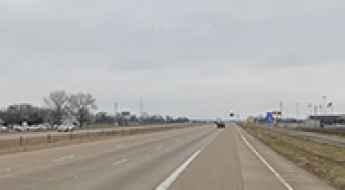
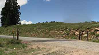
Bull Park Trail: rough and bumpy
Bull Park Trail (Forest Service Road 376A) is a very rough and bumpy road located in Teller County, in the U.S. state of Colorado.
Darley Mountain
Darley Mountain is a high mountain peak at an elevation of 3.997m (13,113ft) above sea level, located in Ouray County, in the U.S. state of Colorado. It’s one of the highest roads in Colorado. Motorized vehicles are currently prohibited on the trailhead.

Ortega Ridge Road is haunted by 3 ghostly nuns
Located on the Central Coast of California, in USA, Ortega Ridge Road is the name of a road supposedly haunted by the spirits of 3 nuns.
Comanche Peak
Comanche Peak is a high mountain peak at an elevation of 3.275m (10,744ft) above the sea level, located in Colfax County, in the U.S. state of New Mexico. It’s one of the highest mountain roads of New Mexico.
Garcia Peak
Garcia Peak is a high mountain peak at an elevation of 3.333m (10,935 ft) above the sea level, located in Colfax County, in the U.S. state of New Mexico. It’s one of the highest mountain roads of New Mexico.
What are the most dangerous roads in Texas?
Texas represents a unique intersection of extreme speed limits, aging infrastructure, and massive industrial logistics. The state consistently reports a fatality rate per 100 million vehicle miles that exceeds the national average. From the high-speed corridors of the "Texas Triangle" to the oil-saturated routes of the Eagle Ford Shale, these roads are defined by structural deficits, high-velocity impacts, and the relentless wear of heavy commercial tonnage. Understanding the specific risks of these corridors is essential for navigating the second-largest state in the U.S.
Big Sam
Big Sam is a high mountain peak at an elevation of 3.298m (10,820ft) above the sea level, located in Tuolumne County, California, United States. It’s one of the highest roads of California.
The road to Blair Mountain in Colorado is a chillout in high mountains
Blair Mountain is a high mountain pass at an elevation of 3,496m (11,469ft) above sea level, located in Garfield County, in the U.S. state of Colorado.
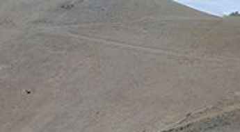
How to drive the unpaved road to Bald Mountain in Douglas County?
Bald Mountain is a high mountain peak at an elevation of 2.814m (9,232ft) above sea level, located in southern Douglas County, in the U.S. state of Nevada.
Government Harvey Pass
Government Harvey Pass is a high mountain pass at an elevation of 2.170m (7,119ft) above the sea level, located in Lake County, in the south-central region of the U.S. state of Oregon.
Kingston Summit
Kingston Summit is a high mountain pass at an elevation of 2.647m (8,684ft) above the sea level, located in Lander County, Nevada, in USA.
Baker Creek Meadow
Baker Creek Meadow is a high mountain meadow at an elevation of 3.185m (10,449ft) above the sea level, located in Inyo County, California. It’s one of the highest mountain roads of California.
Monument Peak
Monument Peak is a high mountain pass at an elevation of 3.188m (10,459ft) above the sea level located in Carbon County, in Utah, USA.
Pine Nut Road
Pine Nut Road is a bumpy dirt road located on the Desert National Wildlife Refuge in Clark County, in the U.S. state of Nevada.
Mount Yeckel
Mount Yeckel is a high mountain peak at an elevation of 3.588m (11,771ft) above the sea level, located in Pitkin County, in the U.S. state of Colorado.
Upper Bridge Canyon Road
Upper Bridge Canyon Road is a short gravel road located in the the Lake Mead National Recreation Area, in Nevada, USA. It’s a 4wd track.
Craig Peak
Craig Peak is a high mountain peak at an elevation of 3.234m (10,610ft) above the sea level, located in Eagle County, in the U.S. state of Colorado.
How To Have The Ultimate Road Trip To Lagunita Saddle
Lagunita Saddle is a high mountain pass at an elevation of 3.218m (10,557ft) above the sea level, located in Taos County, in the U.S. state of New Mexico. It’s one of the highest mountain roads of New Mexico. It’s one of the highest roads of New Mexico.
Cow Mountain
Cow Mountain is a high mountain peak at an elevation of 2.865m (9,399ft) above the sea level, located in Lincoln County, in the U.S. state of New Mexico.
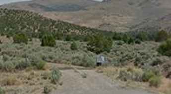
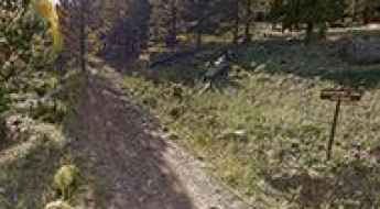
How to drive to the lookout at Horse Mountain in Idaho
Horse Mountain is a high mountain peak at an elevation of 2.103m (6,899ft) above sea level located in Adams County, in the US state of Idaho.
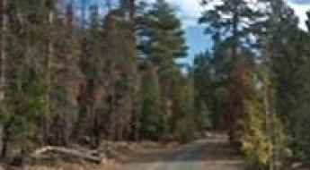
Forest Road 225
Forest Road 225 is a high mountain road located in central Duchesne County, Utah, United States. It’sone of the highest roads of Utah.
Monte Encino
Monte Encino is a high mountain peak at an elevation of 3.039m (9,971ft) above the sea level, located in Rio Arriba County, in the U.S. state of New Mexico.
Driving the iconic road to Lands End Observatory in Colorado
Lands End Observatory is a high mountain observatory at an elevation of 3.033m (9,950ft) above the sea level, located in Mesa County, in the U.S. state of Colorado.

Milk Cow Pass
Milk Cow Pass is a high mountain pass at an elevation of 3.354m (11,004ft) above the sea level located in the Saguache County, in Colorado, USA.
Aker Lake
Aker Lake is a mountain lake at an elevation of 2.703m (8,868) above the sea level, located in the White Mountains, in Greenlee County, in the southeastern part of the U.S. state of Arizona. It’s one of the highest roads of Arizona.
Union Mountain
Union Mountain is a high mountain peak at an elevation of 3.755m (12,319ft) above the sea level, located in Summit County, in the U.S. state of Colorado. It’s one of the highest mountain roads of Colorado.

27 Lessons from 27 Films - Car Breakdowns
Breaking down is never good, especially if you're cruising across the states; with a staggering 89% of breakdowns below occurring on American roads! But is real life really like the movies?
Miller Lake
Miller Lake is a high mountain lake at an elevation of 3.247m (10,652ft) above the sea level, located in Wayne County, in south-central Utah, in USA. It’s one of the highest roads of Utah.
How difficult is the 4WD road to Emma Burr Mountain in Colorado?
Emma Burr Mountain is a high mountain summit reaching an elevation of 3,692m (12,112ft) above sea level on the border of San Isabel and Gunnison National Forests in Colorado. Located in the rugged Sawatch Range, the road to the top is one of the highest in the state. This is not a route for casual drivers; the Chaffee County Road 344 is a demanding jeep trail where the combination of thin air, steep gradients, and loose scree turns a 12-mile climb into a serious off-road expedition.

Forest Road 086
Forest Road 086 is a high mountain road located in Lemhi County in the U.S. state of Idaho. It’s one of the highest mountain roads of Idaho.
Palmetto Mountain
Palmetto Mountain is a high mountain pass at an elevation of 2.724m (8,937ft) above the sea level, located in Esmeralda County, in the U.S. state of Nevada.
Bull Run Pass
Bull Run Pass is a high mountain pass at an elevation of 2.313m (7,588ft) above the sea level, located in Tulare County, in the U.S. state of California.
Summit Drive
Summit Drive is a short mountain road located in Mono County in the east central portion of the U.S. state of California, climbing up to 3.000m (9,842ft) above the sea level. It’s one of the highest mountain roads of California.
State Highway 103 is a chillout in the high mountains of Colorado
Colorado State Highway 103 is a high mountain road located in Clear Creek County, in the U.S. state of Colorado. Join us as we explore the story of this scenic road.
Dixie Butte
Dixie Butte is a high mountain peak at an elevation of 2.317m (7,601ft) above the sea level, located in Grant County, in Eastern Oregon, in USA.
Don’t glance down at your phone on the County Road 867
County Road 867 is a high mountain road located in Gunnison County, in the U.S. state of Colorado.
Cameron Mountain Pass: Driving the Ute Trail in Colorado
Cameron Mountain Pass is a high-altitude mountain gap reaching an elevation of 3,030m (9,940ft) above sea level in Chaffee County, Colorado. Situated within the rugged landscape of the central Rockies, the pass is accessed via County Road 175, also known as the Ute Trail. This is a historic unpaved transit that serves as a technical link through the high country, where the combination of loose gravel, rocky outcrops, and volatile weather defines the driving experience for any 4WD expedition.
Requa Road is a steep coastal drive in California
Requa Road (Patrick J Murphy Memorial Road) is a steep coastal drive located in Del Norte County, in the US state of California. The road is a little bumpy but definitely worth the trip. It’s one of the most scenic drives in the Redwood National and State Parks.
How hazardous is NM-15 Road in winters?
New Mexico State Road 15 (NM-15) is a very scenic drive located in the US state of New Mexico. Snowstorms can temporarily stop travel on the road.
How to drive the unpaved road to Little Molas Lake in Colorado?
Little Molas Lake is a high mountain small body of water at an elevation of 3.333m (10,935ft) above sea level, located in San Juan County, in the US state of Colorado.
Round Mountain
Round Mountain is a high mountain peak at an elevation of 3.216m (10,551ft) above the sea level, located in Inyo County, in the U.S. state of California. It’s one of the highest mountain roads of California.
Road trip guide: Conquering the Music Pass in Colorado
Music Pass is a high mountain pass at an elevation of 3.260m (10,695ft) above the sea level located in Custer County in the U.S. state of Colorado.
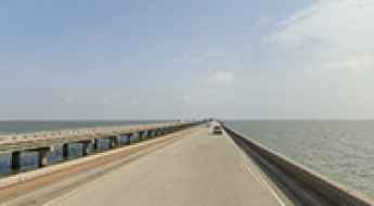
The Most Iconic Coastal Roads in Louisiana
Louisiana’s road network is a marvel of hydraulic engineering, traversing some of the most complex wetland ecosystems in North America. Beyond the urban grid of New Orleans, the state’s infrastructure relies on extensive causeways and elevated byways designed to withstand tropical storm surges and the shifting silt of the Mississippi Delta. Navigating these roads offers a study in maritime-terrestrial transition, requiring drivers to manage high-velocity crosswinds and the unique mechanical stress of high-humidity environments.
Station Peak
Station Peak is a high mountain peak at an elevation of 2.967m (9,734ft) above the sea level, located in Mono County, in the east central portion of the U.S. state of California. It’s one of the highest mountain roads of California.

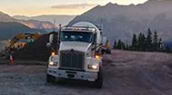
Managing Expedition Fleets in New Mexico’s High-Desert
Operating a vehicle fleet in New Mexico presents a unique set of logistical challenges. Known for its "High-Desert" topography, the state demands high standards of mechanical maintenance and structural resilience. From the heat-saturated basins near Las Cruces to the alpine elevations of the Sangre de Cristo Mountains, vehicles must navigate extreme temperature deltas and long-range isolation. For those managing rentals or expeditionary fleets, success depends on meticulous maintenance protocols and a deep understanding of the region’s technical terrain.