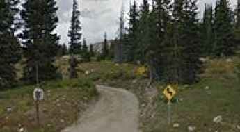
What are the most spectacular roads in the USA?
Located in North America, the USA is a true paradise for drivers, as it hosts more than 2,000 roads listed as the most spectacular in the world.
Featuring mountains, deserts, coasts, and snow, in the USA you’ll get your dream road. And you’ll never want to wake up. For instance, at the top of your list, you need to drive the Million Dollar Highway, the most beautiful road in America, and probably in the world. Built in the late 1880s, you'll be on the "outside" for a while with a hell of a view to your right (let the passenger enjoy the view; you'll want to watch the road). Another paved option must be the Iron Mountain Road, featuring 17 miles, 314 curves, 14 switchbacks, 3 pigtails, and 3 tunnels in the Black Hills of South Dakota. No list would be complete without the winding Tail of the Dragon: 318 curves in 11 miles. Spanning Tennessee and North Carolina, it is one of the most scenic drives in the USA. You also can’t skip driving Mount Evans Scenic Byway, the highest paved road in North America, climbing up to 4,310m (14,130ft) in Colorado. It is said to be the highest paved road in North America.
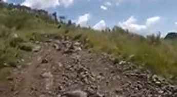
For those who prefer unpaved experiences, the country hosts some of the most defiant yet scenic roads in the world. You can’t miss Black Bear Pass, a high mountain adventure in the Colorado Rockies. Climbing up to 3,915m (12,844ft) above sea level, it's one of the highest roads in Colorado. You can also discover the beauty of Engineer Pass, a mountain pass at an elevation of 3,901m (12,800ft) above sea level in Colorado. It’s mostly a first-gear ride because the road is rough and rocky. The legendary Shafer Trail Road in Utah's Canyonlands National Park is an iconic drive located on the east-central edge of Utah. At times, the road is so narrow that only one car can pass. And Lippincott Mine Road in California is for experienced 4WD drivers using high-clearance vehicles only. You'll need a good map, as the routes are not marked and there are no signs. It’s one of the challenging backcountry roads in Death Valley National Park.
Saddleback Mountain
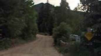
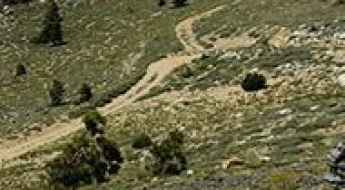
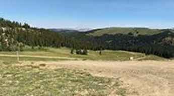
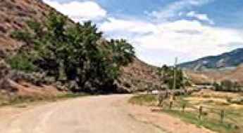
Saddleback Mountain is a high mountain peak at an elevation of 2.843m (9,327ft) above the sea level, located in Clear Creek County, in the U.S. state of Colorado.
Hanson Peak
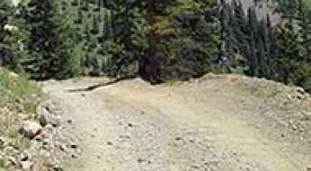
Hanson Peak is a high mountain peak at an elevation of 3.890m (12,762ft) above the sea level, located in San Juan County, in the U.S. state of Colorado. It’s one of the highest mountain roads of Colorado.
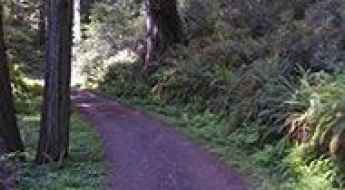
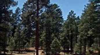
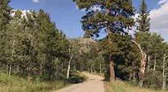
The most scenic drives in Redwood National and State Parks
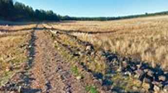
Located along the northern California coast, in the USA, the Redwood National and State Parks comprise a unique partnership between the National Park Service and California State Parks, preserving some of the tallest trees on Earth. The parks span Del Norte and Humboldt counties and include Redwood National Park, Prairie Creek Redwoods State Park, Del Norte Coast Redwoods State Park, and Jedediah Smith Redwoods State Park. Together, they protect ancient redwood forests, rugged coastlines, oak woodlands, upland prairies, and diverse wildlife habitats.
Kiowa Mountain
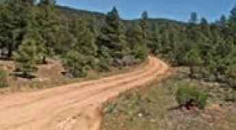
Kiowa Mountain is a high mountain peak at an elevation of 2.967m (9,734ft) above the sea level, located in Rio Arriba County, in the U.S. state of New Mexico.
Glorieta Pass
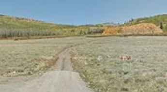
Glorieta Pass is a high mountain pass at an elevation of 2.286m (7,500ft) above the sea level, located in the Sangre de Cristo Mountains of northern New Mexico.
A drive to the top of Manastash Ridge
Manastash Ridge is a mountain pass at an elevation of 825m (2,706ft) above the sea level, located in Kittitas County, in central Washington state in the United States.
Atlantic Peak
Atlantic Peak is a high mountain peak at an elevation of 3.778m (12,395ft) above the sea level, located in Summit County, in the U.S. state of Colorado. It’s one of the highest mountain roads of Colorado.
Wofford Lookout
Wofford Lookout is a high mountain lookout tower at an elevation of 2.798m (9,179ft) above the sea level, located in Otero County, in the U.S. state of New Mexico.
Snow Valley Peak
Snow Valley Peak is a high mountain peak at an elevation of 2.813m (9,229ft) above the sea level, located in Carson City, in the U.S. state of Nevada.

Vehicle Maintenance and Logistics for Technical Mountain Roads
Driving on technical mountain roads or high-altitude passes significantly accelerates the wear and tear of critical vehicle components. From braking systems to suspension geometry, the mechanical stress of navigating steep gradients and unpaved surfaces requires a specific logistical approach to maintenance and repair. Ensuring a vehicle can handle these environments is essential for long-distance transit safety.
Glenn Highway is not something to miss
Glenn Highway (part of Alaska Route 1) is a very scenic drive located in southcentral Alaska, in USA. The road takes you through several towns and natural wonders of Alaska.
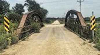
265th Street Bridge
Located in Butler County, Iowa, in USA, the 265th Street Bridge is one of the most spectacular bridges in the world.
How to drive the unpaved road to Houghton Mountain in Colorado
Houghton Mountain is a high mountain peak at an elevation of 3.781m (12,404ft) above sea level, located in San Juan County, in the U.S. state of Colorado.
Fishhook Lake
Fishhook Lake is a high mountain lake at an elevation of 3.249m (10,659ft) above the sea level, located in Carbon County, in the U.S. state of Wyoming. It’s one of the highest mountain roads of Wyoming.
Promontory Divide
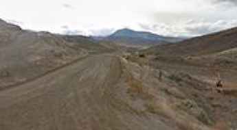
Promontory Divide is a high mountain pass at an elevation of 2.621m (8,599ft) above the sea level, located on the boundary between Custer and Huerfano counties, in southern Colorado, USA.
Currant Creek Pass
Currant Creek Pass is a high mountain pass at an elevation of 2.891m (9,485ft) above the sea level, located in the Front Range of central Colorado, USA.
Driving to Mackinaw Lake is not a piece of cake
Mackinaw Lake is a high mountain lake at an elevation of 3.295m (10,810ft) above the sea level, located in Garfield County, in northwestern Colorado, USA.
Fox Mountain
Fox Mountain is a high mountain peak at an elevation of 2.864m (9,396ft) above the sea level, located in Catron County, in the U.S. state of New Mexico.
Take the Curvy Kingsbury Grade Road and Discover Daggett Pass in NV
Daggett Pass is a high mountain pass at an elevation of 2.239m (7,345ft) above the sea level, located in northwestern Douglas County, in the U.S. state of Nevada.
Bitterroot-Big Hole Road is a Very Scenic Drive in Montana
Located in the U.S. state of Montana, Bitterroot-Big Hole Road is a very exciting journey through history. It is a narrow one-lane road.
Take the Scenic Route and Discover Flesher Pass in Montana
Flesher Pass is a high mountain pass at an elevation of 1.872m (6,141ft) above the sea level, located in Lewis and Clark County, in the U.S. state of Montana.

Take the Scenic Route and Discover Highland Lakes in CA
Highland Lakes are a pair of freshwater alpine lakes at an elevation of 2.631m (8,631ft) above the sea level, located in Alpine County, in the U.S. state of California.
How to drive the unpaved road to Mount Guyot in Colorado?
Mount Guyot is a high mountain peak located in southeastern Summit County, in the U.S. state of Colorado. North of the mountain, an unpaved road climbs up to at an elevation of 3.571m (11,715ft) above sea level.
White Bark Vista
White Bark Vista is a natural overlook at an elevation of 2.943m (9,655ft) above the sea level, located up the mountain above Fresno, in Fresno County, California, in USA. It’s one of the highest roads of California.
The road to Mount Pilchuck isn’t an easy one
Mount Pilchuck is a mountain peak located in Snohomish County, in the U.S. state of Washington. A graveled road leads to the Mount Pilchuck Trailhead parking area, at an elevation of 964m (3,162ft) above the sea level.

Warm Springs Summit
Warm Springs Summit is a high mountain pass at an elevation of 1.916m (6,286ft) above the sea level, located in the US State of Nevada.
Bigelow Divide
Bigelow Divide is a high mountain pass at an elevation of 2.866m (9,403ft) above the sea level, located in Custer County, Colorado, in USA.
How to drive the high-mountain County Road 430 in Colorado?
Located in Mineral County, in the US state of Colorado, the challenging County Road 430 is a high mountain road, topping out at 3.591m (11,781ft) above sea level.
Adventure along Scenic Skyline Drive to North Tent Mountain
North Tent Mountain is a high mountain peak at an elevation of 3.214m (10,544ft) above the sea level, located in Sanpete County, in the U.S. state of Utah. It’s one of the highest roads of Utah.
Malemute Peak
Malemute Peak is a high mountain peak at an elevation of 3.899m (12,791ft) above the sea level, located in Pitkin County, in the U.S. state of Colorado. It’s one of the highest roads of Colorado.
McCord Pass
McCord Pass is a high mountain pass at an elevation of 3.296m (10,814ft) above the sea level located in the Eagle County, in Colorado, USA.
Woody Mountain
Woody Mountain is a high mountain peak at an elevation of 2.440m (8,006ft) above the sea level, located in Coconino County, in the north central part of the U.S. state of Arizona.
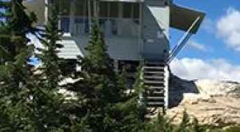
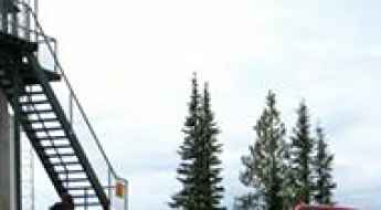
Lookout Mountain
Lookout Mountain is a high mountain pass at an elevation of 1.683m (5,522ft) above the sea level, located in Okanogan County, Washington, United States. At the summit there’s a fire lookout.
The curvy yet scenic TX-166 road
TX-166 is a winding mountain road through the Davis Mountains located in Jeff Davis County, Texas, in the USA. It's one of the highest roads in Texas.
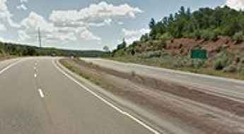
The Deadliest California Roadways for Motorcyclists
California features some of the most demanding roads in the United States, where mountain terrain and heavy traffic create extreme conditions for motorcycles. When wheels leave the city streets and enter high-altitude passes or major freight corridors, the risk of a severe crash spikes due to sharp switchbacks, canyon drop-offs, and high-speed commercial traffic.
Sourdough Peak
Sourdough Peak is a high mountain pass at an elevation of 2.076m (6,811ft) above the sea level located in Idaho County, Idaho, in USA.
How to get by car to the lookout at Long Tom Mountain in Idaho?
Long Tom Mountain is a high mountain peak at an elevation of 2.493m (8,179ft) above sea level located in Lemhi County, in the US state of Idaho.
Elk Park Pass
Elk Park Pass is a high mountain pass at an elevation of 1.936m (6,352 ft) above the sea level, located on the border of Silver Bow/Jefferson counties, in southwestern Montana, USA.
Mount Werner
Mount Werner is a high mountain peak at an elevation of 3.222m (10,570ft) above the sea level, located in the Rocky Mountains of northwestern Colorado, in USA.
Ptarmigan Peak: Ultimate 4wd destination
Ptarmigan Hill is a high mountain peak at an elevation of 3.681m (12,076ft) above the sea level, located in Eagle County, in central Colorado, in the United States. It’s one of the highest mountain roads of Colorado.
Road trip guide: Conquering Big Hole Pass in Montana
Big Hole Pass is a high mountain pass at an elevation of 2,256 m (7,401 ft) above sea level, located in Beaverhead County, in the U.S. state of Montana.
UM Pass
UM Pass is a high mountain pass at an elevation of 3.208m (10,524ft) above the sea level, located in Sevier County, in the central section of the U.S. state of Utah. It’s one of the highest mountain roads of Utah.
Parker Mountain
Parker Mountain is a high mountain peak at an elevation of 2.622m (8,602ft) above the sea level located in Lemhi County, Idaho, USA.
How to drive the unpaved road to Lake Mountain in Idaho?
Lake Mountain is a high mountain peak at an elevation of 2.827m (9,274ft) above sea level located in Lemhi County, in the US state of Idaho. It's one of the highest roads in Idaho.
How to drive the unpaved road to Apache Peak
Apache Peak is a high mountain peak at an elevation of 3.334m (10,938ft) above the sea level, located in Apache County, in the US state of Arizona. It's one of the highest roads in Arizona.
Feltham Creek Point
Feltham Creek Point is a high mountain peak at an elevation of 2.744m (9,002ft) above the sea level located in the Salmon River Mountains, in Custer County, Idaho, in USA. It's one of the highest roads of Idaho.
How to drive the paved UT-14 road to Cedar Canyon Summit?
Cedar Canyon Summit is a high mountain pass at an elevation of 3.023m (9,917ft) above sea level located in Iron County, in the US state of Utah.
White Pine Pass
White Pine Pass is a high mountain pass at an elevation of 2.924m (9,593ft) above the sea level, located in Larimer County, in the U.S. state of Colorado.