What are the most spectacular roads in the USA?
Located in North America, the USA is a true paradise for drivers, as it hosts more than 2,000 roads listed as the most spectacular in the world.
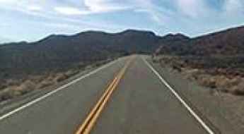
Featuring mountains, deserts, coasts, and snow, in the USA you’ll get your dream road. And you’ll never want to wake up. For instance, at the top of your list, you need to drive the Million Dollar Highway, the most beautiful road in America, and probably in the world. Built in the late 1880s, you'll be on the "outside" for a while with a hell of a view to your right (let the passenger enjoy the view; you'll want to watch the road). Another paved option must be the Iron Mountain Road, featuring 17 miles, 314 curves, 14 switchbacks, 3 pigtails, and 3 tunnels in the Black Hills of South Dakota. No list would be complete without the winding Tail of the Dragon: 318 curves in 11 miles. Spanning Tennessee and North Carolina, it is one of the most scenic drives in the USA. You also can’t skip driving Mount Evans Scenic Byway, the highest paved road in North America, climbing up to 4,310m (14,130ft) in Colorado. It is said to be the highest paved road in North America.
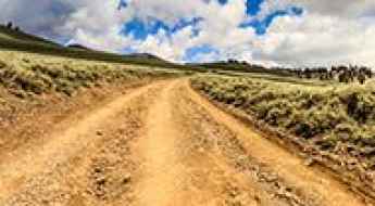
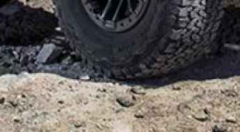
For those who prefer unpaved experiences, the country hosts some of the most defiant yet scenic roads in the world. You can’t miss Black Bear Pass, a high mountain adventure in the Colorado Rockies. Climbing up to 3,915m (12,844ft) above sea level, it's one of the highest roads in Colorado. You can also discover the beauty of Engineer Pass, a mountain pass at an elevation of 3,901m (12,800ft) above sea level in Colorado. It’s mostly a first-gear ride because the road is rough and rocky. The legendary Shafer Trail Road in Utah's Canyonlands National Park is an iconic drive located on the east-central edge of Utah. At times, the road is so narrow that only one car can pass. And Lippincott Mine Road in California is for experienced 4WD drivers using high-clearance vehicles only. You'll need a good map, as the routes are not marked and there are no signs. It’s one of the challenging backcountry roads in Death Valley National Park.
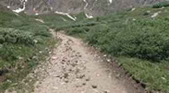
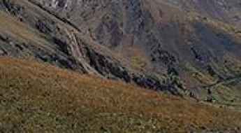
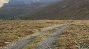
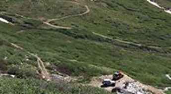
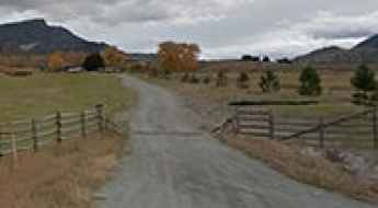
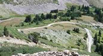
A steep old 4wd road to Ruby Mountain
Ruby Mountain is a high mountain peak at an elevation of 3.607m (11,833ft) above the sea level, located in Summit County, in the U.S. state of Colorado. It’s one of the highest mountain roads of Colorado.
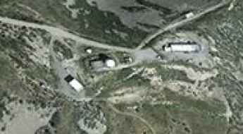
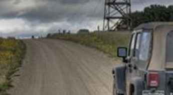
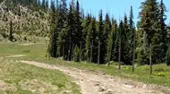
Salinas Peak
Salinas Peak is a high mountain peak at an elevation of 2.730m (8,956ft) above the sea level, located in the White Sands Missile Range of Sierra County, south-central New Mexico, in the United States. There is no public access to this peak nor is photography permitted.
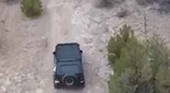
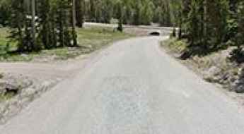
Barillas Peak
Barillas Peak is a high mountain peak at an elevation of 2.847m (9,340ft) above the sea level, located in San Miguel County, New Mexico, United States.
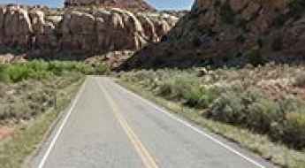
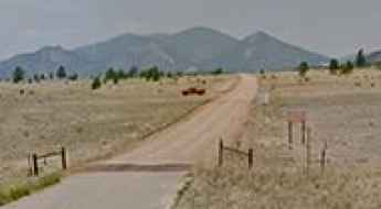
Road UT-211
UT-211 is a very scenic journey in the heart of the Needles region of Canyonlands National Park,in San Juan County, in the southeastern portion of the U.S. state of Utah. Driving in is beautiful with amazing views along the way.

5 Essential Safety Protocols for Driving Remote and Dangerous Routes
Traveling through mountain passes, isolated coastal routes, and remote inland tracks offers unmatched freedom, but it also demands a higher level of preparation. Beyond the basics, ensuring your safety on high-risk routes requires specific protocols that can prevent a scenic drive from turning into a life-threatening situation.
Italian Pass, a Most Tricky Scenic Road
Italian Pass is a high mountain pass at an elevation of 3.584m (11,758ft) above the sea level, located in Gunnison County, in the U.S. state of Colorado.
Red Mountain
Red Mountain is a high mountain peak at an elevation of 3.754m (12,316ft) above the sea level, located in Clear Creek County, in the U.S. state of Colorado. It’s one of the highest mountain roads of Colorado.
Helmet Peak
Helmet Peak is a high mountain peak at an elevation of 3.481m (11,420ft) above the sea level, located in Montezuma County, the southwesternmost of the 64 counties in the U.S. state of Colorado.
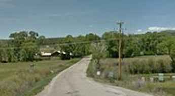
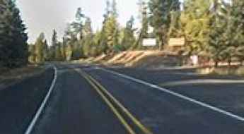
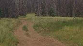
Drews Gap is a drive worth taking in Oregon
Drews Gap is a high mountain pass at an elevation of 1.617m (5,306ft) above sea level, located in Lake County, in the U.S. state of Oregon.
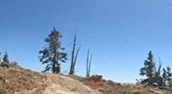
Campito Mountain
Campito Mountain is a high mountain peak at an elevation of 3.294m (10,807ft) above the sea level, located in Mono County, in the east central portion of the U.S. state of California. It's one of the highest roads of California.

FDR Drive offers stunning views of Brooklyn
Franklin D. Roosevelt East River Drive is the name of a very scenic route in the heart of New York City, in the US state of New York.
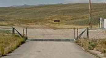
Road trip guide: Conquering McKinney Tanks Summit
McKinney Tanks Summit is a high mountain pass at an elevation of 1.951m (6,400ft) above the sea level, located in Nye County, in the U.S. state of Nevada.
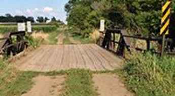
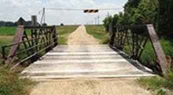
200th Street Bridge
Located in Iowa, in USA, the 200th Street Bridge is one of the most spectacular bridges in the world.
How to drive the steep mining road to Mount Wilcox?
Mount Wilcox is a high mountain peak at an elevation of 3,770m (12,368ft) above sea level, located on the boundary between Clear Creek and Summit counties in the northern part of Colorado. Situated within the White River National Forest, the summit is reached via a technical spur off a historical mining route. Logistically, it is one of the highest driveable points in the state, offering a raw look at high-altitude Front Range terrain.
Can I cross the Victor Avenue Bridge in Iowa?
Located in Buchanan County, in the US state of Iowa, the Victor Avenue Bridge is one of the most spectacular bridges in the world.
How to drive the mining road to Mount Buckskin in Colorado
Mount Buckskin is a high mountain peak at an elevation of 3.881m (12,732ft) above sea level, located in Park County, in the U.S. state of Colorado. It’s one of the highest roads of Colorado.
Copper Mountain
Copper Mountain is a high mountain peak at an elevation of 3.758m (12,329ft) above the sea level, located in Summit County, in the U.S. state of Colorado. It’s one of the highest mountain roads of Colorado.
Yellow Peak
Yellow Peak is a high mountain peak at an elevation of 2.190m (7,185ft) above the sea level, located in Washoe County, in northwestern Nevada, in United States.
Casco Peak
Casco Peak is a high mountain peak at an elevation of 3.925m (12,877ft) above the sea level, located in Lake County, in the U.S. state of Colorado. It’s one of the highest mountain roads of Colorado.
Alta Lakes
Alta Lakes is a a serie of three lakes at an elevation of 3.484m (11,430ft) above the sea level, located in San Miguel County, Colorado, United States. This is a long and bumpy trail, but the scenery is worth the trip.
A steep paved road to Pu’u O Kila Lookout in Hawaiʻi
Pu’u O Kila is a jaw dropping lookout at an elevation of 1.266m (4,153ft) above the sea level, located in Kauaʻi County, Hawaiʻi, United States. The view to the coast is legendary.
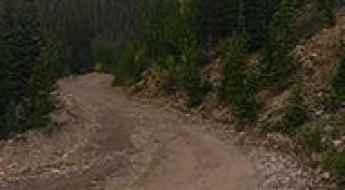
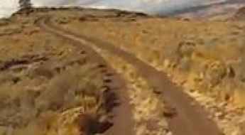
How difficult is the unpaved Forest Road 445 to Don Fernando Peak?
Don Fernando Peak, also known as Sierra de Don Fernando, is a high mountain summit reaching an elevation of 3,147m (10,324ft) above sea level in Taos County, New Mexico. Located in the northern part of the state, south of Taos, the drive to the top is one of the highest mountain roads in New Mexico. This is a primitive journey through the dense timber of the Carson National Forest, where the smooth forest floor can quickly turn into a rocky, bone-jarring climb that demands a capable vehicle and a driver who knows how to manage traction on loose soil.
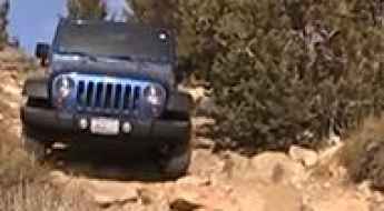
Top Vehicles for America’s Deadliest Routes
When the pavement ends on high-consequence routes like Engineer Pass or the Dalton Highway, the distinction between a standard SUV and a true expedition vehicle becomes a matter of survival. Navigating unpaved, rocky, or ice-saturated terrain requires more than just all-wheel drive; it demands superior ground clearance, heavy-duty suspension articulation, and mechanical locking differentials. This analysis reviews the elite platforms engineered to maintain traction and structural integrity where standard vehicles fail.
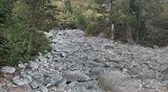
Fordyce Creek
Fordyce Creek is an extremely tough and challenging trail located in Nevada County in Northern California, USA. On high flow days the creek remains impassable. Never underestimate this track.
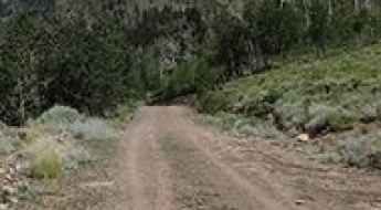
Monument Ridge
Monument Ridge is a high mountain pass at an elevation of 2.518m (8,261ft) above the sea level, located in Sublette County, in western Wyoming, United States.
Austin Pass in Washington is an absolute must for road lovers
Austin Pass is a high mountain pass at an elevation of 1,423m (4,668ft) above sea level, located in Whatcom County, in the U.S. state of Washington.
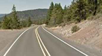
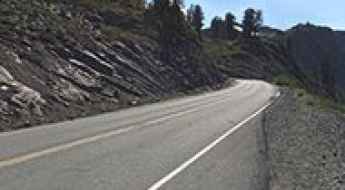
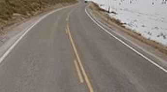
Driving the paved but steep Wauconda Pass in Washington
Wauconda Pass is a high mountain crossing at an elevation of 1,316 meters (4,317 ft) above sea level, located in Okanogan County, Washington. Situated on State Route 20, also known as the North Cascades Highway, this pass is a vital link between the towns of Wauconda and Republic. While the surface is fully paved and lacks the jagged rocks of unpaved forest tracks, the reality of driving here is a sustained climb where the heat of your engine and the wear on your brakes are the main concerns, especially when sharing the road with furgonetas up and down the pass and heavy commercial trucks.
Bear Valley Mountain
Bear Valley Mountain is a high mountain peak at an elevation of 2.528m (8,293ft) above the sea level located in Valley County, in Idaho, USA.

Why 76% of Americans Think They Are Safe Drivers (And Why They Are Wrong)
There is a profound disconnect between perceived driving competence and actual on-road behavior in the United States. While a vast majority of motorists self-identify as "safe" or "expert" drivers, forensic traffic data and behavioral surveys paint a more alarming picture. This phenomenon, often referred to as the "Illusion of Superiority," creates a dangerous environment where overconfidence leads to a systematic disregard for basic safety protocols, turning high-speed arterials into zones of high-consequence risk.

Selecting the Ultimate 4x4 Platform for High-Risk Routes
Selecting a used 4x4 vehicle for high-consequence off-road expeditions is a technical challenge that goes beyond aesthetics. In remote areas where recovery services are non-existent, your vehicle is your primary life-support system. Whether you are navigating the rocky passes of the San Juan Mountains or the isolated tundra of the Dalton Highway, understanding the mechanical hierarchy of off-road platforms is essential for ensuring both operational success and personal safety.
Mineral Peak
Mineral Peak is a high mountain peak at an elevation of 2.233m (7,326ft) above the sea level, located in Missoula County, in the U.S. state of Montana.
A truly outstanding 4x4 adventure to Funnel Lake
Funnel Lake is a high mountain lake at an elevation of 3.176m (10,419ft) above the sea level, located in Inyo County, in the eastern central part of the U.S. state of California. It’s one of the highest roads of California.
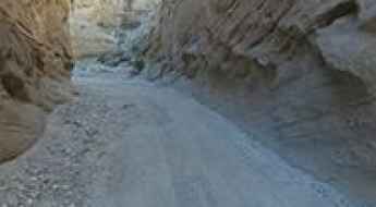
Driving the wild Sandstone Canyon Trail in California
Sandstone Canyon Offroad Trail is the name of a very delightful yet challenging drive through a narrow canyon with impressive high rock walls, in San Diego County, in the southwestern corner of the state of California, in the United States.
Bear Lake summit
Bear Lake summit is a high mountain pass at an elevation of 2.383m (7,818ft) above the sea level, located in Cache County, on the northern edge of Utah, United States.
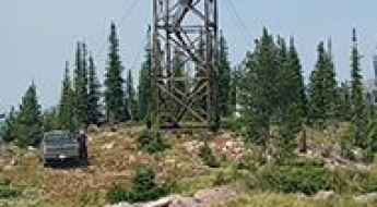
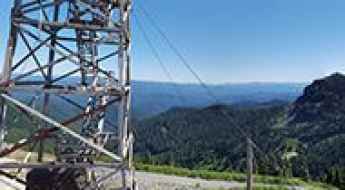
KPQ-FM Wenatchee Radio Broadcaster
KPQ-FM Wenatchee is a high mountain radio broadcaster at an elevation of 2.081m (6,827ft) above the sea level, located in Chelan County, in the U.S. state of Washington. It’s one of the highest mountain roads of Washington.
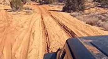
The sandy road to Peekaboo Slot Canyon in Utah
Located in Kane County, in the U.S. state of Utah, Peek-a-boo Gulch is a short slot canyon. Driving is a challenging option. This is not the road to practice your sand driving skills if you are inexperienced.
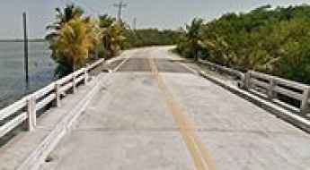
Boca Chica Road
Boca Chica Road is a short asphalted road located in the lower Florida Keys, in Key West, Florida, USA.
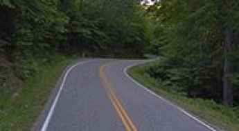
"The Dragon": America's Most Dangerous Road And A Racer's Paradise
This 18-kilometer highway abounds with steep turns, bends, and junctions, and is very popular with fans of fast driving. I decided to look at it with my own eyes.In the 1950s, the federal government paved the highway and turned it into Highway 129. This road, which connects sleepy villages deep in the Appalachian forests, is of secondary importance, and it was not used much until the 1990s, when information about 318 turns began to circulate in online forums.
Jersey Jim Lookout Tower
Jersey Jim is a high mountain lookout tower at an elevation of 3.002m (9,849ft) above the sea level, located in Montezuma County, Colorado, in USA.
Lem Peak
Lem Peak is a high mountain peak at an elevation of 3.083m (10,114ft) above the sea level, located in Lemhi County in the U.S. state of Idaho. It’s one of the highest mountain roads of Idaho.
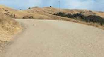
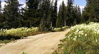
How to drive the steep unpaved road to the lookout at Fairview Peak in Oregon?
Fairview Peak is a high mountain peak at an elevation of 1.812m (5,944ft) above sea level located in Lane County, in the U.S. state of Oregon.
Driving the historic Lolo Motorway in ID
The historic Lolo Motorway is the name of a very scenic drive travelling through central Idaho, in the United States.
Cove Mountain
Cove Mountain is a high mountain pass at an elevation of 3.254m (10,675ft) above the sea level located in the Sanpete County, in Utah, USA. It’s one of the highest roads in Utah.
Travel guide to the top of Coney Summit
Coney Summit is a high mountain peak at an elevation of 4.059m (13,316ft) above the sea level, located in Hinsdale County, in southwest Colorado, in United States. It’s one of the highest mountain roads in Colorado.
How to drive the unpaved road to Palette Lake in Colorado
Palette Lake is a high mountain lake at an elevation of 3.713m (12,181ft) above sea level, located in Chaffee County, in the US state of Colorado. It’s one of the highest roads of Colorado.
Navajo Point
Navajo Point is a high mountain peak at an elevation of 3.188m (10,459ft) above the sea level, located in Iron County, in the U.S. state of Utah.
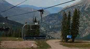
Eagle Point Resort
Eagle Point Resort is a high mountain resort at an elevation of 3.154m (10,347ft) above the sea level, located in eastern Beaver County, Utah, United States. It’s one of the highest roads of Utah.
A memorable road trip to Badger Mountain in Colorado
Badger Mountain is a high mountain peak at an elevation of 3.427m (11,243ft) above sea level, located in Park County, in the southeastern part of the U.S. state of Colorado.