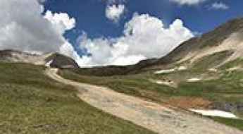
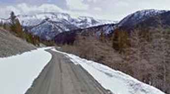
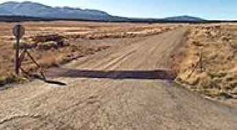
What are the most spectacular roads in the USA?
Located in North America, the USA is a true paradise for drivers, as it hosts more than 2,000 roads listed as the most spectacular in the world.
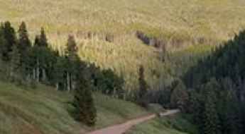
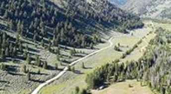
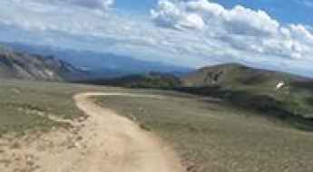
Featuring mountains, deserts, coasts, and snow, in the USA you’ll get your dream road. And you’ll never want to wake up. For instance, at the top of your list, you need to drive the Million Dollar Highway, the most beautiful road in America, and probably in the world. Built in the late 1880s, you'll be on the "outside" for a while with a hell of a view to your right (let the passenger enjoy the view; you'll want to watch the road). Another paved option must be the Iron Mountain Road, featuring 17 miles, 314 curves, 14 switchbacks, 3 pigtails, and 3 tunnels in the Black Hills of South Dakota. No list would be complete without the winding Tail of the Dragon: 318 curves in 11 miles. Spanning Tennessee and North Carolina, it is one of the most scenic drives in the USA. You also can’t skip driving Mount Evans Scenic Byway, the highest paved road in North America, climbing up to 4,310m (14,130ft) in Colorado. It is said to be the highest paved road in North America.
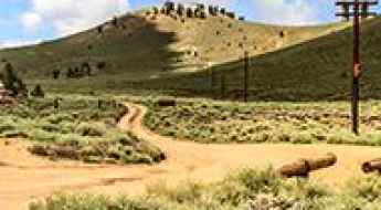
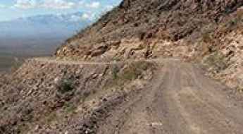
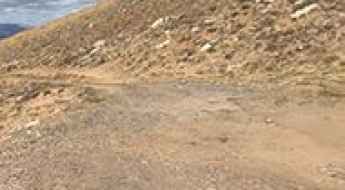
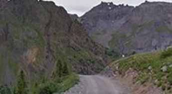
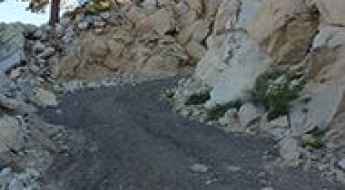
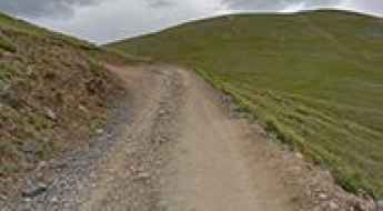
For those who prefer unpaved experiences, the country hosts some of the most defiant yet scenic roads in the world. You can’t miss Black Bear Pass, a high mountain adventure in the Colorado Rockies. Climbing up to 3,915m (12,844ft) above sea level, it's one of the highest roads in Colorado. You can also discover the beauty of Engineer Pass, a mountain pass at an elevation of 3,901m (12,800ft) above sea level in Colorado. It’s mostly a first-gear ride because the road is rough and rocky. The legendary Shafer Trail Road in Utah's Canyonlands National Park is an iconic drive located on the east-central edge of Utah. At times, the road is so narrow that only one car can pass. And Lippincott Mine Road in California is for experienced 4WD drivers using high-clearance vehicles only. You'll need a good map, as the routes are not marked and there are no signs. It’s one of the challenging backcountry roads in Death Valley National Park.
How to Drive the Wild Road to Terrible Mountain in Colorado
Terrible Mountain is a high mountain pass at an elevation of 3,662m (12,014ft) above sea level, located in Gunnison County, in the U.S. state of Colorado. It is one of the highest roads in Colorado.

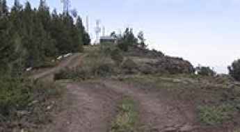
How to conquer the defiant Edison Butte OHV Trail in Oregon?
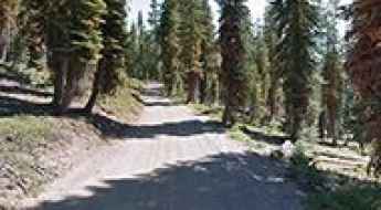
Edison Butte OHV Trail is a very exciting trail with some awesome scenic views, located in Deschutes County, in the US state of Oregon. It’s a rocky trail that involves lava ridges for extra excitement.
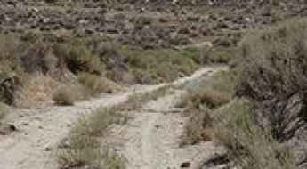
Nellis Cove Road is a drive worth taking on the shore of Lake Mohave
Nellis Cove Road is a scenic sandy road located in Clark County, in the U.S. state of Nevada, leading to the shore of Lake Mohave. It’s a stock-friendly track, but you’ll want four-wheel drive and tires that have some gripping power in the sand.
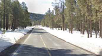
Picturesque Routes for the Ultimate Road-trip & Vacation in the Pocono Mountains
The Pocono Mountains in Northeastern Pennsylvania represent a complex topographical transition for drivers on the U.S. East Coast. This upland region is defined by a dense network of interstate corridors and historic state routes that navigate through deep forests, river gaps, and high-plateau terrain. For the strategic driver, reaching the Poconos requires balancing high-speed transit with technical mountain navigation, especially during the hazardous icing events of the winter season.
A remote drive to Sheep Pass in Nevada
Sheep Pass is a high mountain pass at an elevation of 1,536 m (5,039 ft) above sea level located in Clark County, in the U.S. state of Nevada.
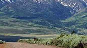
How to get by car to Piney Lake in Colorado?
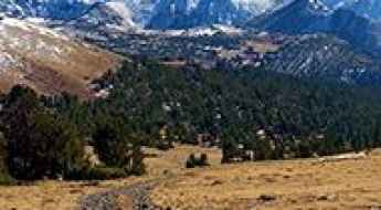
Piney Lake is a high mountain lake at an elevation of 2,864 m (9,396 ft) above sea level, located in Eagle County, in the US state of Colorado. It is one of the highest lakes in the state that you can drive to. The road is a bit rough.
How to get by car to Crooked Creek Station in California?
Crooked Creek Station is a high mountain station at an elevation of 3,090 m (10,150 ft) above sea level, located in Mono County, in the U.S. state of California. It’s one of the highest roads in California.
Driving the historic Black Hills Scenic Byway in Arizona
Black Hills Scenic Byway is a scenic unpaved road located along Greenlee and Graham counties, in the U.S. state of Arizona.
The Wild Road to Sand Creek Pass in Colorado
Sand Creek Pass is a high mountain pass at an elevation of 2,741m (8,992ft) above sea level, located in Larimer County, in the US state of Colorado.
How to drive the defiant unpaved road to Eagle Rock in California?
Eagle Rock is a mountain peak at an elevation of 760 m (2,493 ft) above sea level, located in Santa Cruz County, in the U.S. state of California.
Navigating Avon Pass Road: Utah's Unpaved Adventure Route
Avon Pass is a high mountain pass situated at an elevation of 1,984m (6,509ft) above sea level. It's located on the boundary between Weber and Cache counties in the U.S. state of Utah.
The wild unpaved road to Granite Peak in Madison County
Granite Peak is a high mountain peak at an elevation of 3,002 m (9,849 ft) above sea level, located in Madison County, in the U.S. state of Montana. It’s one of the highest roads in Montana.
A wild unpaved road to Crystal Mountain North in Washington
Crystal Mountain North is a high mountain peak at an elevation of 2,090 m (6,856 ft) above sea level, located in Pierce County, in the U.S. state of Washington. It’s one of the highest roads in Washington.
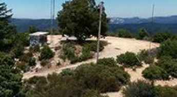
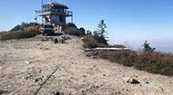
How to get to the lookout at the summit of Roof Butte in Arizona?
Roof Butte is a high mountain peak at an elevation of 2,996m (9,829ft) above sea level, located in Apache County, in the U.S. state of Arizona. It's one of the highest roads in Arizona.
How to get by car to the summit of Mount Pennell in Utah?
Mount Pennell is a high mountain peak at an elevation of 3,302m (10,833ft) above sea level, located in eastern Garfield County, in the US state of Utah. It's one of the highest roads in Utah.
The breathtaking road to Big Indian Mountain in Nevada
Big Indian Mountain is a high mountain pass at an elevation of 2,987m (9,799ft) above sea level, located in Mineral County, in the U.S. state of Nevada. It's one of the highest roads in Nevada.
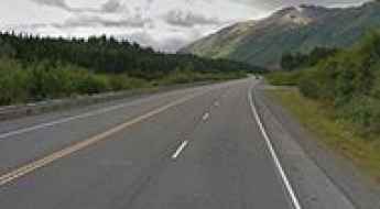
How to drive to Turnagain Pass in Alaska?
Turnagain Pass is a mountain pass at an elevation of 300 m (984 ft) above sea level, located in the U.S. state of Alaska.
How to get by car to South Baldy in New Mexico?
South Baldy is a high mountain peak at an elevation of 3,288 m (10,789 ft) above sea level, located in Socorro County, in the U.S. state of New Mexico. Driving up there through a narrow unpaved road is a bit scary. It’s one of the highest roads in New Mexico.
How to get by car to Big Lake Knoll in Arizona?
Big Lake Knoll is a high mountain peak at an elevation of 2.870 m (9,415 ft) above sea level, located in Apache County, in the U.S. state of Arizona. It's one of the highest roads in Arizona.
An Old Mining Trail to Kuss Peak in Colorado
Kuss Peak is a high mountain peak at an elevation of 4,136m (13,569ft) above sea level, located in Lake County, in the US state of Colorado. It is one of the highest roads in the USA.
How to get by car to the lookout at Martis Peak in California?
Martis Peak is a high mountain peak at an elevation of 2,652 m (8,700 ft) above sea level, located in Placer County, in the U.S. state of California. The drive provides amazing views from North Lake Tahoe and the surrounding Truckee region.
How to get by car to the scenic Juniper Lake in California?
Juniper Lake is a picturesque mountain lake at an elevation of 2,094m (6,870ft) above sea level, located in the U.S. state of California.
A Memorable Road Trip to Resolution Mountain in Colorado
Resolution Mountain is a high mountain peak at an elevation of 3,638 m (11,935 ft) above sea level, located in Eagle County, in the U.S. state of Colorado. It’s one of the highest roads in Colorado.
How to get to the lookout at Mount Hough in California?
Mount Hough is a high mountain peak at an elevation of 2.204m (7,230ft) above sea level, located in Plumas County, in the U.S. state of California.
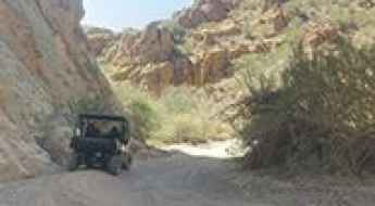
Box Canyon Trail: Arizona's Steep-Walled Drive
The Box Canyon Trail is a unique and scenic drive through a narrow, steep-walled canyon located in Pinal County, in the U.S. state of Arizona. It is one of Arizona’s most popular 4-wheeling areas.
The road to Trico Peak in Colorado is not for the faint of heart
Trico Peak is a high mountain pass at an elevation of 3.849m (12,627ft) above sea level, located in San Miguel County in the U.S. state of Colorado. It's one of the highest roads in Colorado.
How to get to Erickson Mine at the summit of Keystone Mountain in Colorado
Keystone Mountain is a high mountain peak at an elevation of 3,677 m (12,063 ft) above sea level, located in eastern Summit County, in the U.S. state of Colorado. It’s one of the highest roads in Colorado.

San Mateo-Hayward Bridge is the longest bridge in California
Located in San Francisco, in the US state of California, San Mateo-Hayward Bridge is one of the most spectacular bridges in the world.
How To Travel The Scenic Encinal Canyon Road
Encinal Canyon Road is the name of a very scenic yet demanding drive located in western Los Angeles County, in the U.S. state of California. It’s said to be one of the 5 Best Driving Roads in Malibu. It’s one of the Top Scenic Drives in Malibu.
Highway 180 Journey: A Scenic Drive from Flagstaff to Grand Canyon Unveiled
Situated in Coconino County, in the US state of Arizona, Highway 180 offers a picturesque drive from Flagstaff to Grand Canyon, meandering through mountains and forests.
How to get to the lookout at the summit of Devil Peak in Mariposa County?
Devil Peak is a high mountain peak at an elevation of 2.128m (6,981ft) above sea level, located in southern Mariposa County, in the US state of California.
A memorable road trip to Monument Hill in La Plata County
Monument Hill is a high mountain peak at an elevation of 3,253 m (10,672 ft) above sea level, located in La Plata County, in the U.S. state of Colorado.
Driving through the lonely trail to Saint Sophia Ridge in Colorado
Saint Sophia Ridge is a high mountain ridge at an elevation of 3.829m (12,562ft) above sea level, located in Ouray County, in the U.S. state of Colorado. It’s one of the highest roads in Colorado.
Driving the road to Coyote Ridge in California is not a piece of cake
Coyote Ridge is a high mountain ridge at an elevation of 3.492m (11,456ft) above sea level, located in Inyo County, in the U.S. state of California. It’s one of the highest roads in California.
How to drive the wild road to Toro Peak in California
Toro Peak is a high mountain peak at an elevation of 2.655m (8,710ft) above sea level, located in south-central Riverside County, in the U.S. state of California.
How to drive to Cerro Summit in Colorado?
Cerro Summit is a high mountain pass at an elevation of 2,451 m (8,042 ft) above sea level, located in Montrose County, in the US state of Colorado.
The Ultimate Guide to Traveling the Burcham Flat Road in California
Burcham Flat Road is a very scenic alternative to US-395, through the Walker River Canyon, located in Mono County, in the U.S. state of California.
Carlsbad Cavern Highway: A Comprehensive Travel Guide
Carlsbad Cavern Highway (New Mexico State Route 7) is a very scenic drive located in Eddy County, in the U.S. state of New Mexico.
How to get by car to Teton Pass in Montana?
Teton Pass is a high mountain pass at an elevation of 1.905m (6,250ft) above sea level, located in Teton County, in the US state of Montana.
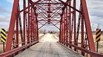
How to cross the Old Durow Road Bridge?
Located in Iowa, in the United States, the Old Durow Road Bridge is one of the most spectacular bridges in the world.
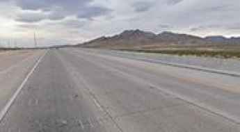
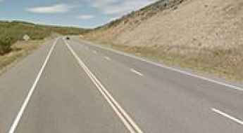
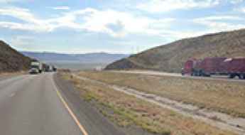
I-15 in Nevada, a bigger risk than casinos in Las Vegas
The I-15 or Interstate 15 is a paved highway located in the U.S. state of Nevada. It is the main route between Los Angeles and Las Vegas.
The Ultimate Road Trip To Mestaa’Ėhehe Mountain in Colorado
Mestaa’Ėhehe is a high mountain peak at an elevation of 3.493m (11,459ft) above sea level, located in Clear Creek County, in the U.S. state of Colorado.
The road to Difficult Pass in Colorado is not for the inexperienced
Difficult Pass is a high mountain pass at an elevation of 3,712m (12,178ft) above sea level, located in the U.S. state of Colorado. It’s one of the highest roads in Colorado.
A memorable road trip to Yvonne Pass in Colorado
Yvonne Pass is a high mountain pass at an elevation of 3,893 m (12,772 ft) above sea level located in the U.S. state of Colorado. It’s one of the highest roads in Colorado.
Interstate-84 Highlights: Navigating Rattlesnake Pass in Utah's Box Elder County
Rattlesnake Pass is a high mountain pass at an elevation of 1.620m (5,314ft) above the sea level, located in Box Elder County in the US state of Utah.
A memorable road trip to Bears Ears Peak in Colorado
Bears Ears Peak is a high mountain peak located in Routt County, in the U.S. state of Colorado. Northwest of the peak, a gravel road climbs up to 3,009 m (9,872 ft) above sea level.
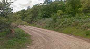
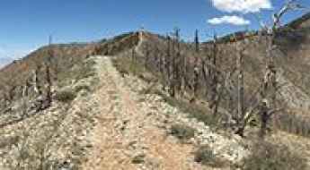
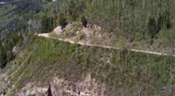
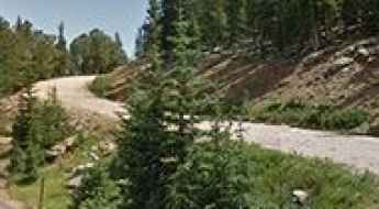
Abajo Loop Scenic Backway
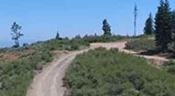
Abajo Loop Scenic Backway is a very exciting journey located in San Juan County, in the southeastern portion of the U.S. state of Utah. The trail loops up through the forested Abajo Mountains north of Blanding, climbs to nearly 11,000 ft, then descends to Monticello. The road is single-lane dirt/gravel and is impassable when wet.
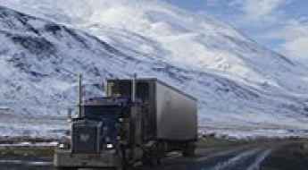
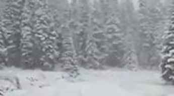
5 Deadliest Roads in the US
While most American highways are built to high safety standards, several routes across the country remain notorious for their high fatality rates and extreme environmental hazards. From the frozen isolation of the Arctic to the congested arteries of Florida and California, these five roads test the limits of even the most experienced drivers.