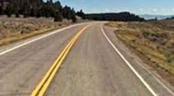
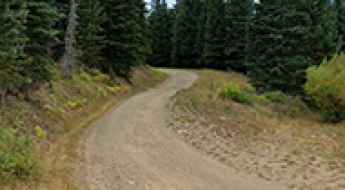
What are the most spectacular roads in the USA?
Located in North America, the USA is a true paradise for drivers, as it hosts more than 2,000 roads listed as the most spectacular in the world.
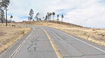
Featuring mountains, deserts, coasts, and snow, in the USA you’ll get your dream road. And you’ll never want to wake up. For instance, at the top of your list, you need to drive the Million Dollar Highway, the most beautiful road in America, and probably in the world. Built in the late 1880s, you'll be on the "outside" for a while with a hell of a view to your right (let the passenger enjoy the view; you'll want to watch the road). Another paved option must be the Iron Mountain Road, featuring 17 miles, 314 curves, 14 switchbacks, 3 pigtails, and 3 tunnels in the Black Hills of South Dakota. No list would be complete without the winding Tail of the Dragon: 318 curves in 11 miles. Spanning Tennessee and North Carolina, it is one of the most scenic drives in the USA. You also can’t skip driving Mount Evans Scenic Byway, the highest paved road in North America, climbing up to 4,310m (14,130ft) in Colorado. It is said to be the highest paved road in North America.
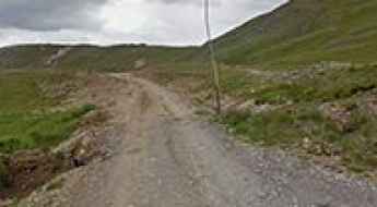
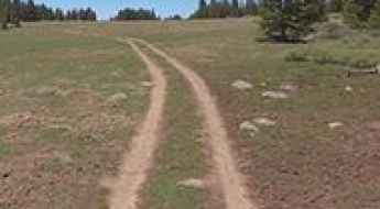
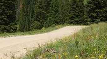
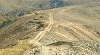
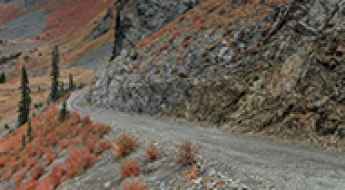
For those who prefer unpaved experiences, the country hosts some of the most defiant yet scenic roads in the world. You can’t miss Black Bear Pass, a high mountain adventure in the Colorado Rockies. Climbing up to 3,915m (12,844ft) above sea level, it's one of the highest roads in Colorado. You can also discover the beauty of Engineer Pass, a mountain pass at an elevation of 3,901m (12,800ft) above sea level in Colorado. It’s mostly a first-gear ride because the road is rough and rocky. The legendary Shafer Trail Road in Utah's Canyonlands National Park is an iconic drive located on the east-central edge of Utah. At times, the road is so narrow that only one car can pass. And Lippincott Mine Road in California is for experienced 4WD drivers using high-clearance vehicles only. You'll need a good map, as the routes are not marked and there are no signs. It’s one of the challenging backcountry roads in Death Valley National Park.
Road trip guide: Conquering Denver Pass in Colorado
Denver Pass is a high mountain pass at an elevation of 3,660 m (12,007 ft) above sea level located in San Juan County, in the U.S. state of Colorado. It’s one of the highest roads in Colorado.
A memorable road trip to Griffin Top in Utah
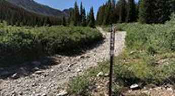
Griffin Top is a high mountain peak at an elevation of 3,283m (10,771ft) above sea level located in Garfield County, in the U.S. state of Utah. It’s one of the highest roads in Utah. There are panoramic views from the summit.
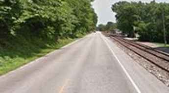
I-80 Nebraska: A Trucker’s Challenge
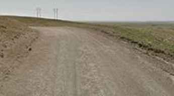
I-80 in Nebraska may look like any ordinary highway, but for truckers, it’s one of the most treacherous stretches in the United States. Truck drivers face dangerous conditions daily — a fact reflected in national statistics. According to Business Insider, truckers make up 2.4% of all road fatalities in the USA, despite being a small portion of drivers.
A Paved Steep Road to Mount Baldy in Southern California
Mount Baldy is a high mountain peak at an elevation of 1,970m (6,463ft) above sea level, located in San Bernardino County, in the U.S. state of California.
Road Trip Guide: Conquering Mount Tilton in Colorado
Mount Tilton is a high mountain peak at an elevation of 3,777m (12,391ft) above sea level, located in Gunnison County, in the U.S. state of Colorado. It’s one of the highest roads in Colorado.
Things to Know Before Driving Arizona State Route 261
State Route 261 is a very scenic high mountain road located in Apache County, in the US state of Arizona. It’s one of the highest roads in Arizona.
How to get to Hacking Lake in Utah?
Hacking Lake is a high mountain lake at an elevation of 3,244m (10,643ft) above sea level, located in Uintah County, in the US state of Utah. It’s one of the highest roads in Utah.
A defiant road to Glacier Mountain in Colorado
Glacier Mountain is a high mountain peak at an elevation of 3,793 m (12,444 ft) above sea level, located in eastern Summit County, in the U.S. state of Colorado. Full-size vehicles should not attempt to drive all the way, as there are a few very narrow spots. It’s one of the highest roads in Colorado.
How to drive the high mountain road to Carter Mountain in Wyoming?
Carter Mountain is a high mountain peak located in Park County, in the U.S. state of Wyoming. East of the summit, a gravel road tops out at 3,445m (11,302ft) above sea level. It’s one of the highest roads in Wyoming.

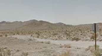
How to drive through the scenic Macedonia Canyon in the Mojave Desert?
Macedonia Canyon Road is a scenic drive located in the Mojave Desert of San Bernardino County, in the U.S. state of California. 4WD, high clearance vehicle required.
A desolate paved road to Emigrant Pass in Utah
Emigrant Pass is a high mountain pass at an elevation of 2.404m (7,886ft) above sea level, located in Sevier County, in the US state of Utah.
A Memorable Road Trip to Mount Sheridan in Colorado
Mount Sheridan is a high mountain peak located in Park County, in the U.S. state of Colorado. South of the summit, an old mining road tops out at an elevation of 4,021 m (13,192 ft) above sea level. It’s one of the highest roads in Colorado.
How to Get by Car to the Lookout at the Summit of Moses Mountain in Washington?
Moses Mountain is a high mountain peak at an elevation of 2,066m (6,778ft) above sea level, located in Okanogan County, in the U.S. state of Washington. It’s one of the highest roads in Washington.
Road trip guide: Conquering Badger Pass in Montana
Badger Pass is a high mountain pass at an elevation of 2,063 m (6,768 ft) above sea level, located in Beaverhead County, in the U.S. state of Montana.
Driving the scenic Ibex Spring Road in Death Valley NP
Ibex Spring Road is a very exciting desert drive located in San Bernardino County, in the U.S. state of California. It’s one of the challenging Backcountry roads in Death Valley National Park.
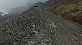
What are the highest roads in Alaska?
Alaska, situated on the northwestern edge of the North American continent, is defined by its colossal, untamed scale. Bordered by Canada to the east, the state is framed by three oceans: the Arctic to the north, the Bering Sea to the west, and the Pacific Ocean to the south. It is a land of immense open spaces, severe cold, and widespread permafrost, where the sheer size of the geography dictates the pace of life and travel.
Amasa Back Trail is a classic ride of Moab
Amasa Back Trail is a challenging trail located in Grand County, in the US state of Utah. It’s one of the classic rides of Moab.
A memorable road trip to Smith Mountain in Adams County
Smith Mountain is a high mountain peak at an elevation of 2,442 m (8,011 ft) above sea level located in Adams County, in the US state of Idaho.
The Defiant Road to Sedgwick Peak in Idaho is for Experienced Drivers Only
Sedgwick Peak is a high mountain peak at an elevation of 2,791m (9,156ft) above sea level, located in Bannock County, in the U.S. state of Idaho. It’s one of the highest roads in Idaho.
Driving the paved road to the historic Marsh Pass in Arizona
Marsh Pass is a high mountain pass at an elevation of 1,860 m (6,102 ft) above sea level, located in Navajo County, in the U.S. state of Arizona.
A 5-star road to Kingman Pass in Yellowstone NP
Kingman Pass is a high mountain pass at an elevation of 2,170 m (7,119 ft) above sea level, located in Park County, in the U.S. state of Wyoming.
How to get by car to Bearwallow Mountain in New Mexico?
Bearwallow Mountain is a high mountain peak at an elevation of 3,039 m (9,970 ft) above sea level, located in Catron County, in the U.S. state of New Mexico. It’s one of the highest roads in New Mexico.
How to drive the scenic New Castle-Buford Road in Colorado?
New Castle-Buford Road is a very scenic mountain drive located along Rio Blanco and Garfield counties in the U.S. state of Colorado.

How to Get by Car to Swamp Lake in California
Swamp Lake is a high mountain lake at an elevation of 2,929m (9,609ft) above sea level, located in Fresno County, in the US state of California. Damage is possible even for the most capable vehicle. It's one of the highest roads in California.
Driving the road to Miller Lake in Montana is not a piece of cake
Miller Lake is a high mountain lake at an elevation of 2,571m (8,435ft) above sea level, located in Deer Lodge County, in the U.S. state of Montana.
Chester Warner Valley Road is a pretty drive in Lassen Volcanic NP
Chester Warner Valley Road is a scenic drive located in Lassen Volcanic National Park in the U.S. state of California.
Travelling the historic Robidoux Pass in Nebraska
Robidoux Pass is a mountain pass at an elevation of 1.403m (4,603ft) above sea level, located in Scotts Bluff County, on the western border of the U.S. state of Nebraska.
How to get to Mesa Seco in Colorado?
Mesa Seco is a high mountain pass at an elevation of 3,846 m (12,618 ft) above sea level, located in Hinsdale County, in the US state of Colorado. While Mesa Seco is technically a mountain peak, the road passes just a few meters east of the summit, making it effectively a mountain pass for vehicles. This makes it one of the highest roads in Colorado.
How to get by car to Capilla Peak in New Mexico?
Capilla Peak is a high mountain peak at an elevation of 2,859m (9,379ft) above sea level, located in Torrance County, in the US state of New Mexico.
How to get by car to Chepeta Lake in Utah?
Chepeta Lake is a high mountain lake at an elevation of 3,228 m (10,590 ft) above sea level, located in Duchesne County, in the U.S. state of Utah. It’s one of the highest roads in Utah.
How to get by car to Black Mesa in Colorado
Black Mesa is a high mountain at an elevation of 3,427 m (11,243 ft) above sea level, located in Dolores County, in the U.S. state of Colorado.
Great River Road is one of the Best Drives in America
The Great River Road is said to be one of the Best Drives in America, tracing the course of the Mississippi River for 3,000 miles through 10 states, from Minnesota to Louisiana.
An Old Mining Road to Whale Peak in Colorado
Whale Peak is a high mountain peak located in the U.S. state of Colorado. A mining road, north of the summit, climbs up to an elevation of 3,940m (12,926ft) above sea level. The road is very rough. It's one of the highest roads in Colorado.
Conquering the Canwell Glacier Trail, one of the highest roads in Alaska
Canwell Glacier Trail is a very exciting and demanding journey located in Valdez-Cordova Census Area, in the US state of Alaska. This fantastic mountain trail follows the lateral moraine of the Canwell Glacier. It’s one of the highest roads in Alaska.
How to get by car to Lewis Lake in Wyoming?
Lewis Lake is a high mountain, crystal-clear snow-melt lake at an elevation of 3,290 m (10,793 ft) above sea level, located in Albany County, in the US state of Wyoming. It's one of the highest roads in Wyoming.
How to get by car to Tip Top Mountain in California?
Tip Top Mountain is a high mountain peak at an elevation of 2,295m (7,529ft) above sea level, located in San Bernardino County, in the US state of California. The road to the summit is rocky, with some great inclines and large, sharp rocks that require a little skill to maneuver. High-clearance 4WD vehicles only.

Famous American Roads for Your Travel Bucket List
The United States offers some of the most diverse and high-consequence driving environments in the world. From the narrow, exposed cliff-edges of the Pacific Coast to the high-altitude Appalachian ridges, a cross-country road trip is more than a vacation—it is a logistical exercise in vehicle endurance and situational awareness. Whether you are seeking historical immersion or technical driving challenges, these five routes represent the pinnacle of American road exploration.
How to Get by Car to Big Windy Peak in Idaho?
Big Windy Peak is a high mountain peak at an elevation of 3,170m (10,400ft) above sea level, located in Lemhi County, in the US state of Idaho. It’s one of the highest roads in Idaho.
A Brutally Steep Road to Lenawee Lift in Colorado
Lenawee Mountain is a high mountain peak located in Summit County, in the U.S. state of Colorado. West of the summit, a chairlift service road tops out at 3,818 m (12,526 ft) above sea level. It’s one of the highest roads in Colorado.
Blue Lakes Road
Blue Lakes Road is a very scenic jourmey in the heart of Alpine County, in Eastern California, USA. The road runs entirely over 2.200m above the sea level.
How to get by car to Convict Lake in California
Convict Lake is a high mountain lake at an elevation of 2,328 m (7,637 ft) above sea level, located in Mono County, in the U.S. state of California. It got its name after an incident in 1871, where a group of convicts escaped from prison in Carson City.
A memorable road trip to Melendrez Pass in Arizona
Melendrez Pass is a high mountain pass at an elevation of 1,763m (5,784ft) above sea level, located in Pima County, in the U.S. state of Arizona.
Mulholland Drive is a Glamorous Road through the Breathtaking Views of Los Angeles
Located in the eastern Santa Monica Mountains in the US state of California, Mulholland Drive is one of the most iconic roads in the country, providing a captivating journey through Los Angeles. The views of the city skyline and distant landscapes are unparalleled.
Adventure along the wild road to the lookout at Monument Peak in Meagher County
Monument Peak is a high mountain peak at an elevation of 2,255 m (7,398 ft) above sea level, located in Meagher County, in the U.S. state of Montana. Drive the unpaved road at your own risk. Very bumpy in good weather, it is not a good idea in rain or snow.
Driving the Scenic Coastal Drive Loop of California
Coastal Drive Loop is a very scenic road located at the far northwest corner of the U.S. state of California, running along the Pacific Ocean. Whales, sea lions, and pelicans may often be seen from overlooks high above the crashing surf. is one of the most scenic drives in the Redwood National and State Parks.
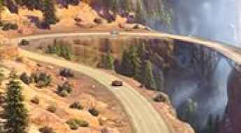
Road Trip Guide: Conquering the Cadillac Range Drive
Located in Radiator Springs, in Carburetor County, in the USA, the Cadillac Range Drive is a very scenic journey. The drive is definitely worth it. A drive not to be missed!
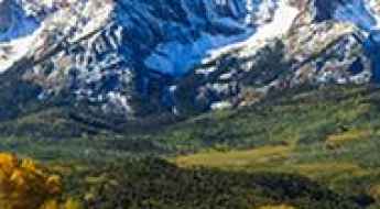
Beyond the Clouds: A Guide to Colorado’s Highest Roads
Colorado is the ultimate high-altitude proving ground in the United States. Dominated by the Rocky Mountains, the state offers a landscape where pristine alpine tundra meets the rugged remains of the 19th-century Gold Rush. For the adventure motorist, Colorado is less about the destination and more about the ascent. This 5-day expedition focuses on the technical climbs and historic trails that define the "Centennial State."
How to get by car to Hancock Lakes in Colorado?
Upper and Lower Hancock Lakes are located in Chaffee County, in the US state of Colorado. The road to the lakes climbs up to 3,556m (11,666ft) above sea level. High-clearance 4-wheel drive recommended.