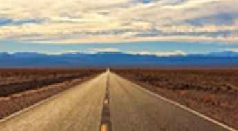
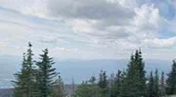
What are the most spectacular roads in the USA?
Located in North America, the USA is a true paradise for drivers, as it hosts more than 2,000 roads listed as the most spectacular in the world.
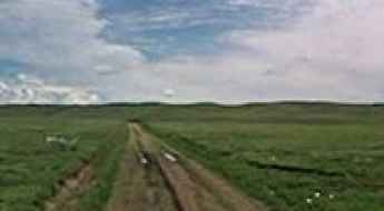
Featuring mountains, deserts, coasts, and snow, in the USA you’ll get your dream road. And you’ll never want to wake up. For instance, at the top of your list, you need to drive the Million Dollar Highway, the most beautiful road in America, and probably in the world. Built in the late 1880s, you'll be on the "outside" for a while with a hell of a view to your right (let the passenger enjoy the view; you'll want to watch the road). Another paved option must be the Iron Mountain Road, featuring 17 miles, 314 curves, 14 switchbacks, 3 pigtails, and 3 tunnels in the Black Hills of South Dakota. No list would be complete without the winding Tail of the Dragon: 318 curves in 11 miles. Spanning Tennessee and North Carolina, it is one of the most scenic drives in the USA. You also can’t skip driving Mount Evans Scenic Byway, the highest paved road in North America, climbing up to 4,310m (14,130ft) in Colorado. It is said to be the highest paved road in North America.
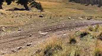
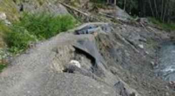
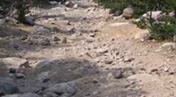
For those who prefer unpaved experiences, the country hosts some of the most defiant yet scenic roads in the world. You can’t miss Black Bear Pass, a high mountain adventure in the Colorado Rockies. Climbing up to 3,915m (12,844ft) above sea level, it's one of the highest roads in Colorado. You can also discover the beauty of Engineer Pass, a mountain pass at an elevation of 3,901m (12,800ft) above sea level in Colorado. It’s mostly a first-gear ride because the road is rough and rocky. The legendary Shafer Trail Road in Utah's Canyonlands National Park is an iconic drive located on the east-central edge of Utah. At times, the road is so narrow that only one car can pass. And Lippincott Mine Road in California is for experienced 4WD drivers using high-clearance vehicles only. You'll need a good map, as the routes are not marked and there are no signs. It’s one of the challenging backcountry roads in Death Valley National Park.
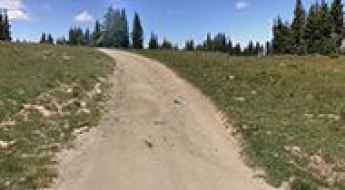
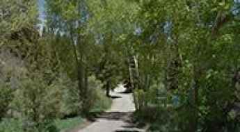
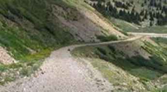
Adventure Along the Scenic Carson-Guler Road in Washington
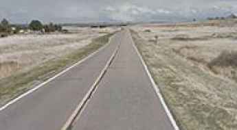
Carson-Guler Road is a very scenic gravel road located in Skamania County, in the U.S. state of Washington.
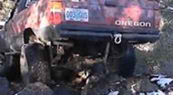
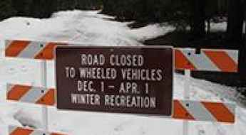
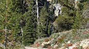
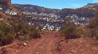
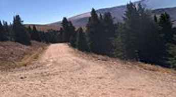
Driving the Breathtaking Rim Butte OHV Jeep Trail in Oregon
Rim Butte OHV Jeep Trail is a very difficult trail with some awesome scenic views, located in Deschutes County, in the U.S. state of Oregon.
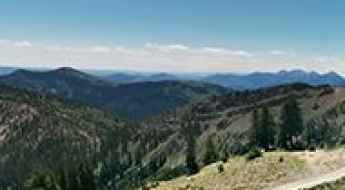
Travel Guide to Dunckley Pass in Northwest Colorado
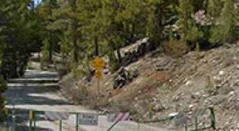
Dunckley Pass is a high mountain pass at an elevation of 2,982m (9,783ft) above sea level, located in Rio Blanco County, in the U.S. state of Colorado.
Firehole Lake Drive in Yellowstone is a scenic road through a thermal area
Located in the Lower Geyser Basin near Fountain Paint Pot, in the US state of Wyoming, Firehole Lake Drive is a one-way road that passes through a thermal area. In 2014, the road was temporarily closed because the ground became too hot, melting the asphalt.
Saddlebag Lake: the highest lake in California that you can drive to
Saddlebag Lake is a high mountain lake at an elevation of 3,091m (10,141ft) above sea level, located in Mono County, in the U.S. state of California. It’s one of the highest roads in California and is said to be the highest drive-to lake in the region.
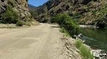
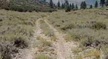
Salmon River Road in Idaho is one of the Best Road Trips in America
Salmon River Road is said to be one of America's Best Road Trips. Located in Lemhi County, in the U.S. state of Idaho, this scenic route follows central Idaho’s largest river north.
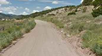
Driving the Scenic Bursum Road in New Mexico
Bursum Road is a stunningly scenic drive located in Catron County, in the U.S. state of New Mexico. Narrow and winding, this road is a single-lane route with occasional turnouts.
A Tricky Scenic Road to Salmo Mountain in Washington
Salmo Mountain is a high mountain peak with an elevation of 2,083m (6,833ft) above sea level, located in Pend Oreille County in the U.S. state of Washington. It’s one of the highest roads in Washington.
What Are California’s Most Dangerous Streets For Cyclists?
Recent analytics from the National Highway Traffic Safety Administration (NHTSA) indicate a critical surge in cyclist fatalities across the United States, with a 25% increase recorded between 2010 and 2018. California, despite its forward-thinking safety initiatives in cities like Davis, remains a high-risk zone. With an average of 139 cyclist fatalities annually, the state faces unique challenges where high-density urban transit intersects with vulnerable road users.
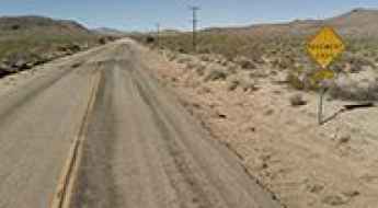
Beef Pasture Gap is One of the Highest Paved Roads in Texas
Beef Pasture Gap is a high mountain pass at an elevation of 1,878 m (6,161 ft) above sea level, located in Jeff Davis County, in the US state of Texas. It's one of the highest roads in Texas.

Otto Mears, a famed Colorado road builder
Born in Estonia and raised in California, Otto Mears emerged as a pivotal entrepreneur, leaving an indelible mark on the development of Southwestern Colorado. His legacy is defined by the construction of over 450 miles of toll roads and railroads, contributing significantly to the region's accessibility, settlement, and mining.
A long rough road to Middle Fork Peak in Idaho
Middle Fork Peak is a high mountain peak at an elevation of 2,767m (9,078ft) above sea level, located in Lemhi County, in the US state of Idaho. It's one of the highest roads in Idaho.
Driving a wild 4x4 road to Mount Ashland in Oregon
Mount Ashland is a high mountain peak at an elevation of 2,284m (7,493ft) above sea level, located in Jackson County, in the U.S. state of Oregon.
A memorable road trip to Bridger Peak in Wyoming
Bridger Peak is a high mountain peak at an elevation of 3,355m (11,007ft) above sea level, located in Carbon County, in the U.S. state of Wyoming. It’s one of the highest roads in Wyoming.
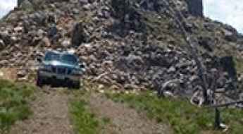
Ultimate 4WD Destination: Scott Mountain in Boise County
Scott Mountain is a high mountain peak at an elevation of 2,491m (8,172ft) above sea level, located in Boise County, in the U.S. state of Idaho.
Driving the road to Hidden Peak in Utah is not a piece of cake
Hidden Peak is a high mountain peak at an elevation of 3,344m (10,971 ft) above sea level, located in Salt Lake County, in the U.S. state of Utah. It’s one of the highest roads in Utah.
Adventure Along Trail Canyon Road in Death Valley NP
Trail Canyon Road is a very exciting desert drive located in Inyo County, in the U.S. state of California. It’s one of the challenging Backcountry roads in the Death Valley National Park.
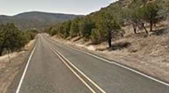
A paved road to the summit of Mitchell Pass in Nebraska
Mitchell Pass is a mountain pass at an elevation of 1,277m (4,189ft) above sea level, located in Scotts Bluff County, in the U.S. state of Nebraska.
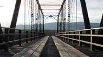
Crossing the historic Costilla Crossing Bridge in Colorado
The historic Costilla Crossing Bridge spanning the Rio Grande is one of the most spectacular bridges in the world. It’s a thacher type truss bridge located in a remote area between Conejos and Costilla counties, in southern Colorado, in the USA.
A memorable road trip to Virginia Lakes in California
Virginia Lakes is the name given to eight pristine alpine lakes in Mono County in the U.S. state of California. A road leads to three of them: Trumbull, Little Virginia, and Big Virginia. Topping out at 2,993m (9,819ft) above sea level, it's one of the highest roads in California.
Driving the scenic Chisos Basin Road in Big Bend NP
Located in the US state of Texas, the Chisos Basin Road is a very scenic drive, featuring sharp curves and switchbacks, through one of America's true hidden gems: Big Bend National Park.
A memorable road trip to Green Mountain in New Mexico
Green Mountain is a high mountain peak at an elevation of 3,407m (11,177ft) above sea level, located in Colfax County, in the U.S. state of New Mexico. The road to the summit is an old logging road and is not well maintained. It’s one of the highest roads in New Mexico.
The Road to Fix It Pass in Utah is Not for the Faint of Heart
Fix It Pass is a high mountain pass at an elevation of 1,899m (6,230ft) above sea level, located in Emery County, in the U.S. state of Utah. The trail has recently become rougher than it was in the past.
Road trip guide: Wind River Pass in Colorado
Wind River Pass is a high mountain pass at an elevation of 2,790m (9,150ft) above sea level, located in Larimer County in the U.S. state of Colorado.
A Memorable Road Trip to Potato Peak in California
Potato Peak is a high mountain peak at an elevation of 3,060m (10,039ft) above sea level, located in Mono County, in the U.S. state of California. It’s one of the highest roads in California.
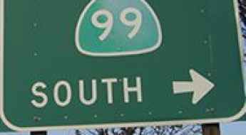
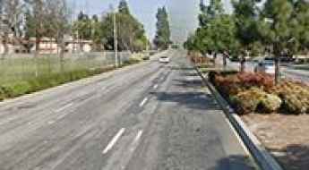
Is Highway 99 In California The Most Dangerous Highway In The United States?
State Route 99 (SR 99), which carves through California’s Central Valley, holds the somber distinction of being ranked as the most dangerous highway in the United States. Despite being shorter than the major Interstates, it leads the nation in fatal accidents per 100 miles. A combination of outdated structural design, insufficient lighting, and high-velocity commercial transit makes this 400-mile stretch a high-consequence environment for any driver.
How to get by car to Mariposa Grove, one of the crown jewels of Yosemite NP?
Located in Mariposa County, in the U.S. state of California, Mariposa Grove Road is a scenic drive leading to Mariposa Grove, the largest sequoia grove in Yosemite and home to more than 500 giant sequoia trees.
Driving the Steep Unpaved Road to Pucker Pass in Utah
Pucker Pass is a high mountain pass at an elevation of 1,783m (5,849ft) above sea level, located in Grand County, in the US state of Utah. The road to the summit is truly dangerous. High-clearance 4WDs are recommended, though any high-clearance vehicle can manage the drive.
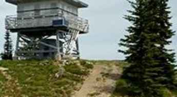
How to get to Libby Flats Observation Area in the Rocky Mountains of Wyoming?
Libby Flats Observation Area is an observation tower at an elevation of 3,313m (10,869ft) above sea level, located in Albany County, in the US state of Wyoming. It's one of the highest roads of Wyoming.
Driving Across High Desert Scenery in California from Goffs to Ivanpah
Located in San Bernardino County, California, the road from Goffs to Ivanpah offers a scenic drive through the breathtaking high desert landscape.
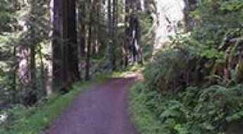
Driving the Narrow and Curvy Cal-Barrel Road in California
Cal-Barrel Road is a very narrow, unpaved road located in Humboldt County in the U.S. state of California. It’s one of the most scenic drives in the Redwood National and State Parks.
Ultimate 4WD Destination: Mosca Pass in Colorado
Mosca Pass is a high mountain peak at an elevation of 3,007 m (9,865 ft) above sea level, located in the U.S. state of Colorado.
What are the most dangerous and technical canyon roads in Malibu?
Beyond the celebrity mansions and sandy beaches of Malibu lies a labyrinth of high-risk canyon roads. Carved into the Santa Monica Mountains, these routes—like the infamous one-way Tuna Canyon or the hairpin-heavy Decker Canyon—are defined by extreme gradients, blind corners, and a total lack of guardrails. This guide explores the 7 most technical drives in Malibu where the Pacific views are as breathtaking as the drops are steep.
A memorable road trip to Mount Sherman in Colorado
Mount Sherman is a high mountain peak located on the boundary between Park and Lake counties, in the U.S. state of Colorado.
Ultimate 4wd destination: Glorieta Baldy in New Mexico
Glorieta Baldy is a high mountain peak at an elevation of 3,096m (10,157ft) above sea level, located in Santa Fe County, in the U.S. state of New Mexico. It’s one of the highest roads in New Mexico.
Travel Guide to the Top of Colorado Mines Peak
Colorado Mines Peak is a high mountain peak at an elevation of 3,812m (12,506ft) above sea level, located in Clear Creek County, in the U.S. state of Colorado. The drive offers amazing views in nearly every direction. It’s one of the highest roads in Colorado.
Driving the unpaved road to Old Red River Pass in New Mexico
Old Red River Pass is a high mountain pass at an elevation of 3,021m (9,911ft) above sea level, located in Taos County, in the US state of New Mexico.
How dangerous is the Pan-American Highway compared to the I-95?
The Pan-American Highway and the I-95 represent two completely different ways to face a dangerous road. While both routes carry infamous death tolls, their traps are fundamentally different. One is a broken network of long roads crossing thick jungles and freezing plains, while the other is the most crowded concrete highway on the U.S. East Coast. Driving these routes requires preparing for either absolute isolation or high-speed urban crashes.
The Wild Road to Blowout Pass in Colorado
Blowout Pass is a high mountain pass at an elevation of 3,590 m (11,779 ft) above sea level, located in Rio Grande County, in the U.S. state of Colorado. The road to the summit is brutally steep, hitting about 12% in gradient.
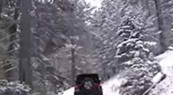
The Dangerous Monte Cristo Road in Washington Was Washed Out Several Years Ago
Monte Cristo Road is a short mountain trail located in eastern Snohomish County in the U.S. state of Washington. The road was washed out several years ago due to the South Fork Sauk River.
Driving the Scenic Battle Ax Road to White Canyon in Arizona
Battle Ax Road is a primitive dirt road located in Pinal County, in the US state of Arizona. It leads to the White Canyon Wilderness area.
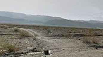
Lemoigne Canyon Road is One of the Gnarliest Drives in Death Valley NP
Lemoigne Canyon Road is an exciting, extremely slow, rocky drive located in Inyo County, in the U.S. state of California. The road features numerous washouts and is often very rocky. It’s one of the most challenging backcountry roads in Death Valley National Park.
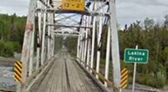
The legend of Lakina River Bridge in Alaska
Located in the Valdez-Cordova Census Area, in the U.S. state of Alaska, the Lakina River Bridge is a significant crossing in the Wrangell-St. Elias National Park and Preserve. It was one of the most spectacular bridges in the world.
A Great Little Curvy Road to Buffalo Pass in Arizona
Buffalo Pass is a high mountain pass at an elevation of 2,610m (8,562ft) above sea level, located in Apache County, in the US state of Arizona.
A Memorable Road Trip to Stunner Pass in Colorado
Stunner Pass is a high mountain pass at an elevation of 3,222m (10,570 ft) above sea level, located in Conejos County in the U.S. state of Colorado.
How to get by car to the lookout at Mount Marston in Montana?
Mount Marston is a high mountain peak at an elevation of 2,238m (7,342ft) above sea level, located in Lincoln County, in the U.S. state of Montana.
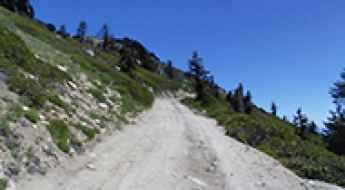
Ultimate 4WD Destination: Upper Summers Meadow in California
Upper Summers Meadow is a high mountain meadow at an elevation of 3,110m (10,203 ft) above sea level, located in Mono County in the U.S. state of California. It’s one of the highest roads in California.
Adventure along the wild road to Cyclone Pass in Wyoming
Cyclone Pass is a high mountain pass at an elevation of 3,212m (10,538ft) above sea level, located in Fremont County, in the U.S. state of Wyoming. It's one of the highest roads in Wyoming.