What are the most spectacular roads in the USA?
Located in North America, the USA is a true paradise for drivers, as it hosts more than 2,000 roads listed as the most spectacular in the world.
Featuring mountains, deserts, coasts, and snow, in the USA you’ll get your dream road. And you’ll never want to wake up. For instance, at the top of your list, you need to drive the Million Dollar Highway, the most beautiful road in America, and probably in the world. Built in the late 1880s, you'll be on the "outside" for a while with a hell of a view to your right (let the passenger enjoy the view; you'll want to watch the road). Another paved option must be the Iron Mountain Road, featuring 17 miles, 314 curves, 14 switchbacks, 3 pigtails, and 3 tunnels in the Black Hills of South Dakota. No list would be complete without the winding Tail of the Dragon: 318 curves in 11 miles. Spanning Tennessee and North Carolina, it is one of the most scenic drives in the USA. You also can’t skip driving Mount Evans Scenic Byway, the highest paved road in North America, climbing up to 4,310m (14,130ft) in Colorado. It is said to be the highest paved road in North America.
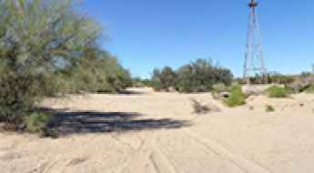
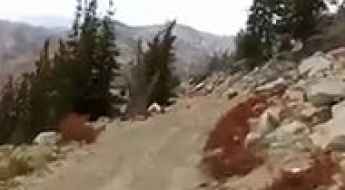
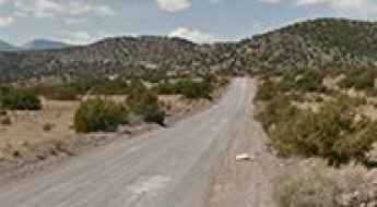
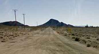
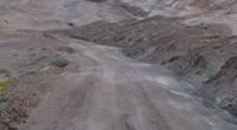
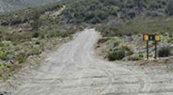
For those who prefer unpaved experiences, the country hosts some of the most defiant yet scenic roads in the world. You can’t miss Black Bear Pass, a high mountain adventure in the Colorado Rockies. Climbing up to 3,915m (12,844ft) above sea level, it's one of the highest roads in Colorado. You can also discover the beauty of Engineer Pass, a mountain pass at an elevation of 3,901m (12,800ft) above sea level in Colorado. It’s mostly a first-gear ride because the road is rough and rocky. The legendary Shafer Trail Road in Utah's Canyonlands National Park is an iconic drive located on the east-central edge of Utah. At times, the road is so narrow that only one car can pass. And Lippincott Mine Road in California is for experienced 4WD drivers using high-clearance vehicles only. You'll need a good map, as the routes are not marked and there are no signs. It’s one of the challenging backcountry roads in Death Valley National Park.
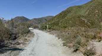
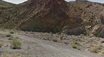
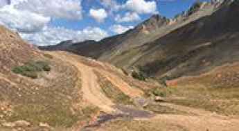
Pleasant Canyon Road is a challenging drive in Death Valley NP
Pleasant Canyon Road/South Park 4x4 Loop is a challenging trail located in Death Valley National Park, in the US state of California. A rough 4WD vehicle is necessary due to washouts and large boulders. This narrow, rocky road is suitable for experienced 4WD drivers only, ranking as one of the challenging Backcountry roads in Death Valley National Park.
The rough and dangerous road to the turquoise Bullion King Lake in Colorado
Bullion King Lake is a high mountain lake at an elevation of 3.832m (12,572ft) above sea level, located in San Juan County, in the US state of Colorado. This trail is well worth the drive; however, it is steep in places and has a limited number of places to pass other vehicles. It's one of the highest roads in Colorado.
The road to Height of Land in Maine, with views of lakes, mountains and forests
Height of Land is a very scenic overlook at an elevation of 685m (2,247ft) above sea level, located in Franklin County, in the US state of Maine.
Travelling through the scenic Wawona Road in California
Wawona Road (Route 41) is a very rewarding journey with stunning views, located in Mariposa County, in the U.S. state of California. It’s a scenic drive with plenty of things to do along the way.
Bradshaw Trail is a soft sand challenge in California
Bradshaw Trail is a maintained road with scenic views, located in Riverside County, in the US state of California. Due to stretches of soft sand, four-wheel-drive vehicles are recommended.
Travel guide to the top of Trinity Mountain in Idaho
Trinity Mountain is a high mountain peak at an elevation of 2.868m (9,409ft) above sea level, located in Elmore County, in the U.S. state of Idaho. The road may be blocked by snow until early July. It’s one of the highest roads in Idaho.
How to get by car to Monjeau Peak in New Mexico?
Monjeau Peak is a high mountain peak at an elevation of 2,927m (9,603ft) above sea level, located in Lincoln County, in the U.S. state of New Mexico.
How to drive to the top of San Antonio Mountain in New Mexico?
San Antonio Mountain is a high mountain peak at an elevation of 3.335m (10,941ft) above sea level, located in Rio Arriba County, in the US state of New Mexico. It’s one of the highest roads in New Mexico.
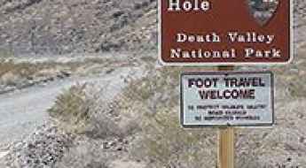
The unpaved road to Devil’s Hole in Nevada
Devil’s Hole is a subaqueous cavern, located in Nye County, in the US state of Nevada, with an eerie legend.
Travel guide to the top of Storm Mountain in Colorado
Storm Mountain is a high mountain peak at an elevation of 3,006m (9,862ft) above sea level, located in Larimer County, in the U.S. state of Colorado.
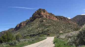
Foote's Crossing Road in California is one of America's most spectacular mountain drives
Foote's Crossing Road is a very scenic drive straddling Nevada and Sierra counties in the U.S. state of California. The road is narrow, steep, twisting and potentially hazardous as it winds through the Tahoe National Forest.
The road to Thompson Pass, the snowiest place in Alaska
Thompson Pass is a mountain pass at an elevation of 841m (2,759ft) above sea level, located in Valdez–Cordova Census Area, in the US state of Alaska.
Adventure along Lytle Creek Road in California
Lytle Creek Road is a short mountain road located in San Bernardino County, in the U.S. state of California.
Hole in the Wall Road is a memorable trip in Death Valley National Park
Hole in the Wall Road is a very scenic drive located in Inyo County, in the U.S. state of California. It’s one of the most challenging backcountry roads in Death Valley National Park.
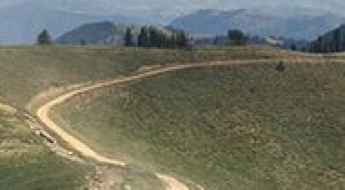
Patchwork Parkway in Utah is one of the most scenic drives in America
Located in the heart of Utah’s southwest, the Patchwork Parkway is one of the most scenic drives in America. The road connects Heritage Highway 89 and Scenic Byway 12, following a 51 mile long course that rises from 6,000 feet on the western slope to elevations over 10,000 feet on a majestic plateau, and eventually descends again to 6,500 feet along the eastern slope.
The paved road to Lost Trail Pass on the Montana-Idaho border
Lost Trail Pass is a high mountain pass at an elevation of 2.143m (7,030ft) above sea level, located on the border between Idaho and Montana, in the northwestern United States.
A narrow road to Twin Peaks South: pray you don't meet someone coming the other way
Twin Peaks South is a high mountain peak at an elevation of 3.154m (10,347ft) above sea level located in the U.S. state of Idaho. It’s one of the highest roads in Idaho.
A paved road to Trout Creek Pass in the Rocky Mountains
Trout Creek Pass is a high mountain pass at an elevation of 2.896m (9,501ft) above sea level, located in the US state of Colorado.
A paved road to the poisonous Horseshoe Lake in California
Horseshoe Lake is a high mountain lake at an elevation of 2,742 meters (8,996 feet) above sea level, located in Mono County, in the US state of California. It is known for its hazardous conditions due to high levels of carbon dioxide (CO₂) seeping from the ground. Warnings about CO₂ exposure are posted in the area.
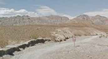
How to get to Chloride City in Death Valley by car?
Chloride City is a ghost town located in Inyo County, in the US state of California. It’s one of the challenging backcountry roads in the Death Valley National Park.
Ultimate 4wd destination: Logan Peak in Utah
Logan Peak is a high mountain peak at an elevation of 2.964m (9,724ft) above sea level, located in Cache County, in the US state of Utah.
Road trip guide: Conquering Goose Lake in Montana
Goose Lake is a pair of high mountain lakes at an elevation of 3.021m (9,911ft) above sea level, located in Park County, in the U.S. state of Montana. It’s one of the highest roads in Montana.
A challenging paved road to Onyx Summit in California
Onyx Summit is a high mountain pass at an elevation of 2,579m (8,461ft) above sea level, located in San Bernardino County, in the US state of California.
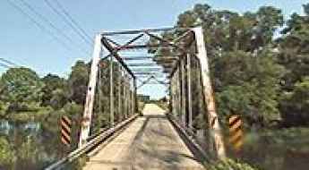
Travelling through the haunted Dyreson Road Bridge
Located in Dane County, in the US state of Wisconsin, the Dyreson Road Bridge is one of the most spectacular bridges in the world.
The Ultimate Guide to Traveling the Polihale Ridge Road of Hawaii
Polihale Ridge Road is a very scenic drive located in Kauaʻi County, in the US state of Hawaiʻi.
Driving the paved Scotty's Castle Road in Death Valley NP
Scotty's Castle Road is a scenic drive located in the desolate northern section of Death Valley National Park, in the US state of California, and it provides access to Scotty’s Castle historic house museum.
Adventure along the wild road to Apache Pass in Arizona
Apache Pass is a high mountain pass at an elevation of 1.563m (5,127ft) above sea level, located in Cochise County, in the U.S. state of Arizona.
Glacier Point Road is the most scenic drive in Yosemite NP
Located in Mariposa County in the U.S. state of California, Glacier Point Road is the most scenic drive in Yosemite National Park. It’s one of the world's most scenic drives.
How To Travel The 31 Mile Road in New Mexico
31 Mile Road is a scenic mountain drive located on the boundary between Rio Arriba and Sandoval counties, in the US state of New Mexico. It’s one of the highest roads in New Mexico.
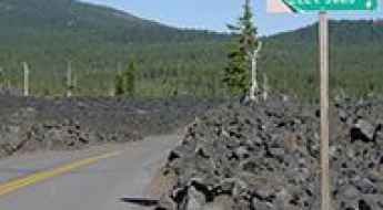
The Road to Hat Point is the Scariest Drive in Oregon
Hat Point is an overlook located in Wallowa County, in the U.S. state of Oregon, at an elevation of 2,130m (6,988ft) above sea level. This is a journey that some will never attempt again because it frightened them so much: there are steep drop-offs and a very narrow road.
CanAm Highway is a sensational drive from Mexico to Canada through the USA
The Canadian-American (CanAm) Highway is an international highway running south-north from Mexico to Canada through the United States.
Driving Mountain Springs Road through the Mojave Desert
Mountain Springs Road is a mountain road located in San Bernardino County, in the U.S. state of California.
The Ultimate Guide to Traveling the Caineville Wash Road in Cathedral Valley
Caineville Wash Road is a highly scenic trail located in Wayne County, in the U.S. state of Utah. A high-clearance vehicle is required, but a 4x4 might be necessary.
Dare to drive the challenging road to Kendall Peak in Colorado
Kendall Peak is a high mountain peak at an elevation of 3.895m (12,778ft) above sea level, located in San Juan County, in the US state of Colorado. The road to the summit is precarious, offering the best in drop-offs and a boulder-lined roadbed. It's one of the highest roads in Colorado.
Driving the tough Dishpan Springs Trail in San Bernardino NF
Dishpan Springs Trail is a short but demanding off-road challenge located in San Bernardino County, in the U.S. state of California.
The Ultimate Road Trip To Flat Iron Mesa in Carbon County
Flat Iron Mesa is a high mountain peak at an elevation of 2.171m (7,122ft) above sea level, located in Carbon County, in the US state of Utah.
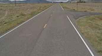
Taking on the Twists and Turns to McKenzie Pass in Oregon
McKenzie Pass is a high mountain pass at an elevation of 1,623m (5,335ft) above sea level, located on the boundary between Linn and Deschutes counties in the US state of Oregon.
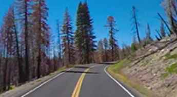
Lassen Volcanic National Highway is a scenic drive in California
Lassen Volcanic National Highway is a scenic drive located within the Lassen Volcanic National Park, in the U.S. state of California. The road, snaking across the western side of the park between the Southwest and Manzanita Lake Entrances, takes the driver near the major volcanic features.
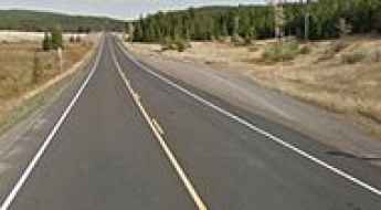
A memorable road trip to North Pass in Colorado
North Pass is a high mountain pass at an elevation of 3,100 meters (10,170 feet) above sea level, located in Saguache County, in the U.S. state of Colorado.
A Paved Road to Marias Pass in Glacier National Park
Marias Pass is a high mountain pass at an elevation of 1,602 meters (5,255 feet) above sea level, located in the US state of Montana. It is one of the lowest and most accessible passes over the Continental Divide in the United States, making it an important transportation corridor.
The Ultimate Guide to Lake Como in San Juan County
Lake Como is a high mountain lake at an elevation of 3,755m (12,319ft) above sea level, located in San Juan County in the U.S. state of Colorado. It’s one of the highest roads in Colorado.
Driving the wild Sheep Creek Truck Trail in California
Sheep Creek Truck Trail is a scenic mountain road located in San Bernardino County, in the US state of California.
A remote road to the scenic Adams Lake in Colorado
Adams Lake is a scenic high mountain lake at an elevation of 3.314m (10,872ft) above sea level, located in Garfield County, in the U.S. state of Colorado. The remote location and steep climb to the lake keep traffic to a minimum.
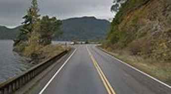
The Ultimate Guide to Traveling the Lake Crescent Highway in Washington
Located in Clallam County, in the US state of Washington, Lake Crescent Highway is one of the most scenic coastal drives in the world. The road runs along the southern shore of Lake Crescent.
A gravel road to the historic Mullan Pass in Montana
Mullan Pass is a high mountain pass at an elevation of 1,799 m (5,902 ft) above sea level, located on the boundary between Powell and Lewis and Clark counties in the US state of Montana.
How to get to Baker Lake in Washington by car?
Baker Lake is a pristine sub-alpine lake located in the US state of Washington. The lake and its surroundings are home to diverse wildlife, including black bears, deer, eagles, and various bird species.
Driving the wild 4x4 road to Cloverdale Mine in Colorado
Cloverdale Mine is an abandoned gold mine at an elevation of 3,497m (11,473ft) above sea level, located in Custer County, in the US state of Colorado. This trail is truly breathtaking.
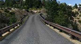
Crossing the Hell's Backbone Bridge of Utah
Located in Garfield County, in southern Utah, in the USA, Hell's Backbone Bridge is one of the most spectacular bridges in the world.