What are the most spectacular roads in the USA?
Located in North America, the USA is a true paradise for drivers, as it hosts more than 2,000 roads listed as the most spectacular in the world.
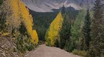
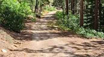
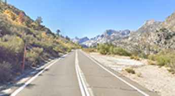
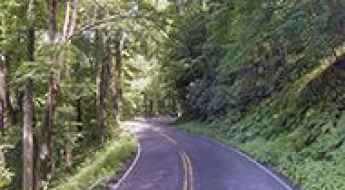
Featuring mountains, deserts, coasts, and snow, in the USA you’ll get your dream road. And you’ll never want to wake up. For instance, at the top of your list, you need to drive the Million Dollar Highway, the most beautiful road in America, and probably in the world. Built in the late 1880s, you'll be on the "outside" for a while with a hell of a view to your right (let the passenger enjoy the view; you'll want to watch the road). Another paved option must be the Iron Mountain Road, featuring 17 miles, 314 curves, 14 switchbacks, 3 pigtails, and 3 tunnels in the Black Hills of South Dakota. No list would be complete without the winding Tail of the Dragon: 318 curves in 11 miles. Spanning Tennessee and North Carolina, it is one of the most scenic drives in the USA. You also can’t skip driving Mount Evans Scenic Byway, the highest paved road in North America, climbing up to 4,310m (14,130ft) in Colorado. It is said to be the highest paved road in North America.
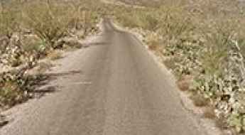
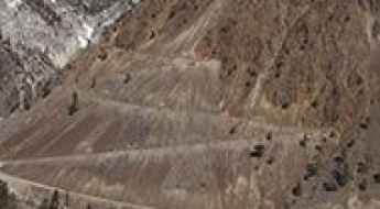
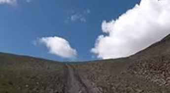
For those who prefer unpaved experiences, the country hosts some of the most defiant yet scenic roads in the world. You can’t miss Black Bear Pass, a high mountain adventure in the Colorado Rockies. Climbing up to 3,915m (12,844ft) above sea level, it's one of the highest roads in Colorado. You can also discover the beauty of Engineer Pass, a mountain pass at an elevation of 3,901m (12,800ft) above sea level in Colorado. It’s mostly a first-gear ride because the road is rough and rocky. The legendary Shafer Trail Road in Utah's Canyonlands National Park is an iconic drive located on the east-central edge of Utah. At times, the road is so narrow that only one car can pass. And Lippincott Mine Road in California is for experienced 4WD drivers using high-clearance vehicles only. You'll need a good map, as the routes are not marked and there are no signs. It’s one of the challenging backcountry roads in Death Valley National Park.
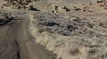
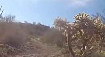
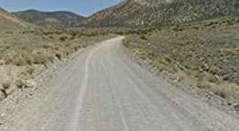
A steep unpaved road to the summit of Peavine Peak in Nevada
Peavine Peak is a high mountain peak at an elevation of 2.517m (8,257ft) above sea level, located in Washoe County, in the U.S. state of Nevada.
The road to American Basin in Colorado is not for the faint of heart
American Basin is a high alpine basin located in Hinsdale County, in the U.S. state of Colorado. Be aware of high altitude sickness, which can be life-threatening.
A memorable road trip to Velocity Basin in Colorado
Velocity Basin is a cirque basin with a small turquoise lake at its base, at an elevation of 3.449m (11,315ft) above sea level, located in San Juan County, in the U.S. state of Colorado.
How To Have The Ultimate Road Trip To Bluebell Knoll in Utah
Bluebell Knoll is a high mountain peak at an elevation of 3.449m (11,317ft) above sea level, located in Wayne County, in the US state of Utah. It’s one of the highest roads in Utah.
Travel guide to the top of La Sal Pass in Utah
La Sal Pass is a high mountain pass at an elevation of 3,093m (10,147ft) above sea level, located in San Juan County, in the US state of Utah.

A Man with No Face in Green Man Tunnel of Pennsylvania
Green Man Tunnel is located in South Park Township, in the US state of Pennsylvania. Locals believe that a man with no face used to walk through this tunnel in the middle of the night. The Green Man is said to have been an electrical worker who was in an accident that melted his face and killed him. His ghost has subsequently been seen near the site of the accident.
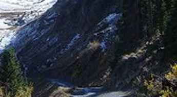
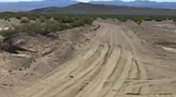
How to Drive the Rocky Gap Road in Nevada
Rocky Gap Road is an extremely rugged backcountry road located in Clark County, in the U.S. state of Nevada. The road is rocky and rough in many areas where it has been washed out. The middle portion of the route can present some challenges.
A hairy scenic road to Steptoe Butte in Washington
Steptoe Butte is an isolated hill at an elevation of 1.101m (3,612ft) above sea level, located in Whitman County, in the US state of Washington.
Pilot Rock Truck Trail is a scenic drive high above Silverwood Lake in California
Pilot Rock OHV Road 2N33 is a roughly graded road located in San Bernardino County, in the U.S. state of California.
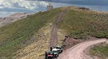
An epic enthralling 4x4 road to Whiskey Pass in Colorado
Whiskey Pass is a high mountain pass at an elevation of 3.546m (11,633ft) above sea level, located in Costilla County, in the US state of Colorado.
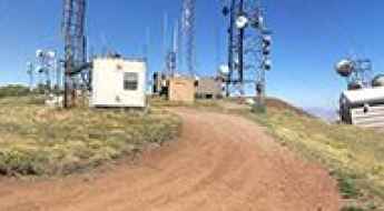
How to Get to Greens Peak in Arizona by Car?
Greens Peak is an extinct cinder-cone volcano at an elevation of 3,091m (10,141ft) above sea level, located in Apache County, in the U.S. state of Arizona. It's one of the highest roads in Arizona.
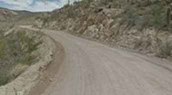
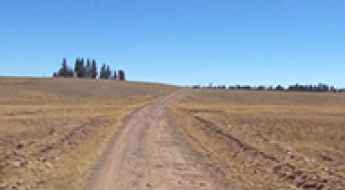
28 miles of uplift to Redington Pass in Arizon
Redington Pass is a mountain pass at an elevation of 1.314m (4,311ft) above sea level, located in Pima County, in the U.S. state of Arizona. The route to the summit has been in existence for hundreds of years.
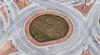
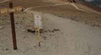
The most dangerous intersection in every US state
Every state has at least one intersection that plays host to more accidents and close calls than all the rest. Time Magazine looked at data from the National Highway Traffic Safety Administration to determine the most dangerous intersection in each US state.
A narrow unpaved road to Devil Mountain in Colorado
Devil Mountain is a high mountain peak at an elevation of 3,026 m (9,927 ft) above sea level, located in Archuleta County, in the U.S. state of Colorado.
A scenic paved road to Tenderfoot Pass in Colorado
Tenderfoot Pass is a high mountain pass at an elevation of 3.124m (10,249ft) above sea level, located in Teller County, in the U.S. state of Colorado.
Road trip guide: Conquering Bountiful Peak in Utah
Bountiful Peak is a high mountain peak at an elevation of 2.787m (9,143ft) above sea level, located in Davis County, in the U.S. state of Utah.
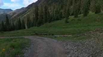
A memorable road trip to Paradise Basin in Colorado
Paradise Basin is a high mountain basin at an elevation of 3.447m (11,309ft) above sea level located in Gunnison County, in the US state of Colorado. It’s an easy drive near the summit of Schofield Pass.
Cactus Forest Drive is a scenic road in Saguaro NP
Cactus Forest Scenic Loop Drive is a one-way paved loop road located in Pima County, in the US state of Arizona.
MacDonald Pass is a scenic drive through the Rocky Mountains in Montana
MacDonald Pass is a high mountain pass at an elevation of 1.930m (6,332ft) above sea level, located in the U.S. state of Montana.
The Wild Road to Jelm Mountain in Wyoming
Jelm Mountain is a high mountain peak at an elevation of 2.948m (9,671ft) above sea level located in Albany County, in the US state of Wyoming.
Driving the Paved Ross Maxwell Scenic Drive in Big Bend NP
Located in West Texas, in the USA, the Ross Maxwell Scenic Drive is a wonderful journey through one of America's true hidden gems: Big Bend National Park, winding along the Rio Grande.
The intimidating road to Mammoth Mountain in California
Mammoth Mountain is a high mountain peak at an elevation of 3.364m (11,036ft) above sea level, located in Madera County, in the U.S. state of California. It’s one of the highest roads in California.
How to get by car to Alma, the highest town in North America?
Located in Park County, in the US state of Colorado, Alma is the highest incorporated town in North America at an elevation of 3.224m (10,578ft) above sea level. It’s one of the highest towns on Earth accessible by car.
Ultimate 4wd destination: Alpine Plateau in Colorado
Alpine Plateau is a high mountain plateau at an elevation of 3.516m (11,535ft) above sea level, located in Gunnison County, in the U.S. state of Colorado.

Driving in Atlanta: 6 Tips for Tourists
Anyone who has ever driven in or through a big city knows that it can be an agonizingly slow and possibly confusing experience that has the potential to drive you to sell your car and cut up your driver's license. Well, when driving in Atlanta, this kind of experience is… exactly what you can expect. While no amount of tips are going to make driving through Atlanta an enjoyable, relaxing experience, hopefully, they can at least minimize the madness.
Drive the dusty yet scenic Cathedral Valley Driving Loop Tour in Utah
Cathedral Valley Driving Loop Tour is a very scenic drive located in Wayne County, in the US state of Utah. It is usually accessible to most cars with high clearance but 4WD is recommended. It’s one of the best drives in Capitol Reef National Park.
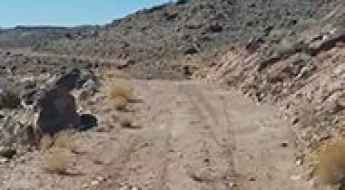
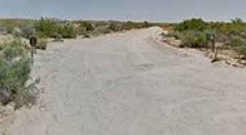
How to Travel the Owl Hole Spring Road in Death Valley NP
Owl Hole Spring Road is an exciting desert drive located in San Bernardino County, in the US state of California. It is one of the most remote locations in the park and one of the challenging backcountry roads in Death Valley National Park.
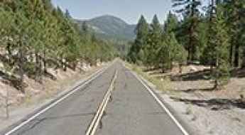
A Scenic Paved Road to Luther Pass in California
Luther Pass is a high mountain pass at an elevation of 2,364 m (7,755 ft) above sea level, located in the U.S. state of California.

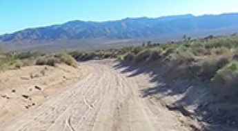
The Wild Road to Deadman Pass in Death Valley NP
Deadman Pass is a mountain pass at an elevation of 996 m (3,267 ft) above sea level, located in Inyo County, in the U.S. state of California. It’s one of the challenging Backcountry roads in Death Valley National Park.
Hardscrabble Pass in Colorado is an absolute must for road lovers
Hardscrabble Pass is a high mountain pass at an elevation of 2.773m (9,097ft) above sea level, located in Custer County, in the U.S. state of Colorado.

Driving the Scenic Deer Creek Road in California Will Take Your Breath Away
Located in Ventura County in the US state of California, Deer Creek Road is one of the Top Scenic Drives in Malibu. The road is very steep (up to 12%), and the heights may give you a sense of vertigo.
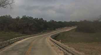
Driving the floodable Rebecca Creek Road in Texas
Rebecca Creek Road is a short paved road located on the Edwards Plateau in the U.S. state of Texas. The road features a river crossing which floods during storm season.
Dare to drive to Rogers Peak in California
Rogers Peak is a high mountain peak at an elevation of 3.049m (10,003ft) above sea level, located in Inyo County, in the US state of California. 4WD might be necessary beyond Thorndike Campground due to steep sections and ruts. No RVs or trailers. Expect snow and ice during winter and spring. It's one of the highest roads in California.
A memorable road trip to Mount Brigham in Utah
Mount Brigham is a high mountain peak at an elevation of 3.559m (11,676ft) above sea level located in Piute County, in the US state of Utah. It’s one of the highest roads in Utah.
Conquering the Pinkham Canyon-Thermal Canyon Road in California
The Pinkham Canyon-Thermal Canyon Road is a very scenic drive located in Riverside County, in the US state of California. It’s one of the most famous backcountry roads in the Joshua Tree National Park.
Discovering the scenic Geology Tour Road in Joshua Tree NP
The Geology Tour Road is a very scenic drive located in Riverside County, in the U.S. state of California. The road leads through one of Joshua Tree National Park's most fascinating landscapes, where the forces of erosion, earthquakes and ancient volcanoes have played out in stunning splendor.
How to get by car to Lake Sabrina in California?
Lake Sabrina is a high mountain lake at an elevation of 2,796 m (9,173 ft) above sea level, located in Inyo County, in the U.S. state of California. It’s one of the highest roads in California.
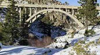
The iconic Donner Summit Bridge in California
Located in Nevada County, in the US state of Califnornia, Donner Summit Bridge is one of the most spectacular bridges in the world.
The Wild Road to Ptarmigan Pass in the Sawatch Range of Colorado
Ptarmigan Pass is a high mountain pass at an elevation of 3.352m (11,777ft) above sea level, located on the boundary between Summit and Eagle counties in the US state of Colorado.
Driving the Wild Red Rock Pass on the Idaho-Montana Border
Red Rock Pass is a high mountain pass at an elevation of 2,180m (7,152ft) above sea level, located on the border of Idaho and Montana, in the USA.
Driving the Scenic Yet Defiant "Redneck Dragon" (Route 32 South) in Tennessee
Route 32 South is a very scenic yet defiant road located in Cocke County, in the U.S. state of Tennessee. This drive is definitely not for beginners, as it features hundreds of turns that demand focus and skill.

A scenic unpaved road to Crooked Creek Pass in Colorado
Crooked Creek Pass is a high mountain pass at an elevation of 3,051 m (10,010 ft) above sea level, located in Eagle County, in the U.S. state of Colorado.
A sensational road to Louis Lake in Wyoming
Louis Lake is a high mountain lake at an elevation of 2,617 m (8,585 ft) above sea level, located in Fremont County, in the U.S. state of Wyoming.
An old mining road to Mount Morgan in California
Mount Morgan is a high mountain peak located in Inyo County, in the US state of California. A gravel road near the summit climbs up to 3.619m (11,873ft) above sea level. It’s one of the highest roads in California.

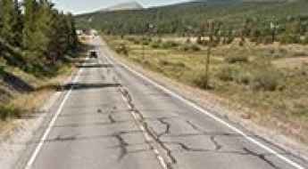
Interstate 40: The Deadliest Highway Corridor in Tennessee
In Tennessee, drivers travel nearly seven billion vehicle miles annually along the state’s extensive road network. Major arteries like Interstate 65, Interstate 24, and Interstate 40 account for 750 miles of critical infrastructure, serving millions of local and transcontinental travelers every year.

How to Manage the Chicago’s Winter Roads?
Navigating Chicago’s metropolitan road network during the winter season requires advanced technical preparation and an understanding of the specific meteorological phenomena of the Great Lakes region. The combination of lake-effect snow, extreme thermal drops, and high-volume traffic on corridors like the Kennedy Expressway (I-90) creates a high-risk environment. Successful transit depends on vehicle preparation, understanding chemical de-icing limitations, and managing traction on high-speed urban arteries.
Ultimate 4WD Destination: Napoleon Pass in Colorado
Napoleon Pass is a high mountain pass at an elevation of 3,668m (12,034ft) above sea level, located in Gunnison County, in the U.S. state of Colorado, with multiple creek crossings. It’s one of the highest roads in Colorado.
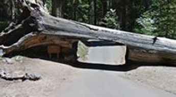
Crescent Meadow Road in California: Where You Can Drive Through a Giant Tree
Crescent Meadow Road is a paved narrow mountain road located in Tulare County, in the U.S. state of California.