What are the most spectacular roads in the USA?
Located in North America, the USA is a true paradise for drivers, as it hosts more than 2,000 roads listed as the most spectacular in the world.
Featuring mountains, deserts, coasts, and snow, in the USA you’ll get your dream road. And you’ll never want to wake up. For instance, at the top of your list, you need to drive the Million Dollar Highway, the most beautiful road in America, and probably in the world. Built in the late 1880s, you'll be on the "outside" for a while with a hell of a view to your right (let the passenger enjoy the view; you'll want to watch the road). Another paved option must be the Iron Mountain Road, featuring 17 miles, 314 curves, 14 switchbacks, 3 pigtails, and 3 tunnels in the Black Hills of South Dakota. No list would be complete without the winding Tail of the Dragon: 318 curves in 11 miles. Spanning Tennessee and North Carolina, it is one of the most scenic drives in the USA. You also can’t skip driving Mount Evans Scenic Byway, the highest paved road in North America, climbing up to 4,310m (14,130ft) in Colorado. It is said to be the highest paved road in North America.
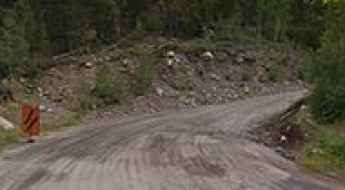
For those who prefer unpaved experiences, the country hosts some of the most defiant yet scenic roads in the world. You can’t miss Black Bear Pass, a high mountain adventure in the Colorado Rockies. Climbing up to 3,915m (12,844ft) above sea level, it's one of the highest roads in Colorado. You can also discover the beauty of Engineer Pass, a mountain pass at an elevation of 3,901m (12,800ft) above sea level in Colorado. It’s mostly a first-gear ride because the road is rough and rocky. The legendary Shafer Trail Road in Utah's Canyonlands National Park is an iconic drive located on the east-central edge of Utah. At times, the road is so narrow that only one car can pass. And Lippincott Mine Road in California is for experienced 4WD drivers using high-clearance vehicles only. You'll need a good map, as the routes are not marked and there are no signs. It’s one of the challenging backcountry roads in Death Valley National Park.
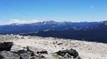
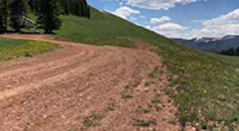
Grayback Mountain is a truly outstanding 4x4 adventure in Colorado
Grayback Mountain is a high mountain peak with an elevation of 3,853 m (12,641 ft) above sea level, located in Rio Grande County, in the U.S. state of Colorado. It’s one of the highest roads in Colorado, offering great views of the surrounding mountains.
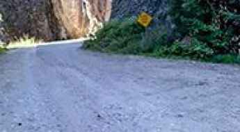
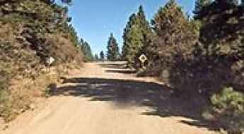
The Ultimate Guide to Traveling the South Willow Canyon Road in Utah
South Willow Canyon Road is a very scenic drive in Tooele County, in the US state of Utah. The road is mostly paved but becomes gravel at the National Forest boundary, and winds through some very interesting narrows.
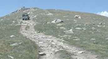
A very bumpy, grueling road to North Twin Cone Peak in Colorado
North Twin Cone Peak is a high mountain peak at an elevation of 3.759m (12,332ft) above sea level, located in Park County, in the U.S. state of Colorado. It’s one of the highest roads in Colorado.
Ultimate 4WD Destination: Leviathan Peak in California
Leviathan Peak is a high mountain peak with an elevation of 2,732m (8,963ft) above sea level, located in Alpine County, in the U.S. state of California. The views from the summit are impressively remote.
Driving the Paved Road to Cuchara Pass in Colorado
Cuchara Pass is a high mountain pass at an elevation of 3,036m (9,960ft) above sea level, located in the US state of Colorado.
Phon D Sutton Trail in Arizona is an Adventure Track You Will Never Forget
Phon D Sutton Trail is a very scenic road located in Maricopa County, in the U.S. state of Arizona.
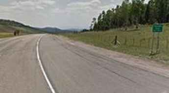
The Ultimate Guide to Traveling the historic Sangre de Cristo Pass of Colorado
Sangre de Cristo Pass is a high mountain pass at an elevation of 2.886m (9,468ft) above sea level, located in the US state of Colorado.

Mountain Waters Scenic Byway in North Carolina is a must if you love waterfalls
Mountain Waters Scenic Byway is a very scenic winding mountain road located in the US state of North Carolina, running through the forest and by rivers and lakes, two river gorges, hardwood forests and countryside vistas.
A paved road to Signal Mountain in Grand Teton NP
Signal Mountain is a high mountain peak at an elevation of 2,355m (7,726ft) above sea level, located in Teton County, in the U.S. state of Wyoming.
A Rough 4x4 Road to Sundance Mountain in Idaho
Sundance Mountain is a high mountain peak at an elevation of 1,914m (6,279ft) above sea level, located in Bonner County, in the U.S. state of Idaho. The summit is accessible by high-clearance 4x4 vehicles during the summer. It was the site of a devastating wildfire caused by lightning in August 1967, which claimed two lives.
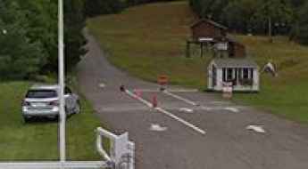
How to Drive the Ice Road to Nuiqsut in Alaska?
Nuiqsut is a small village located on the Colville River Delta, in North Slope Borough, in the U.S. state of Alaska.
A road with lakes, mountains and meadows to Ripple Creek Pass in Colorado
Ripple Creek Pass is a high mountain pass at an elevation of 3,158 meters (10,360 feet) above sea level, located in Rio Blanco County, in the U.S. state of Colorado.
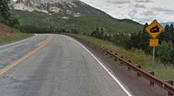
A 5-star road to Tennessee Pass in Colorado
Tennessee Pass is a high mountain pass with an elevation of 3,183m (10,442ft) located in the U.S. state of Colorado.

The Ultimate Guide to Traveling the Virginia Cascade Drive in Wyoming
Virginia Cascade Drive is a highly scenic route in the heart of Yellowstone National Park, Wyoming. The road provides access to the north side of the Virginia Cascades, a 60 ft (18 m) waterfall on the Gibbon River.
Kenosha Pass, a 5 stars road in the Rocky Mountains
Kenosha Pass is a high mountain pass at an elevation of 3.054m (10,019ft) above the sea level, located in Park County, in the U.S. state of Colorado.
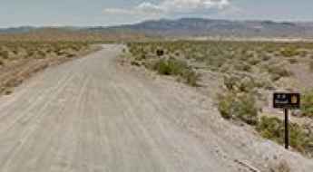
How To Travel The 8 Mile Road in Nevada
8 Mile Road is a very scenic sandy drive leading to Lake Mead, a big reservoir on the Colorado River, located in Clark County, in the U.S. state of Nevada.
Aiken Mine Road: Otherworldly Landscapes of Basalt Flows in California
Aiken Mine Road is an old mining track located in the Mojave Desert of the U.S. state of California. 4x4 vehicles are recommended.

A long and bumpy trail to Billings Lake in Colorado
Billings Lake is a shallow lake at an elevation of 3.594m (11,791ft) above sea level, located in Chaffee County, in the U.S. state of Colorado.
Driving the iconic road to Minaret Summit in Sierra Nevada
Minaret Summit is a high mountain pass at an elevation of 2,824m (9,265ft) above sea level, located in the U.S. state of California. It's one of the highest roads in California.

The road to Wheeler Lake in Colorado is not for the faint of heart
Wheeler Lake is a high mountain lake at an elevation of 3,717m (12,194ft) above sea level, located in Park County, in the U.S. state of Colorado. It’s one of the highest roads in Colorado and a difficult 4×4 trail.
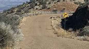
Ultimate 4WD Destination: Hardscrabble Mountain in Colorado
Hardscrabble Mountain is a high mountain pass at an elevation of 3,261m (10,698ft) above sea level, located in Eagle County, in the U.S. state of Colorado.
How to Get by Car to Kitt Peak in Arizona?
Kitt Peak is a high mountain peak at an elevation of 2,082m (6,830ft) above sea level, located in Pima County, in the U.S. state of Arizona.
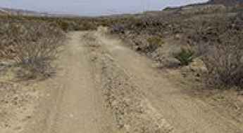
Primitive Dirt Roads in Big Bend National Park
Located in southwest Texas, on the U.S.-Mexico border, the Big Bend National Park is one of the most popular vacation destinations in the state. Scenic vistas, diverse wildlife, and historic siteswhere night skies are dark as coal and rivers carve temple-like canyons in ancient limestone. This remote park features rugged mountains, steep canyons, amazing views, unparalleled night skies, and solitude in a high desert setting.

Ultimate 4WD Destination: Trinchera Peak in Colorado
Trinchera Peak is a high mountain peak at an elevation of 3,860 m (12,664 ft) above sea level, located in the U.S. state of Colorado. It’s one of the highest roads in Colorado.

Road Trip Guide: Conquering Mount Spokane in Washington
Mount Spokane is a high mountain peak at an elevation of 1,785m (5,856ft) above sea level, located in Spokane County, in the U.S. state of Washington.

Rainy Pass is one of Washington State's most dramatic roads
Rainy Pass is a high mountain pass at an elevation of 1.486m (4,875ft) above sea level, located on the boundary between Chelan and Okanogan counties, in the U.S. state of Washington.
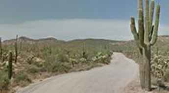
El Camino del Diablo: A Remote Drive in Arizona
El Camino del Diablo ("The Devil's Highway") offers an exciting and historic journey through the Sonoran Desert in Arizona, running close to the Mexican border. This route is suited only for those well-experienced in backcountry travel.
Beckwourth Pass is the Lowest Pass in the Sierra Nevada
Beckwourth Pass is a high mountain pass at an elevation of 1,591m (5,221ft) above sea level, located in the U.S. state of California.
The unpaved road to Fandango Pass in California
Fandango Pass is a high mountain pass at an elevation of 1,879 m (6,164 ft) above sea level, located in Modoc County, in the U.S. state of California.

A Brutal but Stunning Road to Santa Fe Peak in Colorado
Santa Fe Peak is a high mountain peak at an elevation of 4,008m (13,149ft) above sea level, located in Summit County, in the U.S. state of Colorado. The road to the summit may be intimidating for novice drivers. It’s one of the highest roads in Colorado.
The Old Mine Road to Red Mountain Number 3 in Colorado is Not for the Faint of Heart
Red Mountain Number 3 is a high mountain peak with an elevation of 3,932m (12,900ft) above sea level, located in San Juan County, in the U.S. state of Colorado. It’s one of the highest roads in Colorado.

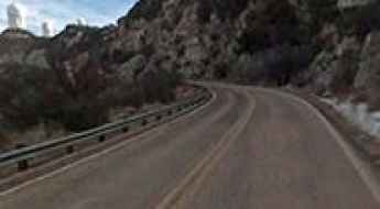
A Paved Road to Raynolds Pass on the Montana-Idaho Border
Raynolds Pass is a high mountain pass at an elevation of 2,086m (6,844ft) above sea level, located on the Montana-Idaho border in the USA.

Steese Highway in Alaska: The Road That Has it All
Steese Highway is a very scenic drive with unforgettable sights and natural wonders, located in the U.S. state of Alaska, running from Fairbanks to Circle.
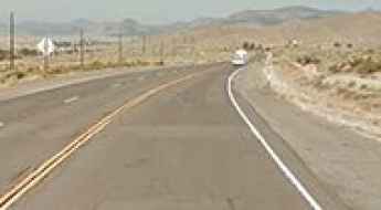
A Brutal and Remote Steep Road to Eagle Peak in Texas
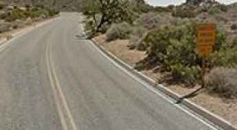
Eagle Peak is a high mountain peak at an elevation of 2,281m (7,484ft) above sea level, located in Hudspeth County, in the US state of Texas. The climb is brutal, with an average gradient of 11.72%. It's one of the highest roads in Texas.
Ultimate 4WD Destination: Seafoam Lake in Idaho
Seafoam Lake is a pair of high mountain lakes at an elevation of 2,474m (8,116ft) above sea level, located in Custer County, in the U.S. state of Idaho.

Traversing the Quarter Circle Bridge
Located in the Glacier National Park of Montana, United States, the Quarter Circle Bridge is a wood bridge where McDonald Creek merges with the Middle Fork Flathead River. It’s one of the most spectacular bridges in the world.

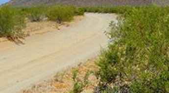
How to Travel the Scenic Glenn Springs Road in Big Bend NP?
Glenn Springs Road is a scenic trail located in Brewster County, in the western part of the U.S. state of Texas. The road provides access to the small town of Glenn Springs, which was abandoned around 1920.
A 4x4 Road to Tip Top, an Abandoned Ghost Town in Arizona
Tip Top is an abandoned ghost town located in Yavapai County in the U.S. state of Arizona. The road to this quiet town requires a 4-wheel drive vehicle in good condition.

Adventure along the remote road to Elk Mountain in New Mexico
Elk Mountain is a high mountain peak at an elevation of 3,558 m (11,673 ft) above sea level, located in San Miguel County, in the U.S. state of New Mexico. It’s one of the highest roads in New Mexico. The drive offers some of the most unique and remote views in the area.

A steep unpaved road to the summit of Mount Walker in Washington
Mount Walker is a mountain peak at an elevation of 844m (2,769ft) above sea level, located in Jefferson County, in the U.S. state of Washington. The road to the summit is brutally steep, reaching a 25 percent gradient on some sections.
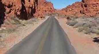
Exploring the scenic Mouse's Tank Road in Nevada
Mouse's Tank Road is a very scenic drive located in Clark County, in the U.S. state of Nevada. It is probably one of the most scenic and photographed spots in the park, featuring narrow canyons, stunning viewpoints, colorful rocks, and petroglyphs.
The Wild Road to Kite Lake, Outside of Alma
Kite Lake is a high mountain lake at an elevation of 3,671m (12,043ft) above sea level, located in Park County, in the U.S. state of Colorado. It's one of the highest roads in Colorado.
Driving the Paved Road to Keys View, an Overlook in Joshua Tree NP
Keys View is a very scenic overlook at an elevation of 1,574m (5,164ft) above sea level, located in Riverside County, in the U.S. state of California.

A scenic paved road to the summit of Yuba Pass in California
Yuba Pass is a high mountain pass at an elevation of 2,050m (6,725ft) above sea level, located in Sierra County, in the U.S. state of California.
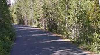
Driving the Curvy Unpaved Road to Mount Mansfield in Vermont
Mount Mansfield is a mountain peak at an elevation of 1,216m (3,989ft) above sea level, located in Lamoille County, in the U.S. state of Vermont. The road to the summit offers spectacular views along the way, with plenty of twists and turns. It’s one of the highest roads in Vermont.
The Breathtaking Road to Taylor Mountain in Colorado
Taylor Mountain is a high mountain peak at an elevation of 3,899m (12,791ft) above sea level, located in Chaffee County, in the U.S. state of Colorado. This is truly a breathtaking trail and is one of the highest roads in Colorado.

Ultimate 4WD destination: Bitter Springs Trail in Nevada
Bitter Springs Trail is a challenging route linking old mining roads and washes through the Muddy Mountains, located in the U.S. state of Nevada.
A Rough and Rocky Road to Calispell Peak in Washington
Calispell Peak is a high mountain peak at an elevation of 2,090m (6,856ft) above sea level, located in Stevens County, in the U.S. state of Washington. It’s one of the highest roads in Washington.