What are the most spectacular roads in the USA?
Located in North America, the USA is a true paradise for drivers, as it hosts more than 2,000 roads listed as the most spectacular in the world.
Featuring mountains, deserts, coasts, and snow, in the USA you’ll get your dream road. And you’ll never want to wake up. For instance, at the top of your list, you need to drive the Million Dollar Highway, the most beautiful road in America, and probably in the world. Built in the late 1880s, you'll be on the "outside" for a while with a hell of a view to your right (let the passenger enjoy the view; you'll want to watch the road). Another paved option must be the Iron Mountain Road, featuring 17 miles, 314 curves, 14 switchbacks, 3 pigtails, and 3 tunnels in the Black Hills of South Dakota. No list would be complete without the winding Tail of the Dragon: 318 curves in 11 miles. Spanning Tennessee and North Carolina, it is one of the most scenic drives in the USA. You also can’t skip driving Mount Evans Scenic Byway, the highest paved road in North America, climbing up to 4,310m (14,130ft) in Colorado. It is said to be the highest paved road in North America.
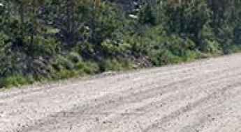
For those who prefer unpaved experiences, the country hosts some of the most defiant yet scenic roads in the world. You can’t miss Black Bear Pass, a high mountain adventure in the Colorado Rockies. Climbing up to 3,915m (12,844ft) above sea level, it's one of the highest roads in Colorado. You can also discover the beauty of Engineer Pass, a mountain pass at an elevation of 3,901m (12,800ft) above sea level in Colorado. It’s mostly a first-gear ride because the road is rough and rocky. The legendary Shafer Trail Road in Utah's Canyonlands National Park is an iconic drive located on the east-central edge of Utah. At times, the road is so narrow that only one car can pass. And Lippincott Mine Road in California is for experienced 4WD drivers using high-clearance vehicles only. You'll need a good map, as the routes are not marked and there are no signs. It’s one of the challenging backcountry roads in Death Valley National Park.
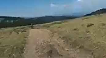
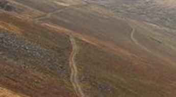
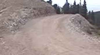
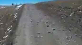
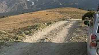
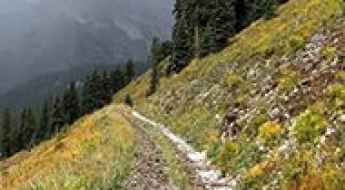
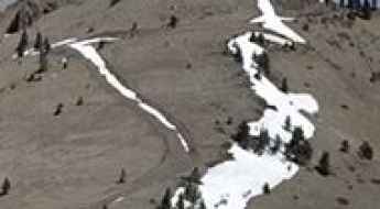
An epic road to La Poudre Pass in the Rocky Mountains of Colorado
La Poudre Pass is a high mountain pass at an elevation of 3,111m (10,206ft) above sea level, located in Larimer County, in the U.S. state of Colorado.

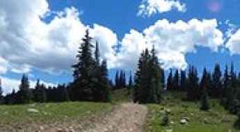
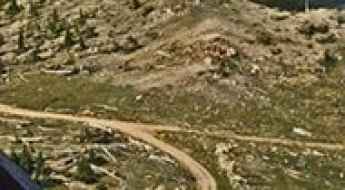
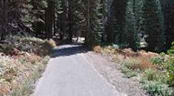
The historic road to Big Mountain Pass in the Wasatch Mountains of Utah
Big Mountain Pass is a high mountain pass at an elevation of 2,267m (7,437ft) above sea level, located in the U.S. state of Utah.

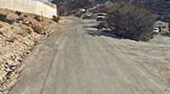
The Inhumane Climb to San Miguel Mountain in California with 21% Ramps
San Miguel Mountain is a peak at an elevation of 782 m (2,567 ft) above sea level, located in San Diego County, in the U.S. state of California.
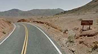
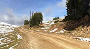
A Smooth Road to Jubilee Pass in Death Valley NP
Jubilee Pass is a mountain pass at an elevation of 403m (1,322ft) above sea level, located in Inyo County, in the US state of California.
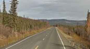
If you love to drive, you will love the Elliott Highway in Alaska
Elliott Highway is a scenic drive located in the U.S. state of Alaska. The road, which includes both paved and gravel stretches, connects the community of Fox with Manley Hot Springs.

A Rough Road with Potholes to Mowich Lake in Washington
Mowich Lake is a high mountain lake with clear, blue waters at an elevation of 1,530m (5,019ft) above sea level, located in Pierce County, in the U.S. state of Washington. It’s the largest and deepest lake in Mount Rainier National Park.
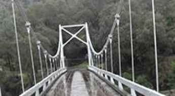
Crossing the Briceburg Bridge in California isn't for the sissies
Located in Mariposa County, California, in USA, the one-lane-metal-and-wood bridge over the Merced River is one of the most spectacular bridges of the world.
Travel Guide to the Top of Cerro Vista in New Mexico
Cerro Vista is a high mountain peak at an elevation of 3,645 m (11,958 ft) above sea level, located in the U.S. state of New Mexico. It’s one of the highest roads in New Mexico.
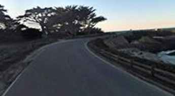
17-Mile Drive is a Scenic Road Along the Monterey Peninsula
17-Mile Drive is a scenic road running along a romantic stretch of coastline through Pebble Beach and Pacific Grove in Monterey County, on the Pacific coast of the U.S. state of California.
A Memorable Road Trip to Richmond Hill in Colorado
Richmond Hill is a high mountain pass at an elevation of 3,738m (12,265ft) above sea level, located in Pitkin County, in the U.S. state of Colorado. It’s one of the highest roads in Colorado.

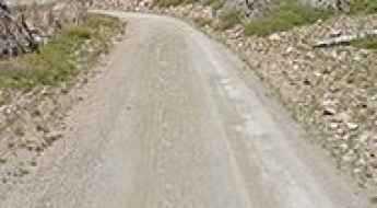
A scenic paved road to Pacific Grade Summit in California
Pacific Grade Summit is a high mountain pass at an elevation of 2.463m (8,080ft) above sea level, located in Alpine County, in the US state of California. The pass is not plowed for snow.
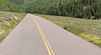
Driving the scenic Castle Creek Road in Colorado with beautiful aspen trees
Castle Creek Road (County Road 15) is a very scenic drive while seeing beautiful aspen trees in Pitkin County, in the U.S. state of Colorado.
Road Trip Guide: Conquering McClellan Mountain in Colorado
McClellan Mountain is a high mountain peak at an elevation of 3,996m (13,110ft) above sea level, located in Clear Creek County, in the U.S. state of Colorado. It’s one of the highest roads in Colorado.
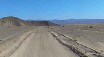
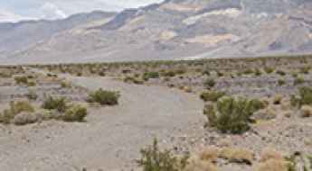
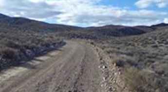
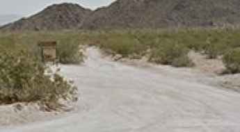
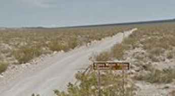
Road trip guide: Conquering the Harry Wade Road in Death Valley
Harry Wade Road is a very exciting desert drive located in Inyo County, in the U.S. state of California. The road leads visitors into the rugged and remote backcountry of Death Valley National Park. It’s one of the challenging backcountry roads in Death Valley National Park.
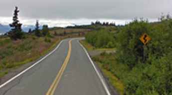
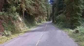
How to Drive the Scenic East End Road in Alaska
East End Road is a very scenic drive located at the head of Kachemak Bay on the Kenai Peninsula, in the U.S. state of Alaska.
A sensational drive to Yellowjacket Pass in Colorado
Yellowjacket Pass is a high mountain pass at an elevation of 2.373m (7,785ft) above sea level, located in Archuleta County, in the US state of Colorado.
Travel Guide to the Top of Abajo Peak in Utah
Abajo Peak is a high mountain peak at an elevation of 3,450m (11,318ft) above sea level, located in San Juan County, in the U.S. state of Utah. It’s one of the highest roads in Utah.
A memorable road trip to Blackhall Mountain in Wyoming
Blackhall Mountain is a high mountain peak at an elevation of 3,345m (10,974ft) above sea level, located in Carbon County, in the U.S. state of Wyoming. It’s one of the highest roads in Wyoming.
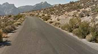
Travel guide to the top of Angel Peak in Nevada
Angel Peak is a high mountain peak at an elevation of 2.707m (8,881ft) above sea level, located in Clark County, in the US state of Nevada.
Daisy Pass is a Truly Outstanding 4x4 Adventure in Southern Montana
Daisy Pass is a high mountain pass at an elevation of 2,966m (9,730ft) above sea level, located in Park County, in the U.S. state of Montana.
The Wild Road to Kennaday Peak in Wyoming
Kennaday Peak is a high mountain peak at an elevation of 3,300m (10,826ft) above sea level, located in Carbon County, in the US state of Wyoming. A high-clearance vehicle is recommended. It's one of the highest roads in Wyoming.
Driving Newton B. Drury Scenic Parkway Through Old-Growth Redwood Forest in California
Newton B. Drury Scenic Parkway is a scenic drive located in Humboldt County, in the US state of California. It’s one of the most scenic drives in the Redwood National and State Parks.
Driving The Scenic Loop at Red Rock Canyon in Nevada
Red Rock Canyon Loop is a stunning scenic road located in Clark County, in the U.S. state of Nevada.
The Iconic Hell's Revenge Trail: One of Moab’s Most Popular Drives
Located in Grand County, in the US state of Utah, Hell's Revenge Trail is a thrilling roller-coaster 4x4 route over slickrock fins. Though incredibly popular, this trail is extremely challenging due to its hazardous terrain.
Driving the Unpaved Road to Deadman Pass in California
Deadman Pass is a high mountain peak at an elevation of 3,129m (10,265ft) above sea level, located in the US state of California. It’s one of the highest roads in California.
Road Trip Guide: Conquering Genoa Peak in Nevada
Genoa Peak is a high mountain peak at an elevation of 2,745m (9,005ft) above sea level, located in Douglas County in the U.S. state of Nevada. Some parts of the road can be tricky.
Travel Guide to the Top of Brian Head Peak in Utah
Brian Head Peak is a high mountain peak at an elevation of 3,450 m (11,318 ft) above sea level, located in Iron County, in the US state of Utah. It’s one of the highest roads in Utah.
Big Four Mine in California: The Ultimate Road Trip Guide
Big Four Mine is an abandoned mine located in Inyo County, in the U.S. state of California. It’s one of the challenging backcountry roads in Death Valley National Park.
An Old Mine Road to Eagle Pass in Colorado
Eagle Pass is a high mountain pass at an elevation of 3,602m (11,817ft) above sea level, located in La Plata County, in the U.S. state of Colorado.
Panoramic Point Road is a sensational drive in Kings Canyon NP
Panoramic Point Road is a delightful drive located in Fresno County, in the U.S. state of California.
A memorable road trip to Mount Pisgah in Colorado
Mount Pisgah is a high mountain peak at an elevation of 3,173m (10,410 ft) above sea level, located in Teller County, in the U.S. state of Colorado.
A paved road to the summit of Yaqui Pass in California
Yaqui Pass is a mountain pass at an elevation of 526m (1.725ft) above sea level, located in San Diego County, in the US state of California.
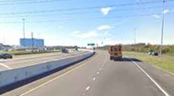
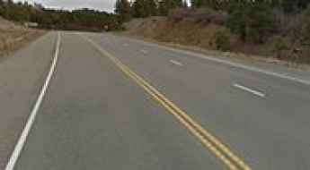
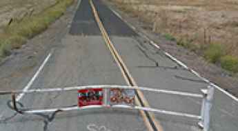
Interstate 4: Mapping the Deadliest Road in the United States
Motor vehicles are America’s lifeblood, and the roads and highways are the vessels. With over 160,000 miles of highway alone crisscrossing the country, it’s safe to say that we are a nation of drivers. And when it comes to individual states, Florida relies on cars, trucks, and other vehicles more than most. In fact, the state has more registered vehicles than most states, trailing only California and Texas.
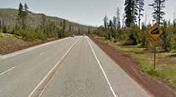
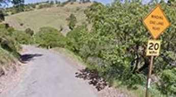
McKenzie Pass-Santiam Pass Scenic Byway is a Journey Through a Land of Contrasts in central Oregon
The McKenzie Pass-Santiam Pass Scenic Byway is an unforgettable drive in central Oregon. This iconic route takes you through a dramatic landscape, climbing up to McKenzie Pass and Santiam Pass.
How to Get to Enderts Beach by Car in California?
Enderts Beach is a rugged beach on the Pacific Ocean, located on the coast of Del Norte County in the U.S. state of California. It’s one of the most scenic drives in the Redwood National and State Parks.
A Thrill Road to Red Pass in Death Valley NP
Red Pass is a high mountain pass at an elevation of 1,589m (5,213ft) above sea level, located in Inyo County, in the US state of California. The road itself is an adventure: a steep, narrow cliff road, but it's well-maintained.
How to Get to the Lookout at La Mosca Peak in New Mexico by Car?
La Mosca is a high mountain peak at an elevation of 3,364m (11,036 ft) above sea level, located in Cibola County, in the U.S. state of New Mexico. It’s one of the highest roads in New Mexico.
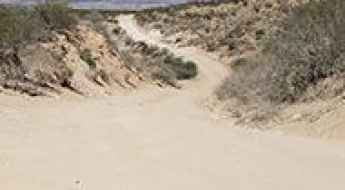
Travelling the most scenic backcountry roads in Joshua Tree
Located at the eastern end of Southern California, in the USA, the Joshua Tree National Park is immense, nearly 800,000 acres, and infinitely variable. Two desert systems, the Mojave and the Colorado, divide the park into two arid ecosystems. A fascinating variety of plants and animals make their homes in a land with strong winds and occasional torrents of rain. For your own safety and for the protection of the natural features of the park please stay on established roads.
Victor Pass: a road through mining history in Colorado
Victor Pass is a high mountain pass at an elevation of 3,115m (10,219ft) above sea level, located in Teller County, in the U.S. state of Colorado.
Palo Flechado Pass in New Mexico is a classic road trip
Palo Flechado Pass is a high mountain pass at an elevation of 2.779m (9,117ft) above sea level, located in the US state of New Mexico.
Driving the Furnace Creek Road in Death Valley NP
Furnace Creek Road is a very exciting desert drive located in Inyo County, in the US state of California. A high-clearance vehicle is required. Due to frequent flooding in the area, road conditions often vary. It’s one of the challenging backcountry roads in Death Valley National Park.
The Scenic Geysers Road Runs Through the Vineyards of Sonoma County
Geysers Road is a very scenic drive that winds through vineyards and wineries in Sonoma County, located in the U.S. state of California.
Grapevine Hills Road is a bumpy drive in Big Bend NP
Grapevine Hills Road is an improved dirt road located in Brewster County, in the U.S. state of Texas. Some areas can be very rough, and you’ll need to be cautious.
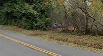
Driving the haunted Fire Trail Road in Marysville
Located in Snohomish County, in the US state of Washington, Marine Drive and Fire Trail Road is said to be haunted. Legend has it that this road gets its name because the Ghost of Firetrail.
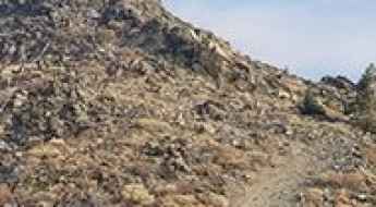
Driving the gnarly Nellie Creek Road in Colorado
Nellie Creek Road (FSR#877) is a very gnarly drive located in Hinsdale County, in the U.S. state of Colorado. This is not a road for people inexperienced with 4wd roads.
Adventure Along the Hanaupah Canyon Road in Death Valley NP
Hanaupah Canyon Road is an exciting desert drive located in Inyo County, in the US state of California. It’s one of the most challenging Backcountry roads in Death Valley National Park.
Empire Mine Road is one of the most haunted roads of California
Located in Contra Costa County, in the U.S. state of California, the mysterious Empire Mine Road is said to be one of the most haunted roads in the area.
Mineral Creek Road in Colorado: Stay Away Unless You Know You Are Capable
Mineral Creek Road is a very challenging drive located in San Juan County, in the U.S. state of Colorado. This is a 4WD road. It’s the quickest way to get to Engineer Pass from Ouray, although not the easiest.