What are the most spectacular roads in the USA?
Located in North America, the USA is a true paradise for drivers, as it hosts more than 2,000 roads listed as the most spectacular in the world.
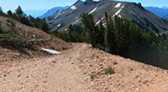
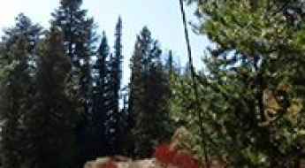
Featuring mountains, deserts, coasts, and snow, in the USA you’ll get your dream road. And you’ll never want to wake up. For instance, at the top of your list, you need to drive the Million Dollar Highway, the most beautiful road in America, and probably in the world. Built in the late 1880s, you'll be on the "outside" for a while with a hell of a view to your right (let the passenger enjoy the view; you'll want to watch the road). Another paved option must be the Iron Mountain Road, featuring 17 miles, 314 curves, 14 switchbacks, 3 pigtails, and 3 tunnels in the Black Hills of South Dakota. No list would be complete without the winding Tail of the Dragon: 318 curves in 11 miles. Spanning Tennessee and North Carolina, it is one of the most scenic drives in the USA. You also can’t skip driving Mount Evans Scenic Byway, the highest paved road in North America, climbing up to 4,310m (14,130ft) in Colorado. It is said to be the highest paved road in North America.
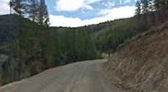
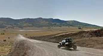
For those who prefer unpaved experiences, the country hosts some of the most defiant yet scenic roads in the world. You can’t miss Black Bear Pass, a high mountain adventure in the Colorado Rockies. Climbing up to 3,915m (12,844ft) above sea level, it's one of the highest roads in Colorado. You can also discover the beauty of Engineer Pass, a mountain pass at an elevation of 3,901m (12,800ft) above sea level in Colorado. It’s mostly a first-gear ride because the road is rough and rocky. The legendary Shafer Trail Road in Utah's Canyonlands National Park is an iconic drive located on the east-central edge of Utah. At times, the road is so narrow that only one car can pass. And Lippincott Mine Road in California is for experienced 4WD drivers using high-clearance vehicles only. You'll need a good map, as the routes are not marked and there are no signs. It’s one of the challenging backcountry roads in Death Valley National Park.
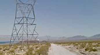
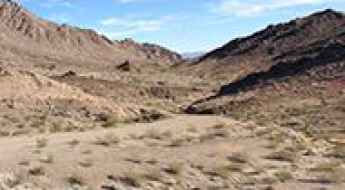
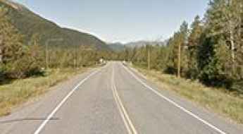
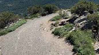
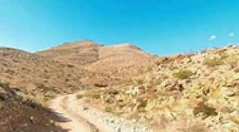
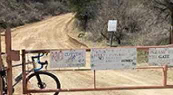
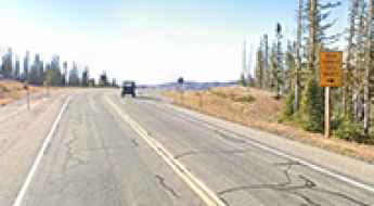
Travelling through the Mead-Davis Powerline Road
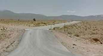
Mead-Davis Powerline Road is a scenic unpaved road located in Clark County, in the U.S. state of Nevada, on the shore of Lake Mohave. It’s the gateway to a variety of roads leading to the Nevada side of Lake Mohave.
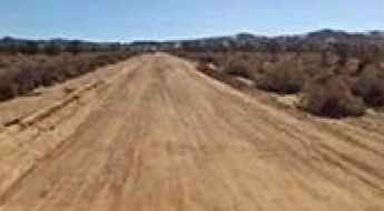
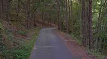
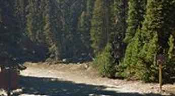
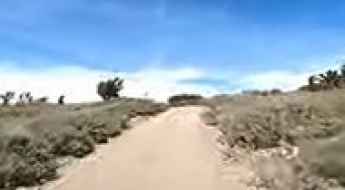
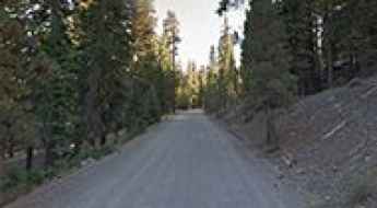
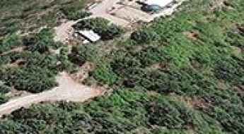
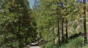
Travelling through the Cedar Canyon Road in California
Cedar Canyon Road is a very scenic drive located in San Bernardino County, in the U.S. state of California.
Fish Lake Hightop: a truly outstanding 4x4 adventure in Utah
Fish Lake Hightop is a high mountain plateau at an elevation of 3,491m (11,453ft) above sea level, located in Sevier County, in the U.S. state of Utah. It’s one of the highest roads in Utah.
The Incredibly Rough Road to Scotch Creek Pass in Colorado
Scotch Creek Pass is a high mountain pass at an elevation of 3,222m (10,570ft) above sea level, located in the U.S. state of Colorado.
Graham Pass in California: A Road to Nowhere
Graham Pass is a mountain pass at an elevation of 509m (1,669ft) above sea level, located in Riverside County, in the U.S. state of California.
How to Get by Car to Sawnee Mountain in Georgia?
Sawnee Mountain is a mountain peak at an elevation of 593m (1,946ft) above sea level, located in Forsyth County, in the U.S. state of Georgia.
Poison Spider Mesa is one of the "Must Do" rides of Moab
Poison Spider Mesa is a very popular trail and is considered one of the "Must Do" rides in Moab, in the US state of Utah. If you're an adventurous driver or biker looking for a challenge, this trail offers thrilling obstacles and incredible views. The trail is 9.6 miles (15.44 km) long and accessible all year round.
Road trip guide: Niwot Ridge in Colorado
Located in the heart of the Indian Peaks, in Boulder County, in the U.S. state of Colorado, Niwot Ridge sits at an elevation of 3,741m (12,273ft) above sea level. It’s one of the highest roads in Colorado.
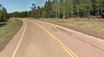
Portage Glacier Road is one of the best drives in Alaska
Portage Glacier Road, nestled in the U.S. state of Alaska south of Anchorage, ranks among the most scenic drives the state has to offer. This 11.59-mile (18.65 km) route connects the Seward Highway near the ghost town of Portage with the town of Whittier, treating travelers to stunning vistas along the way. Completed in 2000, this paved highway is an impressive feat of engineering, featuring a series of roads, bridges, and the iconic Anton Anderson Memorial Tunnel.
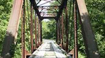
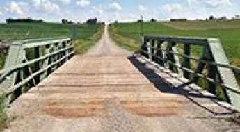
Travelling through the historic Little Sandy River Railroad Bridge
Located in Carter County, in the US state of Kentucky, this pratt through truss bridge over the Little Sandy River is one of the most spectacular bridges in the world.
How to get by car to Hunter Lake in Nevada?
Hunter Lake is a high mountain lake at an elevation of 2,511m (8,238ft) above sea level, located in Washoe County, in the U.S. state of Nevada.
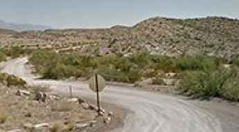
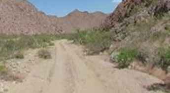
Hot Springs Road: Driving the narrow desert wash in Big Bend
Located in the remote southeastern corner of Big Bend National Park, near the Mexican border, Hot Springs is a historic site in Brewster County, Texas. Reaching the remnants of this desert oasis involves driving a primitive road that drops into a rugged desert environment, where the Rio Grande's unpredictable nature dictates the state of the track.
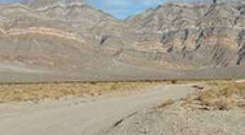
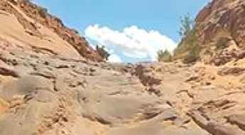
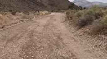
How To Travel The South Eureka Valley Road in Death Valley National Park
South Eureka Valley Road is a very exciting desert drive, located in Inyo County in the U.S. state of California. It’s one of the challenging backcountry roads in Death Valley National Park.
Hites Cove Road is one of the gnarliest drives in California
Located in Mariposa County, in the U.S. state of California, Hite Cove is a small mining camp tucked along the Merced River. The road to the town is a nice 4x4 trail with tight turns.
Scanlon Road in Nevada is a treacherous drive for any freighter
Scanlon Ferry Road is a dangerous and challenging route located in Clark County, in the U.S. state of Nevada. It’s one of the most grueling and remote trails in the country—very narrow and cliff-exposed.
A memorable road trip to Red Mountain in Idaho
Red Mountain is a high mountain peak at an elevation of 2,830 m (9,284 ft) above sea level located in Custer County, in the U.S. state of Idaho. It's one of the highest roads in Idaho.
How to get to Fisher Mountain in southern Montana?
Fisher Mountain is a high mountain peak at an elevation of 3,122m (10,242ft) above sea level, located in Park County, in the US state of Montana. It's one of the highest roads in Montana.

Travel Guide to the Top of Crane Mountain in Oregon
Crane Mountain is a high mountain peak at an elevation of 2,542m (8,339ft) above sea level, located in Lake County, in the U.S. state of Oregon. It’s one of the highest roads in Oregon.
Road trip guide: Conquering Waunita Pass in Colorado
Waunita Pass is a high mountain pass at an elevation of 3,143m (10,311ft) above sea level located in Gunnison County, in the U.S. state of Colorado. The area can be very treacherous during the winter months.
A Memorable Road Trip to the Historic Gibbons Pass in Montana
Gibbons Pass is a high mountain pass at an elevation of 2,126m (6,975ft) above sea level, located in the U.S. state of Montana.
The steep road to Sawmill Mountain in New Mexico isn’t an easy one
Sawmill Mountain is a high mountain peak, at an elevation of 3,346m (10,977ft) above sea level, located in Taos County, in the U.S. state of New Mexico. It’s one of the highest roads in New Mexico.
How to get by car to Left Hand Reservoir in Colorado?
Left Hand Reservoir is a high mountain reservoir at an elevation of 3,256 m (10,682 ft) above sea level, located in Boulder County, in the U.S. state of Colorado. It’s a good reservoir for fishing.
How to get to the lookout at Sardine Peak in California?
Sardine Peak is a high mountain peak at an elevation of 2,482m (8,143ft) above sea level, located in Sierra County, in the U.S. state of California.
Driving the 9 steepest paved mountain passes of Colorado
Colorado, the heart of the American Rocky Mountains, contains the highest concentration of high-altitude paved arterials in North America. Beyond the aesthetic appeal of the peaks, the state’s topography demands extreme road geometries. For the driver, these nine passes represent a technical challenge where sustained gradients and thin air intersect, testing both vehicle cooling systems and braking endurance. In the "High Country," a descent can quickly transition from a scenic drive to a high-consequence survival exercise if brake fade is not managed correctly.
The Wild And Steep Road to Pilot Peak in Mineral County
Pilot Peak is a high mountain peak at an elevation of 2,795m (9,169ft) above sea level, located in Mineral County, in the U.S. state of Nevada.
Why Tierod Canyon Might Be Nevada’s Wildest Road?
Tierod Canyon is an off-road trail located in Clark County, in the U.S. state of Nevada. The canyon cuts through the rugged terrain of the Mojave Desert and is known for its steep, rocky walls and dry wash bottom. The trail that runs through it is popular among off-road enthusiasts due to its challenging surface, rock ledges, and lack of bypasses. The route is suitable only for high-clearance, modified 4x4 vehicles.
Road Trip Guide: Conquering Babbitt Peak in California
Babbitt Peak is a high mountain peak at an elevation of 2,664m (8,740ft) above sea level, located in Sierra County, in the US state of California.
Wondervu Hill in Colorado: The Ultimate Road Trip Guide
Wondervu Hill is a high mountain pass at an elevation of 2.643m (8,671ft) above sea level, located in the U.S. state of Colorado.
Killer Krome: The Dark History of Miami’s State Road 997
Krome Avenue is arguably the most notorious road in South Florida. Known to locals as "Killer Krome," this highway is a magnet for dangerous road enthusiasts due to its haunting history, high-speed drag racing, and a staggeringly high fatality rate. Running along the edge of the Everglades, it serves as the final frontier between Miami's urban sprawl and the wilderness.
How to get by car to Butte Lake in Lassen Volcanic NP?
Butte Lake is a bright blue water lake at an elevation of 1,864m (6,115ft) above sea level, located in Lassen County, in the U.S. state of California.
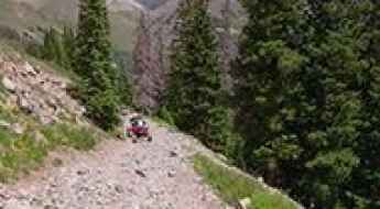
Ultimate 4WD Destination: Hurricane Basin in Colorado
Hurricane Basin is a beautiful basin at an elevation of 3,776m (12,388ft) above sea level, located in Hinsdale County, in the U.S. state of Colorado. The trail is a bit rocky, and in some sections it is narrow with a severe drop-off to one side. It's one of the highest roads in Colorado.
How to get to the lookout at the summit of Hogback Mountain in Montana?
Hogback Mountain is a high mountain pass at an elevation of 2,380m (7,808ft) above sea level, located in Lewis and Clark County, in the U.S. state of Montana.
A memorable road trip to Goldstone Pass on the Idaho-Montana border
Goldstone Pass is a high mountain pass at an elevation of 2,774 m (9,101 ft) above sea level, located on the Idaho-Montana border, in the USA.
The unmaintained road to Vinegar Hill in Oregon
Vinegar Hill is a high mountain peak at an elevation of 2,471m (8,106ft) above sea level, located in Grant County, in the U.S. state of Oregon. It’s one of the highest roads in Oregon.
State Route 99 Voted ‘Most Dangerous U.S. Road’
State Route 99 (SR-99) is a major north-south highway running through the Central Valley of California, United States. The route spans approximately 425 miles (684 km), tracking parallel to Interstate 5 through major agricultural hubs including Bakersfield, Fresno, Modesto, and Sacramento.
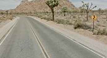
How to drive the scenic Park Boulevard in Joshua Tree National Park?
Park Boulevard is a very scenic drive located in the US state of California. If you have time only for a short visit in the park, driving Park Boulevard is your best choice.
How to get by car to Montana Snowbowl?
Montana Snowbowl is a ski resort at an elevation of 1,520m (4,986ft) above sea level, located in Missoula County, in the U.S. state of Montana.
Driving the wild 4x4 road to Boobe Hole Mountain in Utah
Boobe Hole Mountain is a high mountain pass at an elevation of 3,209 m (10,528 ft) above sea level, located in Sevier County, in the U.S. state of Utah. It’s one of the highest roads in Utah.
How to drive the challenging Forest Road 207 in Wyoming?
Forest Road 207 is a high mountain road located in Park County, in the U.S. state of Wyoming. It’s one of the highest roads in Wyoming.

Top Hazardous Routes in Las Vegas and How to Stay Safe
Traffic accidents and fatalities in the Las Vegas area, in the US state of Nevada, are statistically high and on the rise. The driving risk in the region is unique, compounded by a mix of factors: high-volume city traffic, winding mountain passes, unexpected wildlife hazards, and long stretches of remote, unlit highway. These conditions mean drivers must be aware of the considerable risk of severe car accidents.
Crossing the historic Clear Creek Bridge in Iowa
Located in Iowa County, in the U.S. state of Iowa, Clear Creek Bridge is one of the most spectacular bridges in the world.
How to Get to the Summit of Pastora Peak in Arizona?
Pastora Peak is a high mountain peak at an elevation of 2,786m (9,140ft) above sea level, located in Apache County, in the U.S. state of Arizona. It's one of the highest roads in Arizona. The road is passable by most stock high-clearance 4wd vehicles.
A fire unpaved road to Keystone Peak in Arizona
Keystone Peak, reaching an elevation of 1,886m (6,188ft) above sea level, stands in Pima County, in the US state of Arizona. This region bears the marks of past extensive mining and ranching.
Road Trip Guide: Conquering Alamo Peak in New Mexico
Alamo Peak is a high mountain peak at an elevation of 2,825m (9,270ft) above sea level, located in Otero County, in the U.S. state of New Mexico.
How to get by car to Tikaboo Peak: Nevada’s Best Legal View of Area 51
Tikaboo Peak is a high mountain peak at an elevation of 2,097m (6,879ft) above sea level, located in Lincoln County, in the U.S. state of Nevada. The peak is widely considered the best remaining legal point from which the public may directly view the very secretive Area 51, a military airfield shrouded in mystery and the source of countless UFO stories and conspiracy theories.
Driving a high mountain road to Sunrise Park Resort in Arizona
Sunrise Park Resort is a ski resort at an elevation of 2,852m (9,356ft) above sea level, located in Apache County, in the US state of Arizona. It's one of the highest roads in Arizona.
A paved road to the historic Battle Pass in Wyoming
Battle Pass is a high mountain pass at an elevation of 3,038 m (9,967 ft) above sea level, located in Carbon County, in the U.S. state of Wyoming.
Tobin Ridge Road is a brutal drive in California with 26% ramps
Tobin Ridge Road is a very challenging drive located in Plumas County, in the U.S. state of California. The drive is not easy, featuring 64 hairpin turns.