What are the most spectacular roads in the USA?
Located in North America, the USA is a true paradise for drivers, as it hosts more than 2,000 roads listed as the most spectacular in the world.
Featuring mountains, deserts, coasts, and snow, in the USA you’ll get your dream road. And you’ll never want to wake up. For instance, at the top of your list, you need to drive the Million Dollar Highway, the most beautiful road in America, and probably in the world. Built in the late 1880s, you'll be on the "outside" for a while with a hell of a view to your right (let the passenger enjoy the view; you'll want to watch the road). Another paved option must be the Iron Mountain Road, featuring 17 miles, 314 curves, 14 switchbacks, 3 pigtails, and 3 tunnels in the Black Hills of South Dakota. No list would be complete without the winding Tail of the Dragon: 318 curves in 11 miles. Spanning Tennessee and North Carolina, it is one of the most scenic drives in the USA. You also can’t skip driving Mount Evans Scenic Byway, the highest paved road in North America, climbing up to 4,310m (14,130ft) in Colorado. It is said to be the highest paved road in North America.
For those who prefer unpaved experiences, the country hosts some of the most defiant yet scenic roads in the world. You can’t miss Black Bear Pass, a high mountain adventure in the Colorado Rockies. Climbing up to 3,915m (12,844ft) above sea level, it's one of the highest roads in Colorado. You can also discover the beauty of Engineer Pass, a mountain pass at an elevation of 3,901m (12,800ft) above sea level in Colorado. It’s mostly a first-gear ride because the road is rough and rocky. The legendary Shafer Trail Road in Utah's Canyonlands National Park is an iconic drive located on the east-central edge of Utah. At times, the road is so narrow that only one car can pass. And Lippincott Mine Road in California is for experienced 4WD drivers using high-clearance vehicles only. You'll need a good map, as the routes are not marked and there are no signs. It’s one of the challenging backcountry roads in Death Valley National Park.
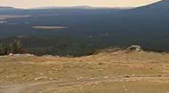
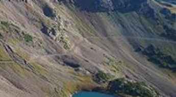
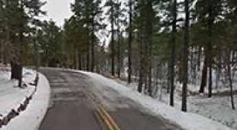
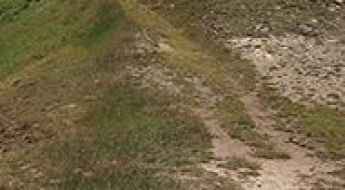
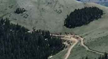
Sheep Mountain
Sheep Mountain is a high mountain peak at an elevation of 2.912m (9,553ft) above the sea level, located in Johnson County, in the U.S. state of Wyoming.
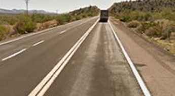
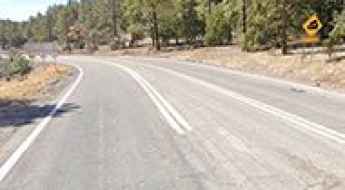
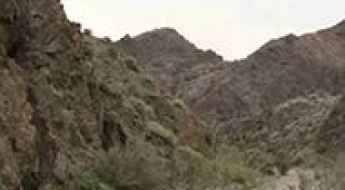
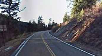
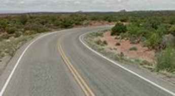
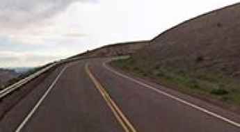
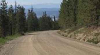
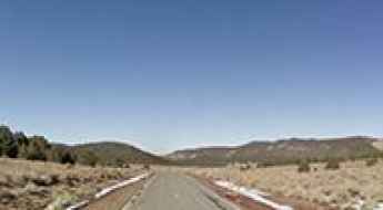
US 93, a major north-south highway in the western United States
US 93 Highway (US 93) is a major highway located in the western United States. The drive features scenic views.
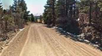
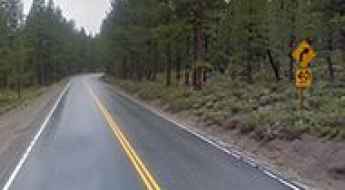
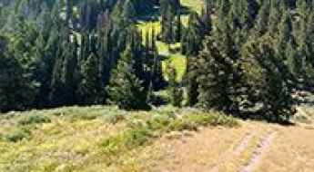
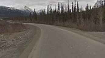
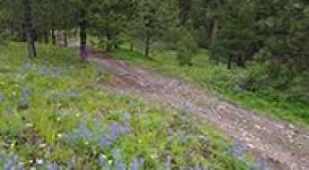
North Lake road
North Lake road is a mountainous journey located in California's Eastern Sierra Nevada mountain range, in Inyo County, in the U.S. state of California.
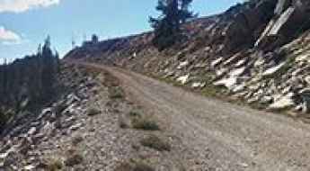
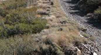
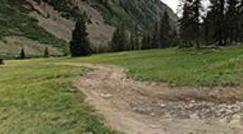
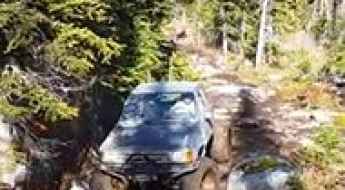
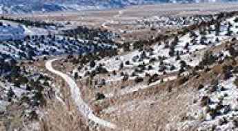
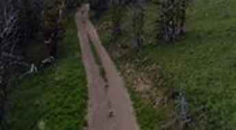
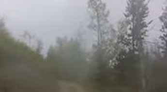
A wild unpaved road to Point Six in Montana
Point Six is a high mountain peak at an elevation of 2.421m (7,942ft) above sea level located in Missoula County, in the US state of Montana.
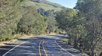
Spine-Chilling Encounter: Ghost of a Girl Haunts Niles Canyon Road in CA
Niles Canyon Road is a short drive located in Alameda County, in the U.S. state of California. The road is said to be haunted by the ghost of a young woman.
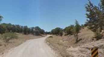
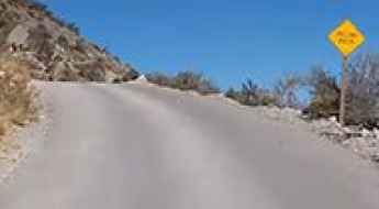
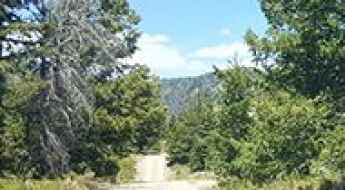
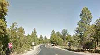
Arizona 62 is a beautiful road through Madera Canyon
Arizona 62 (Highway 62) is a very scenic drive through the Santa Rita Mountains, in Pima County, in the south central region of the U.S. state of Arizona.
How to get by car to McGee Mountain in California?
McGee Mountain is a high mountain peak at an elevation of 3.204m (10,511ft) above sea level, located in Mono County, in the US state of California. It’s one of the highest roads in California.
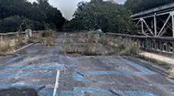
The infamous Jug Bridge of Maryland
Located in Frederick County, in the northern part of the U.S. state of Maryland, the Jug Bridge ruins and its connecting roads are all that remains of what was once a beautiful and historic piece of American infrastructure. It’s one of the most spectacular bridges in the world.
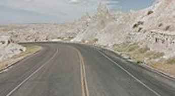
Badlands Loop Road is an adventurous photogenic drive in SD
Badlands Loop Road (SD 240) is the name of a very scenic drive straddling Jackson and Pennington counties in the U.S. state of South Dakota.

Missouri’s Most Accident-Prone Roads Revealed
With an average of 15 fatal accidents annually, Highway 63 remains the most hazardous route in Missouri. However, several urban stretches in St. Louis and Kansas City present even higher fatality rates per mile due to infrastructure limitations and high traffic density.
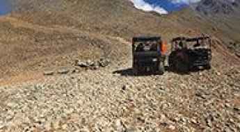
An old 4wd road to Mount Edwards
Mount Edwards is a high mountain peak at an elevation of 3.844m (12,611ft) above the sea level, located in Summit County, in the U.S. state of Colorado. It’s one of the highest mountain roads of Colorado.
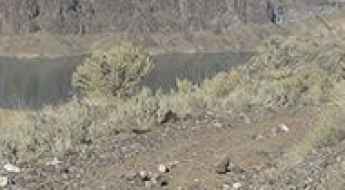
Driving the wild Fisherman Road to Lake Owyhee in OR
Fisherman Road is a gravel wild road located in Malheur County, in the U.S. state of Oregon, leading to Indian Creek Campground, on the southern shores of Lake Owyhee.
Mingus Summit in AZ: a road with several dizzying hairpin bends
Mingus Summit is a high mountain pass at an elevation of 2.146m (7,040ft) above the sea level, located in Yavapai County, in the U.S. state of Arizona.
Bald Mountain
Bald Mountain is a high mountain peak at an elevation of 2.847m (9,339ft) above the sea level, located in Tulare County, in the U.S. state of California. It's one of the highest roads of California.
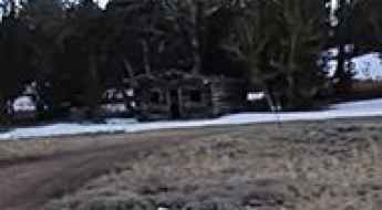
A mining road to the ghost town of Belfort in California
Belfort is an old mining village located in Mono County, in the east central portion of the U.S. state of California, near the Nevada border. It’s one of the highest roads of California.
How to get to Antora Peak in Colorado
Antora Peak is a high mountain peak at an elevation of 3,823 m (12,542 ft) above sea level, located in Saguache County, in the U.S. state of Colorado. It’s one of the highest roads in Colorado.
How to get by car to Cory Peak in Nevada?
Cory Peak is a high mountain peak at an elevation of 3,201m (10,501ft) above sea level, located in Mineral County, in the U.S. state of Nevada. It's one of the highest roads in Nevada.
Ruby Peak
Ruby Peak is a high mountain peak at an elevation of 3.738m (12,263ft) above the sea level, located in the Ruby Range of the Rocky Mountains of North America, in Gunnison County, Colorado, United States. It’s one of the highest mountain roads of Colorado.
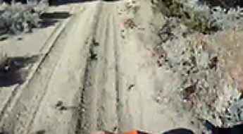
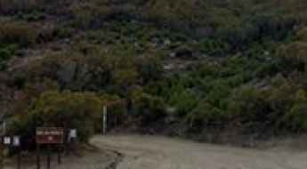
Road trip guide: Conquering the Red Hill Road in NV
Red Hill Road is a short gravel track located in Clark County, in the U.S. state of Nevada. It’s a 4wd drive.
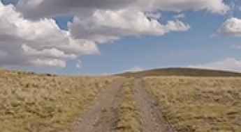
Ocate Mesa
Ocate Mesa is a high mountain peak at an elevation of 3.157m (10,357ft) above the sea level, located in Colfax County, in the U.S. state of New Mexico. It’s one of the highest mountain roads of New Mexico.
Mountain Baldy
Mountain Baldy is a high mountain peak at an elevation of 2.793m (9,163ft) above the sea level located in the Salmon River Mountains, in Lemhi County, Idaho, in USA. It's one of the highest roads in Idaho.
A scenic paved road to Mores Creek Summit in ID
Mores Creek Summit is a high mountain pass at an elevation of 1.871m (6,138ft) above the sea level, located in Boise County, in the U.S. state of Idaho.
Little Truckee Summit, a 5 stars road in the Sierra Nevada
Little Truckee Summit is a high mountain pass at an elevation of 1.954m (6,411ft) above the sea level, located in Sierra County, in the U.S. state of California.
Road trip guide: Conquering Lucky Boy Pass in NV
Lucky Boy Pass is a high mountain pass at an elevation of 2.449m (8,034ft) above the sea level, located in Mineral County, in the U.S. state of Nevada.
Lowell Observatory
Lowell Observatory is an astronomical observatory at an elevation of 2.210m (7,250ft) above the sea level, located in Flagstaff, in northern Arizona, in the southwestern United States.
The breathtaking road to Meridian Peak in CO
Meridian Peak is a high mountain peak at an elevation of 3.789m (12,432ft) above the sea level, located on the boundary between Summit and Eagle counties in the U.S. state of Colorado. This is truly a breathtaking trail. It’s one of the highest roads of Colorado.
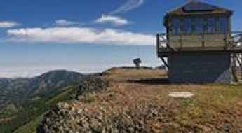
Table Rock Mountain
Table Rock Mountain is a high mountain peak at an elevation of 1.908m (6,259ft) above the sea level, located in Columbia County, in the U.S. state of Washington. It’s one of the highest mountain roads of Washington.
Grand View Point
Grand View Point is an overlook at an elevation of 1.915m (6,282ft) above the sea level located in the Canyonlands National Park, in San Juan County, in the southeastern portion of the U.S. state of Utah.
Oxford Peak
Oxford Peak is a high mountain peak at an elevation of 2.831m (9,288ft) above the sea level, located in Franklin County in southeast Idaho, USA. It’s one of the highest mountain roads of Idaho.
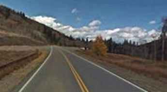
Utah State Route 44
UT-44 is a very scenic winding mountain road located in northern Utah, in USA.
Yogo Peak
Yogo Peak is a high mountain pass at an elevation of 2.686m (8,812ft) above the sea level located in Judith Basin County, in Montana, USA.
Strawberry Peak
Strawberry Peak is a high mountain peak at an elevation of 3.155m (10,351ft) above the sea level, located in Wasatch County, in the U.S. state of Utah.
Top 10 dangerous roads for drivers in the USA
When it comes to selecting the ideal roads for drivers, long uninterrupted stretches where you can push the car to its limits seems viable. But, when you are experiencing the unexpected, danger comes in hovering. Though there are many thrilling road sections in the world where you can enjoy to the fullest, we have some popular patches in the U.S. itself.
A memorable road trip to Stillwater Pass
Stillwater Pass is a high mountain pass at an elevation of 3.246m (10,649ft) above the sea level located in Grand County, in the U.S. state of Colorado. The pass divides the Never Summer Wilderness Area and the Arapaho National Forest.
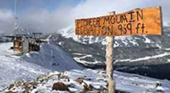
Pioneer Mountain
Pioneer Mountain is a high mountain peak at an elevation of 3.004m (9,855ft) above the sea level, located in Madison County, in the U.S. state of Montana. It’s one of the highest mountain roads of Montana.
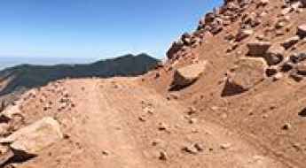
The Wild Road to Almagre Mountain
Almagre Mountain is a high mountain peak at an elevation of 3.774m (12,381ft) above the sea level, located in Teller County, in the U.S. state of Colorado. It’s one of the highest roads of Colorado.

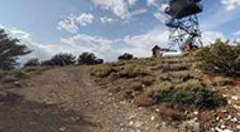
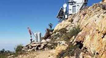
North Rim Lookout
North Rim Lookout is a high mountain lookout tower at an elevation of 2.798m (9,179ft) above the sea level, located in Coconino County, in northern Arizona, in USA. It’s one of the highest mountain roads of Arizona.
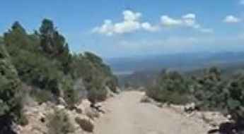
Ella Mountain
Ella Mountain is a high mountain peak at an elevation of 2.280m (7,480ft) above the sea level, located in Lincoln County, Nevada, in United States.
Calamity Pass
Calamity Pass is a high mountain pass at an elevation of 2.956m (9,698ft) above sea level located in Jackson County, in the US state of Colorado.
South Summit Ridge
South Summit Ridge is a high mountain peak at an elevation of 3.483m (11,427ft) above the sea level, located in Garfield County, Utah, United States. It's one of the highest mountains roads of Utah.
Sunnyside Saddle
Sunnyside Saddle is a high mountain peak at an elevation of 4.030m (13,221ft) above the sea level, located in San Juan County, in the U.S. state of Colorado. Drive with care as this is a mountain road with hairpin curves and dangerous dropoffs. It’s one of the highest mountain roads of Colorado.
How to drive the unpaved road to the lookout at Willow Mountain in Montana?
Willow Mountain is a high mountain peak at an elevation of 2.503m (8,211ft) above sea level, located in Ravalli County, in the U.S. state of Montana.
The Ultimate Guide to Traveling Benton Crossing Road
Benton Crossing Road is the name of a very scenic drive with vast mountain views, located in Mono County, in the U.S. state of California.
A paved mountain road to Ute Pass in Grand County
Ute Pass is a high mountain pass at an elevation of 2.924m (9,593ft) above the sea level, located in Grand County, in the U.S. state of Colorado.
A memorable road trip to Santa Rosa Mountain in CA
Santa Rosa Mountain is a high mountain peak at an elevation of 2.456m (8,057ft) above the sea level, located in Riverside County, in the southern portion of the U.S. state of California.
How to get to Yaki Point by car?
Yaki Point is a natural viewpoint at an elevation of 2.213m (7,262ft) above the sea level, located in Coconino County, in the US state of Arizona.
Jordan Peak
Jordan Peak is a high mountain peak at an elevation of 2.619m (8,592ft) above the sea level, located in Tulare County, in the U.S. state of California.
Bingham Mine Overlook
Located at an elevation of 2.748m (9,015ft) above the sea level, in Tooele County in the U.S. state of Utah, Bingham Mine Overlook offers stunning 360 degree views. The average gradient is 9.35%.