What are the most spectacular roads in the USA?
Located in North America, the USA is a true paradise for drivers, as it hosts more than 2,000 roads listed as the most spectacular in the world.
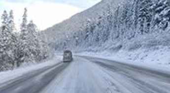
Featuring mountains, deserts, coasts, and snow, in the USA you’ll get your dream road. And you’ll never want to wake up. For instance, at the top of your list, you need to drive the Million Dollar Highway, the most beautiful road in America, and probably in the world. Built in the late 1880s, you'll be on the "outside" for a while with a hell of a view to your right (let the passenger enjoy the view; you'll want to watch the road). Another paved option must be the Iron Mountain Road, featuring 17 miles, 314 curves, 14 switchbacks, 3 pigtails, and 3 tunnels in the Black Hills of South Dakota. No list would be complete without the winding Tail of the Dragon: 318 curves in 11 miles. Spanning Tennessee and North Carolina, it is one of the most scenic drives in the USA. You also can’t skip driving Mount Evans Scenic Byway, the highest paved road in North America, climbing up to 4,310m (14,130ft) in Colorado. It is said to be the highest paved road in North America.
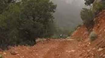
For those who prefer unpaved experiences, the country hosts some of the most defiant yet scenic roads in the world. You can’t miss Black Bear Pass, a high mountain adventure in the Colorado Rockies. Climbing up to 3,915m (12,844ft) above sea level, it's one of the highest roads in Colorado. You can also discover the beauty of Engineer Pass, a mountain pass at an elevation of 3,901m (12,800ft) above sea level in Colorado. It’s mostly a first-gear ride because the road is rough and rocky. The legendary Shafer Trail Road in Utah's Canyonlands National Park is an iconic drive located on the east-central edge of Utah. At times, the road is so narrow that only one car can pass. And Lippincott Mine Road in California is for experienced 4WD drivers using high-clearance vehicles only. You'll need a good map, as the routes are not marked and there are no signs. It’s one of the challenging backcountry roads in Death Valley National Park.

The Ultimate Michigan Road Trip: a Stop-by-Stop Guide
Michigan offers one of the most diverse driving environments in the American Midwest. From the industrial logistics of the Motor City to the high-latitude wilderness of the Upper Peninsula (U.P.), a road trip across this state is a study in coastal geography and infrastructure. Navigating the shores of Lake Michigan and Lake Superior requires a strategic approach to route planning, especially as roads transition from standard interstates to narrow, wind-exposed scenic byways with limited service availability.
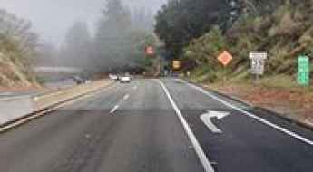
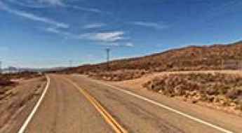
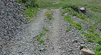
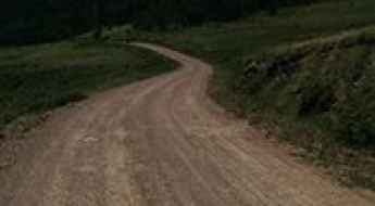
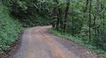
Patchen Pass in California: this road is not for timid drivers
Patchen Pass is a mountain pass at an elevation of 562m (1,843ft) above the sea level, located on the boundary between Santa Cruz and Santa Clara counties in the U.S. state of California.
Osha Mountain
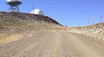
Osha Mountain is a high mountain peak at an elevation of 3.240m (10,629ft) above the sea level, located in Colfax County, in the U.S. state of New Mexico. It’s one of the highest mountain roads of New Mexico.
A very bumpy, grueling road to Warrior Mountain
Warrior Mountain is a high mountain peak at an elevation of 3.433m (11,263ft) above the sea level, located in Clear Creek County, in the U.S. state of Colorado just south of Hwy 103 (Squaw Pass Road).
Relay Peak
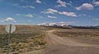
Relay Peak is a high mountain peak at an elevation of 3.102m (10,177ft) above the sea level, located in Washoe County, in the U.S. state of Nevada. It's one of the highest mountain roads of Nevada.
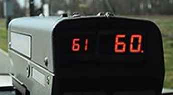
Caught Speeding in the USA? Here's what to do next...
Navigating the vast highway systems of the United States requires strict adherence to variable jurisdictional speed limits. Getting clocked by a radar or being pulled over by state troopers can be a complex logistical and legal challenge, especially for international travelers or long-distance overlanders. Understanding the specific protocols of a "Traffic Stop" and the subsequent administrative steps is essential for mitigating the impact on your driving record and insurance standing.
Patricks Knob
Patricks Knob is a high mountain peak at an elevation of 2.086m (6,843ft) above the sea level located in Sanders County, in Montana, USA.
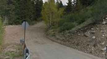
How to drive the unpaved road to Wenatchee Mountain in Washington?
Wenatchee Mountain is a high mountain peak at an elevation of 2.059m (6,755ft) above sea level, located in Chelan County, in the US state of Washington. It’s one of the highest roads of Washington.
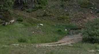
The road to Pine Creek Reservoir in OR isn’t an easy one
Pine Creek Reservoir is a high mountain reservoir at an elevation of 2.003m (6,571ft) above the sea level, located in Baker County, in the U.S. state of Oregon.
Estes Mountain
Estes Mountain is a high mountain peak at an elevation of 2.900m (9,514ft) above the sea level, located in central Custer County, Idaho, in USA. It's one of the highest roads in Idaho.
Terry Flat
Terry Flat is a large meadow at an elevation of 3.033m (9,950ft) above the sea level, located in Apache County, in the northeast corner of the U.S. state of Arizona. It’sone of the highest mountain roads of Arizona.
Cathey Peak
Cathey Peak is a high mountain peak at an elevation of 2.940m (9,645ft) above the sea level, located in Otero County, in the south-central part of the US State of New Mexico.
Mount Bigelow
Mount Bigelow is a high mountain peak at an elevation of 2.571m (8,434ft) above the sea level, located in the Santa Catalina Mountains, in Pima County, in the south central region of the U.S. state of Arizona.
Granite Pass is the highest point of Kelbaker Road
Granite Pass is a high mountain pass at an elevation of 1.233m (4,045ft) above sea level, located in San Bernardino County, in the US state of California.
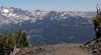
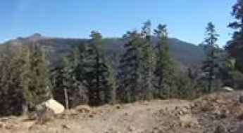
How to drive the unpaved road to Mount Bachelor in Oregon?
Mount Bachelor is a stratovolcano at an elevation of 2.461m (8,074ft) above sea level, located in Deschutes County, in the US state of Oregon. It’s one of the highest roads of Oregon.
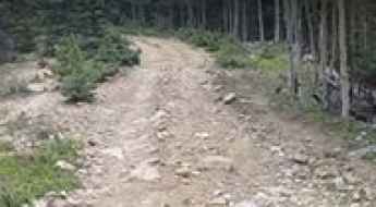
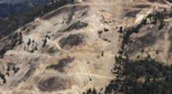
How difficult is the chairlift access road to Golden Bear Peak in Colorado?
Golden Bear Peak is a high mountain summit reaching an elevation of 3,725m (12,221ft) above sea level in Clear Creek County, Colorado. Located within the Rocky Mountains, the peak sits high above the famous Loveland Ski Area. The road to the summit is a rugged, unpaved service track primarily used for chairlift maintenance. As one of the highest mountain roads in Colorado, it presents a significant challenge due to its extreme altitude, steep gradients, and the thin air that starves both lungs and engines of oxygen.
Skidoo Road
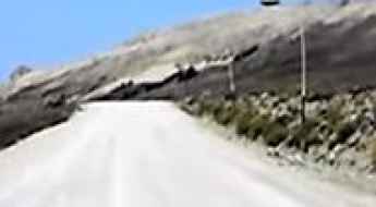
Skidoo Road is a very exciting desert drive in the Death Valley National Park, in USA. High-clearance vehicle required. Steep grade with protruding rocks at 3.5 miles. Sedans risk undercarriage damage. Subject to snow and mud conditions. It’s one of the challenging Backcountry roads in the Death Valley National Park.
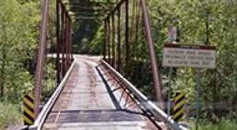
Crossing the scenic Geysers Road Bridge
Geysers Road Bridge is a truss bridge with Phoenix columns located in Sonoma County, in Northern California, in USA. It’s one of the most spectacular bridges in the world.
Elk Lake Road
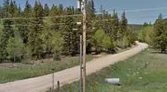
Elk Lake Road is a very scenic drive located in the Adirondack Mountains, in the northeast of Upstate New York in the United States. There are many excellent photo opportunities. The road is lost in space and time.
The Olympic Hot Springs Road in WA, closed to vehicles due to road washout
Located in Clallam County, in the U.S. state of Washington, Olympic Hot Springs Road is totally washed out and closed to vehicles indefinitely.
A paved road to Campbell Pass in NM
Campbell Pass is a high mountain pass at an elevation of 2.219m (7,280ft) above the sea level, located in McKinley County, in the northwestern section of the U.S. state of New Mexico.
La Junta Peak
La Junta Peak is a high mountain peak at an elevation of 3.926m (12,880ft) above sea level, located in San Miguel County, in the U.S. state of Colorado. It’s one of the highest roads in Colorado.
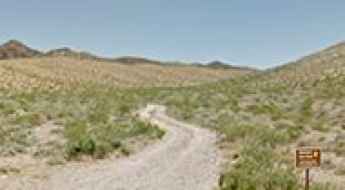
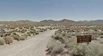
Boathouse Cove Road
Boathouse Cove Road is a bumpy gravel road located on the Northshore of Lake Mead, in Clark County, in the U.S. state of Nevada. Backcountry travel is not recommended in summer.
Hahns Peak
Hahns Peak is a high mountain peak at an elevation of 3.217m (10,554ft) above the sea level, located in Routt County, Colorado, in United States.
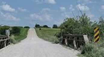
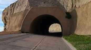
170th Street Rock Creek Bridge: A historic 7-ton truss bridge in Iowa
Hidden in the rural landscape of Keokuk County, Iowa, the 170th Street Rock Creek Bridge is a remarkable survivor of early 20th-century engineering. This iron structure is recognized as one of the most spectacular bridges in the world due to its historical integrity and its position on a remote backroad that feels frozen in time.
How to get by car to the summit of Mount Lewis in Nevada?
Mount Lewis is a high mountain peak situated in Lander County, in the U.S. state of Nevada. The summit, located in the Shoshone Range in the north-central part of the state, reaches an elevation of 2,933 meters (9,622 ft) above sea level. It is considered one of the highest roads in Nevada.
Sliderock Mountain
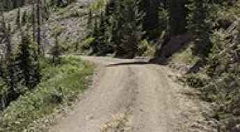
Sliderock Mountain is a high mountain peak at an elevation of 2.386m (7,828ft) above the sea level, located in Granite County, in the U.S. state of Montana.
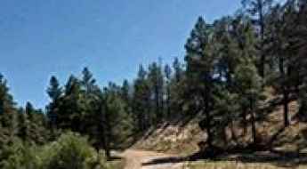
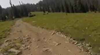
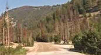
Driving the Roaring Fork Motor Nature Trail in Tennessee
The Roaring Fork Motor Nature Trail is a specialized mountain loop located in Gatlinburg, Tennessee. Situated within the Great Smoky Mountains National Park, this road offers a high-stakes driving experience characterized by its narrow profile and lack of safety barriers. Operating on this road requires total commitment; once a driver enters the one-way circuit, there are no turn-around points. It is a masterclass in low-speed technical handling through a dense, high-moisture forest environment.
Black Canyon Road
Black Canyon Road is a very scenic drive in Arizona, United States, located within the Apache-Sitgreaves National Forest.
Carnero Pass
Carnero Pass is a high mountain pass at an elevation of 3.100m (10,171ft) above the sea level located in the Saguache County, in Colorado, USA.
Missouri Hill
Missouri Hill is a high mountain peak at an elevation of 3.684m (12,086ft) above the sea level, located in Chaffee County, Colorado, in USA. This is truly a breathtaking trail. It’s one of the highest mountain roads of Colorado.
Eagle Peak
Eagle Peak is a high mountain peak at an elevation of 2.753m (9,032ft) above the sea level, located in Tuolumne County, in the U.S. state of California.
Bald Mountain
Bald Mountain is a high mountain peak at an elevation of 2.766m (9,074ft) above the sea level, located in the Glass Mountain Range, Mono County, in the U.S. state of California.
Take the Scenic Route and Discover Stevens Pass in WA
Stevens Pass is a high mountain pass at an elevation of 1.243m (4,078ft) above the sea level, located on the boundary of King and Chelan counties in the U.S. state of Washington.
Scotts Bluff Summit Road is the oldest concrete road in Nebraska
Scotts Bluff Summit is a scenic overlook at an elevation of 1.407m (4,616ft) above sea level, located in Scotts Bluff County, on the western border of the U.S. state of Nebraska.
The steep and historic 4x4 road to the summit of Walkers Peak
Walkers Peak is a high mountain summit reaching 2,735m (8,973ft) above sea level in Valley County, Idaho. It is situated in the Salmon River Mountains, right in the heart of the Frank Church River of No Return Wilderness, one of the most remote areas in the United States. It's one of the highest roads in Idaho.
Hawley Mountain
Hawley Mountain is a high mountain peak at an elevation of 2.223m (7,293ft) above the sea level, located in Boise County, in the U.S. state of Idaho.
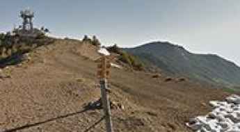
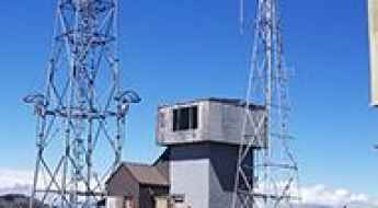
Mount Callaghan
Mount Callaghan is a high mountain peak at an elevation of 3.107m (10,193ft) above the sea level, located in Lander County, in the U.S. state of Nevada. It’s one of the highest mountain roads of Nevada. Thanks to a communications structure located near the highest point on this mountain which can be seen easily from highway 305, a road has been built which makes access easier.
Arta Lake
Arta Lake is a high mountain lake at an elevation of 3.139m (10,298ft) above the sea level, located in Wasatch County, in the U.S. state of Utah.

The wild road to Monarch Ridge South in CO
Monarch Ridge South is a high mountain peak at an elevation of 3.634m (11,922ft) above the sea level, located in Chaffee County, in south-central Colorado in the United States. It’s one of the highest roads of Colorado. The average gradient is 7.45%.
Osha Pass
Osha Pass is a high mountain pass at an elevation of 2.997m (9,832ft) above the sea level, located in Taos County, in the U.S. state of New Mexico.
How to drive the unpaved Forest Service Road 12 to Medicine Mountain?
Medicine Mountain is a high mountain peak at an elevation of 3,039m (9,970ft) above sea level, located in Big Horn County, Wyoming. Situated within the Bighorn National Forest, the access to the summit via Forest Service Road 12 is a technical high-altitude drive characterized by extreme weather exposure and sensitive logistical constraints.
Take the Scenic Skyline Drive and Discover High Top
High Top is a high mountain pass at an elevation of 3.321m (10,897ft) above the sea level located in the Sanpete County, in Utah, USA. It’s one of the highest roads in Utah.
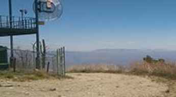
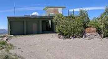
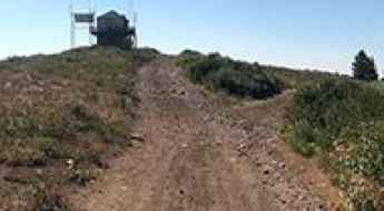
Reno Lookout
Reno Lookout is a high mountain lookout tower at an elevation of 2.775m (9,104ft) above the sea level, located in Greenlee County, Arizona, in USA. It’s one of the highest mountain roads of Arizona.
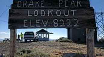
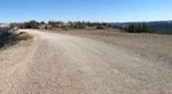
Drake Peak
Drake Peak is a high mountain peak at an elevation of 2.509m (8,231ft) above the sea level, located in the Warner Mountain Range of Lake County, Oregon, in USA. It’s one of the highest roads of Oregon.
Windy Gap
Windy Gap is a high mountain pass at an elevation of 3.354m (11,004ft) above the sea level located in Montezuma County, the southwesternmost of the 64 counties in the U.S. state of Colorado.
Tray Gap
Tray Gap is a mountain pass at an elevation of 1.171m (3,841ft) above the sea level, located in White County, Georgia, United States. Beauty and isolation are what you will find here.
Navajo Mountain
Navajo Mountain is a high mountain peak at an elevation of 3.154m (10,347ft) above the sea level, located in San Juan County, Utah, in USA.