What are the most spectacular roads in the USA?
Located in North America, the USA is a true paradise for drivers, as it hosts more than 2,000 roads listed as the most spectacular in the world.
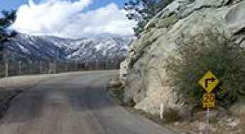
Featuring mountains, deserts, coasts, and snow, in the USA you’ll get your dream road. And you’ll never want to wake up. For instance, at the top of your list, you need to drive the Million Dollar Highway, the most beautiful road in America, and probably in the world. Built in the late 1880s, you'll be on the "outside" for a while with a hell of a view to your right (let the passenger enjoy the view; you'll want to watch the road). Another paved option must be the Iron Mountain Road, featuring 17 miles, 314 curves, 14 switchbacks, 3 pigtails, and 3 tunnels in the Black Hills of South Dakota. No list would be complete without the winding Tail of the Dragon: 318 curves in 11 miles. Spanning Tennessee and North Carolina, it is one of the most scenic drives in the USA. You also can’t skip driving Mount Evans Scenic Byway, the highest paved road in North America, climbing up to 4,310m (14,130ft) in Colorado. It is said to be the highest paved road in North America.
For those who prefer unpaved experiences, the country hosts some of the most defiant yet scenic roads in the world. You can’t miss Black Bear Pass, a high mountain adventure in the Colorado Rockies. Climbing up to 3,915m (12,844ft) above sea level, it's one of the highest roads in Colorado. You can also discover the beauty of Engineer Pass, a mountain pass at an elevation of 3,901m (12,800ft) above sea level in Colorado. It’s mostly a first-gear ride because the road is rough and rocky. The legendary Shafer Trail Road in Utah's Canyonlands National Park is an iconic drive located on the east-central edge of Utah. At times, the road is so narrow that only one car can pass. And Lippincott Mine Road in California is for experienced 4WD drivers using high-clearance vehicles only. You'll need a good map, as the routes are not marked and there are no signs. It’s one of the challenging backcountry roads in Death Valley National Park.
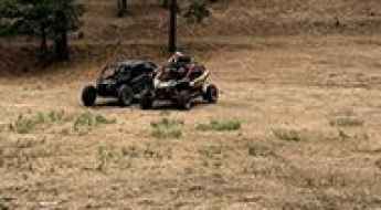
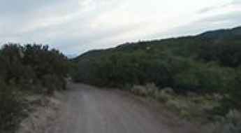
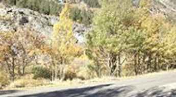
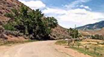
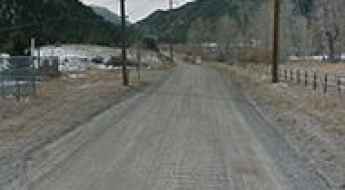
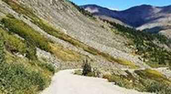
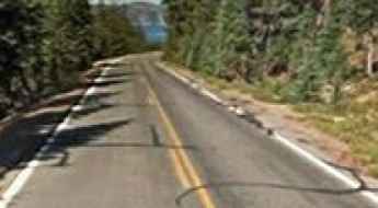
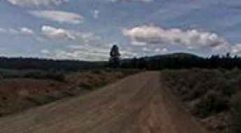
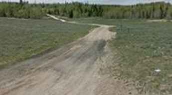
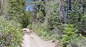
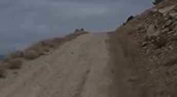
Driving the Old Kern Canyon Road is not a piece of cake
Located in Kern County, in the U.S. state of California, Old Kern Canyon Road is a very challenging drive.
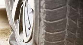
6 Tips for Making Sure You Are Well-Prepared for a Flat Tyre on a Road Trip in the USA
A tyre failure on a high-consequence route—such as the gravel-heavy Dalton Highway or the sharp volcanic tracks of the Mojave Desert—is a critical operational risk. Unlike standard highway driving, a flat tyre in remote sectors of the USA demands total mechanical autonomy. Continuing to operate a vehicle on a compromised carcass not only destroys the wheel rim but can lead to catastrophic lateral instability. Preparedness in these zones is defined by the quality of your recovery gear and your ability to execute repairs in hostile environments.
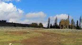
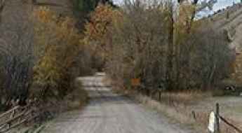
Lookout Mountain
Lookout Mountain is a high mountain peak at an elevation of 2.707m (8,881ft) above the sea level, located in Sierra County, in the U.S. state of New Mexico.
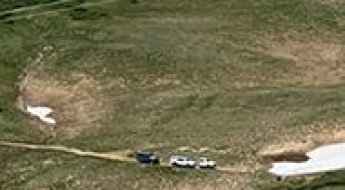
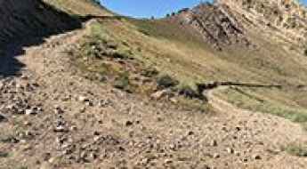
Upheaval Dome
Upheaval Dome is a striking volcanic-type crater located in the Canyonlands National Park of southern Utah, in USA, at an elevation of 1.737m (5,698ft) above the sea level.
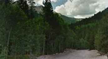
Magleby Pass
Magleby Pass is a high mountain pass at an elevation of 3.216m (10,551ft) above the sea level, located in Sevier County, in the U.S. state of Utah. It’s one of the highest mountain roads of Utah.
Gentry Mountain
Gentry Mountain is a high mountain peak at an elevation of 3.066m (10,059ft) above the sea level, located in Emery County, in the U.S. state of Utah.
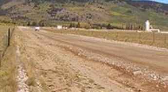
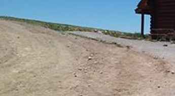
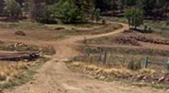
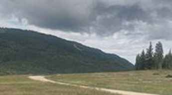
A graded dirt road to Jefferson Lake
Jefferson Lake is a high mountain lake at an elevation of 3.271m (10,731ft) above the sea level, located northwest of Jefferson off US Highway 285, in Park County, Colorado, in USA.
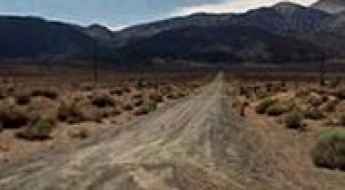
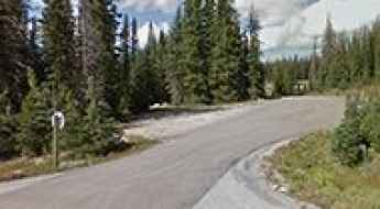
How To Travel The Beaver Creek Road
County Road 655 (Beaver Creek Road) is a high mountain road located in Park County, in the U.S. state of Colorado. It’s one of the highest roads of Colorado.
South Lake
South Lake is a high mountain lake at an elevation of 2.999m (9,839ft) above the sea level, located in Inyo County, in the U.S. state of California. It’s one of the highest mountain roads of California.
Revelation Lift
Located in San Miguel County, Colorado, in USA, the Revelation Lift lies at an elevation of 3.837m (12,588ft) above the sea level. It’s one of the highest mountain roads of Colorado.
Mustang Pass
Mustang Pass is a high mountain pass at an elevation of 3.011m (9,878ft) above the sea level, located in Esmeralda County, in the U.S. state of Nevada. It's one of the highest mountain roads of Nevada.
Beckwourth Peak
Beckwourth Peak is a high mountain peak at an elevation of 2.205m (7,234ft) above the sea level, located in Plumas County, in California, United States. The road is very steep: the average gradient is 8.59%.
Mount Hamilton
Mount Hamilton is a high mountain pass at an elevation of 3.091m (10,141ft) above the sea level, located in White Pine County, along the central eastern boundary of the U.S. state of Nevada. It's one of the highest mountain roads of Nevada.
South Pass
South Pass is a high mountain pass at an elevation of 3.248m (10,656ft) above the sea level located in the Saguache County, in Colorado, USA.
Pegleg Mountain
Pegleg Mountain is a high mountain peak at an elevation of 2.166m (7,106ft) above the sea level, located in Lassen County, in the U.S. state of California.
Quartzite Mountain
Quartzite Mountain is a high mountain peak at an elevation of 2.654m (8,707ft) above the sea level located in Lemhi County, in Idaho, USA.
Empire Pass
Empire Pass is a high mountain pass at an elevation of 2.678m (8,786ft) above the sea level, located in Clear Creek County, in the U.S. state of Colorado.
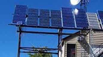
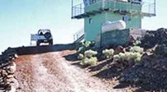
Road trip guide: Conquering Pilot Peak in ID
Pilot Peak is a high mountain peak at an elevation of 2.476m (8,123ft) above the sea level, located in Boise County, in the U.S. state of Idaho. The top is adorned with a building, solar panels, and a bunch of communication gear.
Cone Peak, the second highest mountain in the Santa Lucia Range
Cone Peak is a mountain peak at an elevation of 1.261m (4,137ft) above the sea level, located in Monterey County, on the Big Sur coast of California, USA.
Benson Ridge
Benson Ridge is a high mountain pass at an elevation of 2.906m (9,534ft) above the sea level, located in Otero County, in the U.S. state of New Mexico.
Blue Lakes
Blue Lakes is a high mountain lake at an elevation of 3.573m (11,722ft) above the sea level, located in Summit County, in the U.S. state of Colorado.
Haystack Gate
Haystack Gate is a high mountain pass at an elevation of 2.963m (9,721ft) above the sea level located in the Pitkin County, in Colorado, USA.
Arrastre Lake
Arrastre Lake is a high mountain lake at an elevation of 3.120m (10,236fft) above the sea level, located in Carbon County, in the U.S. state of Wyoming. It’s one of the highest mountain roads of Wyoming.
Bare Cone
Bare Cone is a high mountain peak at an elevation of 2.386m (7,828ft) above the sea level, located in Ravalli County, in the southwestern part of the U.S. state of Montana. Elk, mule deer, badgers, coyotes, and black bears can be seen along the trail.

Farwell Mountain
Farwell Mountain is a high mountain pass at an elevation of 3.302m (10,833ft) above the sea level located in Routt County, Colorado, In USA.
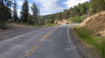
Driving to Kerr Notch: The best view of Crater Lake’s Phantom Ship
Kerr Notch is a high mountain pass at an elevation of 2,038m (6,686ft) above sea level, located on the southeastern rim of Crater Lake in Oregon. It is one of the most significant geological and historical points on the Rim Drive, offering a unique perspective on the massive volcanic collapse that created the deepest lake in the USA.
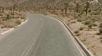
How to drive the paved road to Barker Dam in California?
Barker Dam is a high mountain dam at an elevation of 1.301m (4268ft) above sea level, located in Riverside County, in the US state of California.
Sunset Pass
Sunset Pass is a high mountain pass at an elevation of 1.806m (5,925ft) above the sea level, located in Garfield County, in south central Utah, United States. The road is normally an easy drive, but recommended doing it in dry weather.
A wild road to Pipestone Pass in MT
Pipestone Pass is a high mountain pass at an elevation of 1.972m (6,469ft) above the sea level, located in Silver Bow County, in the U.S. state of Montana.
Dixie Mountain
Dixie Mountain is a high mountain peak at an elevation of 2.525m (8,284ft) above the sea level, located in Lassen County, in northeastern California, USA.

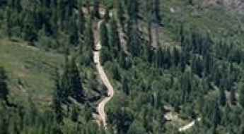
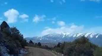
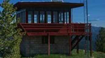
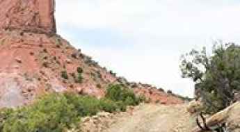
Road to Eightmile Mesa: Driving the 2,494m USFS #651 in Colorado
Located in Archuleta County, Colorado, Eightmile Mesa is a high mountain peak at an elevation of 2,494m (8,182ft) above sea level. Situated within the San Juan National Forest, the summit is accessed via the Eight Mile Mesa Rd (USFS Road #651), a technical unpaved track that provides logistical access to a high-altitude fire lookout tower built in 1963.
How to drive the difficult road to Star Point in Utah
Star Point is a high mountain pass at an elevation of 3.067m (10,062ft) above sea level located in the Carbon County, in the US state of Utah.
Monument Peak
Monument Peak is a high mountain peak at an elevation of 3.040m (9,973ft) above the sea level, located in El Dorado County, California, in USA. It’s one of the highest roads of California.
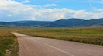
How to drive the road to Highland Peak in Nevada?
Highland Peak is a high mountain peak at an elevation of 2.862m (9,389ft) above sea level, located in Lincoln County, in the US state of Nevada.
Gooseberry Point
Gooseberry Point is a high mountain pass at an elevation of 3.154m (10,347ft) above the sea level located in Iron County, in Utah, USA.
Ulysses Mountain
Ulysses Mountain is a high mountain peak at an elevation of 2.333m (7,654ft) above the sea level located in the Salmon River Mountains, in Idaho, USA.
Mount Ogden
Mount Ogden is a high mountain peak at an elevation of 2.915m (9,563ft) above the sea level, located in Weber County, in the U.S. state of Utah.
How to drive the unpaved road to Middle Mountain in Coloado
Middle Mountain is a high mountain peak at an elevation of 3.610m (11,843ft) above sea level, located in Chaffee County, in the US state of Colorado.
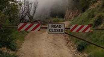
Last Chance Road
Last Chance Road (USFS Road 44-22) is a very demanding drive located. Placer County, California, in USA.

Driving The Strip, the heart of Las Vegas
Located in Clark County, in the US state of Nevada, The Strip is the best-known street in all of Las Vegas. What happens in Vegas, stays in Vegas. It is perhaps the most iconic and well-known street in the city, and indeed, one of the most famous streets in the world.

Lost Trail Road
Lost Trail Road is a high mountain trail located in Gunnison County, in the Crested Butte, Colorado area, USA.
Driving the Snake Creek Road to Johnson's Mill in Nevada
Johnson's Mill is a high-altitude historic mining site reaching an elevation of 3,074m (10,085ft) above sea level, located in White Pine County, Nevada. Situated within the Great Basin National Park, the route to the ruins follows the Snake Creek Road, one of the highest and most isolated unpaved transits in the state, right on the border with Utah. It's one of the highest roads in Nevada.
Road trip guide: Conquering Crown Point Road in CO
Crown Point Road is the name of a very scenic high mountain drive located in Larimer County, in the U.S. state of Colorado.
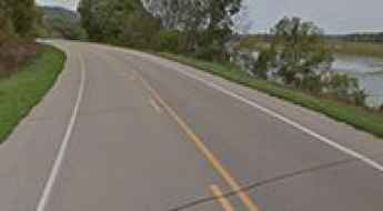
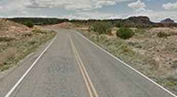
The Great River Road Replaces Danger with the Amazing Natural Beauty of the Mississippi River
The Great River Road is one of the most extensive and strategically significant scenic corridors in the United States. Spanning approximately 3,000 miles from the headwaters in Minnesota to the Gulf of Mexico, this road follows the complex hydrology of the Mississippi River. While it lacks the high-altitude hairpin turns of the Rockies, it presents its own set of navigational challenges: narrow river-town transits, significant humidity shifts, and the unique topography of the Driftless Area, where towering bluffs constrain the road to the river's edge.
Shafer Butte
Shafer Butte is a high mountain peak at an elevation of 2.315m (7.595ft) above the sea level, located in Boise County, Southwest Idaho, in USA.

An Analysis of the Worst Roads in the USA
The integrity of the United States' road network is subject to extreme regional variance, dictated by localized climate volatility, freight tonnage, and infrastructure investment. While some states maintain high-durability corridors, others operate under a state of chronic structural decay. Navigating the worst roads in the U.S. requires a technical understanding of surface failure—from thermal-induced black ice to the mechanical impact of pavement delamination—and a strategic approach to vehicle preservation.
Willow Divide
Willow Divide is a high mountain pass at an elevation of 3.182m (10,439ft) above the sea level located in Dolores County, in southwest Colorado, USA.
Butler Peak
Butler Peak is a high mountain peak at an elevation of 2.570m (8,431ft) above the sea level, located in San Bernardino County, California, United States. A vehicle with decent ground clearance and good tires shouldn’t have an issue.