What are the most spectacular roads in the USA?
Located in North America, the USA is a true paradise for drivers, as it hosts more than 2,000 roads listed as the most spectacular in the world.
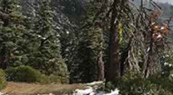
Featuring mountains, deserts, coasts, and snow, in the USA you’ll get your dream road. And you’ll never want to wake up. For instance, at the top of your list, you need to drive the Million Dollar Highway, the most beautiful road in America, and probably in the world. Built in the late 1880s, you'll be on the "outside" for a while with a hell of a view to your right (let the passenger enjoy the view; you'll want to watch the road). Another paved option must be the Iron Mountain Road, featuring 17 miles, 314 curves, 14 switchbacks, 3 pigtails, and 3 tunnels in the Black Hills of South Dakota. No list would be complete without the winding Tail of the Dragon: 318 curves in 11 miles. Spanning Tennessee and North Carolina, it is one of the most scenic drives in the USA. You also can’t skip driving Mount Evans Scenic Byway, the highest paved road in North America, climbing up to 4,310m (14,130ft) in Colorado. It is said to be the highest paved road in North America.
For those who prefer unpaved experiences, the country hosts some of the most defiant yet scenic roads in the world. You can’t miss Black Bear Pass, a high mountain adventure in the Colorado Rockies. Climbing up to 3,915m (12,844ft) above sea level, it's one of the highest roads in Colorado. You can also discover the beauty of Engineer Pass, a mountain pass at an elevation of 3,901m (12,800ft) above sea level in Colorado. It’s mostly a first-gear ride because the road is rough and rocky. The legendary Shafer Trail Road in Utah's Canyonlands National Park is an iconic drive located on the east-central edge of Utah. At times, the road is so narrow that only one car can pass. And Lippincott Mine Road in California is for experienced 4WD drivers using high-clearance vehicles only. You'll need a good map, as the routes are not marked and there are no signs. It’s one of the challenging backcountry roads in Death Valley National Park.
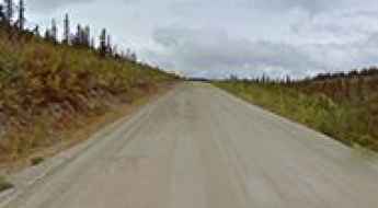
How to Prepare For and Survive Your First Motorcycle Road Trip in Alaska
Operating a motorcycle on Alaskan roads is a high-consequence endeavor that demands absolute mechanical and physical preparedness. Unlike the lower 48 states, Alaska’s infrastructure is defined by extreme isolation, unpredictable permafrost-induced road surface failures, and vast distances between refueling nodes. For the long-range rider, navigating the "Last Frontier" is an exercise in logistical discipline, where the margin for error is minimized by the harsh reality of the sub-arctic environment.
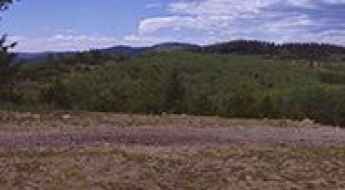
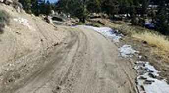
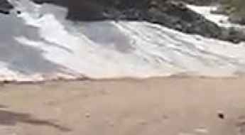
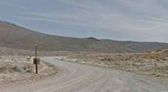
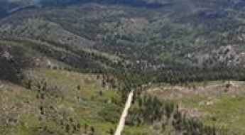
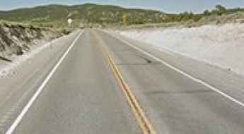
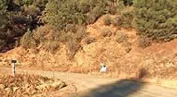
The Loneliest Highway to Sacramento Pass in NV
Sacramento Pass is a high mountain pass at an elevation of 2.185m (7,168ft) above the sea level, located in White Pine County, along the central eastern boundary of the U.S. state of Nevada.
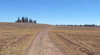
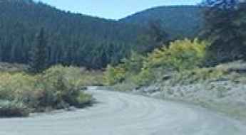
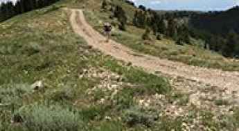
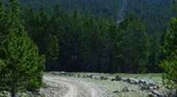
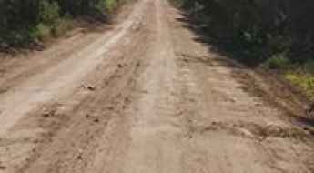
Miller Flat Road
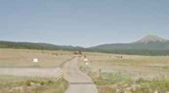
Miller Flat Road is a very scenic journey in the heart of the Manti-La Sal National Forest, in Utah, USA.
Camel Peak
Camel Peak is a high mountain peak at an elevation of 2.877m (9,438ft) above the sea level, located in White Pine County, along the central eastern boundary of the U.S. state of Nevada.
Sacramento Peak: Driving the Forest 64 Road in New Mexico
At an elevation of 2,904m (9,529ft) above sea level, Sacramento Peak is a high mountain summit located in Otero County, New Mexico. Situated south of Cloudcroft within the Lincoln National Forest, the peak is a prominent point in the southern part of the state, housing critical observation infrastructure.

The 57 deadliest road stretches in Georgia: A driver’s black list
Driving through Georgia is a game of patience and reflexes, especially once you hit the massive interchanges around Atlanta. The reality of the road here is dictated by heavy truck traffic, sudden lane changes, and a complete lack of space when things go wrong. If you want to stay out of the wrecking yard, you need to know exactly which sections of the asphalt are eating cars and lives at a higher rate than the rest.
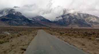
Cape Horn
Cape Horn is a high mountain pass at an elevation of 3.031m (9,944ft) above the sea level, located in La Plata County, in the U.S. state of Colorado.
Road ID-64
ID-64 is a short mountain road located in Lewis County, Idaho, United States. The road is 14.1 miles long.
Caballo Peak
Caballo Peak is a high mountain peak at an elevation of 2.310m (7,578ft) above the sea level, located in Sierra County, in the U.S. state of New Mexico.
How to drive the unpaved road to Snow Summit in California?
Snow Summit is a high mountain peak at an elevation of 2.498m (8,195ft) above sea level, located in San Bernardino County, in the US state of California.
Road trip guide: Conquering Elbow Lake in UT
Elbow Lake is a high mountain sub-alpine lake at an elevation of 3.396m (11,141ft) above the sea level, located in Wayne County, in the US state of Utah. Altitude and extreme weather are always a factor at any time of year. It’s one of the highest roads of Utah.
Road NF-1414
NF-1414 is a high mountain trail located in Stillwater County, in the U.S. state of Montana. Its highest elevation is 2.838m (9,311ft) above the sea level.

Navigating Rural Roads in Lancaster County, PA
Lancaster County, Pennsylvania, represents a high-risk driving environment characterized by the intersection of modern automotive transit and traditional animal-drawn transport. The region’s geography—defined by rolling hills, blind crests, and narrow two-lane arterials—demands a technical approach to speed management and spatial awareness. Statistically, Lancaster accounts for a higher-than-average percentage of the state’s traffic incidents, largely due to the extreme speed differentials between motor vehicles and horse-drawn buggies on its secondary roads.
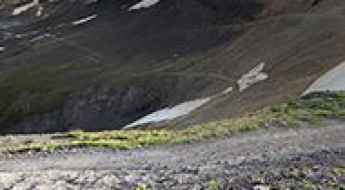
How to drive the unpaved road to Ptarmigan Lake in Colorado?
Ptarmigan Lake is a high mountain lake at an elevation of 3.997m (13,113ft) above sea level, located in Ouray County, in the U.S. state of Colorado. It’s one of the highest roads of Colorado.
Driving the brutal South Colony Road to Broken Hand Peak in Colorado
Broken Hand Peak is a high mountain peak at an elevation of 3,483m (11,427ft) above sea level, located in Saguache County, in the US state of Colorado.
How to drive the unpaved road to Gospel Peak in Idaho?
Gospel Peak is a high mountain pass at an elevation of 2.416m (7,926ft) above sea level located in Idaho County, in the US state of Idaho.
Maverick Mountain: Driving the 30-Mile Dirt Track in Fort Apache
Maverick Mountain is a mountain peak at an elevation of 2,465 meters (8,086 ft) above sea level, located within the White Mountain Apache Indian Reservation in Graham County, in the US state of Arizona.

Safe Driving Tips Every U.S. Driver Should Know
Operating a vehicle on the diverse road networks of the United States—from the high-velocity urban corridors of Los Angeles to the isolated, high-altitude passes of the Rockies—demands more than basic compliance with traffic laws. In 2022, the National Highway Traffic Safety Administration (NHTSA) recorded over 42,000 fatalities, the highest in over a decade. Navigating these environments safely requires a disciplined application of active safety protocols, mechanical oversight, and situational defensive strategies designed to minimize human error in high-consequence scenarios.
Driving the Custer Motorway to Mill Creek Summit
Mill Creek Summit is a high mountain pass at an elevation of 2.685m (8,809ft) above the sea level, located in Custer County, in the U.S. state of Idaho.

The Most Dangerous Roads in Palm Beach County, FL
South Florida’s road network is characterized by extreme traffic density and high-velocity urban transits. In the first half of 2023, Florida recorded over 175,000 traffic incidents, with Palm Beach County emerging as a primary cluster for multi-vehicle collisions. Navigating this sector requires a technical understanding of specific high-fatality intersections and thoroughfares where the margin for error is minimized by aggressive lane-merging and saturated logistical flows.

A Strategic Guide to Car Procurement for Student Operators
Acquiring a reliable vehicle while maintaining academic financial stability requires a rigorous logistical approach to budgeting and asset evaluation. For student operators in the US, a car is not just a personal asset but a critical tool for mobility between educational hubs and professional internships. Managing the procurement process—from credit analysis to mechanical inspection—is essential to minimize long-term operational costs. This guide analyzes the strategic steps for cost-effective vehicle acquisition and fleet maintenance on a limited budget.
A wild 4x4 road to Teddys Peak in Colorado
Teddys Peak is a high mountain peak at an elevation of 3.678m (12,066ft) above sea level, located in the US state of Colorado. It’s one of the highest roads in Colorado.
Beaver Ridge
Beaver Ridge is a high mountain peak at an elevation of 2.249m (7,378ft) above the sea level, located in Idaho County, Idaho, in USA.
Salt Creek Pass
Salt Creek Pass is a high mountain pass at an elevation of 2.967m (9,735ft) above the sea level located in the Park County, in Colorado, USA.
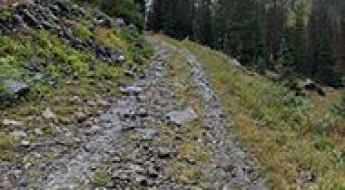
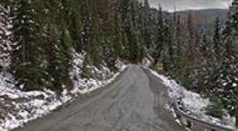
Iron Mountain Road (FS 482): The complete 4x4 guide through the Crazy Mountains
The Iron Mountain Road, officially Forest Service Road 482, is one of the most rugged and scenic backcountry routes in Sweet Grass County, Montana. Spanning 23.2 miles through the Gallatin National Forest, this unpaved track summits three major high points—Ellis Mountain, Sliderock Mountain, and Iron Mountain—offering a definitive Montana off-road experience.
Bodie Bluff
Bodie Bluff is a high mountain peak at an elevation of 2.747m (9,012ft) above the sea level, located situated high in the Sierra Nevada mountain range, in Mono County, California, United States.
Take An Unforgettable Drive to Deadwood Mountain in ID
Deadwood Mountain is a high mountain peak at an elevation of 2.306m (7,565ft) above the sea level, located in Boise County, in the U.S. state of Idaho.
Oreana Ridge: Driving the 4x4 track to the 1934 fire lookout in Idaho
Located in the rugged heart of Lemhi County, Idaho, Oreana Ridge is a high mountain peak reaching an elevation of 2,470m (8,103ft) above sea level. Situated within the massive Salmon-Challis National Forest, the drive to the summit is a classic Idaho backcountry experience, combining a technical 4x4 climb with a trip back in time to the era of mountain fire surveillance.
Rock Creek Trail Pass
Rock Creek Trail Pass, also known as Lost Park Divide, is a high mountain pass at an elevation of 3.260m (10,695ft) above the sea level located in the Park County, in Colorado, USA.
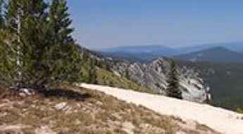
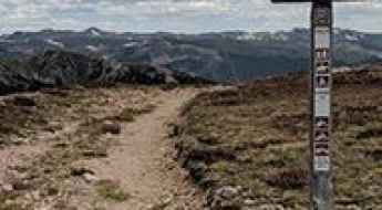
Is the road to West Mountain in Utah difficult to drive?
Reaching the summit of West Mountain is a journey into the wild, high-altitude heart of San Juan County. At 3,314m (10,872ft) above sea level, this peak in the Blue Mountains (Abajo Mountains) is one of the highest roads of Utah. This isn't a quick detour from the highway; it’s a rugged backcountry climb where the air gets thin and the track gets nasty as you leave the red rocks behind for the alpine peaks.
Scott Hill
Scott Hill is a high mountain pass at an elevation of 3.014m (9,888ft) above the sea level, located in Salt Lake County, Utah, USA. It’s a gravel road with some steep drop-offs.
Mustang Mountain
Mustang Mountain is a high mountain peak at an elevation of 3.097m (10,160ft) above the sea level, located in Esmeralda County, in Nevada, USA. It’s one of the highest roads of Nevada.
Aurora Peak
Aurora Peak is a high mountain peak at an elevation of 2.664m (8,740ft) above the sea level, located in Mineral County, in the U.S. state of Nevada.
If you love to drive, you’ll love the road to Murry Summit in NV
Murry Summit is a high mountain pass at an elevation of 2.231m (7,319ft) above the sea level, located in White Pine County, along the central eastern boundary of the U.S. state of Nevada.

How to get to Crystal Lake in Montana by car?
Crystal Lake is a high mountain lake at an elevation of 1,854 m (6,082 ft) above sea level, located in Fergus County, in the US state of Montana.
An old mine road to Ball Mountain
Ball Mountain is a high mountain pass at an elevation of 3.648m (11,968ft) above the sea level, located in Lake County, in the U.S. state of Colorado. It’s one of the highest mountain roads of Colorado.
A mining road to Rogers Pass
Rogers Pass is a high mountain peak at an elevation of 3.633m (11,919ft) above the sea level, located on the boundary of Gilpin and Grand counties in the U.S. state of Colorado. It's one of the highest roads of Colorado.
Lubken Canyon Road is a drive worth taking in CA
Lubken Canyon Road is a very scenic drive with sweeping mountainous views located in Inyo County, in the U.S. state of California.
Weaver Bally
Weaver Bally is a high mountain peak at an elevation of 2.132m (6,994ft) above the sea level, located in Trinity County, California, in USA.
Road trip guide: Conquering the Strawberry Ridge Road in UT
Strawberry Ridge Road is the name of a very challenging drive located on the boundary of Utah and Wasatch counties, in the U.S. state of Utah.

America’s Most Stunning Off-Road Trail Adventures
The transition from scenic asphalt to primitive off-road trails requires a fundamental shift in driver mindset and vehicle preparation. Across the United States, thousands of miles of Forest Service roads and historic trails offer access to isolated wilderness, but they also present significant mechanical and environmental risks. For the professional overlander, success on these routes depends on understanding terrain-specific requirements—from the rock-crawling demands of the Sierra Nevada to the thermal stress of the Mojave Desert.
Middle Mountain
Middle Mountain is a high mountain peak at an elevation of 3.652m (11,981ft) above the sea level, located in Chaffee County, Colorado, in USA. It’s one of the highest roads of Colorado.
Peon Pass
Peon Pass is a high mountain pass at an elevation of 3.157m (10,357ft) above the sea level located in Saguache County, in Colorado, USA.
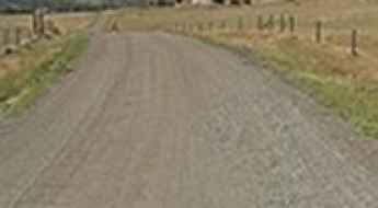
Buffalo Gulch Road
Buffalo Gulch Road is a very narrow drive in Mariposa County, in the U.S. state of California. The road is very narrow and pretty dangerous.

Adventure Logistics: 6 High-Adrenaline Infrastructure Parks in New York State
Executing high-altitude adventure missions requires a combination of technical equipment, rigorous safety protocols, and precise site logistics. New York State hosts some of the most advanced aerial adventure infrastructures in the United States, offering everything from the world’s tallest indoor ropes courses to record-breaking canopy tours. For operators and thrill-seekers, understanding the mechanical constraints—such as weight limits, cable tension, and safety orientation—is essential for a successful experience. This guide analyzes the logistical features of New York’s top adrenaline hubs.
Deadman Hill
Deadman Hill is a high mountain peak at an elevation of 3.265m (10,711ft) above the sea level, located in Larimer County, Colorado, in USA. At the summit there’s a lookout tower.
How to get to TV Mountain in Montana?
TV Mountain is a high mountain peak at an elevation of 2.081m (6,827ft) above sea level located in Missoula County, in the US state of Montana.
Oso Ridge
Oso Ridge is a high mountain peak at an elevation of 2.660m (8,727ft) above the sea level, located in Cibola County, New Mexico, in USA. The road to the summit is not maintained.