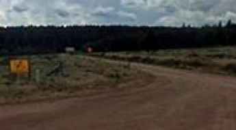
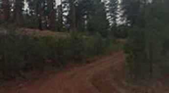
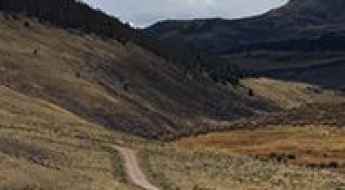
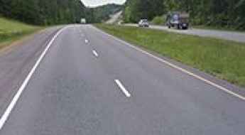
What are the most spectacular roads in the USA?
Located in North America, the USA is a true paradise for drivers, as it hosts more than 2,000 roads listed as the most spectacular in the world.
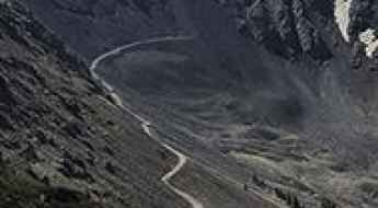
Featuring mountains, deserts, coasts, and snow, in the USA you’ll get your dream road. And you’ll never want to wake up. For instance, at the top of your list, you need to drive the Million Dollar Highway, the most beautiful road in America, and probably in the world. Built in the late 1880s, you'll be on the "outside" for a while with a hell of a view to your right (let the passenger enjoy the view; you'll want to watch the road). Another paved option must be the Iron Mountain Road, featuring 17 miles, 314 curves, 14 switchbacks, 3 pigtails, and 3 tunnels in the Black Hills of South Dakota. No list would be complete without the winding Tail of the Dragon: 318 curves in 11 miles. Spanning Tennessee and North Carolina, it is one of the most scenic drives in the USA. You also can’t skip driving Mount Evans Scenic Byway, the highest paved road in North America, climbing up to 4,310m (14,130ft) in Colorado. It is said to be the highest paved road in North America.
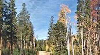
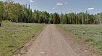
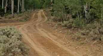
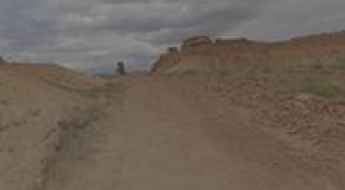
For those who prefer unpaved experiences, the country hosts some of the most defiant yet scenic roads in the world. You can’t miss Black Bear Pass, a high mountain adventure in the Colorado Rockies. Climbing up to 3,915m (12,844ft) above sea level, it's one of the highest roads in Colorado. You can also discover the beauty of Engineer Pass, a mountain pass at an elevation of 3,901m (12,800ft) above sea level in Colorado. It’s mostly a first-gear ride because the road is rough and rocky. The legendary Shafer Trail Road in Utah's Canyonlands National Park is an iconic drive located on the east-central edge of Utah. At times, the road is so narrow that only one car can pass. And Lippincott Mine Road in California is for experienced 4WD drivers using high-clearance vehicles only. You'll need a good map, as the routes are not marked and there are no signs. It’s one of the challenging backcountry roads in Death Valley National Park.
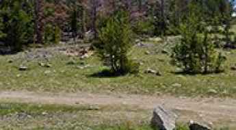
Odart Mountain
Odart Mountain is a high mountain peak at an elevation of 2.600m (8,531ft) above the sea level, located within the Fort Apache Reservation in the U.S. state of Arizona.
Dangerous Roads in South Carolina
South Carolina's picturesque landscapes and charming towns often conceal a less visible but important issue: dangerous roads that pose risks to both locals and visitors. While the state's highways and roads offer scenic drives, some roads are known for their challenging conditions, high accident rates, and safety hazards.
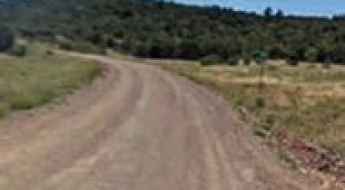
Driving the Forest Road 125 in Utah
Cottonwood Road (Forest Road 125) is a high mountain road in Garfield County, in south central Utah, in USA, running entirely above 2.500m above the sea level. It’s one of the highest roads in Utah.
Conquer the Devil's Highway: The Epic Journey to Mount Diablo in CA
Mount Diablo is a mountain peak at an elevation of 1.172m (3,845ft) above the sea level, located in Contra Costa County, in the US state of California.
How to drive the unpaved road to Lake Mountain in Wyoming?
Lake Mountain is a high mountain pass at an elevation of 2.827m (9,274ft) above sea level located in Albany County, in the US state of Wyoming.
Road trip guide: Conquering Rocky Point in Idaho
Rocky Point is a high mountain peak at an elevation of 1.900m (6,233ft) above the sea level, located in Idaho County, in the US state of Idaho.

6 Things You Should Do After A Traffic Collision in the USA
Every year, there are millions of traffic collisions in the United States. Some of these collisions result in minor property damage, while others lead to serious injury or even death. Often, when you are involved in a traffic accident, no matter how minor it is, you are caught off guard and have no idea what to do. You should always be prepared, just in case. Here are six things you should do after a traffic collision.
How to drive the Sterling Highway in Alaska?
Sterling Highway is a very scenic drive located in the south-central region of the U.S. state of Alaska, Opened in the fall of 1950, the drive runs through the western side of the Kenai Peninsula.
How to get by car to Pride of the West Tunnel in Colorado?
Pride of the West Mine is a high mountain gold mine at an elevation of 3,662 m (12,014 ft) above sea level, located in Chaffee County, in the U.S. state of Colorado. It’s one of the highest roads in Colorado.
Bald Butte
Bald Butte is a high mountain peak at an elevation of 1.801m (5,908ft) above the sea level, located in Harney County, in south-central Oregon, USA.

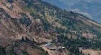
Historic Urban Logistics: Navigating Infrastructure and Mobility in Charleston
Operating a vehicle in cities with deep historical roots presents a unique set of logistical challenges. Charleston, established in 1670, features an urban layout designed long before the requirements of modern vehicular transit. Navigating these roads requires a technical understanding of narrow lane widths, high-density pedestrian zones, and complex coastal geography where major rivers converge with the Atlantic. For professionals and travelers alike, success in this environment depends on a proactive audit of parking logistics, local regulatory frameworks, and route optimization. This guide analyzes the essential protocols for managing mobility and vehicle safety in one of the most historically significant transit hubs in the United States.
Bear Mountain
Bear Mountain is a high mountain peak at an elevation of 2.582m (8,471ft) above the sea level, located in San Bernardino County, in Southern California, United States.
Driving the Klondike Highway to White Pass on the Alaska-Canada border
White Pass is a mountain pass at an elevation of 1,010m (3,313ft) above sea level on the border between Alaska (USA) and British Columbia (Canada). The pass is a major transit point on the Klondike Highway (Route 98), connecting the port of Skagway with the Canadian interior.
Ramcharger Lift
Ramcharger Lift is a lift at an elevation of 2.652m (8,700ft) above the sea level, located in Madison County, in the Rocky Mountains of southern Montana, in USA.

General Guidelines and Tips for Your First Trip as a Truck Driver (CDL) in the USA
Transitioning into a career as a commercial truck driver in the U.S. requires a shift in mindset from casual driving to professional logistics management. Your first trip under a Commercial Driver’s License (CDL) is a critical test of your ability to manage time, equipment, and safety protocols under pressure. Reliability and efficiency are the benchmarks of a successful driver, and mastering the fundamentals early is the only way to secure better routes and high-value loads in the future.
Sony Pass
Sony Pass is a high mountain pass at an elevation of 3.210m (10,531ft) above the sea level located in Saguache County, in Colorado, USA.
La Plata Pass
La Plata Pass is a high mountain pass at an elevation of 3.104m (10,183ft) above the sea level, located in Lake County, Colorado, in USA.
Travel guide to the top of Morton Peak in California
Reaching an elevation of 1,410m (4,625ft) above sea level, Morton Peak is a prominent summit located in San Bernardino County, California. Tucked away within the San Bernardino National Forest, the drive to the top is a classic Southern California fire-lookout route, offering a mix of historical significance and a technical unpaved climb that rewards drivers with some of the best vistas in the region.
Twin Lakes
Twin Lakes are a couple of sub-alpine lakes at an elevation of 3.402m (11,161ft) above the sea level, located in Wayne County, in south-central Utah, in USA. Altitude and extreme weather is always a factor at any time of year. It’s one of the highest roads of Utah.
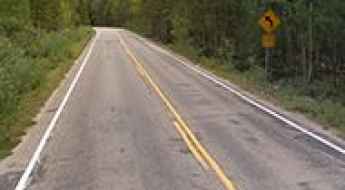
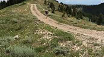
What Are the Most Iconic Drives in the USA?
The American landscape is best deciphered through its diverse road network, which transitions across transcontinental mountain ranges, coastal shelves, and arid basins. A "scenic drive" in the United States is often more than an aesthetic experience; it is a logistical challenge that tests a vehicle’s suspension, thermal management, and a driver’s situational awareness. From the high-precipitation corridors of the Pacific Northwest to the hurricane-exposed bridges of the Florida Keys, these routes represent the pinnacle of American civil engineering and environmental integration.
Forest Service Road 447
Forest Service Road 447 is a high mountain road located in Carbon County, in the U.S. state of Wyoming.
Sidney Peak
Sidney Peak is a high mountain peak at an elevation of 3.291m (10,797ft) above the sea level, located in Garfield County, Utah, United States. It’s one of the highest roads of Utah.
Driving the unpaved FSR 0040 to Trail Mountain in Utah
Trail Mountain is a high mountain peak at an elevation of 3,018m (9,901ft) above sea level, located in Emery County, in the US state of Utah.
Spodue Mountain
Spodue Mountain is a high mountain peak at an elevation of 1.959m (6,427ft) above the sea level, located in Klamath County, Oregon, in USA.
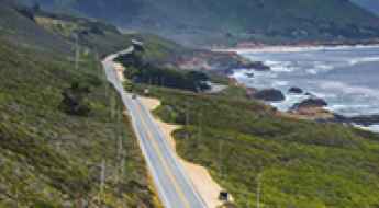
4 Reasons to Take a Trip Along the Coast of California
California, the most populous state in the US with 38 million residents, features over 840 miles of diverse coastline along the Pacific Ocean. Navigating this vast territory requires a strategic approach to diverse road systems, from high-density urban interchanges to technical mountain passes. For the professional traveler, the California coast is not just a scenic destination but a complex environment where vehicle dynamics and topographical awareness are essential for a safe and efficient transit.
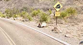
The Desert Risk: Analyzing Traffic Fatality Patterns in High-Density Arid Regions
Analyzing traffic safety in arid, high-growth regions reveals a disturbing paradox: even when road infrastructure is modern, fatality rates can surge due to environmental stress and driver behavior. Using Arizona’s Maricopa County as a primary case study—a region that consolidates over 60% of the state’s population—we can identify critical risk factors that apply to high-traffic desert corridors worldwide. From thermal stress to the psychological impact of "empty road" syndrome, understanding these patterns is essential for long-distance expedition safety.
Bunker Hill
Bunker Hill is a high mountain peak at an elevation of 2.295m (7,529ft) above the sea level, located in California, in USA.
The Ultimate Guide to Mount Powell
Mount Powell is a high mountain peak at an elevation of 2.667m (8,750ft) above the sea level, located in McKinley County, in the northwestern section of the U.S. state of New Mexico.
De Moisy Peak
De Moisy Peak is a high mountain peak at an elevation of 2.815m (9,235ft) above the sea level, located in Weber County, in the U.S. state of Utah.

Navigating Inclusivity and Social Dynamics in US Cities
The United States remains one of the world’s primary travel destinations, defined by a vast network of metropolitan centers that serve as hubs for cultural and social exchange. For the long-distance traveler, understanding the demographic landscape and social inclusivity of a city is as vital as route planning. From the high-density seaports of the Pacific Northwest to the sprawling desert corridors of Arizona, each metropolis offers a unique operational environment shaped by its residents and urban infrastructure.
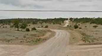
What are the highest roads in Texas?
Located in the southern part of the country and stretching across a diverse, colossal area, Texas is the second-largest state in the nation. Bordered by four other states and the Gulf of Mexico, it features a rich variety of geographical regions, including sweeping plains, arid deserts, dense forests, and, surprisingly, towering mountains.
Travel guide to the top of Dead Indian Hill in WY
Dead Indian Hill is a high mountain peak at an elevation of 2.606m (8,549ft) above the sea level, located in northern Park County, in the U.S. state of Wyoming.
James Peak Lake: Only Experienced Drivers with Advanced Off Road Skills
James Peak Lake is a high mountain lake at an elevation of 3.431m (11,256ft) above the sea level, located in Gilpin County, in the U.S. state of Colorado.
A truly outstanding adventure drive to Byers Peak
Byers Peak is a high mountain peak located in southern Grand County, in the U.S. state of Colorado. A gravel road to the north of the peak climbs up to 3.240m (10,629ft) above the sea level.
Forest Road 514
FR514 is a high mountain road located in Piute County, in south-central Utah, United States. It’s one of the highest roads of Utah.
Forest Road 040: A high-altitude 4x4 shortcut in Utah’s Ashley National Forest
Forest Road 040 is a high mountain road located in Duchesne County, in the US state of Utah. Running entirely at elevations above 3,100 meters, this rugged track is one of the highest roads in Utah, offering a true backcountry driving experience within the Ashley National Forest. It’s one of the highest roads in Utah.
Ultimate 4wd destination: Blue Ridge Mountain
Blue Ridge Mountain is a high mountain peak at an elevation of 3.012m (9,881ft) above the sea level, located in Fremont County, Wyoming, in USA.
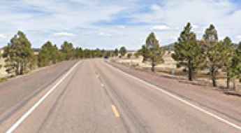
The journey is the destination along the Arizona State Route 273
Arizona State Route 273 is a very scenic high mountain road located in Apache County, in the US state of Arizona. It’s one of the highest roads of Arizona.
The Wild Road to Black Mountain in California
Black Mountain is a high mountain peak at an elevation of 2.184m (7,165ft) above the sea level, located on the boundary between Plumas and Lassen counties, in the U.S. state of California.
Driving the road to Prospect Mountain in Conejos County is not a piece of cake
Prospect Mountain is a high mountain peak at an elevation of 3.724m (12,217ft) above the sea level, located in Conejos County, in the U.S. state of Colorado. It’s one of the highest roads of Colorado.
Hughes Basin
Hughes Basin is a high mountain pass at an elevation of 3.154m (10347ft) above the sea level, located in Park County, Wyoming, United States.
Boulder Creek Road is one of the most difficult drives in Idaho
Located in Blaine County, in the U.S. state of Idaho, Boulder Basin sits at an elevation of 2,987m (9,799ft) above sea level. It’s one of the highest roads in Idaho.
A scenic paved road to Beaver Creek Summit in ID
Beaver Creek Summit is a high mountain pass at an elevation of 1.849m (6,066ft) above the sea level, located in Boise County, in the U.S. state of Idaho.
Chute Canyon Road: Driving through the San Rafael Reef in Utah
Located in the heart of Emery County, Utah, Chute Canyon Road is a stunning backcountry route that pierces through the dramatic limestone fins of the San Rafael Reef. Designated as CO 1016, this drive is a journey into the rugged isolation of the San Rafael Swell, offering a mix of geological wonders and historical remnants of Utah’s intense mining past.
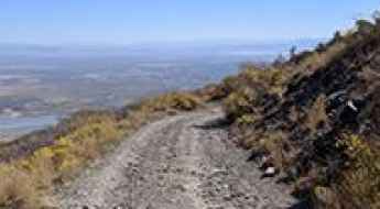
Scotts Pass: Driving the defiant NF-029 in the Wasatch Crest Ridge
Scotts Pass is a high-altitude mountain gap situated at an elevation of 2,892m (9,488ft) above sea level in Salt Lake County, Utah. Located along the prominent Wasatch Crest Ridge, the road to the summit—the NF-029—is a demanding unpaved track that serves as a rugged link between the Big Cottonwood and Park City ridgelines. This is not a standard forest drive; it is a high-mountain transit where the technical integrity of the roadbed and the exposure to steep drops define every mile of the climb.
Driving Safety Tips for Your California Road Trip
Whether you’re sunning yourself on cliff-lined beaches, exploring redwood forests, or seeing the stars in Hollywood, a road trip in California is a fantastic way to spend your time. With so many world-class attractions and stunning natural vistas, it’s not surprising that more than 200 million people visit The Golden State each year.
What are the most challenging National Park roads to drive in the USA?
Driving through the US National Park system involves more than just scenic overlooks; it requires managing high-altitude climbs, unpredictable weather, and technical mountain passes. While these routes are paved, the sheer scale of the terrain and the proximity to unprotected drops make them a test for any driver. Navigating these parks means accounting for heavy tourist traffic, brake fade on long descents, and sudden seasonal closures that can block key mountain arteries for months.
How to drive the unpaved North Fork Clear Creek Trail in Colorado?
North Fork Clear Creek Trail is a very scenic yet defiant mountain road located in the heart of Chaffee County, in the US state of Colorado.