What are the most spectacular roads in the USA?
Located in North America, the USA is a true paradise for drivers, as it hosts more than 2,000 roads listed as the most spectacular in the world.
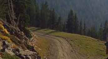
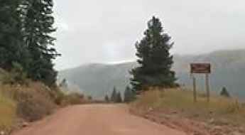
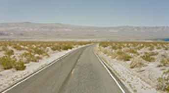
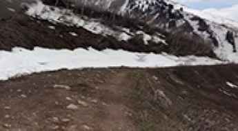
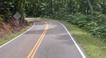
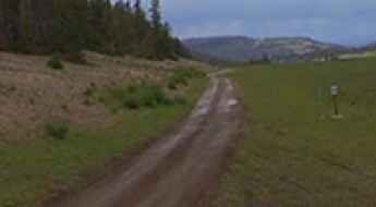
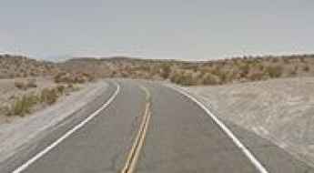
Featuring mountains, deserts, coasts, and snow, in the USA you’ll get your dream road. And you’ll never want to wake up. For instance, at the top of your list, you need to drive the Million Dollar Highway, the most beautiful road in America, and probably in the world. Built in the late 1880s, you'll be on the "outside" for a while with a hell of a view to your right (let the passenger enjoy the view; you'll want to watch the road). Another paved option must be the Iron Mountain Road, featuring 17 miles, 314 curves, 14 switchbacks, 3 pigtails, and 3 tunnels in the Black Hills of South Dakota. No list would be complete without the winding Tail of the Dragon: 318 curves in 11 miles. Spanning Tennessee and North Carolina, it is one of the most scenic drives in the USA. You also can’t skip driving Mount Evans Scenic Byway, the highest paved road in North America, climbing up to 4,310m (14,130ft) in Colorado. It is said to be the highest paved road in North America.
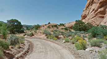
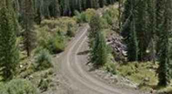
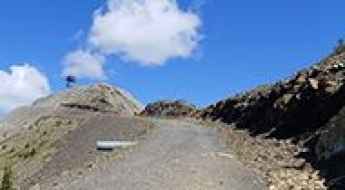
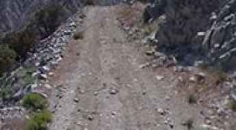
For those who prefer unpaved experiences, the country hosts some of the most defiant yet scenic roads in the world. You can’t miss Black Bear Pass, a high mountain adventure in the Colorado Rockies. Climbing up to 3,915m (12,844ft) above sea level, it's one of the highest roads in Colorado. You can also discover the beauty of Engineer Pass, a mountain pass at an elevation of 3,901m (12,800ft) above sea level in Colorado. It’s mostly a first-gear ride because the road is rough and rocky. The legendary Shafer Trail Road in Utah's Canyonlands National Park is an iconic drive located on the east-central edge of Utah. At times, the road is so narrow that only one car can pass. And Lippincott Mine Road in California is for experienced 4WD drivers using high-clearance vehicles only. You'll need a good map, as the routes are not marked and there are no signs. It’s one of the challenging backcountry roads in Death Valley National Park.

How to Pay New Jersey Parking Tickets?
Paying a New Jersey parking ticket can seem like a hassle, but it doesn't have to be.
Road to Clayton Peak: Driving the 20% Service Track in Utah
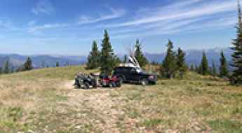
At an elevation of 3,196m (10,485ft) above sea level, Clayton Peak (also known as Mount Majestic) is a high mountain summit located in Salt Lake County, Utah. Situated on the eastern side of the Wasatch Mountains, the access to the peak is managed through a specialized ski-station service road within the Brighton Resort area.
How to drive the unpaved road to Shrine Mountain Inn in Colorado?
Walters, Chucks, and Jays are three different cabins located in Eagle County, in the US state of Colorado. The road to the huts tops out at 3.431m (11,256ft) above sea level.
Anderson Mountain
Anderson Mountain is a high mountain pass at an elevation of 2.455m (8,054ft) above the sea level, located in Lemhi County, in the U.S. state of Idaho.
Degrees of Safety on the Diverse Roads of Northeastern America
The Northeastern United States features a highly diverse road network, ranging from the aging, high-capacity corridors of the I-95 to the isolated, scenic routes of northern New England. While states like Massachusetts and New York statistically rank among the safest for motorists, the region presents a stark contrast in risk levels. Professional navigation in the Northeast requires a dual strategy: managing extreme urban congestion and situational awareness on narrow, historic rural highways.
The Ultimate Guide to Traveling the Cottonwood Cove Road
Located in Clark County, in the U.S. state of Nevada, Cottonwood Cove Road is a very scenic drive leading to Cottonwood Cove Marina and Six Mile Cove.

Preparing For A High Octane Road Trip in the USA
Before embarking on a high-intensity road trip through isolated or technically demanding terrain, ensuring your vehicle is in peak mechanical condition is a non-negotiable safety standard. A "high-octane" journey—defined by steep gradients, extreme temperatures, and long distances—requires more than just a cursory check. A comprehensive, top-to-bottom inspection is necessary to mitigate the risk of mechanical failure in areas where roadside assistance is non-existent.

Eldorado Mountain, a private road to the summit
Eldorado Mountain is a high mountain peak at an elevation of 2.535m (8,316ft) above the sea level, located on the boundary of Boulder, Gilpin, and Jefferson counties in the U.S. state of Colorado.
Discovering Cold Springs Summit: The Highest Point on California's Sierra Vista Scenic Byway
Cold Springs Summit is a high mountain pass at an elevation of 2.233m (7,326 feet) above the sea level, located in the County of Madera, at the geographic center of the U.S. state of California.
How to drive the unpaved road to Buck Ridge in Utah?
Buck Ridge is a high mountain peak at an elevation of 3,180m (10,433ft) above sea level, located in Sanpete County, central Utah. Situated within the Manti-La Sal National Forest, the summit is reached via a technical spur designated as Forest Road 0030 (FR0030). Logistically, it serves as one of the highest accessible points in the Wasatch Plateau.
The Knoll
The Knoll is a high mountain peak at an elevation of 1.902m (6,240ft) above the sea level, located in Grand County, on the east central edge of Utah, United States.
Where are the best roads of Capitol Reef National Park?
Located in south-central Utah, Capitol Reef National Park is defined by the Waterpocket Fold—a 100-mile long warp in the Earth's crust. This remote landscape features a cold semi-arid climate and a complex network of roads that range from scenic paved bypasses to high-clearance dirt tracks. For the off-road enthusiast and the professional traveler, navigating Capitol Reef is an exercise in desert logistics, where seasonal weather volatility and rugged terrain demand precise vehicle preparation.

Navigating Portland and Northern Oregon in Late Season
Portland, Oregon, serves as the primary logistical hub for the Pacific Northwest, a region defined by its rapid atmospheric shifts and complex river-adjacent infrastructure. As the season transitions into autumn and winter, the operational environment for motorists changes drastically. Understanding the unique road conditions of the "Rose City" and its surrounding corridors—such as the transit to St. Helens—is essential for maintaining safety during the high-precipitation months that define Northern Oregon.
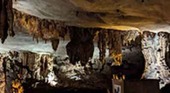
Fantastic Caverns is Missouri’s Only Drive-Through Cave
Located in Greene County, in the US state of Missouri, Fantastic Caverns offers a unique tram-based tour that takes visitors through the heart of a natural cave system. It’s a must-see for anyone exploring scenic drives or road adventures in southwestern Missouri. It’s one of the few roads in the world that runs through a cave.
How to drive the unpaved road to Cox Knoll in Utah?
Cox Knoll is a high mountain peak at an elevation of 3,132m (10,275ft) above sea level, located in Sanpete County, in the US state of Utah.
Cape Royal
Cape Royal is a high mountain peak at an elevation of 2.412m (7,913ft) above the sea level, located on the South Rim of the Grand Canyon, in Coconino County, Arizona, in USA. Take the time to take this drive. So many beautiful things to see.
Yellow Mountain North
Yellow Mountain North is a high mountain peak at an elevation of 3.538m (11,607ft) above the sea level, located in San Miguel County, Colorado, in USA.
Squaw Peak Road is an iconic drive in the Wasatch Mountains
Squaw Peak Road is a very scenic mountainous drive in Utah County, in the U.S. state of Utah.
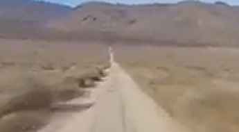
Navigating Butte Valley Road in Death Valley National Park
Butte Valley Road, situated in Inyo County, in the US state of California, offers one of the most challenging drives within Death Valley National Park. For those considering the journey, a 4x4 vehicle is highly recommended.
The Loneliest Highway to Little Antelope Summit in NV
Little Antelope Summit is a high mountain pass at an elevation of 2.272m (7,454ft) above the sea level, located in White Pine County, along the central eastern boundary of the U.S. state of Nevada.
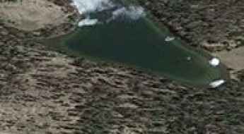
A gravel summer road to De Herrera Lake
De Herrera Lake is a high mountain lake at an elevation of 3.308m (10,853ft) above the sea level, located in Conejos County, in the U.S. state of Colorado.
Most Dangerous Mountain Roads in North Carolina: Curves, Cliffs, and Fog
North Carolina is home to some of the most dangerous mountain roads in the eastern United States. While the Appalachian network offers huge climbs and challenging drives, these mountain routes are frequently the site of severe crashes due to steep drop-offs, endless blind corners, and rapid weather changes. Driving these roads demands heavy respect for the slopes, sharp eyes for narrow lanes, and a car with solid brakes because steel guardrails are rare here.
Castle Peak
Castle Peak is a high mountain peak at an elevation of 3.364m (11,036ft) above the sea level, located in Eagle County, Colorado, United States.
Buck Rock
Buck Rock is a high mountain peak at an elevation of 2.557m (8,389ft) above the sea level, located in Tulare County, California, in USA.
Road trip guide: Conquering the Stillwater Reservoir
Stillwater Reservoir is a scenic alpine lake at an elevation of 3.143m (10,311ft) above the sea level, located in northeast Garfield County, in the U.S. state of Colorado.
Is the Forest Road 0161 in Utah's Manti-La Sal National Forest difficult?
Forest Road 0161 is an extreme high-altitude track located in Sanpete County, in the U.S. state of Utah. Running entirely above 3,200m (10,500ft) sea level, this remote path is one of the highest mountain roads of Utah. Located in the heart of the Manti-La Sal National Forest, the road is a rugged mountain drive that stays on the crest of the range, offering zero protection against the elements and requiring a vehicle that can handle both the thin air and the unpredictable alpine terrain.
A chairlift access road to June Mountain in California
June Mountain is a high mountain peak at an elevation of 3.092m (10,144ft) above the sea level, located in Mono County, in the east central portion of the U.S. state of California. It’s one of the highest roads of California.
Driving the 4x4 trail to Pioneer Lift in Winter Park
Pioneer Lift is a high-altitude chairlift station reaching an elevation of 3,264m (10,708ft) above sea level, located within the Winter Park Resort in Grand County, Colorado. The access route to the summit is a technical service track designed for resort maintenance and emergency logistics.
Driving the unpaved road to Bean Hill in Utah
Bean Hill is a high mountain peak at an elevation of 2,771m (9,091ft) above sea level located in the US state of Utah.

The Ultimate Guide to Camping in the USA: Seasons & Spots
Camping in the United States requires a sophisticated understanding of regional microclimates and topographical diversity. From the saturated bayous of the Gulf Coast to the high-altitude deserts of the Southwest, the operational success of an overland expedition depends on catching the optimal "weather window." Selecting the right season is not merely an aesthetic choice; it is a critical safety decision that affects vehicle traction, engine thermal management, and survival protocols in remote territories.
A paved road to Ibex Pass in Death Valley NP
Ibex Pass is a mountain pass at an elevation of 635m (2,083ft) above sea level, located on the boundary between Inyo and San Bernardino counties, in the eastern central part of the U.S. state of California.
How difficult is the 4x4 road to Treasure Mountain in Colorado?
Treasure Mountain is a high mountain summit reaching an elevation of 3,380m (11,089ft) above sea level in Mineral County, Colorado. Located in the rugged San Juan Mountains, the road to the top, known as County Road 39 (Fall Creek Road), is a deceptive climb. While the lower sections are well-graded, the final approach to the summit turns into a narrow, primitive trail where high-clearance 4x4 vehicles are mandatory to navigate the steep ramps and the unpredictable rocky terrain near the peak.
Graham Peak
Graham Peak is a high mountain peak at an elevation of 2.701m (8,861ft) above the sea level, located in Cassia County in south central Idaho.
How To Have The Ultimate Road Trip To Modjeska Peak
Modjeska Peak is a high mountain peak at an elevation of 1,680m (5,511ft) above sea level, located in Orange County, in the U.S. state of California.
A chairlift access road to Rainbow Summit in California
Rainbow Summit is a high mountain peak at an elevation of 3.046m (9,993ft) above the sea level, located in Mono County, in the east central portion of the U.S. state of California. It’s one of the highest roads of California.
Garden Pass
Garden Pass is a high mountain pass at an elevation of 2.042m (6,699ft) above the sea level, located in Eureka County, Nevada, in USA.
A rough 4x4 road to Bald Mountain in ID
Bald Mountain is a high mountain peak at an elevation of 1.626m (5,334ft) above the sea level, located on the boundary between Latah and Benewah counties, in the U.S. state of Idaho. The road to the summit is a bit bumpy with some areas which need to be taken slowly.
White Peak
White Peak is a high mountain peak at an elevation of 2.684m (8,805ft) above the sea level, located in Colfax County, in the U.S. state of New Mexico.
Take An Unforgettable Drive to Tatie Peak in WA
Tatie Peak is a high mountain peak located in Okanogan County, in the U.S. state of Washington. A gravel road on the way to the summit tops out at 1.961m (6,433ft) above the sea level. It's one of the highest roads of Washington.

A rough 4x4 road to Saddle Mountain in the Bitterroot Range
Saddle Mountain is a high mountain peak at an elevation of 2.526m (8,287ft) above the sea level, located in Ravalli County, in the southwestern part of the U.S. state of Montana.
The Loneliest Highway to Pancake Summit in NV
Pancake Summit is a high mountain pass at an elevation of 1.993m (6,538ft) above the sea level, located in White Pine County, along the central eastern boundary of the U.S. state of Nevada.
Carter Peak
Carter Peak is a high mountain peak at an elevation of 2.036m (6,679ft) above the sea level, located in north-central Sevier County, Utah, United States. The climb is brutal: 15.04% average gradient.
Sandy Wash is a bumpy road on the shore of Lake Mohave
Sandy Wash is a scenic unpaved road located in Clark County, in the U.S. state of Nevada, on the shore of Lake Mohave. Experienced 4-wheel drive recommended.
Providence Peak
Providence Peak is a high mountain peak at an elevation of 2.929m (9,609ft) above the sea level, located in Cache County, on the northern edge of Utah, United States.
How to get by car to Lookout Mountain in Ravalli County?
Lookout Mountain is a high mountain peak at an elevation of 2,387m (7,831ft) above sea level, located in Ravalli County, in the US state of Montana.
A brutal road to the summit of Singatse Peak
Singatse Peak is a mountain peak at an elevation of 1.940m (6,364ft) above the sea level, located in Lyon County, Nevada, USA. The climb is brutal: the average gradient is 9.26%.
A scenic and worthwhile drive to Bear Creek Summit in ID
Bear Creek Summit is a high mountain pass at an elevation of 2.297m (7,536ft) above the sea level, located in Custer County, in the center of the U.S. state of Idaho.
Driving the historic road to Carroll Summit in Nevada
Carroll Summit is a high mountain pass at an elevation of 2,277m (7,470ft) above sea level, located on the boundary between Lander and Churchill counties in the U.S. state of Nevada.