What are the most spectacular roads in the USA?
Located in North America, the USA is a true paradise for drivers, as it hosts more than 2,000 roads listed as the most spectacular in the world.
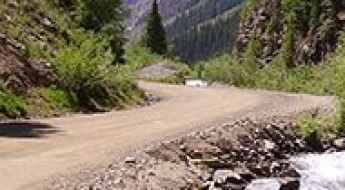
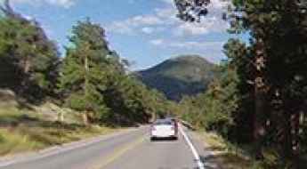
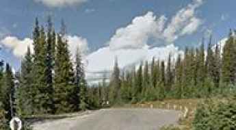
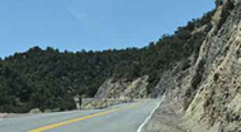
Featuring mountains, deserts, coasts, and snow, in the USA you’ll get your dream road. And you’ll never want to wake up. For instance, at the top of your list, you need to drive the Million Dollar Highway, the most beautiful road in America, and probably in the world. Built in the late 1880s, you'll be on the "outside" for a while with a hell of a view to your right (let the passenger enjoy the view; you'll want to watch the road). Another paved option must be the Iron Mountain Road, featuring 17 miles, 314 curves, 14 switchbacks, 3 pigtails, and 3 tunnels in the Black Hills of South Dakota. No list would be complete without the winding Tail of the Dragon: 318 curves in 11 miles. Spanning Tennessee and North Carolina, it is one of the most scenic drives in the USA. You also can’t skip driving Mount Evans Scenic Byway, the highest paved road in North America, climbing up to 4,310m (14,130ft) in Colorado. It is said to be the highest paved road in North America.
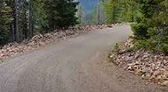
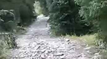
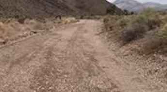
For those who prefer unpaved experiences, the country hosts some of the most defiant yet scenic roads in the world. You can’t miss Black Bear Pass, a high mountain adventure in the Colorado Rockies. Climbing up to 3,915m (12,844ft) above sea level, it's one of the highest roads in Colorado. You can also discover the beauty of Engineer Pass, a mountain pass at an elevation of 3,901m (12,800ft) above sea level in Colorado. It’s mostly a first-gear ride because the road is rough and rocky. The legendary Shafer Trail Road in Utah's Canyonlands National Park is an iconic drive located on the east-central edge of Utah. At times, the road is so narrow that only one car can pass. And Lippincott Mine Road in California is for experienced 4WD drivers using high-clearance vehicles only. You'll need a good map, as the routes are not marked and there are no signs. It’s one of the challenging backcountry roads in Death Valley National Park.
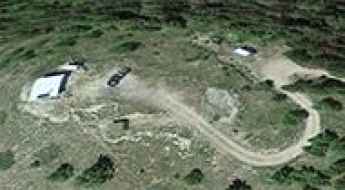
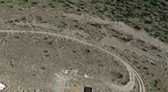
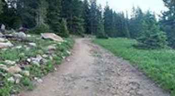
Union Peak: Driving the Rocky Garnet Range Road in Montana
Union Peak is a mountain summit at an elevation of 2,073 meters (6,801 ft) above sea level, located in Granite County, Montana. Tucked deep within the rugged Garnet Range, the route to the historic 1963 lookout tower is the Garnet Range Road. It is an unmaintained, unpaved single-lane forest track packed with loose rock shards, deep ruts, and sharp drop-offs with zero side protections.
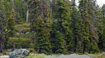
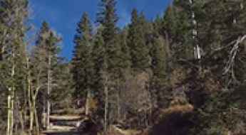
An exciting and pleasant road trip to Sex Peak in MT
Sex Peak is a high mountain peak at an elevation of 1.767m (5,797ft) above the sea level, located in Sanders County, in the U.S. state of Montana.
Highland Mary Mine
Highland Mary Mine is an abandoned gold mine at an elevation of 3.432m (11,259ft) above the sea level, located in San Juan County, in the U.S. state of Colorado.
How to drive the unpaved road to Mill Creek Road in Colorado?
Mill Creek Road (FSR 710) is a high mountain road located in Eagle County, in the US state of Colorado. It’s one of the highest roads in Colorado.
Forest Road 4723
Forest Road 4723 is a short high mountain road located in San Juan County, in the southeastern part of Utah, United States. It’s one of the highest mountain roads of Utah.
How to drive the unpaved road to the lookout at Parkview Mountain in Colorado
Parkview Mountain is a high mountain peak at an elevation of 3.442m (11,292ft) above sea level, located in Jackson County, in the US state of Colorado.
Deer Mountain
Deer Mountain is a high mountain peak at an elevation of 2.221m (7,286ft) above the sea level, located in Ravalli County, Montana, in USA.
Travel guide to the top of Logan Pass in Nevada
Logan Pass is a high mountain pass at an elevation of 2.209m (7,247ft) above the sea level, located in Lincoln County, in the U.S. state of Nevada.
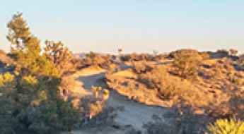
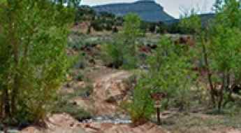
How To Have The Ultimate Road Trip To Eureka Peak in Joshua Tree NP
Eureka Peak is a mountain peak at an elevation of 1.668m (5,472ft) above the sea level, located in San Bernardino County, in the US state of California.
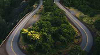
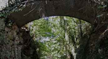
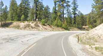
All About the Historic Columbia River Highway
The Historic Columbia River Highway is a very scenic drive located in the U.S. state of Oregon, running through the Columbia River Gorge. It was the country's first scenic highway.
The road to Secret Pass in NV is not for timid drivers
Secret Pass is a high mountain pass at an elevation of 1.507m (4,944ft) above the sea level, located in Nye County in the U.S. state of Nevada.
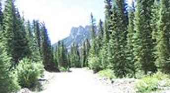
Professional Logistics for Remote Road Travel
Driving through America's wilderness areas requires a shift from standard transit to expedition-level logistics. When the road transitions from maintained asphalt to rugged backcountry tracks, the driver must manage vehicle autonomy, environmental risks, and resource conservation. Proper planning for these remote roads is the only way to ensure that an outdoor expedition remains a controlled operation rather than a survival scenario.
A delightful yet crowded road to Bear Lake in CO
Bear Lake is an alpine lake at an elevation of 2.890m (9,481ft) above the sea level, located in Larimer County, in the U.S. state of Colorado. The road is usually crowded during peak tourist season.
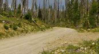
Fall Mountain
Fall Mountain is a high mountain peak at an elevation of 1.811m (5,941ft) above the sea level, located in Grant County, in eastern Oregon, in USA. The road to the summit is well graveled in most areas and should be usable with most vehicles.

What Are the Best Ways to Recover Cash from a Damaged Car on US Roads?
Statistically, the average driver in the United States will be involved in approximately four accidents throughout their lifetime. With the US recording higher accident rates than many other developed nations, the management of post-collision assets is a critical logistical challenge. When a vehicle sustains significant damage, the priority shifts from repair to capital recovery. Understanding how to audit the value of a totaled asset and identifying the most profitable exit strategy is essential for any operator on the roads. This guide analyzes the protocols for evaluating junk cars and the professional channels for maximizing your financial return.
How to drive the technical Soldier Pass Road in Sedona?
Soldier Pass Road is one of the most technical and restricted drives in Sedona, Arizona. Located within the Coconino National Forest, this 1.6 km (1 mile) forest track is a real test for 4x4 drivers, offering a mix of massive rock steps and dusty desert terrain right on the edge of the Red Rock-Secret Mountain Wilderness.
How to get by car to Cascade Lake in Wyoming?
Cascade Lake is a high mountain lake at an elevation of 3,100m (10,170ft) above sea level, located in Carbon County, in the U.S. state of Wyoming. It’s one of the highest roads in Wyoming.
An epic enthralling road to Carter Summit in CA
Carter Meadows Summit is a high mountain pass at an elevation of 1.883m (6,177ft) above the sea level, located in Siskiyou County, in the northernmost part of the U.S. state of California.
What are the most haunted roads of North Carolina?
Driving through North Carolina’s backcountry after dark presents a unique set of challenges, from dense fog to roads steeped in local folklore. Many of these routes are the site of historical accidents and unexplained phenomena that continue to attract motorists seeking a high-exposure driving experience. Whether these incidents are rooted in myth or environmental anomalies, driving these roads at night requires peak situational awareness and a reliable vehicle setup to manage the technical and psychological demands of the terrain.
Driving the wild Vanity Summit in Idaho
Vanity Summit is a high mountain pass at an elevation of 2.381m (7,811ft) above the sea level, located in Custer County, in the center of the U.S. state of Idaho.
Forest Road 0169
Forest Road 0169 is a high mountain road located in Sanpete County is a county in the U.S. state of Utah. It’s one of the highest roads of Utah running entirely over 2.800m above the sea level.
How to drive to the highest fire lookout in North America on Fairview Peak?
Fairview Peak is a high mountain peak at an elevation of 2,532m (8,307ft) above sea level, located in Churchill County, in the U.S. state of Nevada.
County Road 861
County Road 861 is a very scenic high mountain road located in the San Juan Mountains, Gunnison County, in the U.S. State of Colorado. The road runs entirely over 2.760m above the sea level.
A Most Tricky Scenic Drive to Angora Lakes in California
Angora Lakes are a pair of freshwater alpine lakes located on the south end of Lake Tahoe, in the US state of California.
Conquering Elk Summit: Driving the Unpaved Road to Idaho's Historic Lookout
Elk Summit is a high mountain peak at an elevation of 1,949m (6,394ft) above sea level, located in Idaho County, in the U.S. state of Idaho.
Stark Mountain
Stark Mountain is a high mountain peak at an elevation of 2.243m (7,358ft) above the sea level, located in Mineral County, Montana, in USA.
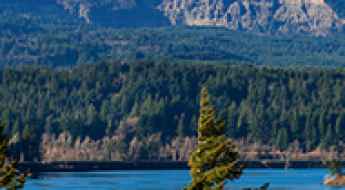
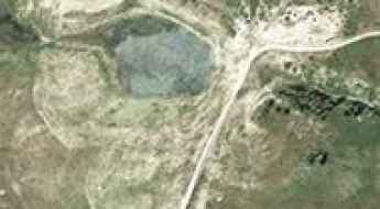
An epic road to Clohesy Lake in the Sawatch Range of CO
Clohesy Lake is an Alpine lake located in Chaffee County, in the U.S. state of Colorado.
Driving the Most Haunted Roads on Long Island
Long Island, situated in Suffolk County, New York, is home to a network of roads that have transcended their role as mere infrastructure to become focal points of regional folklore and paranormal reports. The dense wooded terrain of West Hills County Park provides the backdrop for Sweet Hollow Road and Mount Misery Road. These narrow, winding roads are defined by their limited visibility and a history of tragic events, creating a high-stress environment for motorists and attracting thousands of visitors every year.
The Ultimate Guide to Traveling the Graves Creek Road in WA
Graves Creek Road is a very scenic drive with stunning views located in Jefferson County, in the US state of Washington.
An Unforgettable Drive to Gold Hill Pass in UT
Gold Hill Pass is a high mountain pass at an elevation of 3.060m (10,039ft) above the sea level, located in Summit County, in the U.S. state of Utah.
A beautiful drive to Greenhorn Summit in the southern Sierra Nevada of CA
Greenhorn Summit is a high mountain pass at an elevation of 1.859m (6,102ft) above the sea level, located in Kern County, in the US state of California.
The journey is the destination along the Sylamore Scenic Byway in AR
Sylamore Scenic Byway is the name of a picturesque road located in Stone County, in the U.S. state of Arkansas.

5 Tips to Reduce Risks When Taking a Long Road Trip in the USA
Driving across the United States is one of the best ways to see the country, but long road trips on dangerous roads require real preparation. From sudden weather changes to mechanical breakdowns, the risks are real when you are hundreds of miles from the nearest town. To keep your trip safe and avoid getting stranded, you need to follow a few basic rules before you start driving.
Travel guide to the top of Fredonyer Peak in California
Fredonyer Peak is a high mountain peak at an elevation of 2.423m (7,949ft) above the sea level, located in Lassen County, in the northeastern portion of the U.S. state of California.
Beaver Creek mountain
Beaver Creek mountain is a high mountain peak at an elevation of 3.488m (11,443ft) above the sea level, located in Eagle County, Colorado, United States.
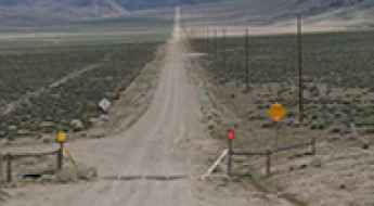
Three High-Risk Roads to Avoid in Nevada
While Nevada is often associated with the high-traffic corridors of Las Vegas, the state’s road network includes some of the most hazardous driving environments in the United States. Driving these roads involves managing extreme elevations, vast stretches of isolation, and unpredictable weather patterns. For many motorists, the risks associated with these routes far outweigh the scenic benefits. Understanding the specific mechanical and psychological demands of these dangerous roads is essential for any professional driver transiting through the Silver State.
Forest Road 1271
Forest Road 1271 is a short mountain road located in Sanpete County is a county in the U.S. state of Utah. It’s one of the highest roads of Utah running entirely over 3.280m above the sea level.
Squaw Pass
Squaw Pass is a high mountain pass at an elevation of 2.219m (7,280ft) above the sea level, located in the Centennial Mountains, on the border of Idaho and Montana, in USA.
Margy's Hut
Margy's Hut is a high mountain refuge at an elevation of 3.454m (11,332ft), located in Pitkin County, in central Colorado, United States.
Driving Florida: From the Overseas Highway to the Everglades wilderness
Florida is much more than theme parks and crowded beaches; it is a state defined by water and extreme engineering. Driving here means navigating some of the longest overseas bridges in the world and crossing vast, alligator-filled wetlands where the asphalt is the only barrier against the wild. From the iconic Seven Mile Bridge to the remote "Alligator Alley," Florida offers a unique driving experience where tropical storms and ocean vistas dictate the pace.
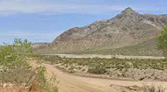
How to drive the unpaved road to the lookout at O'Leary Peak in Arizona?
O'Leary Peak is a mountain peak at an elevation of 2.697m (8,848ft) above sea level, located in Coconino County, in the US state of Arizona.
The twists and turns of Witter Gulch Road: A Colorado driving adventure
The curvy Witter Gulch Road is a very challenging drive located in Clear Creek County, in the U.S. state of Colorado.
Road trip guide: Conquering Bull of the Woods Mountain in NM
Bull of the Woods Mountain is a high mountain peak at an elevation of 3.542m (11,620ft) above the sea level, located in Taos County, in the U.S. state of New Mexico. It’s one of the highest roads of New Mexico.
A scenic paved road to Loup Loup Pass in Washington’s Cascade Range
Loup Loup Pass is a high mountain pass at an elevation of 1.226m (4,020ft) above sea level, located in Okanogan County, in the US state of Washington.
Bertha Peak
Bertha Peak is a high mountain peak at an elevation of 2.503m (8,211ft) above the sea level, located in San Bernardino County, in Southern California, United States.
South Draw Road in Capitol Reef NP will take your breath away
South Draw Road is a very challenging yet scenic drive across the Capitol Reef National Park, in the US state of Utah. In bad weather, the road becomes impassable to even 4-wheel-drive vehicles.
Anchorite Pass in Nevada: The Ultimate Road Trip Guide
Anchorite Pass is a high mountain pass at an elevation of 2.326m (7,631ft) above the sea level, located in Mineral County, in the U.S. state of Nevada, near the California border.
Medsger Pass
Medsger Pass is a high mountain pass at an elevation of 1.447m (4,747ft) above the sea level, located in Lincoln County, in the U.S. state of Nevada.