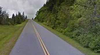
What are the most spectacular roads in the USA?
Located in North America, the USA is a true paradise for drivers, as it hosts more than 2,000 roads listed as the most spectacular in the world.
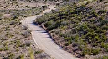
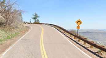
Featuring mountains, deserts, coasts, and snow, in the USA you’ll get your dream road. And you’ll never want to wake up. For instance, at the top of your list, you need to drive the Million Dollar Highway, the most beautiful road in America, and probably in the world. Built in the late 1880s, you'll be on the "outside" for a while with a hell of a view to your right (let the passenger enjoy the view; you'll want to watch the road). Another paved option must be the Iron Mountain Road, featuring 17 miles, 314 curves, 14 switchbacks, 3 pigtails, and 3 tunnels in the Black Hills of South Dakota. No list would be complete without the winding Tail of the Dragon: 318 curves in 11 miles. Spanning Tennessee and North Carolina, it is one of the most scenic drives in the USA. You also can’t skip driving Mount Evans Scenic Byway, the highest paved road in North America, climbing up to 4,310m (14,130ft) in Colorado. It is said to be the highest paved road in North America.
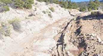
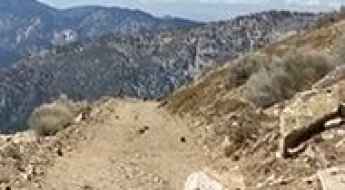
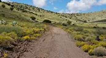
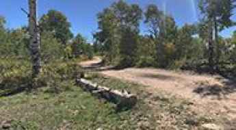
For those who prefer unpaved experiences, the country hosts some of the most defiant yet scenic roads in the world. You can’t miss Black Bear Pass, a high mountain adventure in the Colorado Rockies. Climbing up to 3,915m (12,844ft) above sea level, it's one of the highest roads in Colorado. You can also discover the beauty of Engineer Pass, a mountain pass at an elevation of 3,901m (12,800ft) above sea level in Colorado. It’s mostly a first-gear ride because the road is rough and rocky. The legendary Shafer Trail Road in Utah's Canyonlands National Park is an iconic drive located on the east-central edge of Utah. At times, the road is so narrow that only one car can pass. And Lippincott Mine Road in California is for experienced 4WD drivers using high-clearance vehicles only. You'll need a good map, as the routes are not marked and there are no signs. It’s one of the challenging backcountry roads in Death Valley National Park.

How Do Bad Weather Conditions Impact American Roads?
Weather is a primary factor in approximately 11% of fatal roadway accidents in the United States. Beyond simple visibility issues, extreme meteorological events directly alter the mechanical relationship between the tire and the road surface. From the thermal expansion of asphalt in the Southwest to the cryogenic stress on northern corridors, understanding the physics of weather-related road degradation is essential for maintaining vehicle control in high-risk environments.
River Hill Pass
River Hill Pass is a high mountain pass at an elevation of 2.931m (9,615ft) above the sea level located in the Rio Grande National Forest, in Colorado, USA.
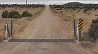
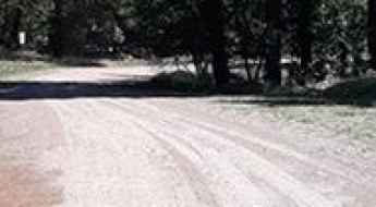
A smooth road to Salsberry Pass in Death Valley NP
Salsberry Pass is a mountain pass at an elevation of 1.006m (3,300ft) above the sea level, located in Inyo County, in the eastern central part of the U.S. state of California.
Driving the challenging Forest Road 120 in Wyoming
Forest Road 120 is a high mountain road located in Park County, in the U.S. state of Wyoming. It’s 24.94km (15.5 miles) long and tops out at 3.104m (10,183ft) above sea level.
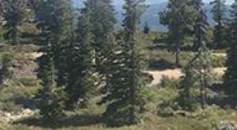
Driving the steep Forest Service Rd 616 to East Lone Cone Pass
East Lone Cone Pass is a high mountain pass at an elevation of 3,286m (10,780ft) above sea level, located in Dolores County, Colorado. Tucked away in the San Miguel Mountains of the Rocky Mountains, this pass offers a secluded and technical driving experience far from the main tourist trails.
How to drive the unpaved road to the lookout at Sawyer Ridge in Idaho?
Sawyer Ridge is a high mountain peak at an elevation of 2.228m (7,309ft) above sea level located in Idaho County, in the US state of Idaho.
Gallinas Peak
Gallinas Peak is a high mountain peak at an elevation of 2.635m (8,645ft) above the sea level, located in Lincoln County, New Mexico, United States.
Herd Peak
Herd Peak is a high mountain peak at an elevation of 2.141m (7,024ft) above the sea level, located in Siskiyou County, California, in USA.
Ultimate 4wd destination: Dickson Pass
Dickson Pass is a high mountain pass at an elevation of 3.190m (10,465ft) above the sea level, located in San Juan County, in the southeastern portion of the U.S. state of Utah.
How to drive the unpaved road to the lookout at Tohatchi Peak in New Mexico?
Tohatchi Peak is a high mountain peak at an elevation of 2.698m (8,851ft) above the sea level, located in McKinley County, in the US state of New Mexico.
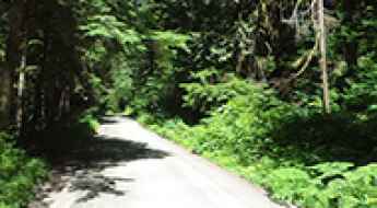
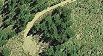
Driving the scenic Mountain Loop Highway in WA
Mountain Loop Highway is the name of a very scenic drive located in Snohomish County, in the US state of Washington.
How to drive the unpaved road to Tower Mountain in Montana?
Tower Mountain is a high mountain peak at an elevation of 2.828m (9,278ft) above sea level, located in Beaverhead County, in the U.S. state of Montana.
How to drive to North Schell Peak in Nevada?
North Schell Peak is a prominent mountain peak located in White Pine County, in the eastern part of Nevada, USA. Reaching an elevation of 2,775m (9,104ft) above sea level within the Schell Creek Range, the road leading towards the summit offers a rugged journey through a scenic and remote landscape.
How to get by car to Old Baldy Mountain in Lewis and Clark County?
Old Baldy Mountain is a high mountain peak at an elevation of 2,499m (8,198ft) above sea level, located in Lewis and Clark County, in the U.S. state of Montana.
Black Butte Mountain
Black Butte Mountain is a high mountain pass at an elevation of 2.860m (9,383ft) above the sea level, located in Madison County, in southwestern Montana, in USA.
How to drive the paved road to Park Point in Colorado?
Park Point is a high mountain peak at an elevation of 2.603m (8,540ft) above sea level, located in Montezuma County, in the US state of Colorado. The views are breathtaking all through the year.
Miller Hill
Miller Hill is a high mountain peak at an elevation of 3.036m (9,960ft) above the sea level, located in Salt Lake County, in the U.S. state of Utah.
The unpaved road to South Mount Hawkins in California
South Mount Hawkins is a high mountain peak at an elevation of 2.373m (7,785ft) above sea level, located in Los Angeles County, in the US state of California. The road to the summit is only maintained on a needed basis such as a fire or access to the forest service repeater.
Navigating the Scenic Byways of Pennsylvania
Pennsylvania’s road network is defined by its complex topography, carving through the heart of the Appalachian Mountains and connecting the Great Lakes to the Atlantic seaboard. Operating within a "Commonwealth" legal framework, the state manages one of the most extensive and historically significant infrastructure systems in the USA. However, travelers must account for a aging network where approximately 30% of surfaces are rated as poor, requiring a tactical approach to suspension management and route selection, especially on its surprise-filled on-ramps.
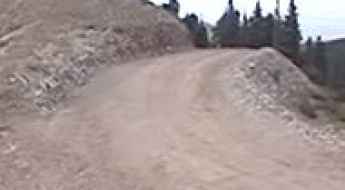
Summit Camp: Driving the Brutal 30% Ski Ramps in New Mexico
Summit Camp is a high-altitude mountain peak reaching an elevation of 3,134 meters (10,282 ft) above sea level in Taos County, New Mexico. Located within the Carson National Forest and the Sangre de Cristo Mountains, the track to the summit is a steep, unpaved service road built for ski resort chairlift maintenance.
Guthrie Peak
Guthrie Peak is a high mountain peak at an elevation of 2.005m (6,578ft) above the sea level, located in Greenlee County, in the southeastern part of the U.S. state of Arizona.
Allen Peak
Allen Peak is a high mountain peak at an elevation of 2.856m (9,370ft) above the sea level, located in Weber County, in the U.S. state of Utah.
How to get by car to Gates Lake in Sevier County?
Gates Lake is a high mountain lake at an elevation of 3,172m (10,406ft) above sea level, located in Sevier County, in the U.S. state of Utah.
How to Plan the Most Epic Roads in the USA?
Executing a long-distance road mission across the United States requires precise route planning and a deep understanding of the national road infrastructure. For operators and travelers alike, these journeys offer more than just transit; they provide a direct connection to the geographical and architectural diversity of the country. From historical corridors to high-altitude mountain passes, the USA offers some of the most iconic roads in the world. This guide analyzes the primary scenic routes for a comprehensive cross-country experience, focusing on logistical stopovers and technical road features.
How to drive the scenic Tremont Road in the Great Smoky Mountains
Tremont Road, located in Blount County in the US state of Tennessee, offers a picturesque drive through the Great Smoky Mountains National Park.
Walnut Canyon Desert Drive is a scenic loop road to Carlsbad Caverns
Walnut Canyon Desert Drive is a scenic drive through the Chihuahuan Desert located in Eddy County in the U.S. state of New Mexico.
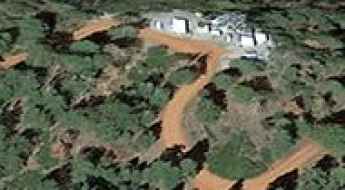
Fowler-Hilliard Hut
Eiseman Hut is a high mountain refuge at an elevation of 3.512m (11,522ft), located in Eagle County, in central Colorado, United States.
Windy Point Pass
Windy Point Pass is a high mountain pass at an elevation of 2.889m (9,477ft) above the sea level located in Montrose County, in Colorado, USA.
Driving the Scenic Road to Lookout Mountain: Stunning Views of Denver and Buffalo Bill's Gravesite
Lookout Mountain is a high mountain peak at an elevation of 2,237m (7,339ft) above sea level, located in Jefferson County, in the US state of Colorado.
Pajarita Mountain
Pajarita Mountain is a high mountain peak at an elevation of 2.438m (7,998 ft) above the sea level, located in Lincoln County, in the U.S. state of New Mexico.
Betty Bear Hut
Betty Bear Hut is a high mountain refuge at an elevation of 3.383m (11,099ft), located in Pitkin County, in central Colorado, United States.
Things to Know Before Driving to Dollarhide Summit in ID
Dollarhide Summit is a high mountain pass at an elevation of 2.657m (8,717ft) above the sea level, located on the boundary of Blaine and Camas counties in the U.S. state of Idaho.
Spruce Mountain
Spruce Mountain is a high mountain peak at an elevation of 3.051m (10,009ft) above the sea level located in Albany County, in Wyoming, USA.
How to drive the unpaved road to Jacks Peak in Utah?
Jacks Peak is a high mountain pass at an elevation of 3,057m (10,029ft) above sea level, located in Millard County, in the US state of Utah.
Desert View Drive offers stunning views of the Grand Canyon
Located in Coconino County, in the north-central part of the U.S. state of Arizona, Desert View Drive is a highly scenic road that leads into the central part of the Grand Canyon.
Driving the wild Antelope Mountain (in Lassen County, CA)
Antelope Mountain is a high mountain peak at an elevation of 2.343m (7,687ft) above the sea level, located in Lassen County, in the northeastern portion of the U.S. state of California.
Rustler Peak
Rustler Peak is a high mountain peak at an elevation of 1.860m (6,102ft) above the sea level, located in Jackson County, Oregon, in USA.

6 Motorcycle Road Trips You Can’t Miss in the U.S.
Riding a motorcycle across the U.S. is the ultimate way to see the country, but it’s not just about the scenery. On a bike, you’re exposed to everything: the wind, the temperature shifts, and the raw condition of the pavement. While these routes offer some of the best views in America, they also demand respect. From high-altitude mountain passes to fog-drenched coastal cliffs, here are six road trips that every rider should have on their bucket list—if they have the skill to handle them.
Take An Unforgettable Drive to Richland Balsam in NC
Richland Balsam is a high mountain pass at an elevation of 1.845m (6,053 feet) above the sea level, located on the boundary between Haywood and Jackson counties in the far southwest of the U.S. state of North Carolina.
Chillycoat Pass: Driving the 91-mile Divide Road
Chillycoat Pass is a high mountain pass at an elevation of 2,935m (9,629ft) above sea level, located in Mesa County, Colorado. Situated within the Dominguez-Escalante National Conservation Area, the pass is a key point along the Divide Road. Logistically, this is one of the longest continuous high-altitude gravel traverses in the state, running along the spine of the Uncompahgre Plateau.
The road to Little Mount Hoffman in CA isn’t an easy one
Little Mount Hoffman is a high mountain peak at an elevation of 2.231m (7,319ft) above the sea level, located in Siskiyou County, in the U.S. state of California.
Kane Creek Canyon Road is a drive with countless creek crossings in UT
Kane Creek Canyon Road is a very exciting drive located in San Juan County, in the southeastern portion of the U.S. state of Utah. This is an intense drive with so many creek crossings that you’ll lose count.
How To Travel The Utah Forest Road 17
Utah Forest Road 17 (FH-17) is a very scenic fairly wide drive through the high mountains of Garfield County, in south central Utah, United States.
The Loneliest Highway to Pinto Summit in NV
Pinto Summit is a high mountain pass at an elevation of 2.246m (7,368ft) above the sea level, located in Eureka County, in the U.S. state of Nevada.
The road to Taylor Peak in CO: a chillout in high mountains
Taylor Peak is a high mountain peak located on the boundary between Pitkin and Gunnison counties in the U.S. state of Colorado. A minor road, north of the summit, climbs up to 3.602m (11,817ft) above the sea level, It’s one of the highest roads of Colorado.
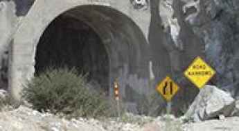
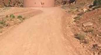
Mueller Tunnel: The Blocked Pass of the Mount Lowe Fire Road
Mueller Tunnel is a mountain gallery located in Los Angeles County, in the US state of California. Cut into the steep rock walls of the San Gabriel Mountains, this historic pass sits on the unpaved Mount Lowe Fire Road, a rough dirt track heavily scarred by continuous rockfalls, debris slides, and intense forest fires.
Sliderock Mountain
Sliderock Mountain is a high mountain pass at an elevation of 3.106m (10,190ft) above the sea level, located in La Plata County, in the U.S. state of Colorado.
Mills Peak
Mills Peak is a high mountain peak at an elevation of 2.232m (7,322ft) above the sea level, located in Sierra County, California, in USA.