What are the most spectacular roads in France?
France is a true paradise for those wishing to experience the most spectacular roads, and it provides endless experiences for each driver. From stunning balcony roads, mountain passes, and coastal drives, to roads disappearing with the tides, it hosts more than 750 roads listed as the most spectacular in the world.
Located in the western part of Europe, France covers an area of 551,695 square kilometers and shares borders with 7 countries: Belgium, Luxembourg, Germany, Switzerland, Italy, Spain, and Andorra. With high mountains in the Alps and the Pyrenees, the roads of the country are famous worldwide because of the Tour de France, the most important cycling race. When traveling to the country, be sure to experience a drive through the best balcony roads. Dramatically carved out of rock on the side of mountains, the balcony roads are a unique experience for any rider.
The country also hosts iconic roads, known worldwide, including Col du Chaussy, a mountain pass at 1,533m (5,029ft) above sea level, famous for the “Lacets de Montvernier,” a special 3 km stretch with 17 hairpins as the road virtually climbs a cliff, or Col de Turini, a treacherous Alpine road with a legendary driving history, as one of the most dangerous and challenging stages of the Monte Carlo Rally and one of the most scenic drives in the world. For those preferring another kind of experience, don’t forget to drive Passage du Gois, the tide-covered road. It’s a natural passage flooded twice a day by the high tide leading to the island of Noirmoutier.
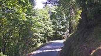
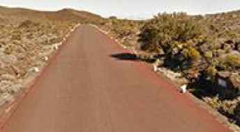
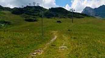
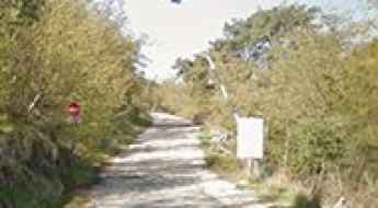
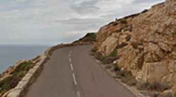
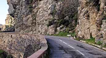
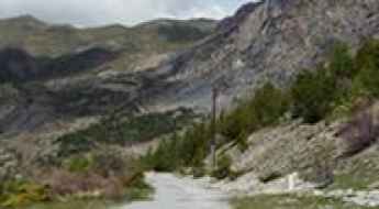
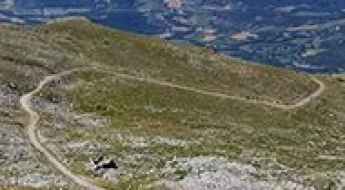
If you love to drive, you’ll love the road to Madone d'Utelle
Madone d'Utelle is a high mountain sanctuary at an elevation of 1.177m (3,861ft) above the sea level, located in the Alpes-Maritimes department in Provence-Alpes-Côte d'Azur region, in France.
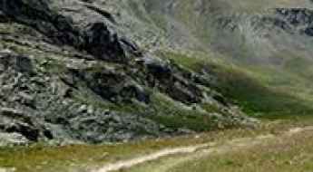
Col Pelouse
Col Pelouse is a high mountain pass at an elevation of 2.261m (7,417ft) above the sea level, located in the Haute-Savoie department in the Auvergne-Rhône-Alpes region in southeastern France.
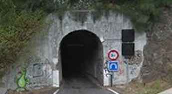
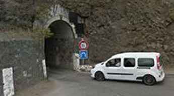
Tunnel de Peter Both
Tunnel de Peter Both is a very challenging tunnel located in Réunion, a French island located in the Indian Ocean, east of Madagascar.
Lac de la Blanche
Lac de la Blanche is a high mountain lake at an elevation of 2.501m (8,205ft) above the sea level, located in the Hautes-Alpes department in southeastern France.
Col des Anies
Col des Anies is a high mountain peak at an elevation of 2.134m (7,001ft) above the sea level, located in the Pyrénées-Atlantiques department in south-western France.
A scenic road to Col de Saint-Barnabé in the French Alps
Col de Saint-Barnabé is a mountain pass at an elevation of 1.368m (4,488ft) above the sea level located in the Alpes-de-Haute-Provence department, in the region of Provence-Alpes-Côte d'Azur in southeastern France.
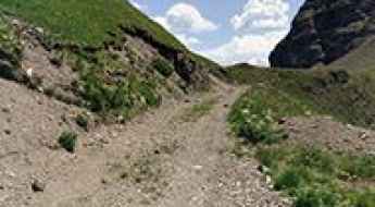
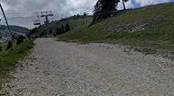
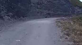
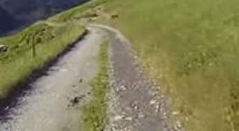
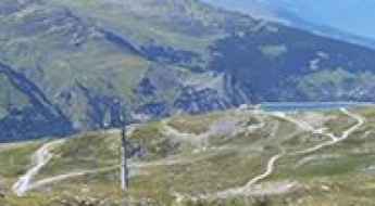
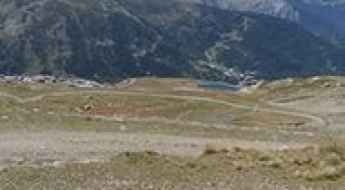
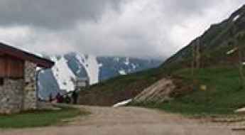
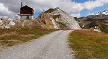
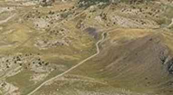
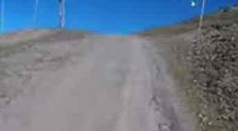
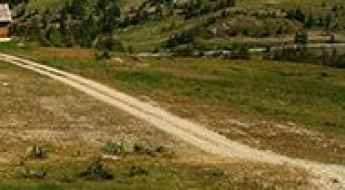
How steep is the unpaved road to Le Plan des Mains in the Savoie?
Le Plan des Mains is a high mountain refuge sitting at an elevation of 2,129m (6,984ft) above sea level in the Savoie department of the French Alps. Located within the heart of the Vanoise National Park, the road to the summit is a rugged mountain track that serves the Méribel ski resort. This is not a path for standard vehicles; it is a steep, unpaved service road where the thin alpine air and the loose surface turn a short climb into a serious test of 4x4 traction and low-range gearing.
Lac de la Grande Moucherolle
Lac de la Grande Moucherolle is a high mountain lake at an elevation of 2.015m (6,610ft) above the sea level, located in the Isère department of the Auvergne-Rhones-Alpes region in southeastern France.

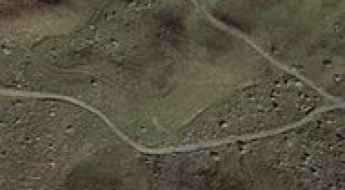
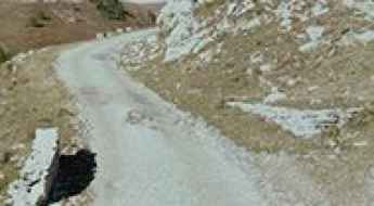
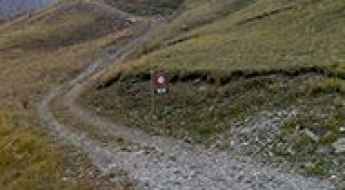
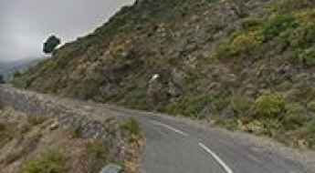
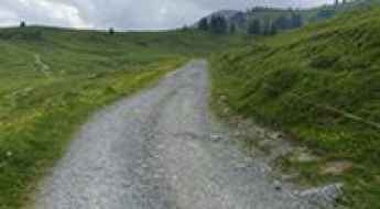
Is the road to Col de Peyrefitte in the Pyrenees paved?
Col de Peyrefitte, also known as Port de Pierrefite, is a high mountain pass at an elevation of 1,859m (6,099ft) above sea level on the border between the Haute-Garonne and Hautes-Pyrénées departments. This remote crossing in southwestern France is a journey through a road in transition; what was once a fully paved route is now a mix of decaying asphalt and rough gravel, reflecting years of exposure to the harsh Pyrenean climate and minimal maintenance.
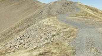
Pas des Sables, a road through a lunar landscape
Pas des Sables is a high mountain pass at an elevation of 2.374m (7,788ft) above the sea level located on the eastern side of Réunion island in the Indian Ocean.
Col du Fornet: Driving the steep 9.3% ski track on the French-Swiss border
Reaching an elevation of 2,245m (7,365ft) above sea level, Col du Fornet is an international high mountain pass situated directly on the border between France and Switzerland. Perched atop the rugged ski slopes above Avoriaz, this pass serves as a strategic mountain link between the two countries, though it remains one of the most technical and raw tracks in the Chablais Alps.
Col de Riondet
Col de Riondet is a high mountain pass at an elevation of 2.409m (7,903ft) above the sea level, located in the Massif de la Vanoise range, in Savoie department, in the Auvergne-Rhône-Alpes region of the French Alps.
The inhumane Mur de Monieux with 21% ramps
Mur de Monieux is a short but devastatingly steep climb in the Vaucluse department in the Provence-Alpes-Côte d'Azur region in southeastern France. It’s one of the steepest roads of the country.
Col de la Platta
Col de la Platta is a high mountain pass at an elevation of 2.391m (7,844ft) above the sea level, located in the Savoie department in the Auvergne-Rhône-Alpes region in south-eastern France.
Blayeul
Blayeul is a high mountain peak at an elevation of 2.172m (7,125ft) above the sea level, located in the Alpes-de-Haute-Provence department in southeastern France. The average gradient is 10.03%, with some sections up to 20%.
Tunnel de Gueule Rouge
Tunnel de Gueule Rouge is a very challenging tunnel located in Réunion, a French island located in the Indian Ocean, east of Madagascar.
Col du Coin
Col du Coin is a high mountain peak at an elevation of 2.275m (7,463ft) above the sea level, located in the Savoie department in the Auvergne-Rhône-Alpes region in south-eastern France.
Cime des Cabanelles
Cime des Cabanelles is a mountain peak at an elevation of 1.087m (3,566ft) above the sea level, located in the Alpes Maritimes department in southeastern France.
Driving to the summit of Mont Rond: A balcony over Lake Geneva
Rising high above the Pays de Gex in the Ain department of France, Mont Rond is a prominent peak in the Jura Mountains. At an elevation of 1,540m (5,052ft) above sea level, it offers one of the most breathtaking panoramic views in the eastern part of the country, acting as a natural balcony over Geneva and the majestic Alps.
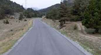
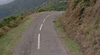
Driving the scenic road to Col du Cenise
Col du Cenise is a mountain pass at 1,723m (5,652ft) high. It is located in the Haute-Savoie department, in the southeast of France. This route is a good option if you want to drive between the Arve and Borne valleys in the Auvergne-Rhône-Alpes region.
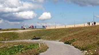
Romantic trip in France: The best honeymoon on the road
Are you recently married and planning the perfect honeymoon? France should be your top pick if you're looking for a unique romantic getaway! With its stunning natural beauty, delicious cuisine, vibrant culture and luxurious accommodations, there's no better place to have a romantic trip of a lifetime with your loved one.
How to drive the unpaved road to Pas de Coterieux?
Pas de Coterieux is a high mountain pass at an elevation of 2,526m (8,287ft) above sea level, located in the Savoie department within the Auvergne-Rhône-Alpes region of south-eastern France. Situated in the Massif des Cerces range, the road to the pass is a technical unpaved trail used primarily for chairlift maintenance. Logistically, this high-altitude corridor is a branch of the mountain infrastructure near Valmeinier and provides a technical off-road link within the shadow of the Col du Galibier area.
Col du Trible: Driving the Narrow D265 Road in Ardèche
At an elevation of 540m (1,771ft) above sea level, Col du Trible is a mountain pass in the Ardèche department of southern France. Located within the Rhône Valley region, the pass serves as a secondary high-altitude link characterized by its extremely constrained driving geometry.
Gros Crey
Gros Crey is a high mountain peak at an elevation of 2.581m (8,467ft) above the sea level, located in the Savoie department in the Auvergne-Rhône-Alpes region in south-eastern France.
Ouvrage Plan Caval
Ouvrage Plan Caval is a military fortress, part of the Maginot Line's Alpine extension, at an elevation of 1.912m (6,272ft) above the sea level, located in the Alpes-Maritimes department in the Provence-Alpes-Cote-d'Azur region in southeastern France.
How to drive the service road to Pas de Chavanette?
Pas de Chavanette is an international high mountain pass reaching an elevation of 2,147m (7,043ft) above sea level, situated on the border between France and Switzerland. Located directly above the Avoriaz 1800 ski resort, the pass is famous for the "Swiss Wall" ski slope. However, for vehicle transit, it features a technical unpaved service road used primarily for lift maintenance. The 4.6 km track is characterized by steep gradients and a loose, slippery surface that becomes logistically impassable during the winter months.
Exploring Corsica's seaside: the D81B coastal road from Calvi to Galeria
D81B is a scenic seaside road with hundreds of turns, located on the island of Corsica. The drive offers one of the best experiences for driving through the island.
Aiguille Grive
Aiguille Grive is a high mountain peak at an elevation of 2.541m (8,336ft) above the sea level, located in the Auvergne-Rhône-Alpes region in south-eastern France.
What are the driving hazards on the D7 road to Col du Campo?
Col du Campo is a mountain pass at an elevation of 452m (1,482ft) above sea level, located in the Haute-Corse department on the island of Corsica, France. Technically, the pass is traversed by the D7 road, a route that links the villages of Borgo and Vignale. Although the elevation is moderate, the driving conditions are defined by extreme lateral exposure and a roadbed that narrows significantly in several technical sectors.
Tete de Vescal
Tete de Vescal is a high mountain peak at an elevation of 2.435m (7,988ft) above the sea level, located in the Alpes-de-Haute-Provence department in the Provence-Alpes-Côte d'Azur region of southeastern France. The average gradient is 17.57%.
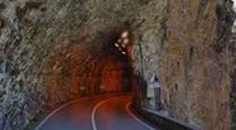
Driving the challenging Defile du Lancone in Corsica
Défilé du Lancone is a scenic gorge located on the island of Corsica, in France. It’s one of the French balcony roads.
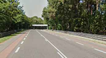
Drive Like a Pro on the Open Road Sections of the 24h of Le Mans Track
The Circuit de la Sarthe, used for the 24 Hours of Le Mans, includes public roads that are open to normal traffic most of the year. Located in northwestern France, this unique layout lets drivers experience more than 9 kilometers of a track known worldwide. While you won’t be racing, you’ll still be driving a section of one of motorsport’s most historic circuits.
Take the Scenic Route and Discover Bigorno Pass in Corsica
Col de Bigorno is a mountain pass at an elevation of 888m (2,913ft) above the sea level, located in the Haute-Corse department of France on the island of Corsica.
Col de la Petite Forcle
Col de la Petite Forcle is a high mountain pass at an elevation of 2.481m (8,139ft) above the sea level, located in the Graian Alps, in the Savoie department in the Auvergne-Rhône-Alpes region in south-eastern France.
Fort superieur de Saint-Ours
Fort superieur de Saint-Ours is a military fortress, part of the Maginot Line's Alpine extension, at an elevation of 1.874m (6,148ft) above the sea level, located in the Alpes-de-Haute-Provence department in southeastern France.
Col de Jaffueil
Col de Jaffueil is a high mountain pass at an elevation of 2.494m (8,182ft) above the sea level, located in the Hautes-Alpes department in southeastern France.
Taking on the Twists and Turns of Gorges de la Mescla
Gorges de la Mescla is a very scenic canyon located in the Alpes-Maritimes department, in the Provence-Alpes-Côte d'Azur region of France.
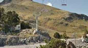
Le Lac
Le Lac is a chairlift at an elevation of 2.487m (8,159ft) above the sea level, located in the Alpes-de-Haute-Provence department in the Provence-Alpes-Côte d'Azur region of southeastern France.
An old military road to Fort de Dormillouse
Fort de Dormillouse is a military fortress at an elevation of 2.480m (8,136ft) above the sea level, located in the Alpes-de-Haute-Provence department in the Provence-Alpes-Côte d'Azur region of France.
Crete de la Balme
Crete de la Balme is a high mountain pass at an elevation of 2.570m (8,431ft) above the sea level, located in the Hautes-Alpes department in southeastern France.
A wild military road to Vallon de Savine
Vallon de Savine is a high mountain peak at an elevation of 2.227m (7,306ft) above the sea level, located in the northern Cottian Alps, in the Savoie department in the Auvergne-Rhône-Alpes region in south-eastern France.
Ultimate 4wd destination: Cima di Tombue
Cima di Tombue is a mountain pass at an elevation of 1.200m (3,937ft) above the sea level, located in the Haute-Corse department of France on the island of Corsica. It’s one of the highest roads of Corsica.
Driving the historic military road to Col Mercière in the Alps
Col Mercière is a high mountain pass at an elevation of 2,346m (7,769ft) above sea level, located in the Alpes-Maritimes department of southeastern France. Tucked away in the heart of the Mercantour National Park, this pass is one of the most iconic high-altitude tracks overlooking the ski resort of Isola 2000.
Col de l'Aiguille
Col de l'Aiguille is a high mountain peak at an elevation of 2.606m (8,549ft) above the sea level, located in the Savoie department in the Auvergne-Rhône-Alpes region in south-eastern France.
Travel guide to the top of Le Collu in the Alps
Le Collu is a high mountain peak at an elevation of 1.988m (6,522ft) above the sea level, located in the Haute-Savoie department in the Auvergne-Rhône-Alpes region in south-eastern France.