What are the most spectacular roads in France?
France is a true paradise for those wishing to experience the most spectacular roads, and it provides endless experiences for each driver. From stunning balcony roads, mountain passes, and coastal drives, to roads disappearing with the tides, it hosts more than 750 roads listed as the most spectacular in the world.
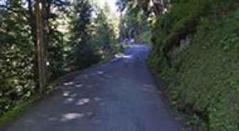
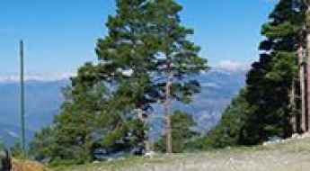
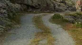
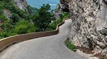
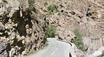
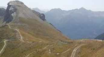
Located in the western part of Europe, France covers an area of 551,695 square kilometers and shares borders with 7 countries: Belgium, Luxembourg, Germany, Switzerland, Italy, Spain, and Andorra. With high mountains in the Alps and the Pyrenees, the roads of the country are famous worldwide because of the Tour de France, the most important cycling race. When traveling to the country, be sure to experience a drive through the best balcony roads. Dramatically carved out of rock on the side of mountains, the balcony roads are a unique experience for any rider.
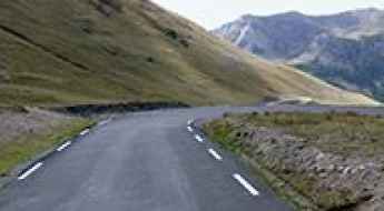
The country also hosts iconic roads, known worldwide, including Col du Chaussy, a mountain pass at 1,533m (5,029ft) above sea level, famous for the “Lacets de Montvernier,” a special 3 km stretch with 17 hairpins as the road virtually climbs a cliff, or Col de Turini, a treacherous Alpine road with a legendary driving history, as one of the most dangerous and challenging stages of the Monte Carlo Rally and one of the most scenic drives in the world. For those preferring another kind of experience, don’t forget to drive Passage du Gois, the tide-covered road. It’s a natural passage flooded twice a day by the high tide leading to the island of Noirmoutier.
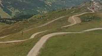
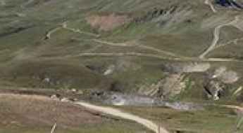
A memorable road trip to Coll des Molles
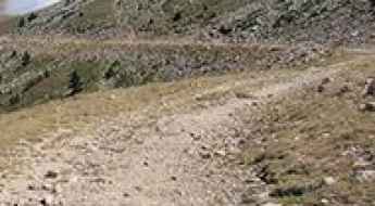
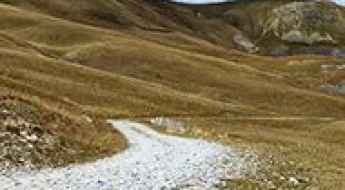
Coll des Molles is a high mountain pass at an elevation of 2.089m (6,853ft) above the sea level, located in the Pyrénées-Orientales department in southern France, near the border with Spain and the Autonomous Community of Catalonia.
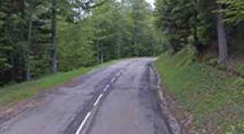
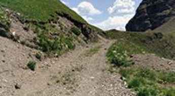
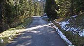
Is the road to Col de Carabès in the French Alps difficult to drive?
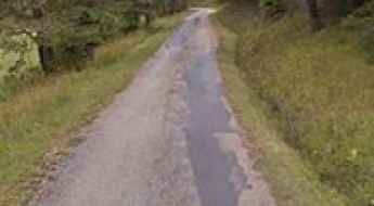
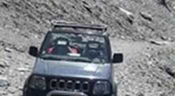
Reaching the Col de Carabès is like stepping back in time to the old, forgotten roads of the French Alps. At 1,261m (4,137ft) above sea level, this pass sits on the boundary between the Hautes-Alpes and the Drôme departments. It’s not a major mountain crossing, but a narrow, winding asphalt ribbon that feels more like a private driveway through the forest than a public road. If you don't like tight spaces and steep drops, this route will test your nerves.
Road trip guide: Conquering Refuge Drayères
Refuge Drayères is a high mountain refuge at an elevation of 2.189m (7,181ft) above the sea level, located in the Hautes-Alpes department in southeastern France.
Road trip guide: Conquering Col de Valbelle
Col de Valbelle is a high mountain pass at an elevation of 2.372m (7,782ft) above the sea level, located in the Hautes-Alpes department in southeastern France.
A narrow and winding mountain road to Mont Caume,
Mont Caume is a mountain pass at an elevation of 801m (2,627ft) above sea level, located in the Var department in the Provence-Alpes-Côte d'Azur region in southeastern France.
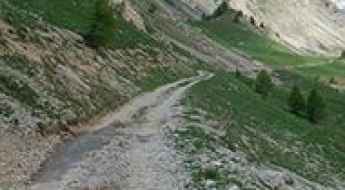
Driving to Pic de Chabrières: A brutal 2.701m 4x4 track in the Queyras Alps
Located in the Hautes-Alpes department of southeastern France, the track to Pic de Chabrières is a high-altitude monster that pushes the limits of off-road driving. Reaching an elevation of 2,701m (8,861ft) above sea level in the Queyras mountains, this is a raw, unpaved service road used for chairlift maintenance. It is a journey through a desolate landscape of rock and shale, where the vertical gain and the thin air at nearly 3,000 meters create a high-consequence environment for any vehicle.
An awe-inspiring road to Col des Basses
Col des Basses is a high mountain pass at an elevation of 1.786m (5,859ft) above the sea level, located in the Pyrénées-Orientales department in southern France, near the border with Spain and the Autonomous Community of Catalonia.
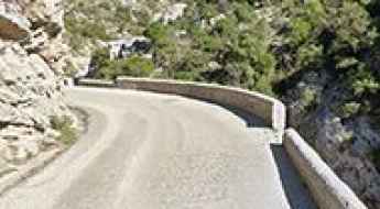
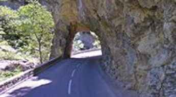
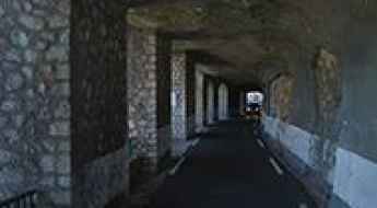
Driving through Gorges de la Cadière, a French balcony road
Gorges de la Cadière is a very scenic canyon carved by the Argentesse river, located in Occitanie region of France. It’s one of the famous French balcony roads.
A nice paved road to Col de Solaison
Col de Solaison is a mountain pass at an elevation of 1.500m (4,921ft) above the sea level, located in Haute-Savoie, in the Rhône-Alpes region of eastern France, bordering both Switzerland and Italy.
A balcony road through the Gorges de Trente-Pas
Gorges de Trente-Pas is a spectacular canyon carved into the limestone by Ruisseau de Trente-Pas river in the Drôme department in southeastern France. It’s one of the French balcony roads.
Col du Lauzet
Col du Lauzet is a high mountain pass at an elevation of 2.225m (7,299ft) above the sea level, located in the Hautes-Alpes department in southeastern France.
Semnoz
Semnoz, also known as Crêt de Chatillon, is a high mountain pass at an elevation of 1.660m (5,446ft) above the sea level, located in the Bauges range, in Haute-Savoie, France.
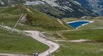
Sommet de la Saulire, one of the highest roads of France
Sommet de la Saulire is a high mountain pass at an elevation of 2.697m (8,848ft) above the sea level, located in the Massif de la Vanoise range, in Savoie department, in the Auvergne-Rhône-Alpes region of the French Alps.
Col de Saint-Alexis: A Scenic Gateway to the Vercors Highlands
Col de Saint-Alexis is a mountain pass at an elevation of 1,222m (4,009ft) above sea level, located in the Drôme department of southeastern France. Situated within the Vercors Regional Natural Park, this pass serves as a serene transition between the rugged southern ridges and the historic high plateau of the Auvergne-Rhône-Alpes region.
The steep narrow road to Lac des Gloriettes
Barrage des Gloriettes is a high mountain lake in the Hautes-Pyrénées department in south-western France.
Chalet-Refuge des Mottets
Chalet-Refuge des Mottets is a high mountain refuge at an elevation of 1.872m (6,1414ft) above the sea level located in the Savoie department in the Rhône-Alpes region in south-eastern France.
How to drive the defiant unpaved road to Col des Cortalets?
Col des Cortalets is a high mountain pass at an elevation of 2.050m (6,725ft) above sea level, located in the Pyrénées-Orientales department in France.
Travel guide to the top of Col des Embrasures
Col des Embrasures is a high mountain pass at an elevation of 2.305m (7,562ft) above the sea level, located in the Savoie department in the Auvergne-Rhône-Alpes region in south-eastern France, near the Italian border.
Taking on the Twists and Turns of Gorges Du Val de Fier
Gorges Du Val de Fier is a very scenic canyon located on the boundary of the Haute-Savoie and the Savoie departments in the Auvergne-Rhône-Alpes region in France. It’s one of the scenic French balcony roads.
Gorges de la Ruda: The Ultimate Road Trip Guide
The Gorges de la Ruda is a canyon located in the Haute-Corse department on the island of Corsica, France. The route is carved into red granite cliffs by the Ruda and Golo rivers and is widely considered one of the French balcony roads due to its narrow ledge construction and vertical drops.
Don’t glance down at your phone on Ravin de la Platte
Ravin de la Platte is a high mountain ravine at an elevation of 1.853m (6,079ft) above the sea level, located in the Hautes-Alpes department in the Provence-Alpes-Côte d'Azur region of France. It’s definitely not for anyone suffering from vertigo.
Taking on the Twists and Turns to Col du Val d'Ese in Corsica
Col du Val d'Ese is a mountain pass at an elevation of 1.615 m (5,298 ft) above sea level, located in the Corse-du-Sud department of France on the island of Corsica.
A paved road to Sanctuaire de Notre Dame de la Salette
Sanctuaire de Notre Dame de la Salette is a high mountain sanctuary at an elevation of 1.787m (5,862ft) above sea level, located in the Isère department in southeastern France.
The road to Col Nazie, pure adventure
Col Nazie is a high mountain pass at an elevation of 1.902m (6,240ft) above the sea level, located in the Isère department in the Auvergne-Rhône-Alpes region in southeastern France.
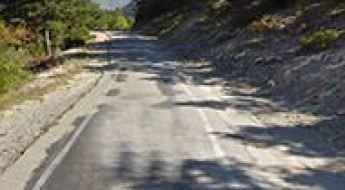
Road D71
Located in the Var department in the Provence-Alpes-Côte d'Azur region in southeastern France, the D71 road is a very exciting journey. This is definitely not a Sunday drive. Steep drops and loads of tourists in summer. Visit outside busy periods.
A Most Tricky Scenic Drive to Lac de la Glère
Lac de la Glère is a high mountain lake at an elevation of 2.152m (7,060ft) above the sea level, located in the Hautes-Pyrénées department in the Occitanie region of south-western France.
Bocca de Sevi
Bocca de Sevi, also known as Col de Sevi, is a mountain pass at an elevation of 1.101m (3,612ft) above the sea level, located in the Corse-du-Sud department of France on the island of Corsica.
Fort de Roche la Croix
Fort de Roche la Croix is a high mountain military fortress at an elevation of 1.906m (6,253ft) above the sea level, located in the Alpes-de-Haute-Provence department in southeastern France.
Fort de Lenlon
Fort de Lenlon is a military fortress at an elevation of 2.508m (8,228ft) above the sea level, located in the Dauphiné region of southeastern France.
Col des Fourches
Col des Fourches is a high mountain pass at an elevation of 2.258m (7,408ft) above the sea level located in the Maritime Alps, in the French region of Provence-Alpes-Côte-d'Azur
Fort de Pattacreuse
Fort de Pattacreuse is a high mountain fortress at an elevation of 2.385m (7,824ft) above the sea level, located in the Savoie department in the Rhône-Alpes region in south-eastern France.
Col de Vaumale
Col de Vaumale is a mountain pass at an elevation of 1.202m (3,943ft) above the sea level, located in the Var department in the Provence-Alpes-Côte d'Azur region in southeastern France.
How to drive the unpaved road to Pas de l'Âne in Savoie?
Pas de l'Âne is a high mountain peak at an elevation of 2.091m (6,860ft) above sea level, located in the Auvergne-Rhône-Alpes region in France.
Col du Lac Blanc
Col du Lac Blanc is a high mountain peak at an elevation of 2.803m (9,196ft) above the sea level, located in the Isère department in southeastern France.
Road trip guide: Conquering Col de l’Eychauda
Col de l’Eychauda is a high mountain pass at an elevation of 2.433m (7,982ft) above the sea level, located in the Hautes-Alpes department in southeastern France.
Gorges of Terminet, a balcony road in France
Clue du Terminet is a spectacular canyon formed by Le Sou river in the Aude department in southern France. It’s one of the French balcony roads.
Les Grandes Platières
Les Grandes Platières is a high mountain pass at an elevation of 2.473m (8,113ft) above the sea level, located in the Haute-Savoie department in the Auvergne-Rhône-Alpes region in southeastern France.
Col du Buis
Col du Buis is a mountain pass at an elevation of 1.196m (3,923ft) above the sea level, located in the Alpes-Maritimes department in the Provence-Alpes-Côte d'Azur region of South-eastern France.
Col de Corobin
Col de Corobin is a mountain pass at an elevation of 1.230m (4,035ft) above the sea level, located in the Alpes-de-Haute-Provence department in southeastern France.
Travel guide to the top of Col du Grand Renard
Col du Grand Renard is a high mountain pass at an elevation of 2.455m (8,054ft) above the sea level, located in the Savoie department in the Rhône-Alpes region in south-eastern France.
How to drive the unpaved road to Bellevarde in Savoie?
Bellevarde is a high mountain peak at an elevation of 2.783m (9,130ft) above sea level, located in the Auvergne-Rhône-Alpes region of France. It’s one of the highest roads of the country.
Col du Ranfolly
Col du Ranfolly is a high mountain pass at an elevation of 1.650m (5,413ft)above the sea level, located in the Haute-Savoie department in the Rhône-Alpes region in south-eastern France.
Col de Saint Georges-Chalet Josserand
Col de Saint Georges-Chalet Josserand is a high mountain pass at an elevation of 2.245m (7,477ft) above the sea level, located in the Alps in the department of Hautes-Alpes in France.
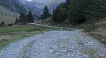
Road to Refugi de Marialles: A Technical Drive in the Canigó Massif
Located in the Pyrénées-Orientales department of southern France, Refugi de Marialles (also known as Refugi de Mariailles) is a high mountain refuge at an elevation of 1,718m (5,636ft) above sea level. Nestled within the Massís del Canigó, the access route is a challenging forest track.
Cugnai Lift
Cugnai Lift is a chair lift for skiers at an elevation of 2.884m (9,471ft) above the sea level, located in the Savoie department of southeastern France.