What are the most spectacular roads in France?
France is a true paradise for those wishing to experience the most spectacular roads, and it provides endless experiences for each driver. From stunning balcony roads, mountain passes, and coastal drives, to roads disappearing with the tides, it hosts more than 750 roads listed as the most spectacular in the world.
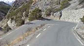
Located in the western part of Europe, France covers an area of 551,695 square kilometers and shares borders with 7 countries: Belgium, Luxembourg, Germany, Switzerland, Italy, Spain, and Andorra. With high mountains in the Alps and the Pyrenees, the roads of the country are famous worldwide because of the Tour de France, the most important cycling race. When traveling to the country, be sure to experience a drive through the best balcony roads. Dramatically carved out of rock on the side of mountains, the balcony roads are a unique experience for any rider.
The country also hosts iconic roads, known worldwide, including Col du Chaussy, a mountain pass at 1,533m (5,029ft) above sea level, famous for the “Lacets de Montvernier,” a special 3 km stretch with 17 hairpins as the road virtually climbs a cliff, or Col de Turini, a treacherous Alpine road with a legendary driving history, as one of the most dangerous and challenging stages of the Monte Carlo Rally and one of the most scenic drives in the world. For those preferring another kind of experience, don’t forget to drive Passage du Gois, the tide-covered road. It’s a natural passage flooded twice a day by the high tide leading to the island of Noirmoutier.
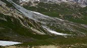
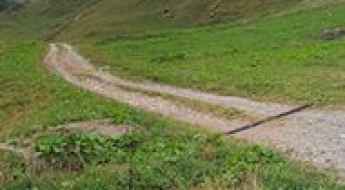
Road to Refugi de Marialles: A Technical Drive in the Canigó Massif
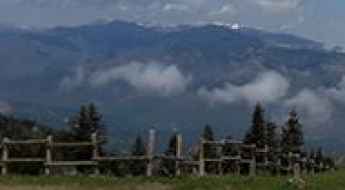
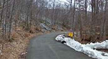
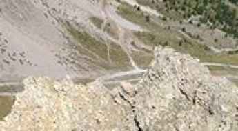
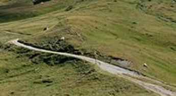
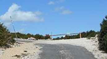
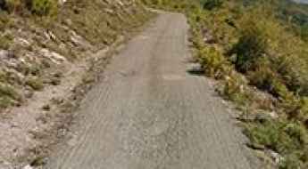
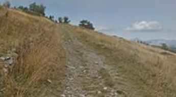
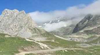
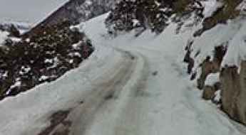
Located in the Pyrénées-Orientales department of southern France, Refugi de Marialles (also known as Refugi de Mariailles) is a high mountain refuge at an elevation of 1,718m (5,636ft) above sea level. Nestled within the Massís del Canigó, the access route is a challenging forest track.
Cugnai Lift
Cugnai Lift is a chair lift for skiers at an elevation of 2.884m (9,471ft) above the sea level, located in the Savoie department of southeastern France.
Col du Ranfolly
Col du Ranfolly is a high mountain pass at an elevation of 1.650m (5,413ft)above the sea level, located in the Haute-Savoie department in the Rhône-Alpes region in south-eastern France.
Col de Saint Georges-Chalet Josserand
Col de Saint Georges-Chalet Josserand is a high mountain pass at an elevation of 2.245m (7,477ft) above the sea level, located in the Alps in the department of Hautes-Alpes in France.
Col du Mont Noir
Col du Mont Noir is a mountain pass at an elevation of 1.421m above the sea level, located in the Isère department in southeastern France.
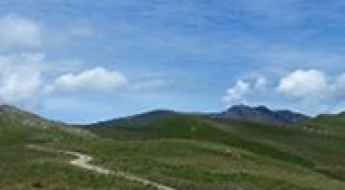
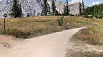
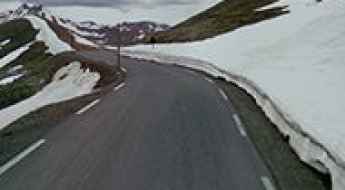
How to drive the Route des Alpages to Col du Pradier in Savoie?
Located in the Savoie department of southeastern France, Col du Pradier is a high mountain pass at an elevation of 1,450m (4,757ft) above sea level. The climb follows the Route des Alpages.
Col de Furfande
Col de Furfande is a high mountain pass at an elevation of 2.500m (8,202ft) above the sea level, located in the Hautes-Alpes department in the Provence-Alpes-Côte d'Azur region of south-eastern France.
Col du Souchet
Col du Souchet is a high mountain pass at an elevation of 2.365m (7,759ft) above the sea level, located in the Hautes-Alpes department in southeastern France.
Pas de l'Âne: Driving the brutal 17.4% ski track in the Massif des Cerces
Situated in the heart of the Hautes-Alpes department in southeastern France, Pas de l'Âne is a high mountain pass reaching an elevation of 2,475m (8,120ft) above sea level. Located within the rugged Massif des Cerces, this pass is not a conventional road but a grueling high-altitude track that serves as a vital service route for the ski infrastructure of the Serre Chevalier valley.
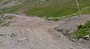
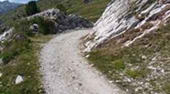
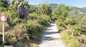
Piste de Clausis is pure adventure in the Hautes-Alpes
Piste de Clausis is a high mountain gravel road located in the Hautes-Alpes department of France. The road is 6.2km long.
Col de Pierre Grosse
Col de Pierre Grosse is a mountain pass at an elevation of 1.322m (4,337ft) above the sea level, located in the Isère department in southeastern France.
Vallon de la Gordolasque
Vallon de la Gordolasque is a high mountain pass at an elevation of 1.689m (5,541ft) above the sea level, located in the Alpes-Maritimes department in southeastern France.
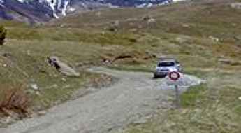
Road to Col du Palet: Driving the 13.06% Service Track in Savoie
Reaching an elevation of 2,658m (8,720ft) above sea level, Col du Palet is a high mountain pass located in the Savoie department, within the Auvergne-Rhône-Alpes region of southeastern France. Situated in the heart of the Vanoise National Park, the route is one of the highest roads in the country.
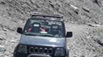
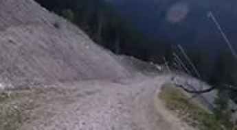
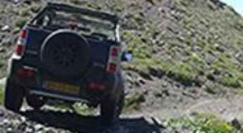
Driving to Col du Piéfroid: A brutal 18% 4x4 climb in the Isère Alps
Located in the Isère department of southeastern France, the track to Col du Piéfroid is one of the most extreme high-altitude challenges in the French Alps. Reaching an elevation of 2,937m (9,635ft) above sea level, this is a raw, unpaved service road that serves the chairlift infrastructure of the region. It is a journey of pure verticality, where the thin air and the brutal incline screen out all but the most experienced off-road drivers and expedition-grade vehicles.
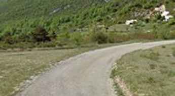
Road D218
The Route Départementale D218 (RD218) is a very scenic road located in the Isère department in southeastern France.
Roche Madeleine
Roche Madeleine is a high mountain pass at an elevation of 2.370m (7,775ft) above the sea level located in the French Alps, near the border with Italy, within the Mercantour National Park on the department of Alpes-de-Haute-Provence.
Les 12 lacets de Ceillac: a breathtaking road with 12 challenging hairpins
Located in the Hautes-Alpes department in southeastern France, Les 12 lacets de Ceillac is a collection of 12 hairpin turns on the road to the small town of Ceillac.
Can I drive the unpaved road to Coll de Creu in Occitania?
Coll de Creu is a high mountain pass at an elevation of 1.708m (5,603ft) above sea level, located in the Pyrénées-Orientales department in France.
Hourquette d'Ancizan
Hourquette d'Ancizan is a high mountain pass at an elevation of 1.564m (5,131ft) above the sea level, located in the French Pyrenees in the department of Hautes-Pyrénées.
How to drive the military track to Col de la Roue?
Col de la Roue (also known as Colle della Rho) is a high-altitude mountain pass at an elevation of 2,534 m (8,313 ft) above sea level, situated on the border between France (Savoie) and Italy (Piedmont). Logistically, the pass follows an ancient military corridor between the Maurienne and Susa valleys. Technically, the route consists of a degraded military track that presents significant challenges for high-altitude navigation and vehicle mechanical stress.
How to drive the steep road to Mont Tauch?
Mont Tauch is a mountain peak at an elevation of 871m (2,857ft) above sea level, located in the Aude department in southern France.
Col de la Pertie
Col de la Pertie is a mountain pass at an elevation of 972m (3,188ft) above the sea level, located in the Drôme department in southeastern France.
Travel guide to the top of Vallon de la Fournache
Vallon de la Fournache is a high mountain peak at an elevation of 2.703m (8,868ft) above sea level, located in the Savoie department in France. It’s one of the highest roads of the country.
Fort de Ronce
Fort de Ronce is a high mountain fortress at an elevation of 2.294m (7,526ft) above the sea level, located in the Savoie department in the Rhône-Alpes region in south-eastern France.
Col de Casardo
Col de Casardo is a mountain pass at an elevation of 1.093m (3,585ft) above the sea level, located in the Haute-Corse department of France on the island of Corsica.
Col du Jovet
Col du Jovet is a high mountain pass at an elevation of 2.404m (7,887ft) above the sea level, located in the Savoie department in the Rhône-Alpes region in south-eastern France.
Col de Savel
Col de Savel is a mountain pass at an elevation of 972m (3,188ft) above the sea level, located in the Alpes-Maritimes department in southeastern France.
How to drive the old military road Pas du Roc in Savoie?
Pas du Roc is a high mountain pass at an elevation of 2.339m (7,673ft) above sea level, located in the Auvergne-Rhône-Alpes region of France.
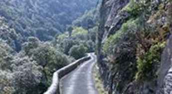
Gorges du Terme Inférieur, a stunning balcony road
Gorges du Terme Inférieur is the name of a very challenging canyon located in the Pyrénées-Orientales department of the region of Occitanie, in Southern France. It’s one of the most scenic French balcony roads.
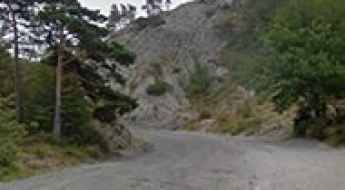
A paved curvy road to Col de Castellaras
Col de Castellaras is a mountain pass at an elevation of 1.248m (4,094ft) above sea level, located in the Alpes-Maritimes department in southeastern France.
How To Have The Ultimate Road Trip To Bocca à Canaghia
Bocca à Canaghia is a high mountain peak at an elevation of 1.848m (6,062ft) above sea level, located on the island of Corsica, in Franca. It’s one of the highest roads of Corsica.
Driving the D231 to Lac de Bious-Artigues: A narrow Pyrenean balcony road
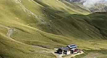
Located in the heart of the Ossau Valley, within the Pyrenees National Park, the D231 road to Lac de Bious-Artigues is a high-consequence mountain drive in the Pyrénées-Atlantiques department. Reaching an elevation of 1,416m (4,646ft) above sea level, this paved route is the only motorized access to one of the most iconic glacial lakes in the Nouvelle-Aquitaine region. It is a journey defined by extreme narrowness and vertical rock faces that dictate exactly what type of vehicle can successfully reach the summit.
A challenging old military road to Cima Marta
Cima Marta is a high mountain pass at an elevation of 2.138m (7,014ft) above sea level, located in the French Ligurian Alps, near the Italian border.
Col de la Pousterle
Col de la Pousterle is a high mountain pass at an elevation of 1.763m (5,784ft) above the sea level, located in the Hautes-Alpes department in southeastern France.
Driving the curvy roads of Corsica
I spent 3 weeks on Corsica and I can say that the title of "Island of the Beauty" is simple correct. There is only 1 highway existing south of Bastia with a length of about 15 km.
Take the Scenic Route and Discover Gorges d'Aulan
Gorges d'Aulan is the name of a spectacular canyon carved into the limestone by the Toulourenc river in the Drôme department of Auvergne-Rhône-Alpes region, in France. It’s one of the French balcony roads.
Col des Encombres
Col des Encombres is a high mountain pass at an elevation of 2.367m (7,765ft) above the sea level, located in the Savoie department in the Auvergne-Rhône-Alpes region in south-eastern France.
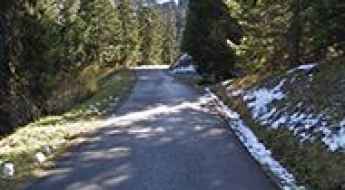
How to drive the paved road to Col de Chalais?
Col de Chalais is a mountain pass at an elevation of 930m (3,051ft) above sea level, located in the Auvergne-Rhône-Alpes Region of France. The road to the summit is very steep.
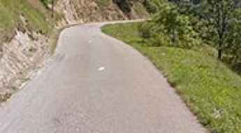
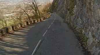
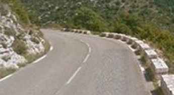
M6202 is a Most Tricky Scenic Road on the French Riviera
Located in the Alpes-Maritimes department, in the Provence-Alpes-Côte d'Azur region of France, M6202 is the name of a very scenic road. It’s one of the French balcony roads.
Col de la Baume
Col de la Baume is a mountain pass at an elevation of 1.068m (3,503ft) above the sea level, located in the Alpes-de-Haute-Provence department in southeastern France.
Col de la Vanoise
Col de la Vanoise is a high mountain pass at an elevation of 2.522m (8,274ft) above the sea level, located in Savoie, France.
Is the C4 Route de Nice to Fortin du Restefond safe for driving?
Fortin du Restefond is a high-altitude military installation at an elevation of 2,558m (8,392ft) above sea level, located in the Alpes-de-Haute-Provence department of France. Situated within the Mercantour National Park, the site was a strategic barracks of the Maginot Line. Logistically, the approach is via the C4 Route de Nice, a high-mountain road that demands specific technical attention due to its age and military engineering origin.
Porte de Cristol is an awe-inspiring track in the Alps
Porte de Cristol is a high mountain peak at an elevation of 2.483m (8,146ft) above the sea level located in the Hautes-Alpes department in the Provence-Alpes-Côte d'Azur region in southeastern France.
Col de Muse
Col de Muse is a mountain pass at an elevation of 932m (3,057ft) above the sea level, located in the Drôme department in the Rhône-Alpes region in southeastern France.
Col des Garcinets
Col des Garcinets is a mountain pass at an elevation of 1.185m (3,887ft) above the sea level, located in the Hautes-Alpes department in southeastern France.