What are the most spectacular roads in France?
France is a true paradise for those wishing to experience the most spectacular roads, and it provides endless experiences for each driver. From stunning balcony roads, mountain passes, and coastal drives, to roads disappearing with the tides, it hosts more than 750 roads listed as the most spectacular in the world.
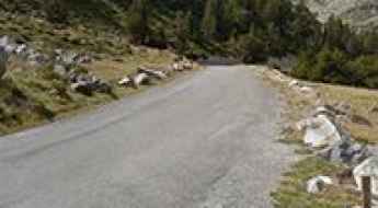
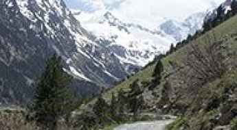
Located in the western part of Europe, France covers an area of 551,695 square kilometers and shares borders with 7 countries: Belgium, Luxembourg, Germany, Switzerland, Italy, Spain, and Andorra. With high mountains in the Alps and the Pyrenees, the roads of the country are famous worldwide because of the Tour de France, the most important cycling race. When traveling to the country, be sure to experience a drive through the best balcony roads. Dramatically carved out of rock on the side of mountains, the balcony roads are a unique experience for any rider.
The country also hosts iconic roads, known worldwide, including Col du Chaussy, a mountain pass at 1,533m (5,029ft) above sea level, famous for the “Lacets de Montvernier,” a special 3 km stretch with 17 hairpins as the road virtually climbs a cliff, or Col de Turini, a treacherous Alpine road with a legendary driving history, as one of the most dangerous and challenging stages of the Monte Carlo Rally and one of the most scenic drives in the world. For those preferring another kind of experience, don’t forget to drive Passage du Gois, the tide-covered road. It’s a natural passage flooded twice a day by the high tide leading to the island of Noirmoutier.
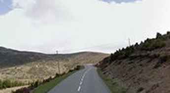
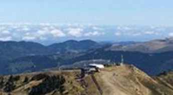
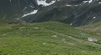
Hautacam is a legendary Tour de France climb
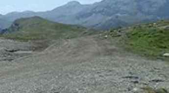
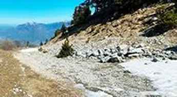
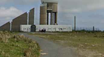
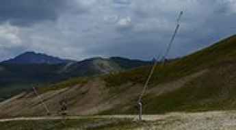
Station du Hautacam is a ski resort at an elevation of 1.523m (4,996ft) above the sea level, located in the Hautes-Pyrénées department in the Occitanie region of France.
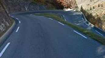
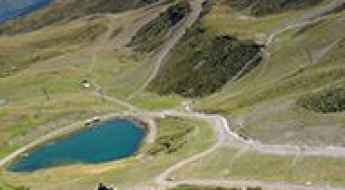
Piau-Engaly
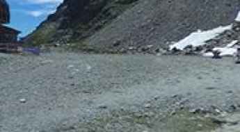
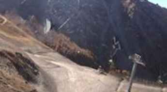
Piau-Engaly is a ski resort at an elevation of 1.870m (6,135ft) above the sea level, located in the Hautes-Pyrénées department in southwestern France.
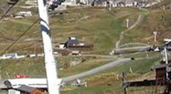
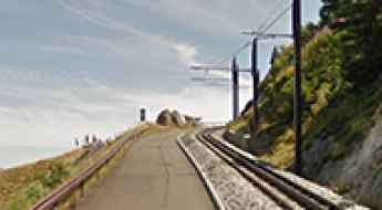
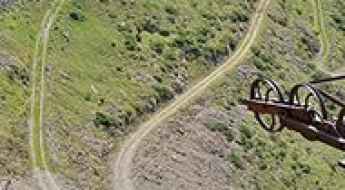
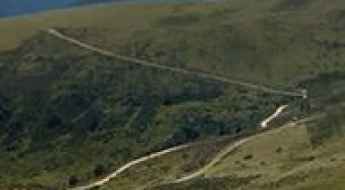
Boismint lift
Boismint lift is a high mountain lift at an elevation of 2.671m (8,763ft) above the sea level, located in the Savoie department in the Auvergne-Rhône-Alpes region in south-eastern France. It’s one of the highest roads of the country.
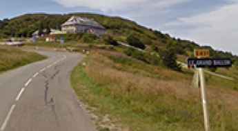
An iconic road to Col du Grand Ballon in the Vosges Mountains
Col du Grand Ballon is a mountain pass at an elevation of 1.343m (4,406ft) above the sea level, located in the Haut-Rhin department of the Grand Est region, in France.
Lac des Estaris
Lac des Estaris is a high mountain lake at an elevation of 2.578m (8,458ft) above the sea level, located in the Hautes-Alpes department in southeastern France.
Collet des Michels
Collet des Michels is a mountain pass at an elevation of 920m (3,018ft) above the sea level, located in the Hautes-Alpes department in southeastern France.
Driving one of the steepest tracks in the world to Le Gros Villan
Le Gros Villan is a high mountain peak at an elevation of 2.522m (8,274ft) above sea level, located in the Savoie department in France.
Driving the military track to Collalunga Pass in the Alps
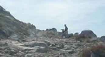
Passo di Collalunga (also known as Pas de Colle Longue) is a high mountain pass at an elevation of 2,441m (8,008ft) above sea level, situated on the border between France (Alpes-Maritimes) and Italy (Piedmont). This former military route is one of the most scenic and technical tracks in the Maritime Alps.
The breathtaking road to Couillade de Llerbès
Couillade de Llerbès is a high mountain peak at an elevation of 2.299m (7,542ft) above the sea level, located in the Ariège department in the Occitanie region of south-western France.
Clue de Rouaine
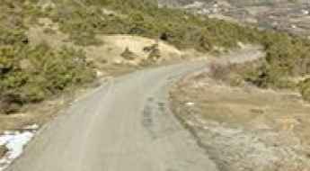
Located in the Alpes-de-Haute-Provence department in southeastern France, the Clue de Rouaine is a very picturesque drive on an unrivalled location in the midst of grandiose scenery.
Puy de Dome is an iconic Tour de France climb
Puy de Dôme, with its magnificent stature and awe-inspiring beauty, stands as an iconic climb in the legendary Tour de France. This dome-shaped volcanic plug rises proudly to an impressive elevation of 1,450 meters (4,757 feet) above sea level, gracing the picturesque landscape of the Puy-de-Dôme department in the enchanting region of Auvergne-Rhône-Alpes of France.
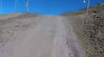
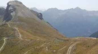
How to drive the unpaved road to Pic de Montferrat in the Hautes-Pyrénées
Pic de Montferrat is a high mountain peak at an elevation of 2.497m (8,192ft) above sea level, located in the Hautes-Pyrénées department in France.
How to drive the unpaved road to Le Moucherotte?
Le Moucherotte is a high mountain peak at an elevation of 1.863m (6,112ft) above sea level, located in the Auvergne-Rhône-Alpes region of southeastern France.
Pas de Saint-Anne
Pas de Saint-Anne is a high mountain pass at an elevation of 2.301m (7,549ft) above the sea level, located in the Maritime Alps, on the French-Italian border.
Col du Fouet
Col du Fouet is a high mountain pass at an elevation of 2.435m (7,988ft) above the sea level, located in the Haute-Savoie department in the Auvergne-Rhône-Alpes region in south-eastern France.
A brutally steep (17.67%) service road to Cime des Orres in the Hautes-Alpes
Cime des Orres is a high mountain peak at an elevation of 2,655m (8,710ft) above sea level, located in the Hautes-Alpes department of France. It’s one of the highest roads in the country.
Lac d'Aubert
Lac d'Aubert is a high mountain lake at an elevation of 2.163m (7,096ft) above sea level, located in Hautes-Pyrénées, a department in southwestern France. It is part of the Midi-Pyrénées region.
Col de la Cucumelle
Col de la Cucumelle is a high mountain pass at an elevation of 2.511m (8,238ft) above the sea level, located in the Hautes-Alpes department in southeastern France.
Fort Pepin
Fort Pepin is a military fortress at an elevation of 2.278m (7,473ft) above the sea level, located in the Alpes-Maritimes department in southeastern France, near the Italian border.
How to drive the unpaved road to Mont Mirantin in Savoie?
Mont Mirantin is a high mountain peak at an elevation of 2.058m (6,751ft) above sea level, located in the Savoie department of France.
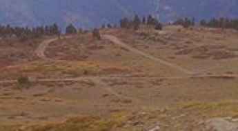
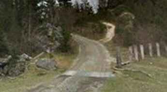
The brutal climb to Artzamendi, the mountain of hell in the Basque Country
Mont Artzamendi is a mountain peak at an elevation of 916m (3,005ft) above sea level, located in the Pyrénées-Atlantiques department in the Nouvelle-Aquitaine region of France.
How to drive the unpaved road to Cheval Noir in Savoie?
Cheval Noir is a high mountain pass at an elevation of 2.166m (7,106ft) above sea level, located in Savoie department, in France.
Road trip guide: 26 hairpin turns to Pas de l’Escous
Pas de l’Escous is a mountain pass at an elevation of 1.012m (3,320ft) above the sea level, located in the Alpes-Maritimes department in the region Provence-Alpes-Côte d'Azur, in France.
Guide to the Mines de Bentaillou
Anciennes mines du Bentaillou is a zinc and silver-bearing abandoned mine at an elevation of 1.875m (6,151ft) above the sea level, located in the Ariège department in southwestern France, near the Spanish border.
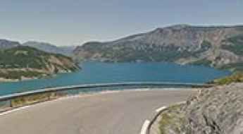
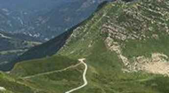
Road D954
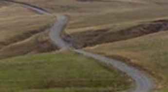
D954 is a very scenic drive in the heart of the Alpes-de-Haute-Provence department in southeastern France. This road overlooks the blue Lac de Serre-Ponçon lake from above, and has some beautiful views.
Col de Mea
Col de Mea is a high mountain pass at an elevation of 2.486m (8,156ft) above the sea level, located in the Hautes-Alpes department in southeastern France.
Bocca di Vizzavona: A Strategic Pass in the Heart of Corsica
Bocca di Vizzavona (also known as Col de Vizzavona) is a mountain pass at an elevation of 1,163m (3,815ft) above sea level, located on the island of Corsica, France. Coordinates: 42.1121, 9.1158. The pass serves as the primary transport link between Ajaccio and Bastia.
Drive Like a Pro on the Open Road Sections of the 24h of Le Mans Track
The Circuit de la Sarthe, used for the 24 Hours of Le Mans, includes public roads that are open to normal traffic most of the year. Located in northwestern France, this unique layout lets drivers experience more than 9 kilometers of a track known worldwide. While you won’t be racing, you’ll still be driving a section of one of motorsport’s most historic circuits.
Setaz des Pres
Sétaz des Près is a high mountain peak at an elevation of 2.314m (7,591ft) above the sea level, located in the Savoie department in the Auvergne-Rhône-Alpes region in south-eastern France.
Col de Frejus
Col de Frejus is a high mountain pass at an elevation of 2.474m (8,116ft) above the sea level, located in the Hautes-Alpes department in southeastern France.
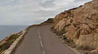
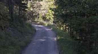
Exploring Corsica's seaside: the D81B coastal road from Calvi to Galeria
D81B is a scenic seaside road with hundreds of turns, located on the island of Corsica. The drive offers one of the best experiences for driving through the island.
Driving the steep 13% track to the summit of La Norma
La Norma is a high mountain peak at an elevation of 2,584m (8,477ft) above sea level, located in the Savoie department in France.
Pas de l'Escalier
Pas de l'Escalier is a high mountain pass at an elevation of 1.907m (6,256ft) above the sea level, located in the Ariège department in the Occitanie region of south-western France.
Col de Barteaux
Col de Barteaux is a high mountain pass at an elevation of 2.384m (7,821ft) above the sea level, located in the Hautes-Alpes department in southeastern France.
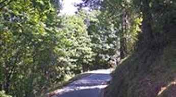
Station de Ski Ghisoni
Located at the foot of the Monte Renosu, in the Haute-Corse department of France on the island of Corsica, the Ghisoni ski resort sits at an elevation of 1.672m (5,485ft) above the sea level.
Col de Terre Nère
Col de Terre Nère is a high mountain pass at an elevation of 2.270m (7,447ft) above the sea level, located in the Pyrenees, a range of mountains in southwest Europe that forms a natural border between France and Spain.
Travel Guide to Lac de Gaube in the Pyrénées
Lac de Gaube is a high mountain lake at an elevation of 1.734m (5,688ft) above sea level, located in the Hautes-Pyrénées department of France.
The wild road to Bocca di Chiralba in Corsica
Bocca di Chiralba is a high mountain peak at an elevation of 1.749m (5,738ft) above the sea level, located in the Corse-du-Sud department of France on the island of Corsica. It’s one of the highest roads of Corsica.
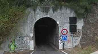
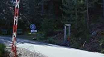
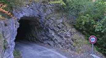
RN5 Tunnels: Driving the Narrow Peter Both and Gueule Rouge Tunnels in Réunion
The Route Nationale 5 (RN5) connects Saint-Louis and Cilaos on the French island of Réunion, in the Indian Ocean. This asphalted mountain road features two narrow single-lane rock tunnels carved into the volcanic cliffs, where two cars cannot pass each other at the same time.
Col de Chanrossa
Col de Chanrossa is a high mountain pass at an elevation of 2.545m (8,349ft) above the sea level, located in the Savoie department in the Auvergne-Rhône-Alpes region in southeastern France.
Collade de la Roquette
Collade de la Roquette is a high mountain pass at an elevation of 2.076m (6,811ft) above the sea level, located in the Pyrénées-Orientales department in southern France, near the border with Spain and the Autonomous Community of Catalonia.
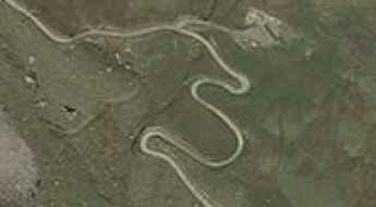
How to drive the unpaved road to Col des Saulces?
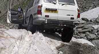
Col des Saulces is an unpaved mountain pass at an elevation of 2,456 meters (8,057 ft) above sea level, located in the Savoie department in the Auvergne-Rhône-Alpes region of southeastern France. Running through the Vanoise National Park near the Courchevel ski resort, the dirt track serves as a high-altitude service route between alpine pastures.
If you love to drive, you’ll love the road to Madone d'Utelle
Madone d'Utelle is a high mountain sanctuary at an elevation of 1.177m (3,861ft) above the sea level, located in the Alpes-Maritimes department in Provence-Alpes-Côte d'Azur region, in France.
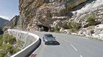
Col de la Serena
Col de la Serena is a mountain pass at an elevation of 1.303m (4,274ft) above the sea level, located in the Alpes-Maritimes department in southeastern France. Be prepared. The road is very narrow. It’s not for the faint of heart or ill prepared.
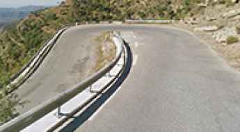
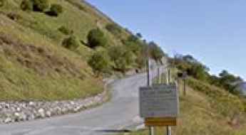
D84, a vertigo paved road in France
D84 is a short narrow mountain road located in the department of Aude, region Languedoc-Roussillon, in southern France. The road is not easy. Not recommended to newbies.