What are the most spectacular roads in France?
France is a true paradise for those wishing to experience the most spectacular roads, and it provides endless experiences for each driver. From stunning balcony roads, mountain passes, and coastal drives, to roads disappearing with the tides, it hosts more than 750 roads listed as the most spectacular in the world.
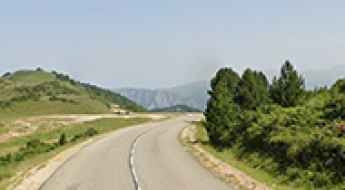
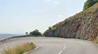
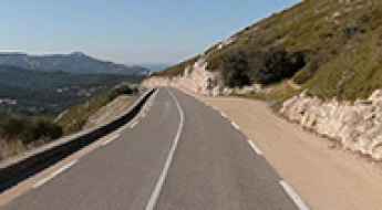
Located in the western part of Europe, France covers an area of 551,695 square kilometers and shares borders with 7 countries: Belgium, Luxembourg, Germany, Switzerland, Italy, Spain, and Andorra. With high mountains in the Alps and the Pyrenees, the roads of the country are famous worldwide because of the Tour de France, the most important cycling race. When traveling to the country, be sure to experience a drive through the best balcony roads. Dramatically carved out of rock on the side of mountains, the balcony roads are a unique experience for any rider.
The country also hosts iconic roads, known worldwide, including Col du Chaussy, a mountain pass at 1,533m (5,029ft) above sea level, famous for the “Lacets de Montvernier,” a special 3 km stretch with 17 hairpins as the road virtually climbs a cliff, or Col de Turini, a treacherous Alpine road with a legendary driving history, as one of the most dangerous and challenging stages of the Monte Carlo Rally and one of the most scenic drives in the world. For those preferring another kind of experience, don’t forget to drive Passage du Gois, the tide-covered road. It’s a natural passage flooded twice a day by the high tide leading to the island of Noirmoutier.
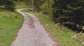
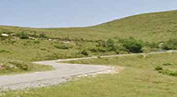
Driving the road to Col de l’Abelle is not a piece of cake
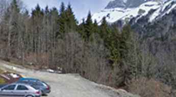
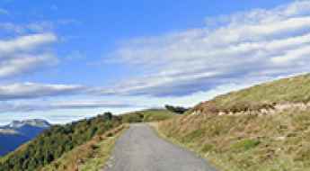
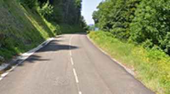
Col de l’Abelle is a high mountain pass at an elevation of 925m (3,034ft) above the sea level, located in the department of Alpes-Maritimes, in the Provence-Alpes-Côte d'Azur region of France.
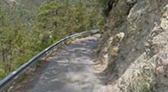
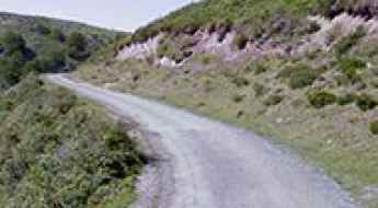
If you’re scared of narrow, curvy roads, avoid the RD117 in the Alpes-Maritimes at all costs
RD117 is a challenging mountain road located in the Alpes-Maritimes department of France. The road is extremely narrow, so proceed cautiously and hope no other vehicles come from the opposite direction.
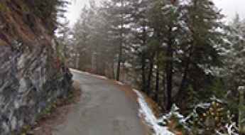
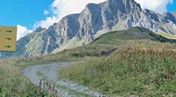
Are you brave enough to drive Route de Maronne?
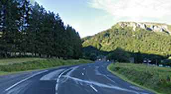
Route de Maronne is a very scenic yet extremely defiant mountain road located in the Isère department, of the region of Auvergne-Rhône-Alpes in France.
Plateau de Beille: A Legendary Tour de France Climb in the Pyrenees
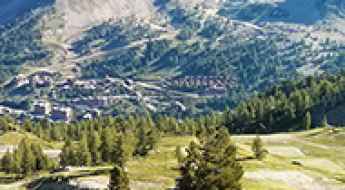
Plateau de Beille is a ski resort at an elevation of 1,787m (5,862ft) above sea level, located in the Ariège department of France. It’s one of the most iconic climbs in the country.
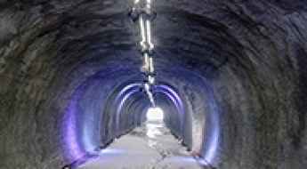
How to reach the high-mountain Tunnel des Inversens in Savoie?
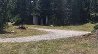
Tunnel des Inversens is a high-altitude mountain tunnel at an elevation of 2,310 meters (7,578 ft) above sea level, located in the Savoie department within the Auvergne-Rhône-Alpes region of France. Situated near the base of the Roche de Mio peak, the unpaved single-lane service track leading to the structure serves as a maintenance passage inside the La Plagne ski resort layout.
How to drive the unpaved road to Crete de Douce in the Alps
Crête de Douce is a high mountain peak at an elevation of 2.029m (6,656ft) above sea level, located in the Savoie department of France.
Is the road to Le Haut Montet in Provence too narrow for cars?
Le Haut Montet is a prominent mountain peak at an elevation of 1,337m (4,386ft) above sea level, located in the Alpes-Maritimes department of France. Situated within the Regional Natural Park of the Pre-Alps d'Azur, the summit is famous for its massive civil aviation radar, known locally as the "White Ball," which dominates the skyline between Gourdon and Caussols.
Col de Pradel: Can you drive the 20 km narrow road with a 12.9% gradient?
Col de Pradel is a high mountain pass at an elevation of 1,696m (5,564ft) in the Occitania region of France. Located between the Ariège and Aude departments, the road connects the Port de Pailhères area with the Gorges de Rebenty. It is a technical drive where the asphalt is narrow, degraded, and features steep ramps that test the vehicle's braking capacity.
Taking on the Twists and Turns of Col de la Buffaz
Col de la Buffaz is a high mountain pass at an elevation of 1,502m (4,927ft) above sea level, located in the Haute-Savoie department in the Auvergne-Rhône-Alpes region in France.
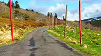
Driving a beautiful balcony road from Guillaumes to Saint-Martin-d'Entraunes
Located in the Alpes-Maritimes department of France, the road from Guillaumes to Saint-Martin-d'Entraunes offers an exciting driving experience. It’s one of the famous French balcony roads.
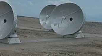
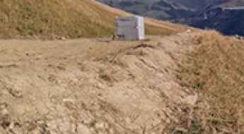
Driving the Unpaved Road to Plateau de Bure in the French Alps: A Moon-like and Star Wars Adventure
Plateau de Bure is a high mountain plateau at an elevation of 2,560m (8,398ft) above sea level, located in the Hautes-Alpes department of France. It is home to the most powerful submillimeter radio telescope array in the northern hemisphere.
How to drive the scenic D656, a balcony road in the Provence?
D656 is a short mountain road located in the Var department of France. It’s one of the most scenic French balcony roads.
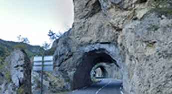
Driving the wild road to Pas de Roland in the Pyrenees
Pas de Roland is a high mountain pass at an elevation of 1.700m (5577ft) above sea level, located in the Ariège department of France.
How to drive the scenic D5 road in Provence?
D5 is a very challenging mountain road, located in the Alpes-Maritimes department of France. It climbs up many mountain passes and tops out at 1,439 m (4,721 ft) above sea level.
Road to Le Hohneck: Driving the 8.14% Gradient in the Vosges
Reaching an elevation of 1,362m (4,468ft) above sea level, Le Hohneck is a prominent mountain peak located in the Grand Est region of France. Situated on the boundary between the Vosges and Haut-Rhin departments, it represents one of the highest accessible points within the Ballons des Vosges Regional Nature Park.
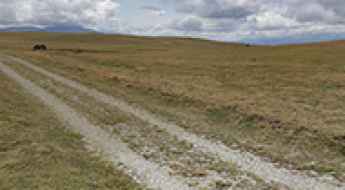
How difficult is the unpaved road to Puigmal in the Pyrenees?
Puigmal, also known as Puigmal d'Err, is a massive mountain peak sitting on the border between France and Spain in the eastern Pyrenees. Reaching an elevation of 2,648m (8,687ft) above sea level, the road west of the summit is one of the highest tracks in the region. This is a wild, unpaved journey that connects the French department of Pyrénées-Orientales with the Catalan comarca of Ripollès. The track is a high-altitude service road that requires a capable vehicle and a driver prepared for the thin air and the absolute isolation of the high border ridges.
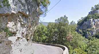
How to drive the D135 balcony road through Gorges de l'Escharis?
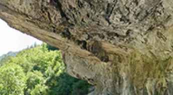
The Gorges de l'Escharis is a deep limestone canyon in the Drôme department of France. The road through the gorge, the D135, is one of the narrowest balcony roads in France. It is a 22.4 km route carved into the cliffs above the Roanne River, where overhanging rocks and the lack of space to pass other vehicles are the main obstacles.
Is the road to Col du Ferrier in Provence difficult to drive?
The Col du Ferrier is a classic limestone gateway into the Prealps of the Côte d'Azur. At 1,041m (3,415ft) above sea level, this pass in the Alpes-Maritimes department isn't the highest in France, but it’s one of the most technical. The road is a twisted ribbon of old asphalt that climbs quickly away from the coast, leaving the palm trees behind for a world of grey rock and scrubland. If you're looking for a smooth, wide highway, the D5 is going to be a rude awakening.
A Scenic Drive Through Col de Clavel: Gateway to Montagne de Lachens
Col de Clavel is a mountain pass at an elevation of 1.076m (3,530ft) above sea level, located in the Provence-Alpes-Côte d'Azur region of France.
How to get to Puy de la Perdrix in the Massif Central?
Puy de la Perdrix is a high mountain peak located in the Puy-de-Dôme department of France. It is one of the highest peaks in central France. A gravel road, southeast of the peak, ends at 1,787m (5,862ft) above sea level, at a cable car station near the summit.
Driving the steep D632 road to Col de la Hourcère in the Pyrenees
Col de la Hourcère (also known as Murkhuillako Lépoua in Basque) is a high mountain pass at an elevation of 1,435m (4,708ft) above sea level in the Pyrénées-Atlantiques department of France. Located in the heart of the Basque country near the Spanish border, the road is a technical masterpiece of steep gradients and narrow asphalt.
How to get by car to Station du Mont-Dore in the Massif Central?
Station du Mont-Dore is a ski resort at an elevation of 1,325m (4,347ft) above sea level, located in the Puy-de-Dôme department of France.
Puig de la Tossa: Can you drive the 3.2 km military track from Col de la Llose?
Puig de la Tossa is a high mountain peak at an elevation of 2,032m (6,666ft) in the Pyrénées-Orientales, France. The road is a 3.2 km military track that starts at Col de la Llose and leads to an abandoned 19th-century fortification. It is a narrow, unpaved route located west of Pic de Figuéma, where the gravel surface and the isolation are the main obstacles.
Pic de Figuéma: Can you drive the 3.1 km unpaved road from Col de la Llose?
Pic de Figuéma, also known as Pic de Figamà, is a high mountain peak at an elevation of 2,021m (6,630ft) in the Pyrénées-Orientales department of France. Located east of Puig de la Tossa, the access is a 3.1 km unpaved track that starts from the Col de la Llose. It is a narrow service road leading to an antenna at the summit, where the rocky surface and steep drops are the primary hazards.
How to get to Cime de Sistron in the Alps?
Cime de Sistron is a high mountain peak at an elevation of 2,605m (8,546ft) above sea level, located in the Alpes-Maritimes department of France. Situated near the Italian border in the Provence-Alpes-Côte d'Azur region, the summit is accessed via a technical unpaved service road. Operating a vehicle on this track requires high-clearance 4x4 capabilities due to the extreme gradients and the fragile high-altitude environment of the Parc national du Mercantour.
How to drive the curvy road to Col de la Taillade in the Pyrenees
Col de la Taillade is a mountain pass at an elevation of 1,407m (4,616ft) above sea level, located in the Pyrénées-Atlantiques department of France.
How to drive the unpaved road to Col d’Anglas in the Pyrenees?
Col d’Anglas is a high mountain peak at an elevation of 2,453m (8,047ft) above sea level, located in the Pyrénées-Atlantiques department.
Col Saint-Bernard road in Castellar: A brutal 4WD climb in the Alpes-Maritimes
Located near the village of Castellar in the Alpes-Maritimes, Col Saint-Bernard is a high-altitude destination for 4x4 enthusiasts. At an elevation of 771m (2,529ft) above sea level, this mountain pass combines a relentless 13% gradient with a deep historical legacy that dates back to the Middle Ages.
Driving the narrow Route des Tourres through Gorges de Saucha Négra
The Route des Tourres, which cuts through the Gorges de Saucha Négra, is one of the most obscure and technical drives in the Alpes-Maritimes. This 13.1-kilometer track, branching off the Route des Grandes Alpes, is a vertical lesson in survival. Carved directly into high limestone cliffs and crossing unstable "gray lands," the road hangs hundreds of meters above the Barlatte torrent. It is a world of loose scree, deep ruts, and dark tunnels where the mountain feels like it is constantly trying to reclaim the path.
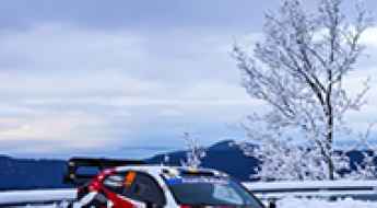
Driving the Monte-Carlo Rally: The most legendary mountain passes
The Rallye Monte-Carlo is the ultimate test of mechanical focus and tire management. Unlike other events, the "Monte" is defined by its unpredictable verticality, where drivers can face dry asphalt, deep snow, and black ice in a single 30 km stage. The heart of this race lies in the mountain passes of the Alpes-Maritimes and the Hautes-Alpes, a network of narrow, high-consequence roads that have become the proving grounds for the world's most elite drivers.
Driving the D199 road through Col de la Portette in the Vercors
The Col de la Portette is a mountain pass at an elevation of 1,168m (3,832ft) above sea level, located in the Drôme department of southeastern France. Situated within the Vercors massif, the pass is a minor but technical logistical link on the D199 road, serving as a transitional climb between the lower valleys and the higher Alpine plateaus.
How to drive the balcony road to Col de Saint-Pancrace in Peille?
Col de Saint-Pancrace is a mountain pass at an elevation of 677m (2,221ft) above sea level, located in the Provence-Alpes-Côte d'Azur region of France. It is one of the balcony roads of the country.
Driving the steep road to Château de Quéribus in Aude
Château de Quéribus is a high-mountain fortress at an elevation of 614 meters (2,014 ft) above sea level, located in the Aude department of France.
How to drive the steep paved road to Mont Colombis in the Hautes-Alpes?
Mont Colombis is a high mountain peak at an elevation of 1,734 meters (5,686 ft) above sea level, located in the Hautes-Alpes department of France.
Col de la Gineste: Driving the D559 Coast Road From Marseille to Cassis
Col de la Gineste is a mountain pass at an elevation of 326 m (1069ft) above sea level, located in the department of Bouches-du-Rhône, in France.
How to drive the 11.6% gravel road to Crête de la Soumaye?
Crête de la Soumaye is a high mountain peak at an elevation of 2,348m (7,703ft) above sea level, located in the Hautes-Pyrénées department of France.
How to drive the unpaved road to Lac de l’Ouillette in Savoie?
Lac de l’Ouillette is a high mountain lake at an elevation of 2,521m (8,270ft) above sea level, located in the Savoie department of France.
How to drive the unpaved road to Coll de la Farella?
Coll de la Farella is an international mountain pass at an elevation of 305m (1,000ft) above sea level, located on the French-Spanish border.
How to drive the paved road to Col de Bostmendieta
Col de Bostmendieta is a mountain pass at an elevation of 1,054m (3,458ft) above sea level, located in the Pyrénées-Atlantiques department of France.
How to drive the unpaved road to Col du Gollet in the Massif de la Vanoise
Col du Gollet is a high mountain pass at an elevation of 1,979m (6,492ft) above sea level, located in the Savoie department of France. It serves as the gateway to the higher ridges of the Valmorel ski area.
How to drive the steep road to Mur de Peguere in Occitanie?
Mur de Péguère is a mountain pass at an elevation of 1,375m (4,511ft) above sea level, located in the Occitanie region of France.
How to drive is the D54 road to Col du Sappenay in France?
Col du Sappenay is a mountain pass at an elevation of 897 meters (2,942 ft) above sea level located in the Savoie department of France.
How to drive the military road to Pierre-sur-Haute in France?
Pierre-sur-Haute is the highest point of the Monts du Forez, at an elevation of 1,631 meters (5,351 ft) above sea level located in the Massif Central region of France. Straddling the border between the Loire and Puy-de-Dôme departments, the peak hosts a restricted military radio station accessed via a narrow single-lane road that splits into asphalt on the northern face and raw dirt on the southern slope.
How to drive the steep road to Col du Haag in the Haut-Rhin department
Col du Haag is a mountain pass at an elevation of 1.233m (4,045ft) above sea level, located in Grand Est region of France.
Driving the Ski Service Tracks of Montgenèvre: Chalvet, Alpet & Serre Thibaud
In the mountains surrounding Montgenèvre, on the border between France and Italy, several high-altitude tracks climb above 2,400 meters elevation. Built to construct and service the local ski resort infrastructure, these three unpaved service routes—Le Chalvet, Col de l'Alpet, and Crête de la Serre Thibaud—scale steep slopes, running along narrow ridges above the Cottian Alps.