What are the most spectacular roads in France?
France is a true paradise for those wishing to experience the most spectacular roads, and it provides endless experiences for each driver. From stunning balcony roads, mountain passes, and coastal drives, to roads disappearing with the tides, it hosts more than 750 roads listed as the most spectacular in the world.
Located in the western part of Europe, France covers an area of 551,695 square kilometers and shares borders with 7 countries: Belgium, Luxembourg, Germany, Switzerland, Italy, Spain, and Andorra. With high mountains in the Alps and the Pyrenees, the roads of the country are famous worldwide because of the Tour de France, the most important cycling race. When traveling to the country, be sure to experience a drive through the best balcony roads. Dramatically carved out of rock on the side of mountains, the balcony roads are a unique experience for any rider.
The country also hosts iconic roads, known worldwide, including Col du Chaussy, a mountain pass at 1,533m (5,029ft) above sea level, famous for the “Lacets de Montvernier,” a special 3 km stretch with 17 hairpins as the road virtually climbs a cliff, or Col de Turini, a treacherous Alpine road with a legendary driving history, as one of the most dangerous and challenging stages of the Monte Carlo Rally and one of the most scenic drives in the world. For those preferring another kind of experience, don’t forget to drive Passage du Gois, the tide-covered road. It’s a natural passage flooded twice a day by the high tide leading to the island of Noirmoutier.
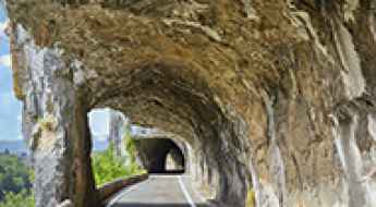
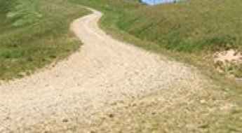
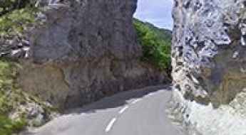
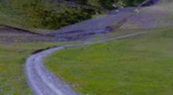
Driving the challenging Défilé de Ruoms, a French balcony road
Défilé de Ruoms is the name of a very scenic defile located in the Ardèche department in the Auvergne-Rhône-Alpes region of France. It’s one of the most scenic balcony roads of the country.
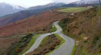
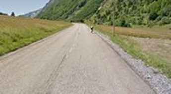
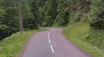
How to drive the narrow road to Col des Veaux?
The Col des Veaux is an international mountain pass at an elevation of 540m (1,771ft) above sea level, located on the border between France (Pyrénées-Atlantiques) and Spain (Navarre). The road spans 19.9 km, linking Louhossoa in the north with Amaiur-Maya in the Baztan valley to the south. Although the surface is fully paved, the route is pretty challenging due to its extreme narrowness and steep gradients that characterize the western Pyrenees.
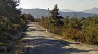
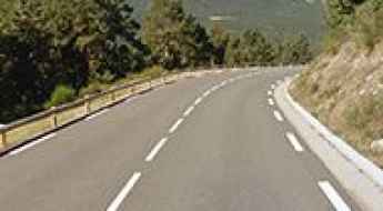
A curvy paved road to Col de Perty
Col de Perty is a mountain pass at an elevation of 1.302m (4,271ft) above the sea level, located in the Drôme department in the Auvergne-Rhône-Alpes region in southeastern France.
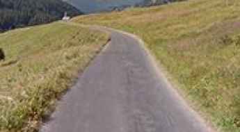
Travel guide to the top of Col des Annes
Col des Annes is a high mountain pass at an elevation of 1.721m (5,646ft) above the sea level, located in the Haute-Savoie department in the Rhône-Alpes region in south-eastern France.
Pointe de la Masse
Pointe de la Masse is a high mountain peak at an elevation of 2.790m (9,153ft) above the sea level, located in the Savoie department in the Auvergne-Rhône-Alpes region of the French Alps.
Col de Menté and Col de la Clin: Driving the 25 hairpins of the Haute-Garonne
Located in the heart of the Haute-Garonne department in southwestern France, Col de Menté is a classic Pyrenean mountain pass reaching an elevation of 1,347m (4,419ft) above sea level. This pass, combined with the nearby Col de la Clin, forms a challenging and spectacular driving route through the Occitania region, famous for its technical switchbacks and its history in professional cycling.
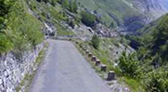
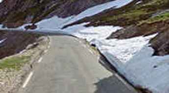
The road to Lac du Barrage d'Ossoue isn't an easy one
Lac du Barrage d'Ossoue is a high mountain lake at an elevation of 1.842m (6,043ft) above the sea level, located in the Hautes-Pyrénées, a department in southwestern France.
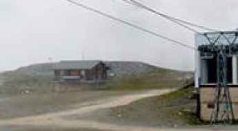
How to drive the unpaved road to Roche de Mio?
Roche de Mio is a high mountain peak at an elevation of 2.716m (8,910ft) above sea level, located in the Auvergne-Rhône-Alpes region of France. It’s one of the highest roads in the country.
The road to Mont Vial is said to be the scary of scaries
Mont Vial is a high mountain peak at an elevation of 1.527m (5,009ft) above the sea level, located in the Alpes-Maritimes department in southeastern France. It’s one of the few peaks of the backcountry behind Nice that is recognisable from the sea.
A winding road to Bocca di Sorba in Corsica
Bocca di Sorba is a mountain pass at an elevation of 1.311m (4,301ft) above the sea level, located in the Haute-Corse department of France on the island of Corsica. The road to the summit is awesome, with sections up to 10.7%. Tight bends and faster sweepers. It’s one of the highest roads of Corsica.
17 Tournants de Chevreuse, an iconic drive south of Paris
17 Turns of Chevreuse is a legendary motorcycle ride located in the Yvelines department in the Île-de-France, in the south suburb of Paris, in north-central France.
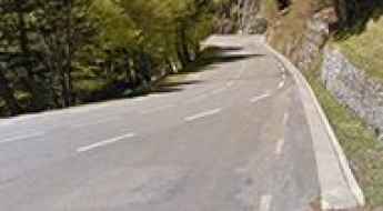
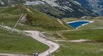
Driving the steep D308 to Col de la Ramaz: The challenge of Tunnel de Sommand
Col de la Ramaz is a high mountain pass at an elevation of 1,619m (5,311ft) above sea level, located in the Haute-Savoie department of France. This pass is a classic of the French Alps, connecting the Giffre valley with the Praz de Lys ski area, and is world-renowned for its frequent inclusion in the Tour de France.
An awe-inspiring drive to Col d'Ornon
Col d'Ornon is a mountain pass at an elevation of 1.360m (4,462ft) above the sea level, located in the Dauphiné Alps, in the department of Isère in France.
A very bumpy, grueling road to Grand Col
Grand Col is a high mountain peak at an elevation of 2.939m (9,642ft) above the sea level, located in the Savoie department in the Auvergne-Rhône-Alpes region in south-eastern France. It’s one of the highest roads of Europe.
Prat d'Albis is a drive worth taking
Prat d'Albis is a mountain pass at an elevation of 1.201m (3,940ft) above the sea level, located in the Ariège department in southwestern France in the Occitanie region.
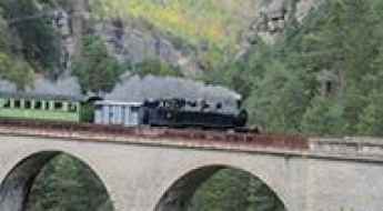
10 Most Scenic Railroads Across France
One of the best ways to explore the true beauty of France is by hopping on a train and letting it take you through the most stunning locations! However, how to know which railways to choose and which journeys are the most worth it? Do not worry; we are here to help you make this decision. Here are our top 10 most scenic railroads across France!
Col de Fresse
Col de Fresse is a high mountain pass at an elevation of 2.777m (9,110ft) above the sea level, located in the Savoie department, in the Auvergne-Rhône-Alpes region of the French Alps. I
Adventure along Pas de Colle Ardente
Passo di Collardente-Pas de Colle Ardente, is a high mountain pass at an elevation of 1.617m (5,305 ft) above the sea level, located in the Maritime Alps on the border between Italy and France. The pass is traversed by the spectacular Via del Sale.
Fort de la Platte
Fort de la Platte is a military fortress at an elevation of 2.009m (6,591ft) above the sea level, located in the Savoie department in the Rhône-Alpes region in south-eastern France.
How to drive the paved road to Col Bagargui?
Col Bagargui is a mountain pass at an elevation of 1.327m (4,353ft) above sea level, located in the Pyrénées-Atlantiques department in France.
A brutally steep classic climb to Planche des Belles Filles
La Planche des Belles Filles is a ski resort at an elevation of 1.148m (3,766ft) above sea level, located in the Bourgogne-Franche-Comté region, in France.
The wild unpaved road to Col de la Fréte in Savoie
Col de la Fréte is a high mountain pass at an elevation of 2.494m (8,182ft) above sea level, located in the Savoie department in France.
Bocca di Verdi: Driving the high-altitude D69 in Corsica
Bocca di Verdi is a mountain pass at an elevation of 1,289m (4,229ft) above sea level, located on the island of Corsica, France. The pass, also known as Col de Verde or Foci di Verdi, sits on the boundary between the departments of Corse-du-Sud and Haute-Corse. The road through the summit is a central segment of the D69, a high-altitude route that crosses the island’s interior through dense pine forests and granite ridges.
Col des Posettes: a wild unpaved road to the summit
Col des Posettes is a high mountain pass at an elevation of 1.997m (6,551ft) above the sea level, located in the Haute-Savoie département in the Rhône-Alpes region in south-eastern France.
Tête de Veret: Driving the Inhuman Unpaved 21% Ramps of the Grand Massif
Tête de Veret is a high mountain peak at an elevation of 2.309 m (7,575 ft) above sea level, located in the Haute-Savoie department of the Rhône-Alpes region, in southeastern France.
Col de la Chal
Col de la Chal is a high mountain pass at an elevation of 2.460m (8,070ft) above the sea level, located in the Savoie department in the Rhône-Alpes region in south-eastern France.
Driving the scenic Col de la Core in the heart of the Ariège Pyrenees
Col de la Core is a high mountain pass at an elevation of 1,395m (4,577ft) above sea level, located in the Ariège department of the French Pyrenees. This pass is a staple of the Tour de France and serves as a vital link between the Bethmale Valley and the Salat Valley.
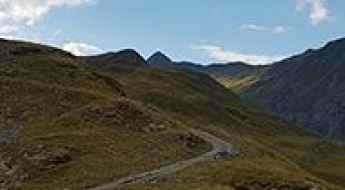
Driving to Port de Lers: A high-altitude pass in the Ariège Pyrenees
Located in the department of Ariège, in the heart of the French Pyrenees, Port de Lers (also known as Port de l'Hers) is a high-mountain pass that reaches 1,517m (4,977ft) above sea level. Part of the technical D18 road, this crossing in the Occitania region is much more than a famous cycling climb; it is a narrow, winding transit where the mountain's verticality and the changing weather conditions demand absolute focus from any driver.
A hairpinned steep road to Parking des Millefonts
Parking des Millefonts is a high mountain parking at an elevation of 2.040m (6,692ft) above the sea level, located in the Alpes-Maritimes department in the Provence-Alpes-Côte d'Azur region in southeastern France.
Col de la Sinne: A Balcony Road in the Alpes-Maritimes
Col de la Sinne (also known as Col de la Sinna) is a mountain pass at an elevation of 1,438m (4,717ft) above sea level, located in the Alpes-Maritimes department of France. At the summit (44.0255, 7.06854), there is a small historic chapel.
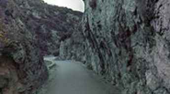
Gorges de Padern, a balcony road in France
The scenic Gorges de Padern are located in the Aude department in southern France. It’s one of the French balcony roads.
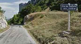
The Ultimate Guide to Traveling the Col de Tourniol
Col de Tourniol is a mountain pass at an elevation of 1.145m (3,756ft) above the sea level, located in the Drôme department in Auvergne-Rhône-Alpes region, in southeast-central France.
A memorable road trip to Collet du Plan Nicolas
Collet du Plan Nicolas is a high mountain pass at an elevation of 2.406m (7,893ft) above the sea level, located in the Savoie department in the Rhône-Alpes region in south-eastern France.
Col de la Quillane
Col de la Quillane is a high mountain pass at an elevation of 1.714m (5,623ft) above the sea level, located in the Pyrénées-Orientales, in southern France.
Driving through Gorges de Nouailles, a French balcony road
Gorges de Nouailles is a canyon formed by the Loue River, located in the Doubs department in the Bourgogne-Franche-Comté region in eastern France. It’s one of the famous French balcony roads.
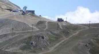
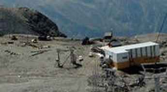
How to drive the 4x4 road to Col du Mottet?
Col du Mottet (also known as Col de Roche Blanche) is a high mountain pass at an elevation of 2,374 meters (7,788 ft) above sea level, located in the Savoie department within the Auvergne-Rhône-Alpes region of France. Situated in the Massif de la Vanoise, the rough unpaved service track climbs directly to the summit station of the Mottet chairlift, connecting the Valmorel resort lines with the upper ridges of the Bellevilles valley.
Grande Motte
Grande Motte is a high mountain peak at an elevation of 3.030m (9,940ft) above the sea level, located in Savoie department in the Auvergne-Rhône-Alpes region, France. It’s one of the highest roads of Europe.
Driving through Gorges de la Cadière, a French balcony road
Gorges de la Cadière is a very scenic canyon carved by the Argentesse river, located in Occitanie region of France. It’s one of the famous French balcony roads.
Driving the D199 road through Col de la Bataille in the Vercors
Col de la Bataille is a mountain pass at an elevation of 1,313 meters (4,307 ft) above sea level, located in the Drôme department, in the Auvergne-Rhône-Alpes region of France. Situated within the Vercors Massif, the pass is crossed by the paved D199 road.
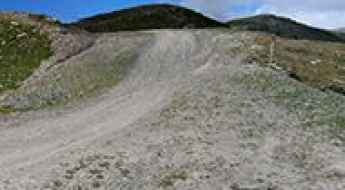
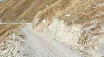
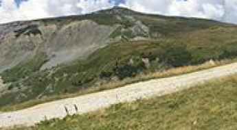
Driving to Pic de Chabrières: A brutal 2.701m 4x4 track in the Queyras Alps
Located in the Hautes-Alpes department of southeastern France, the track to Pic de Chabrières is a high-altitude monster that pushes the limits of off-road driving. Reaching an elevation of 2,701m (8,861ft) above sea level in the Queyras mountains, this is a raw, unpaved service road used for chairlift maintenance. It is a journey through a desolate landscape of rock and shale, where the vertical gain and the thin air at nearly 3,000 meters create a high-consequence environment for any vehicle.
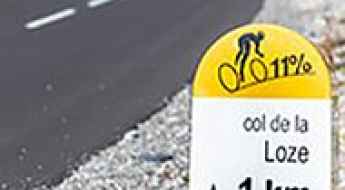
A new paved road to Col de la Loze
Col de la Loze is a high mountain pass at an elevation of 2.308m (7,572ft) above the sea level, located in the Savoie department in the Auvergne-Rhône-Alpes region in south-eastern France.
How to drive the paved road to the top of Col du Festre in the Hautes-Alpes
Col du Festre is a mountain pass at an elevation of 1.441m (4,727ft) above sea level, located in the Hautes-Alpes department of France.
Cirque de Cilaos
Cirque de Cilaos is a large rock amphitheater, at an elevation of 1.586m (5,203ft) above the sea level, located on the French island of Réunion in the Indian Ocean. The sometimes nail-biting drive is well worth it!
Mont Bouquet
Mont Bouquet is a mountain pass at an elevation of 628m (2,060ft) above the sea level, located in the Gard department in southern France.
Road trip guide: Conquering Col du Lisey
Col du Lisey is a high mountain pass at an elevation of 2.086m (6,843ft) above the sea level, located in the Hautes-Pyrénées department, in the Midi-Pyrénées.