What are the most spectacular roads in France?
France is a true paradise for those wishing to experience the most spectacular roads, and it provides endless experiences for each driver. From stunning balcony roads, mountain passes, and coastal drives, to roads disappearing with the tides, it hosts more than 750 roads listed as the most spectacular in the world.
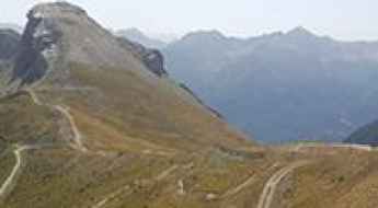
Located in the western part of Europe, France covers an area of 551,695 square kilometers and shares borders with 7 countries: Belgium, Luxembourg, Germany, Switzerland, Italy, Spain, and Andorra. With high mountains in the Alps and the Pyrenees, the roads of the country are famous worldwide because of the Tour de France, the most important cycling race. When traveling to the country, be sure to experience a drive through the best balcony roads. Dramatically carved out of rock on the side of mountains, the balcony roads are a unique experience for any rider.
The country also hosts iconic roads, known worldwide, including Col du Chaussy, a mountain pass at 1,533m (5,029ft) above sea level, famous for the “Lacets de Montvernier,” a special 3 km stretch with 17 hairpins as the road virtually climbs a cliff, or Col de Turini, a treacherous Alpine road with a legendary driving history, as one of the most dangerous and challenging stages of the Monte Carlo Rally and one of the most scenic drives in the world. For those preferring another kind of experience, don’t forget to drive Passage du Gois, the tide-covered road. It’s a natural passage flooded twice a day by the high tide leading to the island of Noirmoutier.
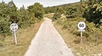
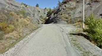
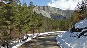
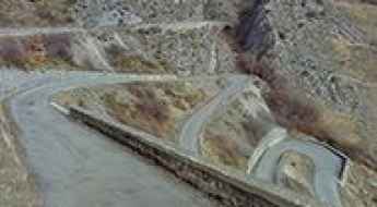
How to drive the paved road to Col de Marocaz?
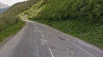
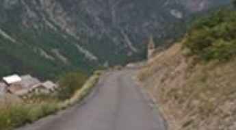
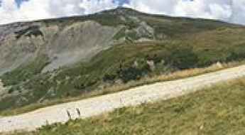
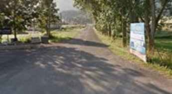
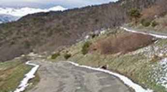
Col de Marocaz is a mountain pass at an elevation of 958m (3,143ft) above sea level, located in the Savoie department of France.
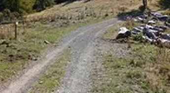
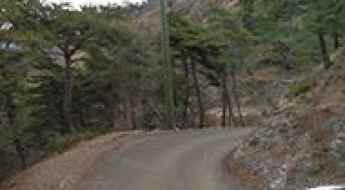
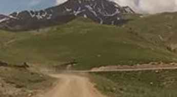
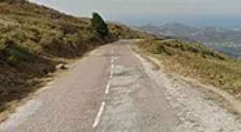
Col Gaudissart
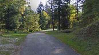
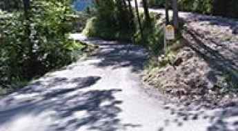
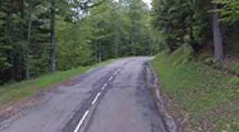
Col Gaudissart is a mountain pass at an elevation of 896m (2,939ft) above the sea level, located in the Drôme department in southeastern France.
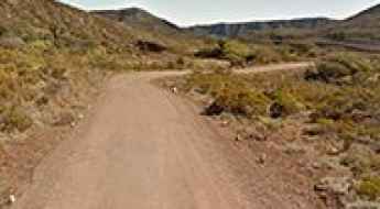
Road to Lac Long Supérieur: Driving the 2,500m Restricted Track in the Mercantour
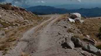
Located in the Alpes-Maritimes department of southeastern France, Lac Long Supérieur is a high-altitude glacial lake reaching an elevation of 2,500m (8,202ft) above sea level. Situated within the core zone of the Mercantour National Park, the track leading to the lake is a restricted mountain corridor used for park maintenance and mountain refuge logistics.
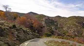
Route de Pierrefitte
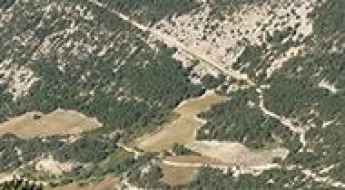
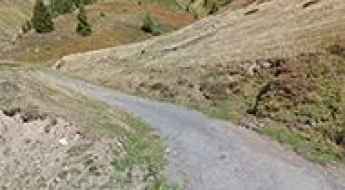
Route de Pierrefitte (D920) is a mountain road located in the Hautes-Pyrénées department and the region of Midi-Pyrénées in south-western France.
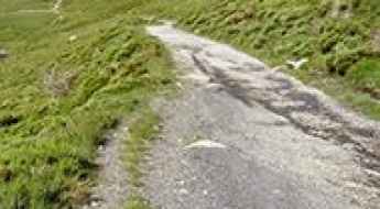
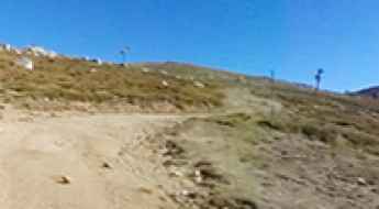
Col de la Loge: Driving the narrow and degraded road in Drôme
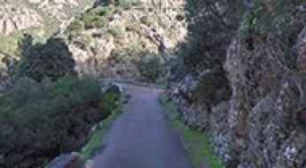
Col de la Loge is a mountain pass at an elevation of 1,002 meters (3,287 ft) above sea level, located in the Drôme department of southeastern France. The route is a short but technical link starting from Ferrassières. Defined by its narrow dimensions and a severely degraded surface, the road serves as a secondary mountain pass and a service track for local agricultural machinery, requiring constant attention to tire grip and vehicle width.
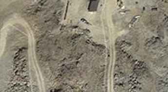
La Déa Fortress: Driving the 15km Military Track in the Alpes-Maritimes
At an elevation of 1,753m (5,751ft) above sea level, La Déa Fortress (locally known as Petit Ouvrage de la Baisse de la Déa) is a military fortification in the Alpes-Maritimes department of southeastern France. Built in 1934 as part of the Alpine extension of the Maginot Line, the fortress is located in a high-altitude strategic position near the Italian border.
Road trip guide: Conquering the Pas de Bellecombe
Pas de Bellecombe is a high mountain pass at an elevation of 2.361m (7,746ft) above sea level located on the eastern side of Réunion island in the Indian Ocean.
D26 Road: Driving the steep 16% ramps from Olivese to Col de la Vaccia
The D26 is a technical mountain road located in the Corse-du-Sud department on the island of Corsica, France. The most critical section of this route runs west-east, linking the village of Olivese with the Col de la Vaccia. This 11-kilometer climb is characterized by its narrow profile and extreme gradients that test the cooling systems and braking capacity of any vehicle navigating the interior of the island.
Col des Verniers
Col des Verniers is a mountain pass at an elevation of 1.042m (3,418ft) above the sea level, located in the Hautes-Alpes department in southeastern France.
Col de Rioupes
Col de Rioupes is a mountain pass at an elevation of 1.430m (4,691ft) above the sea level, located in the Hautes-Alpes department in Provence-Alpes-Côte d'Azur region in southeastern France.
Driving to Col de la Porte: A technical 18-hairpin climb in the Alpes-Maritimes
Col de la Porte (also known as Cuolla de Liporte) is a mountain pass at an elevation of 1,060 meters (3,477 ft) above sea level, located in the Alpes-Maritimes department of southeastern France. The pass is traversed by the narrow D73 road, connecting Lantosque and Lucéram in the pre-Alpine hills of the Provence-Alpes-Côte d'Azur region.
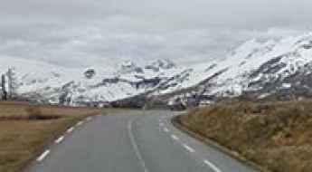
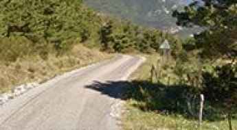
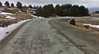
How to drive the paved road to Col d'Albanne in Savoie
Col d'Albanne is a high mountain pass at an elevation of 1.652m (5,419ft) above sea level, located in the Savoie department of France.
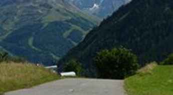
Les Arcs 2000
Les Arcs 2000 is a ski station at an elevation of 2.120m (6,955ft) above the sea level, located in the Savoie department in the Rhône-Alpes region in south-eastern France.
Col de la Biche
Col de la Biche, also known as Golet de la Biche, is a mountain pass at an elevation of 1.310m (4,297ft) above the sea level, located in the Ain department in eastern France. The climbs is exceedingly steep with some sections up to 13.6%.
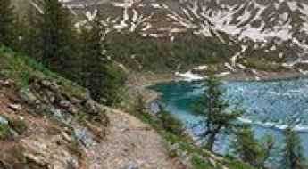
How to get to Lac d'Allos, the largest natural high-altitude lake in Europe
Lac d'Allos is a high mountain lake at an elevation of 2,248 m (7,375 ft) above sea level, located in the Alpes-de-Haute-Provence of France.
Col de Pierre Vesce
Col de Pierre Vesce is a mountain pass at an elevation of 1.042m (3,418ft) above the sea level, located in the Drôme department in southeastern France.
Col de Font Belle
Col de Font Belle is a mountain pass at an elevation of 1.304m (4,278ft) above the sea level, located in the Alpes-de-Haute-Provence in the south of France.
The road to Col de Saluces is not for the faint of heart
Col de Saluces is a high mountain pass at an elevation of 2.445m (8,021ft) above the sea level, located in the Hautes-Alpes department in southeastern France.
Driving the steep Chemin Garcia to Estany de la Coma d'en Garcia
Estany de la Coma d'en Garcia is a high mountain lake at an elevation of 2,303m (7,555ft) above sea level, located in the Pyrénées-Orientales department of southern France. Tucked away in the high Pyrenees near Porté-Puymorens, this remote glacial pond offers a true alpine escape.
Pla de la Calma-Mollera dels Clots
Pla de la Calma-Mollera dels Clots is a high mountain pass at an elevation of 2.040m (6,692ft) above the sea level, located in the Pyrénées-Orientales and Cerdagne near the Spanish border in the south of France.
Fort de la Grande Maye
Fort de la Grande Maye is a high mountain fort at an elevation of 2.401m (7,877ft) above the sea level, located in the Hautes-Alpes department in southeastern France.
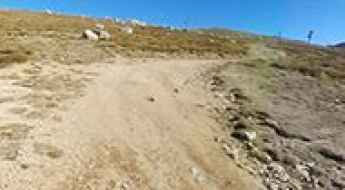
How to drive the unpaved road to Col Nord des Lacs in Savoie
Col Nord des Lacs is a high mountain peak at an elevation of 2.533m (8,310ft) above sea level, located in the Savoie department of France.
Col de Plantara
Col de Plantara is a mountain pass at an elevation of 1.002m (3,287ft) above the sea level, located in the Drôme department in the Rhône-Alpes region in southeastern France.
How to drive the unpaved road to the top of Col de la Ricelle
Col de la Ricelle is a high mountain pass at an elevation of 2.366m (7,762ft) above sea level located in the Hautes-Alpes department in France.
How to get by car to Les Fonds in the Hautes-Alpes department?
Les Fonds is a remote high mountain town located at an elevation of 2,040m (6,692ft) above sea level, located in the Hautes-Alpes department, within the Provence-Alpes-Côte d'Azur region of southeastern France. Tucked away east of the famous Col d’Izoard, this settlement is a hidden gem in the Cottian Alps.
Road D76
The D76 road is a very exciting journey in the Alpes-Maritimes department in southeastern France. Located at the gateway to the National Mercantour Park, the road is asphalted but very narrow.
Sommet de la Reynière
Sommet de la Reynière is a high mountain peak at an elevation of 1.717m (5,633ft) above the sea level, located in the Alpes-de-Haute-Provence department in southeastern France.
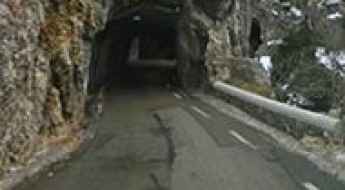
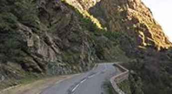
Road trip guide: Conquering Gorges de la Spelunca
Gorges de la Spelunca is a very scenic canyon located in the Corse-du-Sud department of France on the island of Corsica. If you don't like winding roads this may be a problem.
How to drive the steep 14.24% ascent to Col de Balme?
The Col de Balme is an international high mountain pass at an elevation of 2,209m (7,247ft) above sea level, situated on the border between France (Haute-Savoie) and Switzerland (Valais). The French side is accessed via a narrow and extremely steep gravel track from Vallorcine, while the Swiss side consists exclusively of a walking path toward Trient. Logistically, the summit is a dead-end for motor vehicles, and the ascent requires a high-performance 4x4 to manage the sustained vertical climb.
Pas de Cherferie
Pas de Cherferie is a high mountain pass at an elevation of 2.142m (7,027ft) above the sea level located in the Savoie department in the Auvergne-Rhône-Alpes region in south-eastern France.
Col des Gourses
Col des Gourses is a high mountain pass at an elevation of 2.565m (8,415ft) above the sea level, located in Rhone-Alpes in the French Isère département.
How to drive the paved road to Pas des Escaliers?
Pas des Escaliers is a high mountain pass at an elevation of 1.700m (5,577ft) above sea level, located in the Isère department in France.
Col du Teil
Col du Teil is a high mountain pass at an elevation of 1.628m (5,341ft) above the sea level, located in the Aude department of southern France.
Col de Scaldasole is the highest road of Corsica
Col de Scaldasole is a high mountain pass at an elevation of 1.938m (6,358ft) above the sea level, located in the Corse-du-Sud department of France on the island of Corsica. It’s one of the highest roads of Corsica.
Station de Camurac
Station de Camurac is a ski station at an elevation of 1.630m (5,347ft) above the sea level, located in the Aude department of southern France.
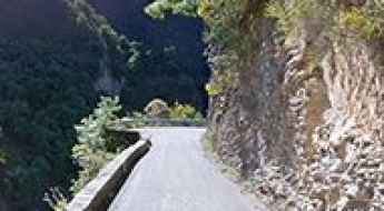
Taking on the Twists and Turns of Défilé de l'Inzecca
Défilé de l'Inzecca is a very scenic canyon located in the Haute-Corse department of France on the island of Corsica.
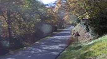
D428 is a balcony road through Vallon de Pierlas
Vallon de Pierlas is the name of a very scenic valley located in the Alpes-Maritimes department, in the Provence-Alpes-Côte d'Azur region of southeastern France. It's one of the famous French balcony roads.
Les Tourniquets d'Astoin
Les Tourniquets d'Astoin is the name of the sharply winding and precipitous ascent in a steep and narrow zig-zag road in the Alpes-de-Haute-Provence department in southeastern France.
A very bumpy, grueling road to Bocca di Battaglia
Bocca di Battaglia is a mountain pass at an elevation of 1.104m (3,622ft) above the sea level, located in the Haute-Corse department of France on the island of Corsica. The road to the summit is awesome, with sections up to 12%. Tight bends and faster sweepers.
Adventure along Breche du Grand Creux
Breche du Grand Creux is a high mountain peak at an elevation of 2.830m (9,284ft) above the sea level, located in Rhone-Alpes in the Isère département, in France.
What are the highest roads in Corsica?
Surrounded by rugged and rocky coasts, Corsica is a Mediterranean island located southeast of France and west of Italy. The island represents a large variety of morphological landscapes, and for the most part, the terrain of Corsica is mountainous: Mont Cinto is the highest peak, reaching to 2706m, while more than 30 summits surpass 2000m. It one of 18 French regions, with Ajaccio as its capital. It is the fourth largest island in the Mediterranean, behind Sicily, Sardinia and Cyprus.
Road D93
Road D93 is challenging drive in the heart of the Savoie department in the Auvergne-Rhône-Alpes region in south-eastern France. The average gradient is 6.82% with 18 hairpin turns along the way.
How to drive the D76 road to Col de Lachau in the Vercors?
Col de Lachau is a mountain pass at an elevation of 1,332m (4,370ft) above sea level, located in the Drôme department of southeastern France. Situated within the Vercors Natural Regional Park, the pass is a critical logistical link on the D76 road, serving as the technical gateway to some of the most challenging cliff-edge sectors in the French Prealps.
Collada del Vent
Collada del Vent is a high mountain pass at an elevation of 2.301m (7,549ft) above the sea level, located in the Pyrénées-Orientales department in southern France, near the border with Spain and the Autonomous Community of Catalonia.
Driving the Piste du Capet to Pêne Det Pouri in the Pyrenees
Pêne Det Pouri is a high mountain peak at an elevation of 2,030m (6,660ft) above sea level, located in the department of Hautes-Pyrénées in France. Situated in the heart of the central Pyrenees, the summit offers one of the best balconies overlooking the famous Tourmalet area.