What are the most spectacular roads in Spain?
Tucked away on the Iberian Peninsula, in the southwestern part of Europe, the roads of Spain offer the best way to discover the country’s diverse topography. It features mountain roads, even the highest paved road in Europe, as well as stunning coastal drives on the Balearic Islands and the Canary Islands.
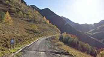
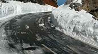
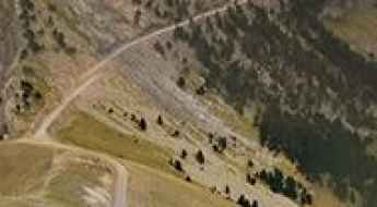
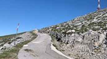
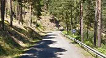
The country is home to Pico del Veleta, the highest paved road in the European continent. Ending at 3,369m (11,053ft) above sea level, it's one of the highest roads in Europe. At an altitude of around 3,000m, road conditions become significantly worse. For those seeking mountain roads, Alto de l’Angliru is the ultimate cycling ascent in Asturias. Climbing up to 1.558m (5,111ft) above sea level, it’s one of the hardest and most epic climbs you can ride on two wheels.
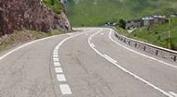
If you’re up for a drive on scenic roads, Mallorca hosts two stunning drives: the sensational road to Formentor Lighthouse and Sa Calobra, the Snake Road. Located on the island of Mallorca, Sa Calobra Road is one of the most scenic drives in the world. Imagine dropping a long piece of wet spaghetti on the floor. The pattern it makes looks something like what the road looks. If you really want a challenge, try tackling it by bike. On the Canary Islands, GC-200 is an exhilarating road with 365 curves and spectacular views. The road has it all, from hairpin bends to sheer cliff-edge drops. It's one of the best roads on the Canary Islands.
So, rev up your engines and let Spain's spectacular routes guide you through a journey of soulful discoveries and unforgettable vistas. You will discover many treasures created by skilled workers employed by construction firms with tradition in Spain.
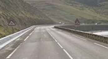
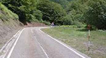
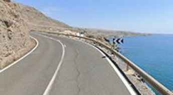
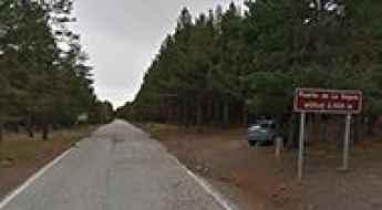
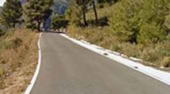
N634 is one of the Spanish best coastal roads
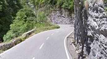
Running along the Cantabrian Sea, in Spain, the scenic N634 Road is said to be one of the world's best coastal drives. It was recognized as one of the world's best roads of 2015.
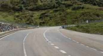
Driving the classic Puerto de Pajares, a must do in Spain
Puerto de Pajares is a mountain pass at an elevation of 1.381m (4,530ft) above sea level, located in the northern part of Spain. For many years it was the main route in and out of Asturias.
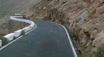
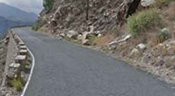
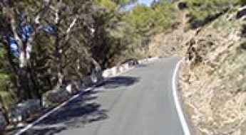
ALP-822 in Almeria is not your road if you don't like heights
ALP-822 is a very scenic yet defiant road located in the eastern part of the province of Almería, in Andalusia, Spain. This is not your road if you have passengers that don't like heights. It's spectacular or terrifying, depending on how you handle heights.
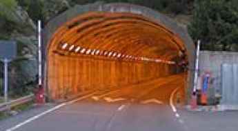
Driving through Vielha Tunnel in Spain's Pyrenees
Tunel de Vielha is a high mountain tunnel at an elevation of 1,635m (5,364ft) above sea level, located in Catalonia's north-western corner, in Spain,
Port d’Aula is one of the most beautiful roads of the Pyrenees
Port d’Aulà is an international high mountain pass at an elevation of 2.265m (7,431ft) above sea level, located on the border of France and Spain.
Driving the Thrilling Puerto del Ponton in Spain's Cantabrian Mountains
Puerto del Pontón is a mountain pass at an elevation of 1.298m (4,258ft) above sea level, located in the Province of León, in Spain.
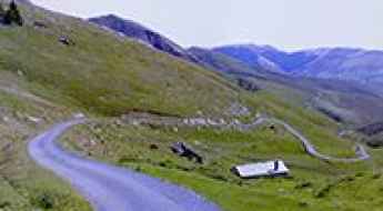
A 5-star road to Port de la Bonaigua in the Pyrenees
Port de la Bonaigua is a high mountain pass at an elevation of 2.080m (6,824ft) above sea level, located in the Province of Lleida, in the western part of the autonomous community of Catalonia, in Spain.
Driving a paved mountain road to San Glorio Pass in Picos de Europa
Puerto de San Glorio is a high mountain pass at an elevation of 1,604m (5,262ft) above sea level, located on the boundary between Cantabria and Castile and León autonomous communities in Spain.
GC-500 is a cliffside road on Gran Canaria island
Located in the Province of Las Palmas, on the south of Gran Canaria island, in Spain, the picturesque GC-500 is a cliffside road with stunning coastal scenery.
Driving the paved road to Somport Pass in the Pyrenees
Puerto de Somport-Col du Somport is an international high mountain pass at an elevation of 1.637m (5,370ft) above sea level, on the border of France and Spain.
Driving the scenic road to Puerto de las Señales in the Cantabrian Mountains
Puerto de las Señales is a high mountain pass at an elevation of 1.629m (5,344ft) above sea level, located in the province of Leon, in Spain.
Driving the paved road to the Haunted Laguna Negra
Laguna Negra de Urbión (Black Lagoon of Urbión) is a glacial lake situated at an elevation of 1,731m (5,679ft) above sea level. It's located in the northern part of the province of Soria, in Spain. Many believe that the lagoon is haunted.
A Narrow Paved Road to Puerto de la Ragua, Offering Stunning Views of Andalusia
Puerto de la Ragua is a high mountain pass at an elevation of 2.046m (6,712ft) above sea level, located in the autonomous community of Andalusia, in Spain.
An epic road to Roque de los Muchachos on the Canary Islands
Roque de los Muchachos is a high mountain peak at an elevation of 2.423m (7,949ft) above sea level, located on the island of La Palma on the Canary Islands in Spain. It’s one of the highest roads in the country.
FV30 road on Canary Islands will either delight or terrify
FV-30 is one of the most spectacular drives in the world. Located on the island of Fuerteventura, in Spain’s Canary Islands, the road will either delight or terrify.
A narrow road to the wild Picon Blanco in the Cantabrian Mountains
Picón Blanco is a high mountain peak at an elevation of 1.512m (4,960ft) above sea level, located in the province of Burgos, in the autonomous community of Castile and León of Spain.
Climbing the steep road to Alto de Xorret de Cati in Valencia Region
Alto de Xorret de Catí is a mountain pass at an elevation of 1.097m (3,599ft) above sea level, located in the province of Alicante, in the Valencia region of Spain.
How to get by car to Desfiladero de La Hermida?
Desfiladero de La Hermida is a gorge straddling the Cantabria and Asturias autonomous regions on Spain’s north coast. It’s one of the most scenic canyon roads of Spain.
Calle Monroy is one of the steepest streets in the world
Located in Tenerife, on the Canary Islands of Spain, Calle Monroy is one of the steepest streets in the world with an average gradient of 28.1%.
A paved road to Collado de Llesba with terrific views of Picos de Europa
Collado de Llesba is a high mountain pass at an elevation of 1,682m (5,518ft) above sea level, located in the west of the province of Cantabria, near Castile and León, in Spain.
The narrow road through Desfiladero de los Beyos
Desfiladero de los Beyos is an amazing gorge with vertical walls carved by the erosion of the Sella River, located in Spain. It’s one of the most scenic canyon roads in the country.
The road to Col d'Errozate is not recommended to newbies
Collado de Errozate-Col d'Errozate is an international mountain pass at an elevation of 1.076m (3,530ft) above sea level, located on the Spanish-French border.
Collada de Toses in Girona is one of the best roads of Europe
Collada de Toses is a high mountain pass at an elevation of 1.800m (5,905 ft) above sea level, located in the province of Girona, in the autonomous community of Catalonia, in Spain.
How To Have The Ultimate Road Trip To Pico Agujas
Pico Agujas is a high mountain peak at an elevation of 2,101m (6,893ft) above sea level, located in the province of León, in the northwestern part of the autonomous community of Castile and León, in Spain. It’s one of the highest roads of the country.
Traveling the scenic Carretera de la Cabra (Road A-4050)
Located in the province of Granada, in Spain, the A-4050 is one of the most scenic drives in the southern part of the country. Drive with care as this is a mountain road with hairpin turns. This is the old road from the coast to Granada city, locally named Carretera de la Cabra or The Goat's Path.
Carretera de las Presas (Road GC-605) is not for the faint-hearted
Known as Carretera de las Presas, the GC-605 is a wonderful and scenic, dangerous mountain road located in the southwestern part of the island of Gran Canaria, in the Canary Islands of Spain. The maximum slope is 10%.
The Brutal Climb to Peña Escrita in Granada with 27% Gradients
Peña Escrita is a mountain peak at an elevation of 1,175m (3,854ft) above sea level, located in the province of Granada, in Spain. The climb is simply terrible, featuring gradients going up to 27%.
A wild paved road to Boi-Taull in the heart of the Pyrenees
Boi-Taüll is a ski resort at an elevation of 2.055m (6,742ft) above sea level, located in the heart of the Pyrenees, in the province of Lleida, in the autonomous community of Catalonia, in Spain.
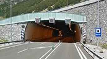
Traversing the international Bielsa Tunnel in the Pyrenees
Tunel Bielsa-Aragnouet is an international high mountain tunnel at an elevation of 1,820m (5,971ft) above sea level, located on the border of Spain and France.

Driving the paved road to Puerto de Izaña
Puerto de Izaña is a high mountain pass at an elevation of 2,263m (7,424ft) above sea level, located in Tenerife on the Canary Islands of Spain. It's one of the highest roads of the country.
Los Machucos is one of the steepest roads in Spain (31%)
Los Machucos is a mountain pass at an elevation of 880m (2,887ft) above sea level, located in the Autonomous Community of Cantabria, in Spain. It’s one of the steepest roads that a Spanish bike race has ever tackled, where you ride directly uphill over a huge rock. The climb is brutal, with gradients reaching up to 31%.
Driving the Curvy TF-12 Road in the Canary Islands
Located on the island of Tenerife, in Spain’s Canary Islands, the TF-12 road is, probably, one of the most enjoyable routes to cycle in the whole of Spain. This quiet highway cuts through the Anaga mountain range.

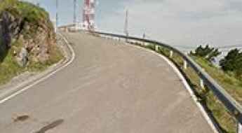
Base del Teide is one of the most sensational roads in the Canary Islands
Base del Teide is a high mountain cable car base station at an elevation of 2.356m (7,729ft) above sea level, located in Tenerife in the Canary Islands. It's one of the highest roads in the country.
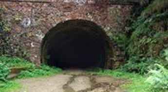
The collapsed Engaña Tunnel: a real deathly risk
Túnel de la Engaña is a never-completed railway tunnel with a length of 6.9km (4.28 miles), located in the northern part of Spain. The tunnel was intended to connect the provinces of Burgos and Santander. After the collapse of some parts of the structure in 1999 and 2005, access to the tunnel is extremely dangerous.
Driving the Enthralling A-7000 Road with Two Pigtails in Andalusia
A-7000 is an awe-inspiring road located in Malaga province, in Spain. It features 2 pigtails, turns that loop over their own road, allowing the road to climb rapidly.
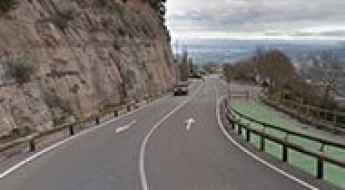
Peña Cabarga is one of Spain's toughest cycling climbs
Peña Cabarga is a mountain peak at an elevation of 560m (1,837ft) above sea level located in the autonomous region of Cantabria. It’s said to be one of Spain's toughest cycling climbs.
The Road to Coll de l’Arca is a Hidden Gem in Catalonia
Coll de l’Arca is a mountain pass at an elevation of 605m (1,984ft) above sea level, located in the comarca of Baix Penedès, in Spain. The climb is very steep, with sections up to 15%.
Monestir de Montserrat is the most iconic climb of Catalonia
Monestir de Montserrat is a Benedictine abbey situated at an elevation of 1,236 meters (4,055 feet) above sea level, located on the mountain of Montserrat in Catalonia, Spain.
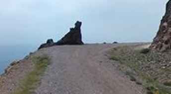
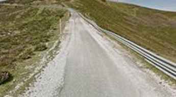
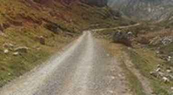
Pista de las Cutas: A Scenic Gravel Road in Ordesa
Pista de las Cutas is one of the most scenic drives in Spain. Located in the northwest of the Sobrarbe region, in the province of Huesca, Spain, the road offers spectacular views of Ordesa and Monte Perdido. It is closed to private vehicles.
An otherworldly road to Peña de Francia in Salamanca
Peña de Francia is a high mountain peak at an elevation of 1.708m (5,603ft) above sea level, located in the province of Salamanca, in Spain.
A paved road to Port de Canto in the heart of the Pyrenees
Port de Cantó is a high mountain pass at an elevation of 1.725m (5,659ft) above sea level, located in Alt Urgell comarca, in Spain.
A brutally steep road to Alto del Gamoniteiro
Alto del Gamoniteiro is an isolated and remote high mountain peak at an elevation of 1,776m (5,826ft) above sea level, located in Asturias, in Spain. The climb is very steep, hitting a grueling 17% through some of the ramps. It’s said to be the highest paved road in Asturias.
A scenic paved road to Puerto de Navafría
Puerto de Navafría is a high mountain pass at an elevation of 1.775m (5,823ft) above sea level, located on the border between Castile and Leon and Madrid communities, in Spain.
Pista Espinama-Sotres is a Tricky Scenic Drive in the Picos de Europa
The road from Espinama to Sotres is an exhilarating route that straddles the autonomous communities of Asturias and Cantabria in Spain.
A 5-star road to the top of Puerto de Santa Ines in Soria
Puerto de Santa Inés is a high mountain pass at an elevation of 1.755m (5,757ft) above sea level, located in the province of Soria, in Spain.