What are the most spectacular roads in China?
Located in the eastern part of Asia, and bordering 14 countries, China covers 9.6 million square kilometers. It’s the world's third-largest country by land area and it hosts more than 500 brutal driving experiences, listed as the most spectacular roads in the world. Due to its size and difficult geography, featuring mountains, plateaus, deserts, and plains, it has scenic, mountainous, and even flooding roads. It also holds many records, such as the world's longest traffic jam: a 100 km, 12-day standstill that occurred in August 2010, when the country witnessed the mother of all traffic jams.
When travelling to China, you can’t miss the infamous Tian Men Shan Big Gate, a road with 99 turns, built in 1998, that offers a thrilling 11-kilometer journey; or the iconic Guoliang Tunnel, which was dug through the side of a mountain by hand. Built in the early 1970s it is one of the most famous Chinese tunnel roads. It’s also worth driving the Sichuan-Tibet Highway, one of the world's highest roads.
And if you like challenging mountain roads situated at high elevations, remember to check out our list with the highest roads in China, where you’ll find real gems, such as Chāmkang, a mountain pass at 5.953m (19,530ft) above sea level.
How to drive the unpaved road to Bayi Daban in the Kunlun Mountains?
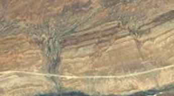
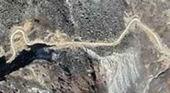
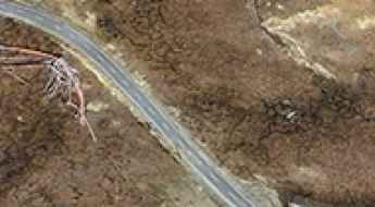
Bayi Daban is a high mountain pass at an elevation of 5,366m (17,604ft) above sea level, located in Tibet.
How to drive the unpaved road to Naktse La?
Naktse La is a high mountain pass at an elevation of 5,533m (18,152ft) above sea level, located in the Ngari Prefecture of Tibet. Set high in the Himalayas, it’s one of the highest roads in the country.
How to drive the mountain road from Kangbeicun to Zhangcun?
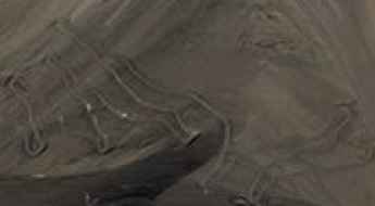
The road running between the villages of Kangbeicun and Zhangcun, in the Tibet Autonomous Region is a 60 km dirt track near the Nepalese border. The road tops out at 5,432m (17,821ft) above sea level.
How to get by car to Shimo Lake in Tibet?
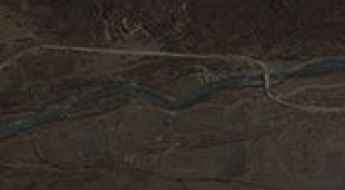
Shimo Co is a glacial lake at an elevation of 5,070m (16,633ft) above sea level, located in Xigazê in the Tibet Autonomous Region.
How to drive the Unpaved Road to Zing La in Cona County
Zing La is a high mountain pass at an elevation of 4,936m (16,194ft) above sea level, located in Cona County, within the Shannan Prefecture of Tibet. The rugged, unpaved track to the summit connects the high valleys of the region.
How to drive the steep unpaved road to Changlashan Pass?
Changlashan Pass is a high mountain pass at an elevation of 4,708 m (15,446 ft) above sea level, located in Zadoi County, in the southwest of Qinghai Province, China, bordering the Tibet Autonomous Region to the south.
How to drive to Chugyu La in the Qomolangma National Nature Preserve?
Chugyu La is a high mountain pass at an elevation of 4,415m (14,484ft) above sea level, located in Tingri County, within the Xigazê Prefecture of the Tibet Autonomous Region, in China.
How long is the unpaved road to Kaichisa La?
Kaichisa La is a high mountain pass at an elevation of 3,620m (11,876ft) above sea level, situated on the border between Myanmar and China. The road is a rugged 48.7 km mountain track that connects Shingkawng in Myanmar with Road Duli in China's Yunnan province.
How to drive the paved road to Kyipogo La in Xaitongmoin
Kyipogo La is a high mountain pass at an elevation of 5.054m (16,581ft) above sea level, located in Xaitongmoin County of Xigazê in the Tibet Autonomous Region, in China.
How to drive the unpaved road to Riong La
Riong La is a high mountain pass at an elevation of 5.153m (16,906ft) above sea level, located in the Tibet Autonomous Region of China.
How to drive the paved G318 Road to Tra La Pass?
Tra La is a mountain pass at an elevation of 4,046m (13,274ft) above sea level, located in the Samzhubzê District of Shigatse, Tibet Autonomous Region, China. The pass is a key point along the Friendship Highway, connecting Central Tibet with the Nepal border.
How to drive the unpaved road to Puram La?
Puram La is a high mountain pass at an elevation of 5.218m (17119ft) above sea level, located in the southeastern part of the Tibet Autonomous Region, China.
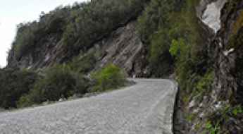
How to drive the cobblestone road to Fengxue Pass in Yunnan?
Fengxue Pass, also known as Fengxue Yakou, is a high mountain pass at an elevation of 3,157m (10,357ft) above sea level, located in Lushui County, Yunnan Province, in China.
How to drive the unpaved road to Drakde La in Qinghai?
Drakde La (also known as Dragde La) is a high-altitude mountain pass at an elevation of 4,611m (15,127ft) above sea level, located in Maqên County, within the Golog Tibetan Autonomous Prefecture of Qinghai, China.
How to drive the unpaved road to Shargang La in Tibet?
Shargang La is a high mountain pass at an elevation of 5.335m (17,503ft) above sea level located in Banbar County, Chamdo Prefecture in the Tibet Autonomous Region of China.
Driving the unpaved S217 road to Daxuenshan Pass in the Hengduan Mountains
Daxuenshan Pass (Da Xue Shan) is a high-mountain pass at an elevation of 4,337m (14,229ft) above sea level, located on the border between the Diqing Tibetan Autonomous Prefecture in Yunnan and the Garzê Tibetan Autonomous Prefecture in Sichuan, China.