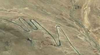
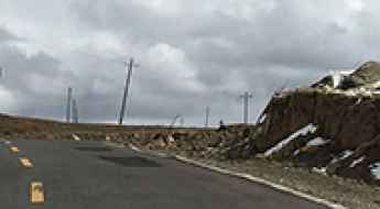
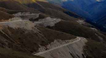
What are the most spectacular roads in China?
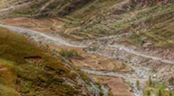
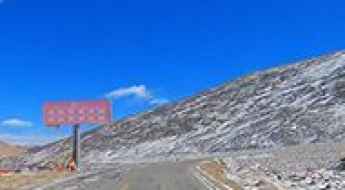
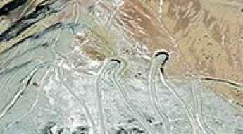
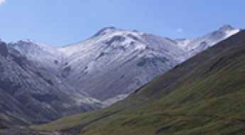
Located in the eastern part of Asia, and bordering 14 countries, China covers 9.6 million square kilometers. It’s the world's third-largest country by land area and it hosts more than 500 brutal driving experiences, listed as the most spectacular roads in the world. Due to its size and difficult geography, featuring mountains, plateaus, deserts, and plains, it has scenic, mountainous, and even flooding roads. It also holds many records, such as the world's longest traffic jam: a 100 km, 12-day standstill that occurred in August 2010, when the country witnessed the mother of all traffic jams.
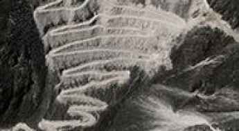
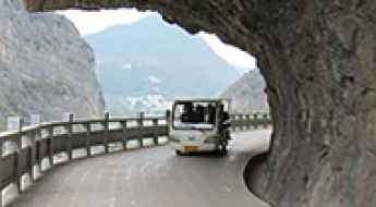
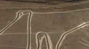
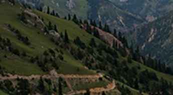
When travelling to China, you can’t miss the infamous Tian Men Shan Big Gate, a road with 99 turns, built in 1998, that offers a thrilling 11-kilometer journey; or the iconic Guoliang Tunnel, which was dug through the side of a mountain by hand. Built in the early 1970s it is one of the most famous Chinese tunnel roads. It’s also worth driving the Sichuan-Tibet Highway, one of the world's highest roads.
And if you like challenging mountain roads situated at high elevations, remember to check out our list with the highest roads in China, where you’ll find real gems, such as Chāmkang, a mountain pass at 5.953m (19,530ft) above sea level.
Driving the 5.031m Damne La: A high-altitude road in Biru County
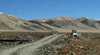
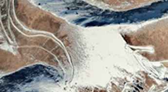
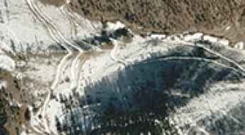
Damne La is an extreme high-mountain pass at an elevation of 5,031 meters (16,505 ft) above sea level, located in Biru County, within the Nagqu prefecture of the Tibet Autonomous Region, China. The unpaved mountain road connects the localities of Gongmaduocun and Duogeiduo.
Road trip guide: Conquering Kanggar Tzoxe La
Kanggar Tzoxe La is a high mountain pass at an elevation of 5.613m (18,415ft) above the sea level, located on the border of Tolung Dechen and Qüxü Counties of Lhasa Prefecture, in Tibet, China. It’s one of the highest roads of the country.
Trawo La: Driving the high plateau road between Tibet and Qinghai
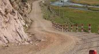
Trawo La is a high mountain pass at an elevation of 4,946m (16,227ft) above sea level, situated on the border between the Tibet Autonomous Region and Qinghai Province in China. This remote crossing connects Nyainrong County (Nagqu) with Zadoi County, traversing a desolate high-altitude plateau in the northern part of the Tibetan highlands.
Travel Guide to Gongnaisi Daban in the Tian Shan Mountains
Gongnaisi Daban is a high mountain pass at an elevation of 3,066m (10,059ft) above sea level, located on the boundary between Hejing and Xinyuan counties, in the Xinjiang Uyghur Autonomous Region of China.
Take An Unforgettable Drive to Zhawa La
Zhawa La is a high mountain pass at an elevation of 5,021m (16,473ft) above sea level, located in Batang County, Sichuan Province, People's Republic of China.
How to drive the challenging mountain road to Gang La in Tibet?
Gang La is a high mountain pass at an elevation of 4.824m (15,826ft) above sea level, located in Biru County, the most populated county within Nagqu of the Tibet Autonomous Region, in China.
The road to Kyi La is not for the faint of heart
Kyi La is a high mountain pass at an elevation of 5.106m (16,751ft) above sea level, located in the Comai County of Shannan, in the Tibet Autonomous Region of China.
How to drive the nice turns on the way to Lumu La?
Lumu La is a high mountain pass at an elevation of 4.797m (15,738ft) above sea level, located in Sichuan, in the Tibetan Autonomous Prefecture of China.
Driving the high-altitude unpaved road to Orkyi La in Tibet
Orkyi La is a high-altitude mountain pass reaching an elevation of 5,567m (18,264ft) above sea level, located in Kangmar County of Xigazê, within the Tibet Autonomous Region of China. Positioned near the Bhutanese border, it is officially one of the highest roads in the country, demanding extreme mechanical preparation.
Driving the wild Dongu La
Dongu La is a high mountain pass at an elevation of 4.944m (16,220ft) above the sea level, located in the Namling County of Shigatse in the Tibet Autonomous Region, in China.
A very bumpy, grueling road to Yamtse La
Yamtse La is a high mountain pass at an elevation of 4.685m (15,370ft) above the sea level, located in Kangmar County of Xigazê in the Tibet Autonomous Region, bordering India's Sikkim state to the south.
How is the drive through Gele La pass on the G317?
Crossing the Gele La is a test of mechanical and physical endurance in the heart of the Tibet Autonomous Region. At an elevation of 4,369m (14,333ft) above sea level, this pass in Jomda County is a critical and high-risk point on the legendary China National Highway 317. It is a route where the vastness of the Tibetan plateau meets the raw engineering challenges of high-altitude asphalt, offering a driving experience that is as breathtaking as it is exhausting.
Driving the unpaved road to Phenpogo La north of Lhasa
Phenpogo La, also known as Penpogo La or Penbogo La, is an extreme high-altitude mountain pass at an elevation of 5,086 meters (16,686 ft) above sea level, located on the boundary of Chengguan and Lhünzhub districts in the Lhasa City Prefecture, Tibet. Situated directly north of the capital, the road to the summit is predominantly unpaved and represents a significant mechanical challenge. The route is defined by its steep gradients, narrow ledge sections, and a complex sequence of tight bends that test the vehicle's torque and the driver's focus in a high-load, low-oxygen environment.
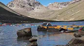
Gongga Co: Driving the steep 11.79% ascent to the Bhutanese border
Gongga Co, also known as Lake Gongga, is a high-altitude alpine lake at an elevation of 4,642 meters (15,229 ft) above sea level, located in Lhozhag County of the Shannan Prefecture, in the southeastern Tibet Autonomous Region. Positioned deep within the Himalayas, the remote track to the lake runs close to the international border with Bhutan.
Driving the steep road through Men La
Men La is a high mountain pass situated at an elevation of 4,265m (13,992ft) above sea level. It is located in Zayul County, within the Nyingchi Prefecture of the southeastern Tibet Autonomous Region in China. This remote pass is part of the rugged landscape that characterizes the border regions of southeastern Tibet, where high altitudes and steep terrain are the norm.
Ker La: Driving the 26km Unpaved Ascent in Riwoche
At an elevation of 5,024m (16,482ft) above sea level, Ker La is a high mountain pass in Riwoche County, within the Chamdo prefecture of Tibet. This remote crossing connects the town of Ratsaka with Shagongxiang, running along the high ridges above the Ngom River.
Dzekri La, an absolute must for road lovers
Dzekri La is a high mountain pass at an elevation of 4.693m (15,396ft) above the sea level, located in Riwoche county, in the prefecture-level city of Chamdo in the northeast of the Tibet Autonomous Region of China.
Driving the remote road to Ji La
Gyai La is a high mountain pass at an elevation of 4.979m (16,335ft) above the sea level, located in Tingri County in the prefecture-level city of Xigazê in the Tibet Autonomous Region of China.
How difficult is the steep road to Drongu La in Tibet?
Drongu La is a high-altitude mountain pass reaching an elevation of 4,929m (16,171ft) above sea level in Sa'gya County, part of the Xigazê prefecture in Tibet. While the road over the pass is fully paved, the extreme elevation and the brutal geometry of the terrain make it a high-risk route. Known locally as the Sa Chu Xian, this asphalt track is a masterclass in mountain engineering, but for the driver, it is a constant battle against oxygen depletion and the mechanical strain of one of the steepest paved climbs in the region.
Mingyue Gorge Ancient Plank Road: A Historic Passage Through the Cliffs
The Mingyue Gorge Ancient Plank Road is located in Chaotian District, Guangyuan City, Sichuan Province, China. It sits at the entrance of the Jialing River Valley and marks the starting point of the Jianmen Shu Road Scenic Tourist Line. Once a crucial transportation route, this ancient road was carved into cliffs to connect the region, playing a vital role in both daily life and military strategy. It’s one of the most famous Chinese tunnel roads.
Rathi La: Driving the high-altitude paved road in Batang
Rathi La is a high mountain pass at an elevation of 4.689m (15,383ft) above sea level, located in Sichuan, in China.
Driving the dizzying 564 Country Road
Located in Zogong County of the Chamdo Prefecture in the Tibet Autonomous Region of China, 564 Country Road (Y564) is the name of a defiant road through the mountains with many deep drop offs.
Hor La: Driving the S202 High Mountain Pass in Tibet
Hor La is a high mountain pass at an elevation of 4,807m (15,771ft) above sea level, located in the Shannan Prefecture of the Tibet Autonomous Region, China.
The Ultimate Road Trip To Galaga Pass
Galaga Yakou is a high mountain pass at an elevation of 4.504m (14,776ft) above the sea level, located in Yushu Prefecture, Qinghai Province of China.
How to manage the 25% gradients of the S315 road to Lach La?
The Lach La is a high-altitude mountain pass at an elevation of 4,731m (15,521ft) above sea level, situated in Nangqên County, within the Qinghai province of China. Technically, the pass is traversed by the S315 road, an unpaved high-mountain corridor that connects Xiangdazhen and Zhuoxiao. The route is defined by its extreme verticality, with specific ramps reaching a maximum gradient of 25%, placing it among the steepest unpaved provincial roads in the region.
Norchung La: A scenic and steep high-altitude pass on the S206
Norchung La is a high mountain pass at an elevation of 5,090m (16,699ft) above sea level, located in Coqên County, in the southeast of the Ngari Prefecture in China.
How dangerous is the road with 60 hairpins to Teganaqik Pass in Xinjiang?
Teganaqik Pass is a high mountain crossing reaching an elevation of 3,778m (12,395ft) above sea level in Akto County, within the Xinjiang region of China. Tucked away in the Kizilsu Kyrgyz Autonomous Prefecture, the road over this pass is a relentless zig-zag carved into a barren, rocky landscape. It is a world of 60 tight hairpin turns where the air is thin, the drops are unprotected, and the mechanical endurance of your vehicle is tested at every single bend of the 46-kilometer journey.
How to drive the 5,561m Jizha La Pass in the Himalayas?
Jizha La is an extreme high-altitude mountain pass at an elevation of 5,561m (18,244ft) above sea level, located in Lhozhag County, Shannan, Tibet. Known as Jí Zhā Lā, it is one of the highest roads of China, representing a logistical frontier where mechanical performance is severely compromised by extreme hypoxia and glacial proximity.
The road to Ye La will take your breath away
Ye La is a high mountain pass at an elevation of 5.041m (16,538ft) above sea level, located in Nagarzê County of Shannan Prefecture, in Tibet, China.
An epic enthralling road to Chepzi Observation Post
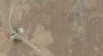
Chepzi Observation Post is a military facility at an elevation of 4.835m (15,862ft) above the sea level, located in Zanda County, Ngari Prefecture, Tibet.
The rough and curvy road to Racaka Pass
Racaka La is a high mountain pass at an elevation of 4.641m (15,226ft) above sea level, located in Riwoche, a county of the prefecture-level city of Chamdo in the Tibet Autonomous Region, China.
Travel guide to the top of Upyang Pass
Upyang Pass is a high mountain pass at an elevation of 4.927m (16,164ft) above the sea level, located in the Taxkorgan Tajik Autonomous County of Kashgar Prefecture in Western Xinjiang, China.
The brutally steep (36%) road to Pang La in Zogong County
Pang La is a high mountain pass at an elevation of 4.221m (13,848ft) above the sea level, located in Zogong County, is a county of the Chamdo Prefecture in the Tibet Autonomous Region of China.
Travel guide to the top of Wahusi Pass
Wahusi Pass is a high mountain pass at an elevation of 4.456m (14,619ft) above sea level, located in Qinghai Province, in China.
Is the 4x4 road to Chuka La in Tibet difficult to drive?
Chuka La (also known as Quka La) is an extreme high-mountain pass at an elevation of 5,318m (17,447ft) above sea level, located in Zhongba County, within the Shigatse Prefecture of the Tibet Autonomous Region. Tucked away in the rugged Godong Gangri range, this unpaved track is one of the most remote and oxygen-deprived routes in western China, offering a true test for high-altitude explorers.
How to drive the paved road to Kazi La?
Kazi La is a mountain pass at an elevation of 4,439m (14,563ft) above sea level, located in Litang County, within the Garzê Tibetan Autonomous Prefecture, Sichuan, China. The pass is traversed by a paved segment of the highway.
Hei Daban Pass: Conquering the 17% Unpaved Ramps near Qiyi Glacier
Hei Daban is a high mountain pass at an elevation of 4,364m (14,317ft) above sea level, located in Sunan Yugur Autonomous County in China.
Driving the Jiu Ruo Road to Lamaling Shankou: 1,000 curves in the Minshan Mountains
Lamaling Shankou is a high mountain pass at an elevation of 3,993 meters (13,100 ft) above sea level, located on the boundary between Zoigê and Jiuzhaigou counties, within the Ngawa Tibetan and Qiang Autonomous Prefecture of Sichuan Province, China. The pass cuts through the limestone ridges of the Minshan mountain range via a fully paved regional road.
What You Need to Know About Driving Through Kongpo La
Kongpo La is a high mountain pass at an elevation of 5.327m (17,477ft) above the sea level, located on the border of Nang County (Nyingtri Prefecture) and Lhünzê County (Shannan Prefecture) in the Tibet Autonomous Region of the People's Republic of China.