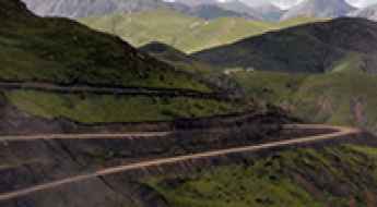
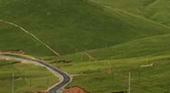
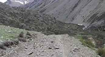
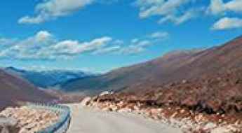
What are the most spectacular roads in China?
Located in the eastern part of Asia, and bordering 14 countries, China covers 9.6 million square kilometers. It’s the world's third-largest country by land area and it hosts more than 500 brutal driving experiences, listed as the most spectacular roads in the world. Due to its size and difficult geography, featuring mountains, plateaus, deserts, and plains, it has scenic, mountainous, and even flooding roads. It also holds many records, such as the world's longest traffic jam: a 100 km, 12-day standstill that occurred in August 2010, when the country witnessed the mother of all traffic jams.
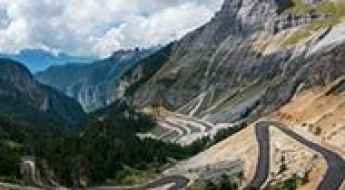
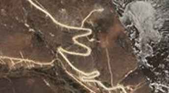
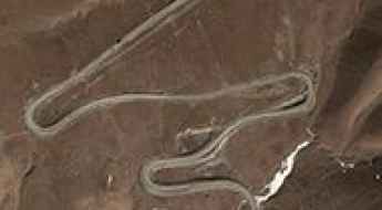
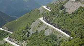
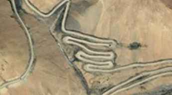
When travelling to China, you can’t miss the infamous Tian Men Shan Big Gate, a road with 99 turns, built in 1998, that offers a thrilling 11-kilometer journey; or the iconic Guoliang Tunnel, which was dug through the side of a mountain by hand. Built in the early 1970s it is one of the most famous Chinese tunnel roads. It’s also worth driving the Sichuan-Tibet Highway, one of the world's highest roads.
And if you like challenging mountain roads situated at high elevations, remember to check out our list with the highest roads in China, where you’ll find real gems, such as Chāmkang, a mountain pass at 5.953m (19,530ft) above sea level.
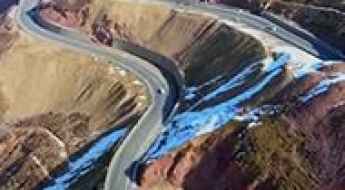
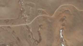
Dabanshan Pass: Driving the old mountain road and the G227 tunnel
Dabanshan Pass is a high mountain pass at an elevation of 3,944m (12,939ft) above sea level, located on the border between Haibei and Xining Prefectures in China's Qinghai Province. Situated within the rugged Qilian Mountains, the road through the pass is the G227 national road, a route steeped in the history of the ancient Silk Road.
The road to Churi Meri La, a chillout in high mountains
Churi Meri La is a high mountain pass at an elevation of 4,507m (14,786ft) above sea level, located in Nangqên County, in the Yushu Tibetan Autonomous Prefecture, in China.
How to drive the military track to Samto La?
The Samto La is an international high mountain pass reaching an elevation of 5,064m (16,614ft) above sea level, situated on the border between China (Tibet) and Nepal (Mustang District). Logistically, this is a dead-end corridor; while the Chinese side is serviced by a military track starting from Qukane, there is no road, trail, or motorable path on the Nepalese side. Driving to the summit requires a high-clearance 4x4 and is strictly restricted to authorized personnel due to its sensitive border location.
Driving the unpaved 232 Country Road (Y232) in Tibet
The 232 Country Road (also known as Y232) is a high-altitude mountain route located in Ngamring County, within the remote Tibet Autonomous Region of China. Running entirely above 4,000 meters, the road is a grueling logistical transit across the northern Tibet plateau, reaching a maximum elevation of 5,274m (17,303ft) above sea level.
Dadongshu Pass Is Miles Of White-Knuckle Driving
Dadongshu Pass is a high mountain pass at an elevation of 4.120m (13,517ft) above the sea level, located in Qilian County of Qinghai Province, part of Haibei Tibetan Autonomous Prefecture, in China.
Bangmeilong Peak: Driving the 44 hairpin turns to the Tibet Observatory
Bangmeilong Peak is an extreme high-altitude summit located in Yadong County, within the Tibet Autonomous Region of China. Reaching an elevation of 5,190m (17,027ft) above sea level, the peak sits in the strategic Chumbi Valley near the Bhutanese border. The road to the summit is a high-mountain service track that leads to an astronomical observatory, offering one of the most visually stunning and technically demanding zig-zag climbs in the Himalayas.
An Unforgettable Road to Götse La
Götse La (also known as Gray Head Pass or Gose La) is a high mountain pass at an elevation of 4,628m (15,183ft) above sea level, located in Dêgê County, within the Garzê Tibetan Autonomous Prefecture of Sichuan, China. This remote track is famous for its extreme altitude and for being the primary access route to the historic Palpung Monastery.
Zhilung La: A technical 4x4 climb through the 20% ramps of Tibet
Zhilung La, also known as Drilung La, is a high mountain pass at an elevation of 4,970 meters (16,305 ft) above sea level, located in the Ngari Prefecture of the Tibet Autonomous Region, in China. Tucked into an isolated northern mountain sector, the pass is crossed by a steep, completely unpaved backcountry track.
Is the X605 Road to Gyaring Lake safe for 4x4 vehicles?
X605 (County Road 605) is a high-altitude unpaved route located in the Nagqu prefecture of Tibet, China. Linking the villages of Shenyaxiang and Xiaguoxiang, the rough dirt track runs entirely above 4,600 meters (15,090 ft) as it climbs through the remote northern plains of the Tibetan plateau.
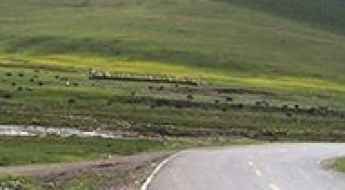
How to drive the seasonal Napa Lake Highway?
Napa Lake highway is a seasonal road located in the Diqing Tibetan Autonomous Prefecture of Yunnan Province, in China. It’s one of the periodically flooded roads around the world.
The Ultimate Guide to Traveling the Balagezong Mountain Road
Balagezong Mountain Road is the name of a very exciting drive located in the northwest of Shangri-la county, in Northwestern Yunnan Province of People's Republic of China.
Heka Mountain Pass, an iconic road in the Tibetan plateau
Heka Mountain Pass is a high mountain pass at an elevation of 3.939m (12,923ft) above the sea levele, located in Xinghai County, in the Hainan Tibetan Autonomous Prefecture, in the east-central part of Qinghai Province, People's Republic of China.
Xiagete Wall Road: A Nerve-Wracking Cliff Drive in Guizhou
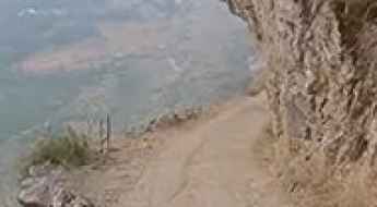
Xiagete Wall Road is one of the most heart-stopping cliffside tracks in Southern China. Located in Shuicheng County, within the rugged Guizhou Province, this narrow path skirts the border with Yunnan and offers a driving experience that is not for the faint of heart.
Gochak La, an epic enthralling road to the summit
Gochak La is a high mountain pass at an elevation of 4.755m (15,600ft) above sea level, located in Yadong County in the Tibet Autonomous Region of China.
Driving the Bingchacha Road is not a piece of cake
Bingchacha Road is said to be the most primitive road in China. It’s a new stretch of the G219 national road, running from Yunnan county to Tibet.
Hongshan Mountain, a truly outstanding SUV adventure
Hongshan Mountain is a high mountain pass at an elevation of 4.530m (14,862ft) above the sea level, located in Northwestern Yunnan Province, People's Republic of China.
Ela Shankou: enjoy a drive among the clouds
Ela Shankou is a high mountain pass at an elevation of 4.502m (14,770ft) above sea level, located in Xinghai County, in China.
A sensational drive to Xuebaoding Snow Mountain Pass
Xuebaoding Snow Mountain Pass is a high mountain pass at an elevation of 4.015m (13,172ft) above the sea level, located in Songpan county of northwestern Sichuan province, in China.
Regong La: Driving the Unpaved Road between Jomo Chu and Mang Chu
At an elevation of 5,016m (16,456ft) above sea level, Regong La is a high-altitude mountain pass located in Namling County, within the Shigatse prefecture of the Tibet Autonomous Region, China. This crossing serves as a remote link between the Jomo Chu and Mang Chu valleys, traversing a barren high-plateau environment.
Chipchap Pass: Driving the remote Wuersisan-Radome Road in Xinjiang
Chipchap Pass is an extreme high-altitude mountain pass at an elevation of 5,301m (17,391ft) above sea level, located in the Hotan Prefecture of the Xinjiang Autonomous Region, China. Situated in a sensitive border area, this pass is one of the highest navigable points in the region.
Gaoersi Pass, an adventure road you will never forget
Gao'ersi La is a high mountain pass at an elevation of 4.352m (14,278ft) above the sea level, located in the traditional Kham Region of the eastern Tibet, under the administation of Ganzi Tibetan Autonomous Prefecture, in China.
Xiangpi Pass is an epic climb in Tibet
Xiangpi Pass is a high mountain pass at an elevation of 3.824m (12,545ft) above the sea level, located In Gonghe County, in Qinghai Province, China under the administration of Hainan Prefecture.
How to handle the military driving at New Changlung La?
The New Changlung La is a brutal high-altitude track located in Xinjiang, near the border with India. Reaching 5,590 meters (18,339ft) is a serious challenge that pushes both the driver and the vehicle to their absolute limits. At this height, the air is so thin that your engine loses most of its power and your own reaction time slows down. This isn't a road for a standard car; you need a prepared 4x4 and a clear head to handle the lack of oxygen and the steep military terrain. It’s one of the highest roads of the country.
Take An Unforgettable Drive to Pang La
Pang La is a high mountain pass at an elevation of 4.736m (15,538ft) above the sea level, located in the Tibet Autonomous Region of China.
Driving the unpaved X260 road to the 5,292m Tratsang La
Tratsang La is an extreme high-altitude mountain pass at an elevation of 5,292 meters (17,362 ft) above sea level, located in Gyirong County, within the Tibet Autonomous Region of China. Traversed by the unpaved X260 road, this pass is a technical masterclass in mountain driving, linking the China National Highway 219 (G219) with the remote village of Dênggar. Climbing to nearly 5,300 meters on a dirt track is a high-load operation that tests the limits of any vehicle's cooling system and the driver's ability to manage 27 aggressive hairpin turns in an environment where oxygen is a scarce commodity.
Sala La: A high-altitude paved pass in Sêrxü County
Sala La is a high mountain pass at an elevation of 4,459m (14,629ft) above sea level located in Sêrxü County, within the Garzê Tibetan Autonomous Prefecture of northwest Sichuan, in China.
Kura La: Driving the 25% Gradients on the S209 in Tibet
At an elevation of 5,395m (17,700ft) above sea level, Kura La is a high mountain pass located on the boundary between Ngamring and Nyalam counties in the Xigazê prefecture of Tibet. This crossing on the S209 Provincial Road is one of the highest navigable points in the region, situated south of the Yarlung Tsangpo river.
Lunkar La is a winding road only for experienced drivers
Lunkar La is a high mountain pass at an elevation of 5.390 m (17,683ft) above the sea level, located in Zhongba County of Xigazê Prefecture in China's Tibet Autonomous Region.
Chun La: Driving the Bingchacha Line in Southeast Tibet
Reaching an elevation of 4,516m (14,816ft) above sea level, Chun La is a high mountain pass in Zayü County, within the Nyingchi Prefecture of Tibet. The pass is a critical and technical point on the Bingchacha Line (Chacha Highway), widely regarded as the most primitive and demanding overland route connecting Yunnan to southeastern Tibet.
Driving the wild Tingri-Penjixiang road
The Tingri-Penjixiang mountain road is a very challenging journey in the heart of Tingri County, in the Tibet Autonomous Region of China.
Driving the curvy unpaved road to the summit of Shera La
Shera La is a high mountain pass at an elevation of 5.563m (18,251ft) above sea level, located in the Shannan Prefecture of Tibet, in China. It’s one of the highest roads of the country.
Driving the savage road to Lungkar La
Lungkar La is a high mountain pass at an elevation of 5.645m (18,520ft) above the sea level, located in Zhongba County of Shigatse Prefecture in China's Tibet Autonomous Region. It’s one of the highest roads of the country.
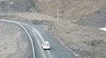
Driving the rugged Dorje Yuchong Pass in Sichuan
Dorje Yuchong Pass is a high-altitude mountain gap sitting at 4,367 meters above sea level on the boundary between Danba and Daofu counties in Sichuan, China. This crossing is the core section of the so-called Dandao Secret Realm, a remote route that takes you through the heart of the Garzê Tibetan Autonomous Prefecture. While the road is technically open to most vehicles, the reality on the ground is a brutal mix of potholes, loose gravel, and thin air that will push any standard engine and suspension to their absolute limits.
A rough 4x4 road to Yilanga La
Yilanga La is a high mountain pass at an elevation of 5.555m (18,225ft) above the sea level, located in Zanda County, in the Ngari Prefecture to the extreme west of the Tibet Autonomous Region of China. It’s one of the highest mountain roads of the country.
How to drive the S514 Road to Nye La in Tibet
Nye La is a high mountain pass at an elevation of 4,925m (16,158ft) above sea level, located in Dinggyê County, within the Xigazê prefecture of the Tibet Autonomous Region, in China.
Is the road to Xuemenkan Pass in Sichuan difficult to drive?
Reaching the Xuemenkan Pass is a journey into the vertical heart of the Garzê Tibetan Autonomous Prefecture. At 3,984m (13,070ft) above sea level, this pass in the Yajiageng Mountains of Southwest China is a true test of a driver's focus. The road, known as the S434, is a newly-built engineering marvel that slices through the mist between the massive Minya Konka and Lamoshe massifs. It’s a high-altitude ribbon of asphalt that never stays straight for more than a few seconds.
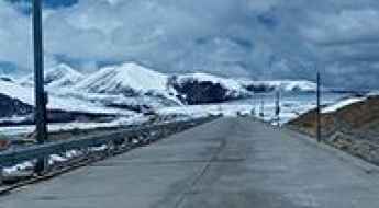
Yingkuoshan Pass: Driving the scenic G214 high-altitude route in Qinghai
Located in the Chindu County of Qinghai Province, the Yingkuoshan Pass (also known as Jarong La) is a high mountain pass reaching an elevation of 4,465m (14,648ft) above sea level. Situated on the vast Tibetan Plateau between the cities of Yushu and Xining, this pass is a legendary segment of the historic G214 National Highway.
Haizi Pass: enjoy a road among the clouds
Haizi La is a high mountain pass at an elevation of 4.689m (15,383ft) above the sea level, located in Batang County, in western Garzê Tibetan Autonomous Prefecture, Sichuan Province, People's Republic of China. The area has a lunar landscape.
The road to Birukangqing La is not for the faint of heart
Birukangqing La is a high mountain pass at an elevation of 5.288m (17,349ft) above the sea level, located in Biru County, within Nagqu of the Tibet Autonomous Region, in China.