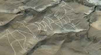
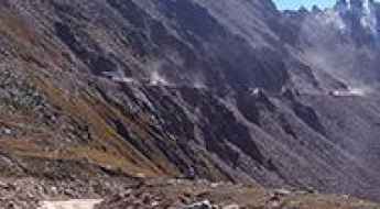
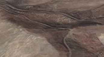
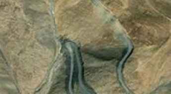
What are the most spectacular roads in China?
Located in the eastern part of Asia, and bordering 14 countries, China covers 9.6 million square kilometers. It’s the world's third-largest country by land area and it hosts more than 500 brutal driving experiences, listed as the most spectacular roads in the world. Due to its size and difficult geography, featuring mountains, plateaus, deserts, and plains, it has scenic, mountainous, and even flooding roads. It also holds many records, such as the world's longest traffic jam: a 100 km, 12-day standstill that occurred in August 2010, when the country witnessed the mother of all traffic jams.
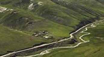
When travelling to China, you can’t miss the infamous Tian Men Shan Big Gate, a road with 99 turns, built in 1998, that offers a thrilling 11-kilometer journey; or the iconic Guoliang Tunnel, which was dug through the side of a mountain by hand. Built in the early 1970s it is one of the most famous Chinese tunnel roads. It’s also worth driving the Sichuan-Tibet Highway, one of the world's highest roads.
And if you like challenging mountain roads situated at high elevations, remember to check out our list with the highest roads in China, where you’ll find real gems, such as Chāmkang, a mountain pass at 5.953m (19,530ft) above sea level.
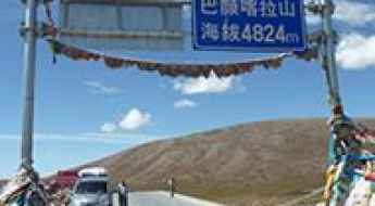
Gela Mountain
Gela Mountain is a high mountain pass at an elevation of 5.172m (16,968ft) above the sea level, located in the Tanggula Mountains, a mountain range in the central part of the Tibetan Plateau in the People's Republic of China.
An Unforgettable Drive to Jamgang La
Jamgang La is a high mountain pass at an elevation of 5.257m (17,247ft) above the sea level, located in Nyalam County, in Tibet's Shigatse Prefecture.
Kura La
Kura La is a high mountain pass at an elevation of 5.105m (16,748ft) above the sea level, located in the Himalayan mountain range, in Tibet, China.
Chenjiayuan Hanging Highway is a dangerous road cut from a cliff
Chenjiayuan Hanging Highway is the name of a challenging mountain road located in Lingchuan County in Shanxi Province, in China. It’s one of the famous Chinese tunnel roads.

Get behind the wheels for Yangi Daban, one of Earth’s highest roads
Yangi Daban is a high mountain peak at an elevation of 5.899m (19,353ft) above the sea level, located in the northwestern part of Hotan Prefecture of Xinjiang Autonomous Region, in China. It’s one of the world's highest motorable roads.
The rugged road to Dza La: a high mountain drive in Qinghai province
Dza La is a high mountain pass at an elevation of 4.690m (15,384ft) above the sea level, located in Yushu City County, Yushu Prefecture of Qinghai Province, in China
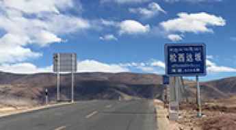
203 Provincial Road (S203)
Located in Ngari Prefecture, in the central part of Tibet, in China, the 203 Provincial Road (S203) is a very challenging and scenic trip in the middle of nowhere.
Dare to drive the dangerous Galong La
Galong Pass is a high mountain pass at an elevation of 4.296m (14,094ft) above the sea level, located in the Nyingchi Prefecture in the south-east of the Tibet Autonomous Region.
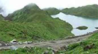
An awe-inspiring road to Quanshui Lake
Quanshui Lake is a high mountain lake at an elevation of 5.137m (16,853ft) above the sea level, located in Tibet, north-east of the Himalayas, in the People's Republic of China.
Lanak La: Driving the high-altitude border track in Aksai Chin
Lanak La is a high mountain pass at an elevation of 5,495m (18,028ft) above sea level, situated in the disputed Aksai Chin region. This pass sits on the territorial line between India (Ladakh) and China (Tibet), making it one of the most politically sensitive and geographically isolated mountain crossings in the world.
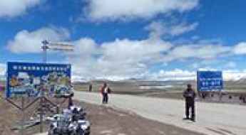
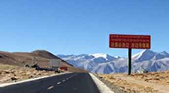
An Explorer's Guide to the Qinghai-Tibet Highway
Located in China, the Qinghai-Tibet Highway is one of the highest highways in the world, with an average elevation of above 4,000 meters.
Buduo La: this drive is not for timid drivers
Buduo La is a high mountain peak at an elevation of 5.825m (19,110ft) above the sea level, located in Zanda County, in the Ngari Prefecture to the extreme west of the Tibet Autonomous Region of China, near the Indian border. It’s one of the highest roads on Earth.
Is the road through Koshbel Duban in Xinjiang difficult to drive?
Crossing the Koshbel Duban is like driving through a desert made of ice and rock. At 4,279m (14,038ft) above sea level, this pass in southwestern Xinjiang is a critical point on the legendary China National Highway 219 (G219). Also known as the Tibet-Xinjiang Highway, this is one of the highest paved roads on the planet. It’s a place where the horizon never ends, the oxygen is scarce, and the wind blows so hard it feels like it’s trying to push your vehicle off the plateau.
How to drive to the summit of Lame La in Ngari Prefecture
Lame La is a high mountain pass at an elevation of 4,832m (15,853ft) above sea level, located in Ngari Prefecture of China.
Driving the wild paved road to Shan Da Ban
Shan Da Ban is a high mountain pass at an elevation of 5.257m (17,247ft) above the sea level, located in the Himalayan mountain range, in Tibet, China.
How to Travel the Duku Highway to Laerdun Daban?
Laerdun Daban is a high mountain pass at an elevation of 2,723m (8,933ft) above sea level, located in the northwestern part of China.
218 Country Road (S218): Conquering Buze La Pass at 5,418m
The 218 Country Road (County Road 218 or S218) is a famously rugged high mountain road located in the southern Tibet Autonomous Region of China, offering one of the most challenging drives in the Tibetan/Nepalese Himalayas. This unpaved, high-altitude journey traverses the remote Ra Chu Valley and demands maximum preparedness from all travelers.
An epic road to Cha Cang La
Cha Cang La is a high mountain pass at an elevation of 4.810m (15,780ft) above the sea level, located in the Himalayan mountain range, in Tibet, China.
Driving the defiant X716: A 223km high-altitude journey across Tibet
The X716 (716 County Road) is an epic high mountain road located in the Ngari Prefecture of China's Tibet Autonomous Region. It is one of the most remote and challenging unpaved routes in the country, designed only for those prepared to handle extreme altitudes and a total lack of modern facilities.
Driving to the summit of Bayanka La
Bayanka La is a high mountain pass at an elevation of 4.950m (16,236ft) above the sea level, located in Madoi county of Qinghai province, in China.
The road to Sha Zi La isn't an easy one
Sha Zi La is a high mountain pass at an elevation of 4.717m (15,475ft) above the sea level, located in the Himalayan mountain range, in Tibet, China.
A paved road to the summit of Kudi Pass
Kudi Daban is a high mountain pass at an elevation of 3.312m (10,866ft) above the sea level, locared in Kargilik County, in southwest of the Xinjiang Uyghur Autonomous Region of China.
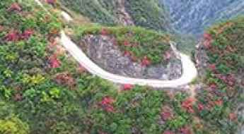
The journey is the destination along the Yunguichuan Cliff sky road
Tucked away in Wuxi County, in People's Republic of China, the defiant Yunguichuan Cliff sky road is a marvel of engineering dug out by hand.
Driving the unpaved X701 road to Lawoche La in Tibet
The X701 County Road is an extreme high-altitude unpaved route located in the Ngari Prefecture of the Tibet Autonomous Region, in China. Running for 425 kilometers (264 miles), the single-lane mountain track reaches its highest point at the Lawoche La pass, topping out at an elevation of 5,387 meters (17,673 ft) above sea level, making it one of the highest mountain roads of China.
How to drive the County Road 787 in the Tibetan Plateau?
County Road 787 is a high-altitude unpaved road located in the Ngari Prefecture of the Tibet Autonomous Region. Spanning 139 km (86 miles), this north-south track connects the X711 road with the China National Highway 219. Driving this route involves a sustained elevation of over 5,000 meters, reaching a maximum summit at 5,518 meters (18,103 ft), making it one of the highest roads of China.
Kheriya ancient road is a drive you'll never forget
Kheriya ancient road is the name of a 4x4 unforgettable adventure through the infamous Kunlun Mountains in Tibet, China.
A road trip to Sing La is truly epic
Sing La is a high mountain pass at an elevation of 4.914m (16,122ft) above sea level, located in the Himalayan mountain range, in Tibet, China.
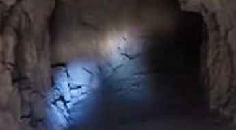
Driving the hand-carved Xiya Valley Hanging Tunnel
The Xiya Valley Hanging Tunnel, also known as Xiyagou Guabian Road, is a legendary feat of manual labor hidden deep within the Taihang Mountains of China's Shanxi Province. This is not a standard highway; it is a raw, hand-carved spiral through vertical cliffs that was hammered out over three decades. The road was the only lifeline for Xiyagou village, and today it remains one of the most technical and visually overwhelming drives in the world, where the layers of asphalt overlap inside the mountain like a concrete corkscrew.
How to drive the restricted military track to Bedel Pass?
Bedel Pass (Pereval Bedel) is an international high mountain pass at an elevation of 4,093 meters (13,428 ft) above sea level, situated in the Tian Shan Mountains on the frontier between Kyrgyzstan (Issyk-Kul Region) and China (Xinjiang). Located in a restricted military border zone, the pass is currently closed to civilian transit.
Jerko La
Jerko La is a high mountain pass at an elevation of 4.832m (15,853ft) above the sea level, located in Tibet, in the People's Republic of China. Great views of mountains all around. Many nomads and yaks.
How to drive the military track to Nilung La?
The Nilung La is an extreme high-altitude mountain pass in the Ngari Prefecture of the Tibet Autonomous Region. Reaching an elevation of 5,730m (18,799ft), it is one of the highest roads in the world. The road, also known as Zulung La or Zulang La, is a totally unpaved military track that connects Naiwuse with Nerbole. Driving at this altitude is a high-risk operation that requires a vehicle specifically prepared for extreme low-pressure environments and a driver experienced in high-altitude desert logistics.
Driving the extreme Tiankong Xian road to Hongpinshan and Tianhedong Daban
The Tiankong Xian is a high-altitude military and logistical road located in the southwestern part of the Hotan Prefecture, within the Xinjiang Autonomous Region of China. This 69.2 km (43 miles) corridor is officially one of the highest roads in the country, crossing several passes exceeding 5,400 meters above sea level.
Chola Shan Pass
Chola Shan Pass is a high mountain pass at an elevation of 4.920m (16,141ft) above the sea level, located in Ngawa Tibetan and Qiang Autonomous Prefecture, an autonomous prefecture of northwestern Sichuan, in China.
S201, a road through the mountains
S201 Provincial Road is a high mountain road located in Zayü County, in the southeast of the Tibet Autonomous Region, China.
Driving the 5,486m Samye La: A high-altitude challenge in Tibet
Samye La is a high mountain pass at a staggering elevation of 5,486 m (17,998 ft) above sea level, located in Zhongba County, within the Xigazê Prefecture of China's Tibet Autonomous Region. Standing near the 5,500m mark, it is one of the highest navigable points in the world.
Dajia Lake
Dajia Lake is a high mountain lake at an elevation of 5.247m (17,214ft) above the sea level, located in the Shigatse Prefecture of the Tibet Autonomous Region of China.
How to drive the military road to Tun Jun La?
Tun Jun La is an international high-altitude mountain pass at an elevation of 4,976m (16,325ft) above sea level, situated on the border between India and China. Located in the Kumaun Himalayas and the Ngari Prefecture of Tibet, the pass is served by an unpaved military road. This route is a critical tactical corridor and is strictly closed to foreigners. Logistically, the road is only suitable for specialized 4x4 vehicles due to the extreme altitude, steep gradients, and the total absence of civilian infrastructure along the 19.5 km transit.
The Ultimate Road Trip To Huoshaoyun
Huoshaoyun is a high mountain peak at an elevation of 5.765m (18,914ft) above the sea level, located in the Xinjiang autonomous region of China, in the northwest of the country. It’s one of the world's highest motorable roads.
Driving to Changlung Pangtung La: A 5.647m military mission in Xinjiang
Located in the remote Xinjiang autonomous region of Northwest China, the ascent to Changlung Pangtung La is a high-altitude operation that pushes motorized travel to its absolute limit. Reaching a staggering elevation of 5,647m (18,526ft) above sea level, this is one of the highest roads on the planet. It is a strictly functional military track where the vertical scale of the mountains and the geopolitical isolation of the Kunlun range create an environment where mechanical survival is the only priority.