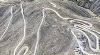
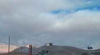
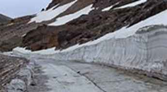
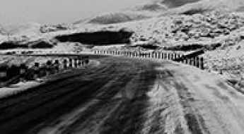
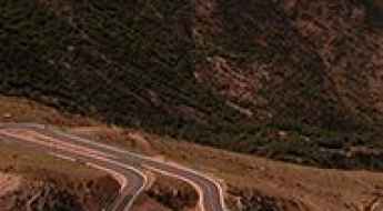
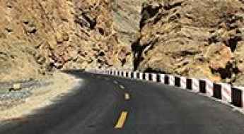
What are the most spectacular roads in China?
Located in the eastern part of Asia, and bordering 14 countries, China covers 9.6 million square kilometers. It’s the world's third-largest country by land area and it hosts more than 500 brutal driving experiences, listed as the most spectacular roads in the world. Due to its size and difficult geography, featuring mountains, plateaus, deserts, and plains, it has scenic, mountainous, and even flooding roads. It also holds many records, such as the world's longest traffic jam: a 100 km, 12-day standstill that occurred in August 2010, when the country witnessed the mother of all traffic jams.
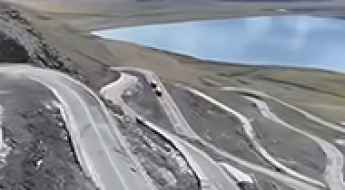
When travelling to China, you can’t miss the infamous Tian Men Shan Big Gate, a road with 99 turns, built in 1998, that offers a thrilling 11-kilometer journey; or the iconic Guoliang Tunnel, which was dug through the side of a mountain by hand. Built in the early 1970s it is one of the most famous Chinese tunnel roads. It’s also worth driving the Sichuan-Tibet Highway, one of the world's highest roads.
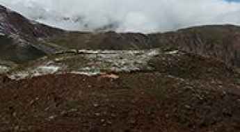
And if you like challenging mountain roads situated at high elevations, remember to check out our list with the highest roads in China, where you’ll find real gems, such as Chāmkang, a mountain pass at 5.953m (19,530ft) above sea level.
Road trip guide: Conquering the 562 Country Road
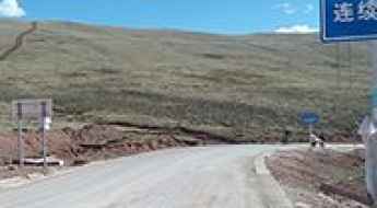
562 Country Road is a defiant high mountain road located in Zogong County, in the Chamdo Prefecture of Tibet Autonomous Region, China.
How to drive the unpaved road to Maryan Pass in the Kunlun Mountain Range?
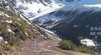
Maryan Pass is a high mountain pass at an elevation of 4,347m (14,261ft) above sea level located in the Taxkorgan Tajik Autonomous County of Kashgar Prefecture in western Xinjiang, in China.
Driving to Rib La: The remote mountain pass to China’s smallest township
Rib La is an epic high-mountain pass reaching an elevation of 4,760m (15,616ft) above sea level, located in Lhünzê County, within the southeastern Tibet Autonomous Region of China. This dangerous and narrow route is the vital link to one of the most isolated settlements in the world.
A curvy road to the summit of Chen-ne La
Chen-ne La is a high mountain pass at an elevation of 5,077 m (16,656 ft) above sea level, located in Shannan, in the Tibet Autonomous Region, China.
Jangkhu La: Driving one of the highest paved passes on the G317 Road
Jangkhu La is a high-altitude mountain pass at an elevation of 4,935m (16,190ft) above sea level, located in the Seni District of Nagqu, within the Tibet Autonomous Region of China. As part of the legendary G317 (Northern Sichuan-Tibet Highway), this pass is a critical link for those driving across the vast and remote Tibetan Plateau.
Norgo La: The Ultimate Road Trip Guide
Norgo La is a high mountain pass at an elevation of 5.256m (17,244ft) above the sea level, located in Coqên County in the southeast of Ngari Prefecture in the west of the Tibet Autonomous Region of China.
Road trip guide: Conquering the Mengkete Ancient Road
Mengkete Ancient Road is the name of a thousand-year old road located in the Xinjiang Province of China, on the boundary of Nilka County and Usu City district, in Ili Kazakh Autonomous Prefecture.
Gola La: Driving the unpaved 5,247m Y651 road in Tibet
Gola La is a high mountain pass at an elevation of 5,247 meters (17,214 ft) above sea level, located in Lhari County, within the Nagqu Prefecture of Tibet. The road through the pass is part of the Y651, a 54.4-kilometer unpaved track that follows the Yi’ong Zangbo valley. At over 5,200 meters, the lack of oxygen causes a massive loss in engine torque, and the low boiling point of water at this altitude puts extreme stress on the vehicle's cooling system.
Travel Guide to the top of Guza La
Guza La is a high mountain pass at an elevation of 5.084m (16,679ft) above the sea level, located in Bomê County in the south-east of the Tibet Autonomous Region, in China.
Things to Know Before Driving to Tari La
Tari La is a high mountain pass at an elevation of 5.521m (18,113ft) above sea level, located in the south-east of the Tibet Autonomous Region, in China. It’s one of the highest roads of the country.
Driving the remote Xila Daban: A 5.292m military track in Ngari
Located in the extreme west of the Tibet Autonomous Region, near the sensitive border with India, the road to Xila Daban is a high-altitude endurance test. Reaching an elevation of 5,292m (17,362ft) above sea level in Zanda County, this unpaved route is a strategic link that serves remote border patrol facilities like Qipu Jilie. It is a journey through the desolate beauty of the Ngari Prefecture, where the vertical scale and the absolute lack of infrastructure demand a vehicle prepared for the harshest conditions on the plateau.
An awe-inspiring drive to Lisuo Pass
Lisuo Pass is a high mountain pass at an elevation of 4.675m (15,337ft) above the sea level, located in Garzê Tibetan Autonomous Prefecture in Sichuan province of Southwest China. If you're afraid of heights, it's probably best to keep your eyes forward.
A remote unpaved road to Mata La
Mata La is a high mountain pass at an elevation of 5.348m (17,545ft) above the sea level, located on the boundary between Comai and Cona counties, in the south of the Tibet Autonomous Region, People's Republic of China.
Ljou La: Ascending China's Majestic Mountain Pass in Tibet
Ljou La is a high mountain pass at an elevation of 4.759m (15,613ft) above the sea level, located on the boundary of Baxoi and Riwoqê Counties,Chamdo Prefecture, in the Tibet Autonomous Region of China.
The Ultimate Guide to Traveling to Chak La
Chak La is a high mountain pass at an elevation of 4.514m (14,809ft) above the sea level, located in Nagqu, a prefecture-level city in the north of the Chinese autonomous region of Tibet.
How dangerous is the G317 road over Lazhi La in Tibet?
Lazhi La is a brutal high-mountain pass sitting at 4,501m (14,767ft) above sea level in the Chamdo Prefecture of eastern Tibet. This isn't some quiet backroad; it’s a key sector of the G317 (China National Highway 317), the main artery connecting Karuo District and Jomda County. Driving here means sharing a narrow, winding strip of asphalt with massive freight trucks that dominate the road, all while your engine gasps for oxygen on a relentless 178-kilometer haul through one of the most remote corners of the plateau.
Chongnye La, a chillout in high mountains
Chongnye La is a high mountain pass at an elevation of 4.478m (14,691ft) above the sea level, located in the east of the Tibet Autonomous Region, in China.
Driving the unpaved road to Beru La Pass in Tibet
Beru La is a high-altitude mountain pass at an elevation of 4,780 meters (15,682 ft) above sea level, located in Sog County within the Nagqu Prefecture of the Tibet Autonomous Region, China. Branching off from the National Highway 317 (G317), the road to the summit is a raw, unpaved track that serves as a technical link toward the village of Kezadacun. Driving here involves navigating a high-load environment where the notorious lack of oxygen at nearly 4,800 meters tests the mechanical limits of your vehicle's aspiration and cooling systems.
Tiejiangshan Pass: Driving the brutal 20% ramps in Sichuan
Tiejiangshan Pass, also known as Blacksmith Mountain Pass, is a high-altitude crossing at an elevation of 4,796 meters (15,734 ft) above sea level, located in Litang County, Sichuan. The road to the summit is a fully paved but technical 29.8-kilometer climb that branches off the China National Highway 318 (G318). The physical reality of driving this pass involves managing several ramps that hit a maximum gradient of 20%, where the combination of extreme steepness and thin air at nearly 4,800 meters tests the engine's torque and the braking system's thermal limits.
Driving the extreme road to Gyandro La: A 5,147m mountain pass with 62 hairpin turns
Gyandro La is a high mountain pass reaching an elevation of 5,147m (16,886ft) above sea level, located on the boundary between Lhünzê and Cona counties in the Shannan Prefecture of Tibet. This remote Himalayan pass offers one of the most technical unpaved driving experiences in the southern part of the region.
How to drive the mountain road to Zongba La?
Zongba La is a high mountain pass at an elevation of 4.161m (13,651ft) above sea level, located in Markham County, in the Tibet Autonomous Region of China.
Driving the unpaved and muddy road to Zholpel La
Zholpel La is a brutal high-mountain pass sitting at 4,615 meters above sea level in the Qamdo district of eastern Tibet. Part of the legendary China National Highway 317, also known as the Northern Sichuan-Tibet Highway, this pass is a chaotic mix of mud, loose gravel, and thin air. While a modern tunnel now bypasses the most treacherous sections, the original surface route over the Tannyaintangoin Mountains remains a technical nightmare for anyone driving a heavy vehicle or a standard 4x4 through the high-altitude slush.
How to drive the 12 hairpin turns of Yepuchen La in Tibet?
Yepuchen La (also known as Yipuqin La) is a high-altitude mountain pass at an elevation of 5,113m (16,774ft) above sea level, located in the eastern Nyenchen Tanglha mountains of Tibet, China. Technically, the pass marks the logistical boundary between Biru County (Nagqu) and Banbar County (Chamdo). Navigating this 33 km unpaved route requires a high-clearance 4x4 vehicle to manage the extreme gradients and the technical series of hairpins near the summit.
Wugeshan Pass: The unnumbered 4x4 mud track in the Qilian Mountains
Wugeshan Pass is a high-altitude mountain crossing at an elevation of 4,351 meters (14,274 ft) above sea level, located on the boundary of Tianjun and Qilian counties in the Qinghai Province of China. Positioned within the rugged Qilian Mountains, the pass is crossed by a primitive, unnumbered mountain track.
Driving the G227 through Eboling Pass: The 22% wall of the Qilian Mountains
Located on the high-altitude boundary between the Qinghai and Gansu provinces, the Eboling Pass (also known as Biandukou or Oboling) is one of the most mechanically demanding sectors of the G227 Ningzhang Highway. Reaching an elevation of 3,700m (12,139ft) above sea level in the Qilian Mountains, this paved route is a vital interprovincial link that transforms into a technical trap when the temperature drops. It is a journey where the vertical scale of the ramps and the unpredictable grip of the asphalt demand absolute focus from every operator.
Is the unpaved road to Dingo La in Tibet dangerous?
Dingo La is an extreme high-mountain pass reaching a staggering elevation of 5,047m (16,558ft) above sea level in Rutog County, within the Ngari Prefecture of Tibet. This remote crossing is tucked away in the far western corner of the Tibetan plateau, a place where the landscape is as beautiful as it is lethal for an unprepared vehicle. Reaching the summit means driving through a high-altitude desert where the track is barely visible and the mechanical strain of operating at over 5,000 meters becomes a constant threat to your journey.
How to drive the curvy road to Ganden Monastery in Lhasa?
Ganden Monastery is a high mountain monastery at an elevation of 4.327m (14,196ft) above sea level, located in Dagzê District, Lhasa, in China.
Pendang La: enjoy a road among the clouds
Pendang La is a high mountain pass, at an elevation of 4.848m (15,905ft) above sea level, located in Xigazê Prefecture in China's Tibet Autonomous Region.
Mt. Rawobanba: Driving the steep paved canyon road in Gyirong
Located in the heart of Gyirong County, within the Shigatse Prefecture of the Tibet Autonomous Region, Mt. Rawobanba is a high mountain pass reaching an elevation of 4,107m (13,474ft) above sea level. This pass is a critical link in the dramatic transition between the high Tibetan plateau and the lush, deep valleys that lead toward the border with Nepal.
The road to Kharpo La is not for the sissies
Kharpo La is a high mountain pass at an elevation of 5.002m (16,410ft) above the sea level, located in Lhünzê County in the southeastern Tibet Autonomous Region, China.
Take the Iconic G318 and Discover Gya La Pass
Gya La is a high mountain pass at an elevation of 3.968m (13,018ft) above the sea level, located in the Samzhubzê District of the prefecture-level city of Shigatse, in the Tibet Autonomous Region of the China.
Is the Pongkor La pass the ultimate challenge on Tibet’s X202 road?
Pongkor La is an epic high-mountain pass reaching an elevation of 4,962m (16,279ft) above sea level, located in Gyantse County, within the Xigazê prefecture of the Tibet Autonomous Region in China. Traversing this pass via the X202 road is a journey through one of the most remote and oxygen-deprived landscapes on the planet.

Driving the unpaved road to Lungdri La on the Tibet-Sichuan border
Lungdri La is a high mountain pass at an elevation of 4,689m (15,383ft) above sea level, located in China.
Driving the Inhumane Paved Road to Gu La with 31% Ramps in Tibet
Gu La is a high mountain pass at an elevation of 5,075m (16,650ft) above sea level, located in Cona County, in People's Republic of China.
A Most Tricky Scenic Drive to Gang La
Gang La is a high mountain pass at an elevation of 4.538m (14,888ft) above the sea level, located in Ngamring County, a county of Xigazê in the Tibet Autonomous Region.
Jingyangling Pass is worth the white-knuckle drive
Jingyangling Pass is a high mountain pass at an elevation of 3.770m (12,368ft) above the sea level, located on the boundary between Qilian and Menyuan Hui counties of Qinghai Province, in the Haibei Tibetan Autonomous Prefecture of China.
Tsogugye La: courage is required to drive to the summit
Tsogugye La is a high mountain pass at an elevation of 4.999m (16,400ft) above the sea level, located on the boundary between Qusum and Gyaca counties, under the administration of the prefecture-level city of Shannan in the south-east of the Tibet Autonomous Region, China.
Rong La: The dizzying 22-hairpin ascent in Eastern Tibet
Located in the heart of Dêngqên County, in the eastern reaches of the Tibet Autonomous Region, Rong La is a formidable mountain pass at an elevation of 4,831m (15,849ft) above sea level. This pass is a classic example of high-altitude Himalayan engineering, where the road has to fight for every meter of elevation against a nearly vertical mountainside.
Driving to the Sengri Mountain Observatory: A High-Altitude 4x4 Climb in Tibet
Located in the Bayi District of Nyingchi, within the Tibet Autonomous Region of China, Sengri Mountain offers a challenging high-altitude drive to one of the most remote astronomical observatories in the world. Reaching an elevation of 4,632m (15,196ft) above sea level, this peak provides a brutal test for both drivers and vehicles amidst the thinning air of the Himalayas.