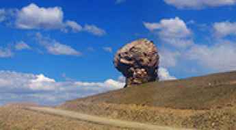
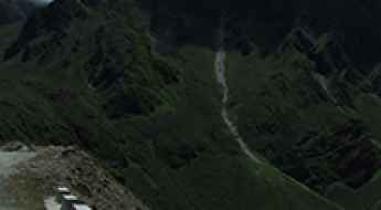
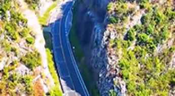
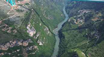
What are the most spectacular roads in China?
Located in the eastern part of Asia, and bordering 14 countries, China covers 9.6 million square kilometers. It’s the world's third-largest country by land area and it hosts more than 500 brutal driving experiences, listed as the most spectacular roads in the world. Due to its size and difficult geography, featuring mountains, plateaus, deserts, and plains, it has scenic, mountainous, and even flooding roads. It also holds many records, such as the world's longest traffic jam: a 100 km, 12-day standstill that occurred in August 2010, when the country witnessed the mother of all traffic jams.
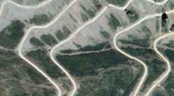
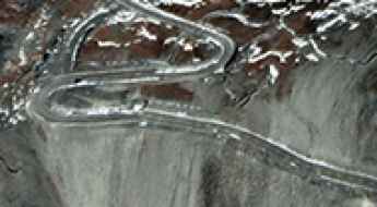
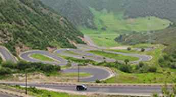
When travelling to China, you can’t miss the infamous Tian Men Shan Big Gate, a road with 99 turns, built in 1998, that offers a thrilling 11-kilometer journey; or the iconic Guoliang Tunnel, which was dug through the side of a mountain by hand. Built in the early 1970s it is one of the most famous Chinese tunnel roads. It’s also worth driving the Sichuan-Tibet Highway, one of the world's highest roads.
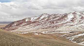
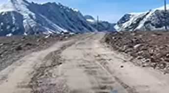
And if you like challenging mountain roads situated at high elevations, remember to check out our list with the highest roads in China, where you’ll find real gems, such as Chāmkang, a mountain pass at 5.953m (19,530ft) above sea level.
Driving the unpaved 205 Provincial Road to Zaka La
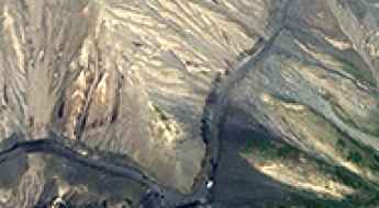
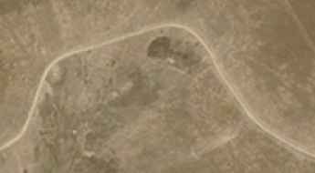
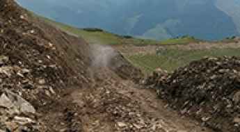
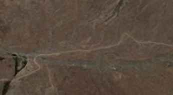
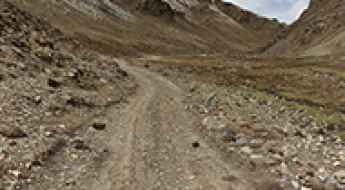
Zaka La is a high-altitude mountain pass at an elevation of 4,920 meters (16,141 ft) above sea level, located in Nyima County within the Nagqu prefecture of the Tibet Autonomous Region, China. Traversed by the rugged 205 Provincial Road, this pass is a test of mechanical endurance. Running along the desolate shores of lake Dangqiong Cuo (Tangshung Tso), the road is an unpaved track where the reality of driving at nearly 5,000 meters means managing extreme engine power loss and a surface that shifts between hard-packed dirt and deep, loose gravel.
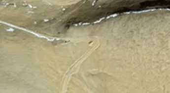
How to drive the turns of the road to Zhong Daban?
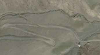
Zhong Daban is a high mountain pass at an elevation of 3.779m (12,398ft) above sea level, located in Qinghai, China.
Driving to Chake La: A 5.338m high-altitude mission in Changtang
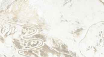
Located on the boundary of Nyima and Shuanghu counties, the ascent to Chake La (also known as Qagê La) is a high-altitude operation through the heart of the Changtang National Nature Reserve. Reaching an elevation of 5,338m (17,513ft) above sea level, this unpaved track is one of the most isolated motorized routes in southwest China. It is a journey defined by the brutal scale of the Tibetan plateau, where the verticality of the peaks and the absolute absence of civilian infrastructure demand total mechanical respect.
Driving the S101 through Sangchi Mountain Pass: A 4.061m mission in Qinghai
Located in the heart of Jigzhi County, within the Golog Prefecture of Qinghai Province, the transit through Sangchi Mountain Pass (Sangchi Shan Yakou) is a high-altitude endurance test. Reaching an elevation of 4,061m (13,323ft) above sea level, the road—known as the S101 (formerly G345)—crosses one of the most rugged sectors of the Tibetan Plateau. It is a journey where the vertical scale and the absolute isolation of Central China demand total mechanical respect and a vehicle prepared for sustained thin-air operations.
Gydzhen Pass: The Ultimate Road Trip Guide
Gydzhen Pass is a high mountain pass at an elevation of 3,988m (13,083ft) above sea level, located in the Xinjiang Uygur Autonomous Region of China. It offers a remote route through the Kizilsu Kyrgyz Autonomous Prefecture, near the border with Tajikistan.
Ilfsu Pass: Driving the 25 hairpins of the Gaijiake Daban
Ilfsu Pass, known locally as Gaijiake Daban, is a high mountain pass at an elevation of 4,858 meters (15,938 ft) above sea level, located in Taxkorgan Tajik Autonomous County, within the Kashgar Prefecture of the Xinjiang Autonomous Region, China. Positioned in the westernmost fringes of the Karakoram range, the pass runs close to the borders with Pakistan and Tajikistan.
The road to Kaindi in the Pamir Mountains will take your breath away
Kaindı is an international high mountain peak with an elevation of 4,915m (16,125ft) above sea level, situated on the border between China and Tajikistan.
How to drive the high-altitude road to Zongguo Monastery?
Zongguo Monastery is a stunning Buddhist temple perched on a cliff at 4,196m (13,766ft) above sea level. Located in Nangqên County, in China's Qinghai Province, the road to reach it is a brutal 28.6 km dirt track that follows the Jiqu River before climbing straight up the mountain walls.
How to Survive and Journey through the Dangerous Tso-Le Road
Tso-Le Road is a very scenic drive located in the southern part of Tibet, within Cona County of the Shannan Prefecture, in China.
Driving the remote road to Tayeparva La
Tayeparva La is a high mountain pass at an extreme elevation of 5,497m (18,034ft) above sea level. It is located in Zhongba County, within the Shigatse Prefecture of China's Tibet Autonomous Region. The pass sits in a very isolated area of western Central Tibet, positioned between two major high-altitude lakes: Renqing Xiubucuo and Ang Larencuo.
Chure Chu Valley Road: Driving Through Southeastern Tibet
The Chure Chu Valley Road is a mountain route located in the Shannan Prefecture of the southeastern Tibet Autonomous Region. Following the Chure Chu-Xia Chu river valley, this section connects Lhozhag and Comai counties.
Lugu La: Driving the High-Altitude Track East of Yamzho Yumco
Reaching an elevation of 5,065m (16,617ft) above sea level, Lugu La is a high mountain pass situated on the boundary of Qonggyai and Zhanang counties in the Shannan prefecture of Tibet, China. Located to the east of the Yamzho Yumco lake, the pass serves as a remote crossing through the high-altitude ridges of the Transhimalaya.
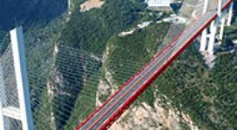
Duge Bridge: Crossing the Iconic 565m Gorge in Guizhou
The Duge Bridge (locally known as Beipanjiang Bridge Duge) is a masterpiece of modern engineering on the border between the Yunnan and Guizhou provinces in China. Rising 565 meters (1,854 ft) above the river, it was recognized by Guinness World Records as the World's Highest Bridge from its completion in 2016 until 2025. It’s one of the most spectacular bridges in the world.
Karu La: this road is not for timid drivers
Karu La is a high mountain pass at an elevation of 5.063m (16,610ft) above the sea level, located in Comai County, a county of Shannan, in the Tibet Autonomous Region of China.
Driving the countless turns to Jimu Gong La in Tibet
Jimu Gong La is a high mountain pass at an elevation of 5,483m (17,988ft) above sea level, located in the Shannan Prefecture of Tibet, in China.
Driving the Unpaved Road to Dri La Heading Deep into the High Mountains
Dri La is a high mountain pass at an elevation of 4,734m (15,531ft) above sea level, located in Karub District of Qamdo, in China.
How to drive the remote road to Karkang La in Tibet
Karkang La is a high mountain pass at an elevation of 4,785m (15,698ft) above sea level, located in the southeastern part of the Tibet Autonomous Region, in China.
Driving the unpaved 4x4 road to Lagen La
Lagen La is a high mountain pass at an elevation of 5.259m (17,253ft) above sea level, located in the Tibet Autonomous Region of the People's Republic of China.
Anwu La Pass: Crossing the high-altitude G317 in Northern Tibet
Anwu La, also known as Angu La or Angwu La, is a high mountain pass at an elevation of 4,602 meters (15,098 ft) above sea level, located in the Nagqu prefecture of the Tibet Autonomous Region. Situated on the China National Highway 317 (G317), the pass is a critical logistical link between Baqen and Zaqu. While the road is totally paved, the physical reality of driving at 4,600 meters involves managing extreme oxygen deprivation for the internal combustion engine and navigating high-altitude plateaus where road conditions can shift from clean asphalt to treacherous ice in minutes.
How to drive the high-altitude road from Tinizi to Bianlongduo?
The road from Tinizi to Bianlongduo is a high-altitude technical track located in Xaitongmoin County, within the Xigazê prefecture of the Tibet Autonomous Region, China. Spanning 20.4 km (12.67 miles), this north-south corridor is a critical logistical challenge, as it requires crossing two extreme mountain passes: Sera La at 5,305m and Chesang La at 5,362m.
Driving the 30 hairpin shelf road to Dawagenzha Peak in Sichuan
Dawagenzha Peak is a high-altitude summit reaching 3,862m (12,670ft) above sea level in Baoxing County, Sichuan Province. For those behind the wheel, the attraction isn't just the 360-degree view of the Qionglai Mountains, but the terrifying "shelf road" that clings to the cliffs with more than 30 hairpins and no room for error.
Driving the grueling road to Dagchu La
Dagchu La is a high mountain pass at an elevation of 4.894m (16,056ft) above the sea level, located in Rutog County, Ngari Prefecture of Tibet, in China.
An epic enthralling road to Soge La in Tibet
Soge La is a high mountain pass at an elevation of 4.732m (15,524ft) above sea level, located in Drongpa County of Shigatse Prefecture in China's Tibet Autonomous Region.
Yaksang La: A Comprehensive Travel Guide
Yaksang La is a high mountain pass at an elevation of 4.894m (16,056ft) above the sea level, located on the boundary of Comai and Qonggyai counties of Shannan in the Tibet Autonomous Region of China.
How is the unpaved road to Tagu La pass in Tibet?
Tagu La is an extreme high-altitude mountain pass rising to 4,978m (16,332ft) above sea level in Drongpa County, part of the Shigatse Prefecture in the Tibet Autonomous Region. Located in the remote western part of Central Tibet, the journey over this pass is a brutal test of mechanical endurance. At nearly 5,000 meters, the environment is stripped of all modern infrastructure, leaving drivers to face the raw elements of the Tibetan plateau on a track where the air is thin and the ground is unpredictable.
Ganja La in Tibet is an absolute must for road lovers
Gänja La is a high mountain pass at an elevation of 4.775m (15,666ft) above sea level, located in Drongpa County of Shigatse Prefecture in China's Tibet Autonomous Region.
Here's What You Need to Know about Driving the Road to Chaguola post
Chaguola is a military outpost at an elevation of 5.261m (17,260ft) above the sea level, located in Yadong County of the Tibet region of China, part of its Shigatse Prefecture.
Taking on the Twists and Turns of Shakaleb La
Shakaleb La is a high mountain pass at an elevation of 5.143m (16,873ft) above sea level, located in the Comai County of Shannan, in the Tibet Autonomous Region of China.
How To Travel The Wild Road to Tsekne La in Tibet
Tsekne La (also known as Cegne La) is a high mountain pass at an elevation of 5,057m (16,591ft) above sea level. It is located on the administrative border between Baqên County (Tibet Autonomous Region) and Zadoi County (Qinghai Province) in China.
Driving the Guanxing Highway: China's engineering marvel in the sky
The Guanxing Highway (also known as the Guanxing Expressway) is a spectacular and technical toll road located in the Guizhou Province of China. Known as the "Highway in the Sky," this 160-kilometer route is celebrated for its engineering daring, winding through the complex and vertical karst mountain terrain of southwestern China.
Huajiang Canyon Bridge: How It Feels to Cross the World's Highest Suspension Bridge
The Huajiang Canyon Bridge is a suspension bridge located in Guizhou province, China. It crosses the Beipan River within the deep Huajiang Canyon and serves as a vital section of the Guizhou S57 (Liuzhi-Anlong Expressway).
It currently holds the world record for the highest bridge, measured by the vertical distance from the bridge deck to the water surface. The bridge was constructed to significantly improve regional transportation and stimulate economic development and tourism as part of the Chinese government’s infrastructure campaign. It’s one of the most spectacular bridges in the world.
How to drive the high road to Kyakyen La in Tibet?
Kyakyen La is a high mountain pass at an elevation of 4,837m (15,869ft) above sea level, located in Cona County, Shannan Prefecture, Tibet Autonomous Region, China. The route runs through the southern mountain range of the Tibetan plateau, passing near the Geching Tso lake basin.
What are the driving hazards of the road to Zong Co Lake in Tibet?
Zong Co (also known as Dzongka Tso or Tingye Gungtso) is a high mountain glacial lake at an elevation of 4,976m (16,325ft) above sea level. Located in Dinggyê County, within the Xigazê prefecture of the Tibet Autonomous Region, the access route is one of the most mechanically demanding unpaved tracks in the southwestern Himalayas. Operating a vehicle at this altitude requires a strict technical protocol to manage both engine efficiency and tire integrity on sharp glacial debris.
Driving the paved curvy road to Beishan Daban
Beishan Daban is a high mountain pass at an elevation of 3,485m (11,433ft) above sea level, located in Huzhu Tu Autonomous County, or in short Huzhu County, an autonomous county under the jurisdiction of the prefecture-level city of Haidong, in China.

How difficult is the high-altitude paved road to Me La in Tibet?
Me La is an extreme high-mountain pass reaching a staggering elevation of 5,179m (16,991ft) above sea level in Lhozhag County, within the Shannan Prefecture of Tibet. Located south of Lake Pu Moyongcuo and near the brutal Jizha La Pass, this is one of the highest paved roads in the world. But don't let the asphalt fool you: at over 5,000 meters, the lack of oxygen turns a simple drive into a mechanical survival test where every hairpin bend feels like a struggle for both the driver and the engine.
Driving the wild 4x4 road to Tsurphu La in Tibet
Tsurphu La is a high mountain pass at an elevation of 5,302 m (17,395 ft) above sea level, located in Lhasa City in the Tibet Autonomous Region, China.
Driving in China: Do Foreigners Need a Chinese License?
Planning a road trip on China's spectacular highways requires crucial preparation regarding local laws. China's traffic regulations are specific: foreign driving permits and licenses are not valid for use in the mainland.
Lachin La: The brutally steep 10% climb in Eastern Tibet
Located in the Dêngqên County of Chamdo City, in the eastern part of the Tibet Autonomous Region, Lachin La is a high mountain pass reaching an elevation of 4,826m (15,833ft) above sea level. Situated south of the Dak Chu Valley, near the town of Dêngqên (Tengchen), this pass is one of the most demanding climbs in the region due to its extreme verticality.
The Winding Road to Pen La in Cona County is Only for Experienced Drivers
Pen La is a high mountain pass at an elevation of 5,273m (17,299ft) above sea level, located in Cona County, in China.