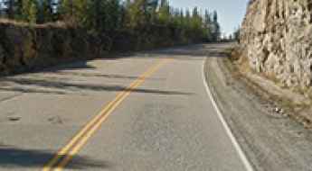
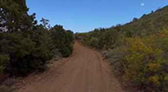
What are the most spectacular roads in the USA?
Located in North America, the USA is a true paradise for drivers, as it hosts more than 2,000 roads listed as the most spectacular in the world.
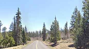
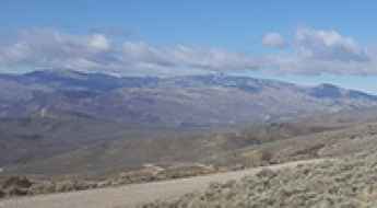
Featuring mountains, deserts, coasts, and snow, in the USA you’ll get your dream road. And you’ll never want to wake up. For instance, at the top of your list, you need to drive the Million Dollar Highway, the most beautiful road in America, and probably in the world. Built in the late 1880s, you'll be on the "outside" for a while with a hell of a view to your right (let the passenger enjoy the view; you'll want to watch the road). Another paved option must be the Iron Mountain Road, featuring 17 miles, 314 curves, 14 switchbacks, 3 pigtails, and 3 tunnels in the Black Hills of South Dakota. No list would be complete without the winding Tail of the Dragon: 318 curves in 11 miles. Spanning Tennessee and North Carolina, it is one of the most scenic drives in the USA. You also can’t skip driving Mount Evans Scenic Byway, the highest paved road in North America, climbing up to 4,310m (14,130ft) in Colorado. It is said to be the highest paved road in North America.
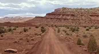
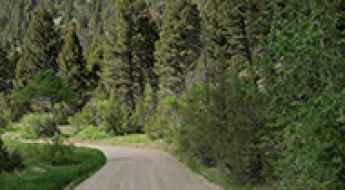
For those who prefer unpaved experiences, the country hosts some of the most defiant yet scenic roads in the world. You can’t miss Black Bear Pass, a high mountain adventure in the Colorado Rockies. Climbing up to 3,915m (12,844ft) above sea level, it's one of the highest roads in Colorado. You can also discover the beauty of Engineer Pass, a mountain pass at an elevation of 3,901m (12,800ft) above sea level in Colorado. It’s mostly a first-gear ride because the road is rough and rocky. The legendary Shafer Trail Road in Utah's Canyonlands National Park is an iconic drive located on the east-central edge of Utah. At times, the road is so narrow that only one car can pass. And Lippincott Mine Road in California is for experienced 4WD drivers using high-clearance vehicles only. You'll need a good map, as the routes are not marked and there are no signs. It’s one of the challenging backcountry roads in Death Valley National Park.
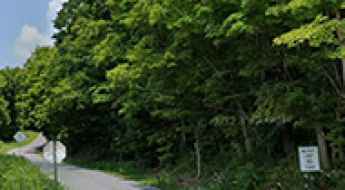
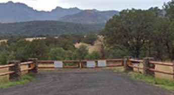
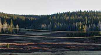
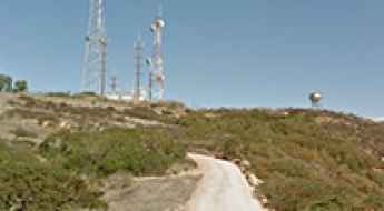
Gravity Hill in New Paris: The Road That Defies Gravity
Gravity Hill in Bedford County, in the US state of Pennsylvania, is one of the most famous optical illusions in the United States. Located just south of New Paris, this quiet country lane makes cars, water, and even balls appear to roll uphill against gravity. What seems like a supernatural force is, in reality, a fascinating trick of perspective that draws curious travelers from across the country.

Legal and Technical Framework for Motorcycle Accident Claims
Motorcycle accidents present unique challenges in liability assessment due to the vulnerability of the rider and the specific dynamics of two-wheeled vehicle collisions. Managing a claim requires a technical understanding of traffic laws, accident reconstruction, and long-term medical prognosis.
The 10 Deadliest Roads in Texas: Traffic Risks and Data
Texas consistently records some of the highest traffic fatality numbers in the country. Certain roads stand out as especially hazardous due to high speeds, heavy truck traffic, and complex designs. With more than 554,000 crashes reported in Texas in 2024, the scale of the problem is clear. Drivers should be aware of these high-risk areas to maintain safety while driving across the state.

Driving Safely in the Big Rig: A Guide to Trucking Safety
Trucking is a demanding job that keeps the economy moving. Because of the extreme size and weight of commercial trucks, safety is the most important part of the job. A small error can lead to a serious accident on the road. Following professional driving practices is the only way to protect yourself and other motorists. This guide covers the essential steps every truck driver should take to ensure a safe journey.
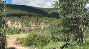
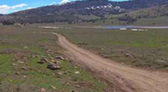
A Memorable Road Trip to Mount Tom in Jefferson County
Mount Tom is a high mountain peak at an elevation of 2,889m (9,478ft) above sea level, located in Jefferson County, in the US state of Colorado.

Toyota Tacoma Technical Specifications: Towing, Payload, and Off-Road Performance
The Toyota Tacoma is a mid-size pickup truck engineered for durability and versatile performance. Known for its high residual value and off-road heritage, the Tacoma is a primary choice for both commercial tasks and recreational use.
Why the Volcanic Legacy Scenic Byway Might Be America’s Best Hidden Drive
The Volcanic Legacy Scenic Byway is a designated All-American Road in the U.S. states of California and Oregon. Spanning approximately 500 miles (800 km), it follows the Cascade Range and passes numerous volcanic sites, including Crater Lake National Park, Mount Shasta, and Lassen Volcanic National Park. The route is recognized for its geological significance and connects a range of natural and cultural landmarks.
Driving the mining road to Silver Lake near Silverton
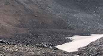
Silver Lake is a high mountain lake located in San Juan County, in the US state of Colorado. A gravel road, to the north of the lake, ends at 3,403 m (11,164 ft) above sea level.
How to get to the top of Chase Mountain in Oregon
Chase Mountain is a high mountain peak at an elevation of 1,936m (6,351ft) above sea level, located in Klamath County, in the U.S. state of Oregon.
How to get by car to the summit of Hamaker Mountain in Oregon
Hamaker Mountain is a high mountain peak at an elevation of 2,012m (6,601ft) above sea level, located in Klamath County, in the U.S. state of Oregon.
How to get by car to Whitetail Mountain in Texas?
Whitetail Mountain is a high mountain pass at an elevation of 2.216m (7,270ft) above sea level, located in central Jeff Davis County, in the U.S. state of Texas. It's one of the highest roads in Texas.
An epic 4x4 road to Lockes Gap in Texas
Lockes Gap is a high mountain pass at an elevation of 2.035m (6,676ft) above sea level, located in central Jeff Davis County, in the U.S. state of Texas. It's one of the highest roads in Texas.
Driving the breathtaking 4x4 road to Lo 7 Hill in Colorado is not easy
Lo 7 Hill is a high mountain peak at an elevation of 2,603 m (8,540 ft) above sea level, located in Rio Blanco County, in the U.S. state of Colorado.
How to drive to Blue Lake in south Montana?
Blue Lake is a high mountain lake at an elevation of 2,901m (9,517ft) above sea level, located in Sweet Grass County, in the U.S. state of Montana.
A Wild Mining Road to MacKay Peak in Idaho
MacKay Peak is a high mountain peak located in Custer County, in the U.S. state of Idaho. A mining road that leads high up its slopes, south of the peak, tops out at 2,913m (9,557ft) above sea level. It’s one of the highest roads in Idaho.
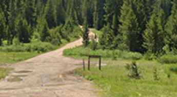
Driving the NF-388 to Cougar Peak in Oregon
Cougar Peak is a high mountain peak at an elevation of 2,415 m (7,923 ft) above sea level, located in Lake County, in the U.S. state of Oregon. Situated within the rugged Fremont-Winema National Forest, it is one of the prominent summits in the southern part of the state.
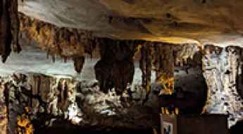
Fantastic Caverns is Missouri’s Only Drive-Through Cave
Located in Greene County, in the US state of Missouri, Fantastic Caverns offers a unique tram-based tour that takes visitors through the heart of a natural cave system. It’s a must-see for anyone exploring scenic drives or road adventures in southwestern Missouri. It’s one of the few roads in the world that runs through a cave.

How to drive the scenic British Columbia Highway 93?
Highway 93 is a north-south route that runs through the southeastern part of British Columbia, connecting with U.S. Highway 93 at the Canada-U.S. border. It follows the Crowsnest Highway (Highway 3) and Highway 95, passing through Radium Hot Springs, and crosses the Continental Divide into Alberta at Vermilion Pass, where it continues as Alberta Highway 93.
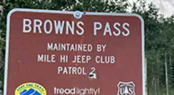
A Memorable Road Trip to Browns Pass in Park County
Browns Pass is a high mountain pass at an elevation of 3,475m (11,400ft) above sea level, located in Park County, in the U.S. state of Colorado.
Driving the high mountain MT-569 Road in Anaconda
MT-569 is a high mountain road located in Deer Lodge County, in the U.S. state of Montana.
Sheep Ridge: Driving the rugged Forest Service Road in Colorado’s Pike National Forest
Sheep Ridge is a mountain peak situated in Park County, Colorado, reaching an elevation of 3,418m (11,213ft) above sea level. For off-road enthusiasts, the real draw is the rugged forest service road that climbs the southern ridge, offering a short but technical high-altitude driving experience in the heart of the Pike National Forest.
A Steep 4x4 Road to McMillan Peak in Colorado
McMillan Peak is a high mountain located in San Juan County, in the U.S. state of Colorado. A gravel road east of the summit climbs up to an elevation of 3,587 m (11,768 ft) above sea level.
How to get by car to Walton Peak in Colorado?
Walton Peak is a high mountain peak at an elevation of 3,224 m (10,577 ft) above sea level, located in Routt County, in the U.S. state of Colorado.
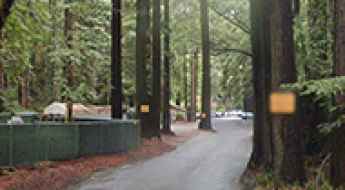
Mystery Spot Road in Santa Cruz: Gravity Defying in the Redwoods
Nestled in the lush redwoods of Santa Cruz, in the US state of California, Mystery Spot Road is home to one of the most famous gravity hill attractions in the world. Since its founding in 1939, the Mystery Spot has been baffling visitors with optical illusions that make balls roll uphill, people appear to lean impossibly, and everyday physics seem… optional.
How to get by car to North Walton Peak in Colorado?
North Walton Peak is a high mountain peak at an elevation of 3,090 m (10,137 ft) above sea level, located in Routt County, in the U.S. state of Colorado.
The Wild Unpaved 4x4 Road to Bald Knoll in Sevier County
Bald Knoll is a high mountain pass at an elevation of 2,881m (9,452ft) above sea level, located in Sevier County, in the U.S. state of Utah.
A lonely scenic drive to Chilkat Pass in British Columbia
Chilkat Pass is a mountain pass at an elevation of 1,061m (3,480ft) above sea level, located in the province of British Columbia, Canada. It’s one of the highest roads in Alaska.
Exploring Lakeview Drive in North Carolina: The Mysterious Road to Nowhere
Lakeview Drive, commonly known as the Road to Nowhere, is a unique and scenic drive located near Bryson City, in the US state of North Carolina. Nestled in the Great Smoky Mountains National Park, it’s both a historical landmark and a popular destination for tourists, hikers, cyclists, and even paranormal enthusiasts.
An Unforgettable Drive to Blueberry-Paulson Summit in BC
Blueberry-Paulson Summit is a high mountain pass at an elevation of 1,517m (4,977ft) above sea level, located in British Columbia, Canada's westernmost province.
Driving the scenic MT-278 Road through the mountains of Montana
Montana State Highway 278 (MT-278) is a very scenic road, running through the mountains of Beaverhead County, in the U.S. state of Montana.
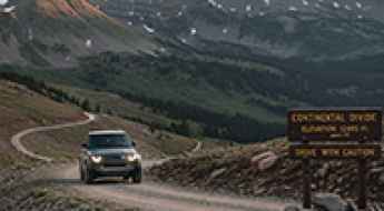
Safety Guide: Driving the Highest Passes in the US
America’s loftiest roads are gorgeous and unforgiving. Grades run long, shoulders stay narrow, and the air gets thin enough to bother engines and people. If you’re aiming for Colorado fourteeners or western summit byways, a little planning turns a white-knuckle climb into a day you’ll actually enjoy.
How to Get by Car to the Lookout at the Summit of Buck Mountain in Washington?
Buck Mountain is a high mountain peak at an elevation of 1,868m (6,128ft) above sea level, located in Okanogan County, in the U.S. state of Washington.
How to get by car to Daniel’s Pass in Sevier County?
Daniel’s Pass is a high mountain pass at an elevation of 3,129 m (10,265 ft) above sea level, located in Sevier County, in the U.S. state of Utah.
How to Get by Car to the Lookout at the Summit of Mount Leecher in Washington?
Mount Leecher is a high mountain peak at an elevation of 1,531m (5,022 ft) above sea level, located in Okanogan County, in the U.S. state of Washington.
How to get to Leidy Peak in Utah?
Leidy Peak is a high mountain peak located in Uintah County, in the US state of Utah. To the east of the summit, a gravel road climbs up to 3,361m (11,026ft) above sea level. It’s one of the highest roads in Utah.
Lucky Strike Mine: Driving to Utah’s Forgotten Uranium Ghost Town
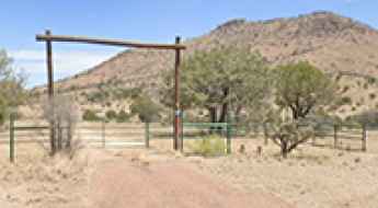
Lucky Strike Mine is an old abandoned mining ghost town at an elevation of 1,771 m (5,810 ft) above sea level, located in Emery County, in the U.S. state of Utah. You are best exploring it with a high-clearance 4WD.
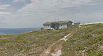
Santa Cruz Island: The Largest Island with Roads—But No Public Driving
Santa Cruz Island is the largest of the Channel Islands, located about 20 miles off the coast of Ventura, California. It is managed by the National Park Service and The Nature Conservancy. Although the island has a network of rugged dirt tracks and old utility roads, no public cars or motor vehicles are allowed. Visitors must explore this wild territory on foot or by kayak, making it a perfect destination for those looking for a real wilderness experience.
How to Get by Car to the Lookout at the Summit of Whitmore Mountain in Washington?
Whitmore Mountain is a mountain peak at an elevation of 1,201m (3,940ft) above sea level, located in Okanogan County, in the U.S. state of Washington.
How to get by car to the TV Hill Summit in Nevada?
TV Hill is a high mountain peak at an elevation of 3,137m (10,291ft) above sea level, located in Mineral County, in the U.S. state of Nevada. It's one of the highest roads in Nevada.
How to drive the unpaved road to Stanton Pass in Utah?
Stanton Pass is a high mountain pass at an elevation of 2,253m (7,391ft) above sea level, located in eastern Garfield County, in the US state of Utah.
How to drive the unpaved road to Pennellen Pass in Utah?
Pennellen Pass is a high mountain pass at an elevation of 2,411m (7,910ft) above sea level, located in eastern Garfield County, in the US state of Utah.
How to drive the Three Forks Road of Arizona?
Three Forks Road is a stunning drive with awesome views of streams, forest, and meadows, located in Apache County, in the U.S. state of Arizona. It’s one of the highest roads in Arizona.
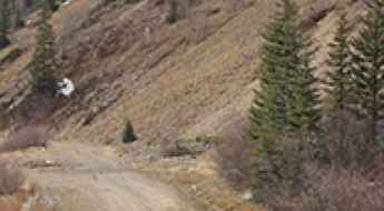
How to get by car to Jack Mountain in Jefferson County?
Jack Mountain is a high mountain peak at an elevation of 2,667m (8,750ft) above sea level, located in Jefferson County, in the US state of Montana.
San Miguel Island: Military Service Tracks and UXO Access Restrictions
San Miguel Island, the westernmost of the Channel Islands in California, features a unique network of unpaved service tracks within a high-risk environment. Due to its history as a military bombing range, the island's infrastructure is subject to some of the strictest access regulations in the United States.
Driving an easy dirt road to Muddy Pass in Eagle County
Muddy Pass is a high mountain pass at an elevation of 2,632m (8,635ft) above sea level, located in Eagle County in the US state of Colorado.
Peak to Peak Highway: Driving Colorado’s Oldest and Most Scenic Byway
Established in 1918, the Peak to Peak Highway is Colorado's oldest scenic byway. Spanning 55 miles (89 km) through the heart of the Front Range, this route offers matchless views of the Continental Divide. It is an essential mountain corridor that connects Rocky Mountain National Park with historic gold-mining districts, blending alpine nature with the rugged ghost towns of the Old West.
Cedar Mountain in Cody: The Secret Grave of Buffalo Bill
Cedar Mountain is a high mountain peak located in Park County, in the US state of Wyoming. Set in the rugged Absaroka Range at the western edge of the Bighorn Basin, this mountain reaches an elevation of 2,405m (7,890ft) above sea level. Beyond its height, it is famous for being the center of one of the greatest mysteries of the American West: the true final resting place of William F. "Buffalo Bill" Cody.
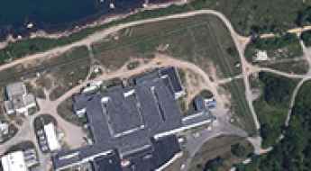
Plum Island: The High-Security Island Where the Only Road Trip is to the Decontamination Chamber
Plum Island is a small, restricted island located in the Long Island Sound, just off the coast of New York State. The island features an extensive network of accessible roads, but its highly sensitive purpose—housing a federal animal disease research center—means public access is absolutely prohibited, making it one of the most securely restricted pieces of infrastructure in the United States.