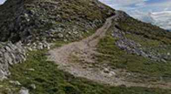
What are the most spectacular roads in Italy?
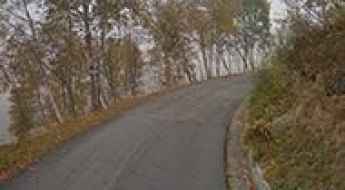
Located in the southern part of Europe, Italy is a dream for drivers as it hosts the mountain passes (the Alps), coastal drives (Adriatic, Ionian, Tyrrhenian, and Ligurian), and some of the most famous scenic routes in the world.
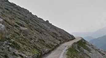
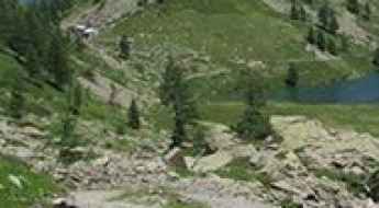
Choosing only a few roads to drive in the country is nearly impossible, as there are about 600 spectacular routes. Stelvio Pass is Europe's most famous road. At an elevation of 2,757m (9,045ft) above sea level, the pass is located in the northern part of the country. It's one of the highest roads in Europe. Featuring 48 hairpin turns, the road through the summit is a marvel of engineering.
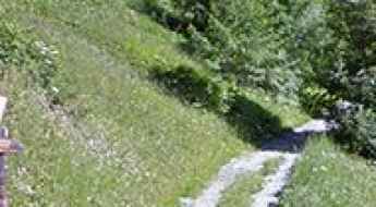
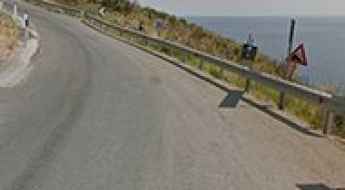
If you prefer coastal drives, you must experience the breathtaking Amalfi Coast Road. The road follows the shoreline from Sorrento south to Salerno. The road has been featured in films since cameras started rolling at 24 frames per second. If you want to feel like James Bond, don’t skip Strada della Forra. A small car with a functioning horn is recommended. For skilled drivers only. The drive is known by motorcyclists from all over Europe, as it is impressive and not without danger in a few narrow and steep spots. If you prefer roads with a story, don’t miss the Strada delle 52 Gallerie, a WWI military mule road. Built on the massif of Pasubio, it was constructed in this position to stay away from Austro-Hungarian artillery fire.
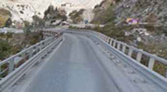
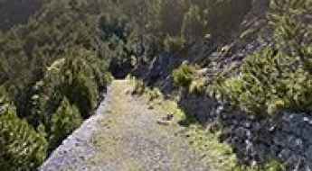
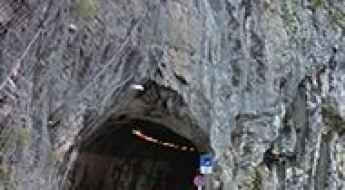
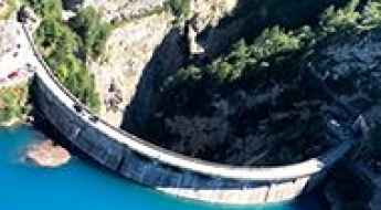
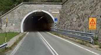
A road with countless tunnels on Ponti di Vara to transport marble to the quarry
Originally built as a railway tunnel, the historic Vara Bridge was constructed in 1876 for marble transportation to the quarries of Carrara, Italy. Today, the bridge is used by trucks and vehicles. It’s one of the most spectacular bridges in the world.
Selle Pass
Passo le Selle is a high mountain peak at an elevation of 2.536m (8,320ft) above the sea level, located in Trentino in the northern Italian region Trentino-Alto Adige/Südtirol. High winds blow here all year long. It’s one of the highest roads of the country.
How to drive the challenging mountain road to Colle Pian Fum in Piedmont
Colle Pian Fum is a high mountain pass at an elevation of 1,999 meters (6,558 ft) above sea level, located in the Province of Turin, in Italy.
Monte Castelberto
Monte Castelberto is a high mountain pass at an elevation of 1.765m (5,790ft) above the sea level, located in Trentino, in the northern Italian region Trentino-Alto Adige/Südtirol.
Forte del Monte Scale
Forte del Monte Scale is a high mountain military fortress at an elevation of 2.213m (7,260ft) above the sea level, located in the municipality of Valdidentro Sondrio, in Lombardy (Italy) and belongs to the Alps.
Alpe Vieille
Alpe Vieille is a high mountain pass at an elevation of 2.240m (7,349ft) above the sea level, located in the Valle d’Aosta region, in northwestern Italy.
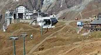
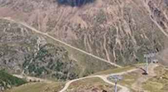
How to drive to the summit of Plan Maison?
Plan Maison is a mountain peak at an elevation of 2.552m (8,372ft) above sea level, located in the Aosta Valley region of Italy. It’s one of the highest roads in the country.
Lago Dietro la Torre
Lago Dietro la Torre is a high mountain artificial lake at an elevation of 2.372m (7,782ft) above the sea level, located in the Italian region Piedmont.
Punta del Cavallo Pass
Punta del Cavallo is a high mountain pass at an elevation of 2.290m (7,513ft) above the sea level, located in the Province of Cuneo in the Italian region Piedmont.
Bassa di Colombart
Bassa di Colombart is a high mountain pass at an elevation of 2.466m (8,090ft)above the sea level, located in the Province of Cuneo in the Italian region Piedmont.
How to drive the unpaved road to Punta Chaligne?
Punta Chaligne is a high mountain peak located in the Valle d’Aosta region, in Italy. A gravel road west of the peak, ends at an elevation of 2.311m (7,582ft) above sea level.
Lavaredo Refuge
Rifugio Lavaredo is a high mountain hut at an elevation of 2.353m (7,719ft) above the sea level, located in the Sexten Dolomites of northeastern Italy, rising on the border between the northernmost section of the province of Belluno and Alta Pustera, in South Tyrol.
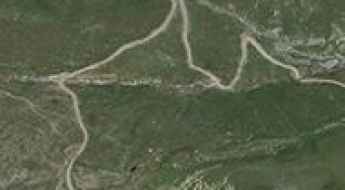
SR251 is the Italian road of the tsunami
Strada Regionale 251 (SR-251) is a scenic road located on the boundary between Veneto and Friuli Venezia Giulia, in the northern part of Italy.
Monte Cuccio
Monte Cuccio is a mountain peak at an elevation of 1.041m (3,415ft) above the sea level, located in the Italian island of Sicily. The climb is brutal: narrow and steep.
Padon Pass
Passo Padon is a high mountain peak at an elevation of 2.427m (7,962ft) above the sea level, located in Veneto region, in Northern Italy. The average gradient is 17.05%, with some sections up to 25%.
Monte Zoufplan: Driving the narrow 1,343m climb in Friuli-Venezia Giulia
Located in the Province of Udine, within the Friuli-Venezia Giulia region of Italy, Monte Zoufplan is a mountain peak at an elevation of 1,968m (6,456ft) above sea level. Situated in the Central Carnic Alps, the road to the summit is used to access weather and seismic monitoring infrastructure.

Driving the steep road to Rifugio Nino Corsi in South Tyrol
Rifugio Nino Corsi (also known as Zufallhütte) is a high-altitude mountain refuge at an elevation of 2,245m (7,365ft) above sea level, located in the Val Martello of the Autonomous Province of Bolzano, Italy. Situated within the heart of the Stelvio National Park, the access road is a technical alpine climb characterized by tight hairpins and significant vertical gain.
Colle di Sant'Anna di Vinadio
Colle di Sant'Anna di Vinadio is a high mountain pass at an elevation of 2.301m (7,549ft) above the sea level, located in the Maritime Alps, on the French-Italian border.
Driving the impossible turns on the Val Mara Road
Val Mara Road is the name of a challenging drive running across the border of Switzerland and Italy, to the south of Lago di Lugano.
Grosté Pass
Passo Grosté is a high mountain peak at an elevation of 2.446m (8,024ft) above the sea level, located in Trentino in the northern Italian Alps.
SP22 Road, a sensational drive in Calabria
Strada Provinciale 22 is a very scenic high mountan road located in the heart of the province of Catanzaro of the Calabria region of Italy.
Alpe Buri
Alpe Buri is a high mountain pass at an elevation of 1.525m (5,000ft) above the sea level, located in the Piedmont region of northwestern Italy.
Strada Ascea-Marina di Campagna
Strada Ascea-Marina di Campagna is an amazing and exciting journey in the Campania region, in southwestern Italy. The road offers stunning views of the Tyrrhenian Sea.
How To Travel The Challenging Diga della Maina
Diga della Maina is the name of a narrow high dam located in the province of Udine, in Friuli-Venezia Giulia, in Italy. It’s one of the most spectacular bridges in the world.
Strada delle Farfalle, a wild road in Sardinia
Strada delle Farfalle is a mountain road located in the Province of Sassari in the Italian region Sardinia. Located in the Limbara mountain range, the road is pretty rough in parts.
Col Sud de Menouve
Col Sud de Menouve is a high mountain peak at an elevation of 2.429m (7,969ft) above the sea level, located in the Valle d’Aosta region, in northwestern Italy.
Lazaunhutte Refuge
Rifugio Lazaunhutte is a high mountain refuge at an elevation of 2.425m (7,956ft) above the sea level, located in the Ortler Range, in South Tyrol, in northern Italy.
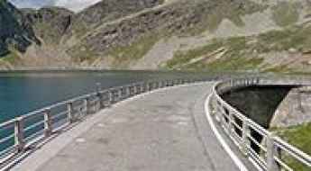
Lago Agnel
Lago Agnel is a high mountain reservoir at an elevation of 2.332m (7,650ft) above the sea level, located in the Province of Turin in the Italian region Piedmont.
Monte La Mula
Monte La Mula is a high mountain peak at an elevation of 1.934m (6,345ft) above the sea level, located in the Calabria region of southern Italy.
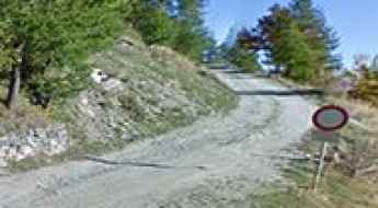
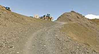
Ceresole Tunnel is the steepest tunnel in the Italian Alps
Located in the Metropolitan City of Turin in the Italian region Piedmont, Ceresole Tunnel is said to be the steepest tunnel in the Alps, with gradients of around 14-16%.
Malga Trela
Malga Trela is a high mountain pass at an elevation of 2.181m (7,155ft) above the sea level, located in the Province of Sondrio, Lombardy region of the Alps in northern Italy.
Driving the historic military road to Colle Ciarbonet in the Piedmont Alps
Colle Ciarbonet is a high mountain pass at an elevation of 2,290m (7,513ft) above sea level, located in the Province of Cuneo, in the Italian region of Piedmont. This ancient military track offers a technical and scenic driving experience through the rugged Unerzio Valley.
Contrabbandieri Pass
Passo dei Contrabbandieri (Smugglers pass) is a high mountain peak at an elevation of 2.581m (8,467ft) above the sea level, located in Trentino-South Tyrol in northern Italy. The road goes through the ruins of several WWI fortifications. It's one of the highest roads of the country.
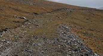
Driving the rugged track to Coletto di Laus: A rocky climb in Cuneo
Located in the heart of the Maritime Alps, in the Province of Cuneo, the ascent to Coletto di Laus is a journey through some of Piedmont’s most aggressive high-altitude terrain. Reaching an elevation of 1,948m (6,391ft) above sea level, this unpaved track links the isolated village of San Bernolfo with the stunning Lago di San Bernolfo and the Rifugio Laus. It is a route where the definition of a "road" is pushed to the limit, demanding a high-clearance vehicle and a driver who knows how to navigate a path made of loose stone and glacial debris.
How to drive the old military road to Testa Crevacol?
Testa Crevacol, also known as Tête de Crévacol, is a high mountain peak at an elevation of 2,502m (8,208ft) above sea level in the Aosta Valley, Italy. Located in the Pennine Alps near the Swiss border, the summit is reached via a historical military track known for its loose stone surface and alpine drops.
Is the road to Picco Palù in South Tyrol difficult to drive?
Picco Palù is a high mountain peak at an elevation of 2,490m (8,169ft) above sea level, located in the Italian province of South Tyrol.